Blog
Himalayas Formation: The Complete Geological Story of Earth’s Highest Mountains


Table of Contents
- The Tectonic Forces Behind Himalayas Formation
- Plate Tectonics: The Engine of Mountain Building
- The Indian Plate's Epic Journey
- Stages of Himalayas Formation: A Geological Timeline
- Phase 1: Initial Collision (50-40 Million Years Ago)
- Phase 2: Crustal Thickening and Uplift (40-20 Million Years Ago)
- Phase 3: Modern Himalayas Formation (20 Million Years Ago to Present)
- The Anatomy of the Himalayan Range
- Geological Divisions from South to North
- Iconic Peaks and Their Geological Significance
- Ongoing Himalayas Formation: A Living Mountain Range
- Measuring Modern Uplift
- Erosion: The Counterforce to Uplift
- Global Impacts of Himalayas Formation
- Climate and Monsoon Systems
- Biodiversity Hotspot
- Water Tower of Asia
- Scientific Research and Future Directions
- Key Research Programs
- Unresolved Questions
- Human Dimensions of Himalayas Formation
- Cultural and Spiritual Significance
- Geohazards and Risk Mitigation
- Conclusion: The Enduring Legacy of Himalayas Formation
The Himalayas formation represents one of the most dramatic geological events in Earth’s history, creating the planet’s highest mountain range through the colossal collision of tectonic plates. Around 50 million years ago, the Indian Plate began its relentless northward journey, eventually smashing into the Eurasian Plate with unimaginable force. This monumental Himalayas formation process continues today, with the mountains still rising approximately 5 millimeters annually, making them a living testament to our planet’s dynamic nature.
- Himalayas formation began approximately 50 million years ago when the Indian Plate collided with the Eurasian Plate
- The mountain range continues to grow at roughly 5 mm per year due to ongoing tectonic convergence
- Mount Everest, the highest peak at 8,848.86 meters, remains geologically active
- The collision zone spans over 2,400 kilometers across five countries
- Himalayas formation influences global climate patterns, monsoon systems, and biodiversity
The Tectonic Forces Behind Himalayas Formation
Plate Tectonics: The Engine of Mountain Building
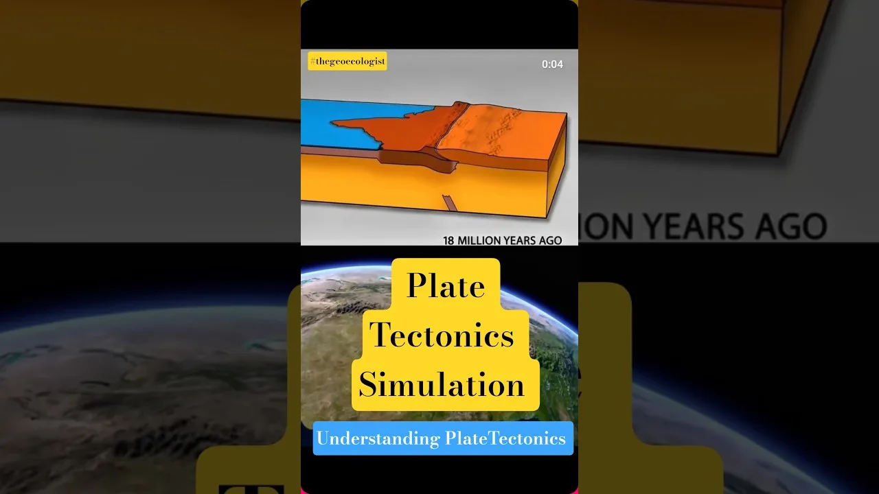
The story of Himalayas formation begins with the theory of plate tectonics, the fundamental geological framework explaining how Earth’s lithosphere—the rigid outer shell comprising the crust and upper mantle—is divided into several large and small plates that float on the semi-fluid asthenosphere beneath. These plates move at rates of a few centimeters per year, driven by convection currents in the mantle. When plates converge, diverge, or slide past each other, they create earthquakes, volcanoes, and mountain ranges.
In the case of Himalayas formation, we witness a textbook example of continental-continental convergence. Unlike oceanic-continental collisions where the denser oceanic plate subducts beneath the continental plate, continental crust is too buoyant to subduct deeply. Instead, the crust crumples, thickens, and thrusts upward, creating towering mountain ranges. The Himalayas represent the most spectacular manifestation of this process on Earth.
The Indian Plate’s Epic Journey
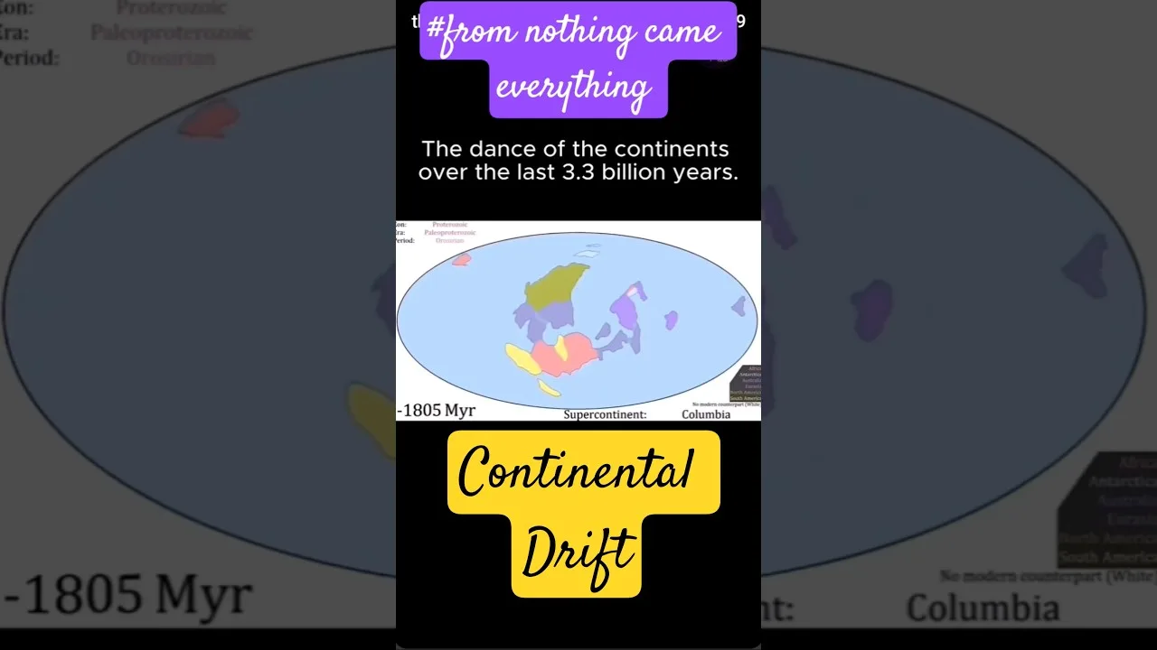
The Indian Plate’s voyage toward Eurasia represents one of geology’s most remarkable journeys. Following the breakup of the supercontinent Gondwana around 180 million years ago, the Indian subcontinent drifted northward across the Tethys Ocean at an astonishing rate of 15-20 centimeters per year—exceptionally fast for plate tectonics. This rapid movement was likely facilitated by a mantle plume that created the Deccan Traps, one of Earth’s largest volcanic features, around 66 million years ago.
By approximately 50-55 million years ago, the leading edge of the Indian Plate made initial contact with the Eurasian Plate, marking the beginning of Himalayas formation. The Tethys Ocean, which once separated these landmasses, began closing as its oceanic crust subducted beneath Eurasia. Marine sediments that had accumulated on the Tethys seafloor for millions of years were scraped off, folded, and thrust upward, forming the sedimentary rocks we now find at the summits of Himalayan peaks—including the famous limestone bands near Mount Everest’s peak that contain marine fossils.
Stages of Himalayas Formation: A Geological Timeline
Phase 1: Initial Collision (50-40 Million Years Ago)
The earliest phase of Himalayas formation involved the collision of the Indian Plate’s northern margin with the Eurasian Plate’s southern edge. This initial impact created the Indus-Tsangpo Suture Zone, a fundamental geological boundary marking where the two continents welded together. The suture zone contains ophiolites—fragments of oceanic crust thrust onto continental crust—providing definitive evidence of the vanished Tethys Ocean.
Phase 2: Crustal Thickening and Uplift (40-20 Million Years Ago)
As convergence continued, the crust thickened dramatically through thrust faulting and folding. The Main Central Thrust (MCT), one of the most significant fault systems in the Himalayas, developed during this period, carrying high-grade metamorphic rocks over lower-grade sediments. This crustal thickening doubled the crustal thickness from a normal 35-40 kilometers to 70-80 kilometers beneath the high Himalayas, driving isostatic uplift—the same principle that makes icebergs float higher when more ice is submerged.
Phase 3: Modern Himalayas Formation (20 Million Years Ago to Present)
The current phase of Himalayas formation involves the Main Frontal Thrust (MFT), the youngest and southernmost major thrust fault, which accommodates much of the ongoing convergence. The Himalayas continue to rise, but erosion simultaneously wears them down. This dynamic equilibrium between uplift and erosion creates the dramatic relief we see today. GPS measurements confirm that the Indian Plate continues moving northward at approximately 4-5 centimeters per year, with roughly 1-2 centimeters absorbed by crustal shortening across the Himalayas.
The Anatomy of the Himalayan Range
Geological Divisions from South to North
Understanding Himalayas formation requires recognizing the range’s distinct geological zones, each telling a chapter of the collision story:
- Sub-Himalaya (Siwaliks): Youngest sedimentary rocks (Miocene-Pleistocene) eroded from the rising mountains and deposited in the foreland basin
- Lesser Himalaya: Low-grade metamorphic and sedimentary rocks (Proterozoic to Paleozoic) thrust over the Siwaliks along the Main Boundary Thrust
- Greater Himalaya: High-grade metamorphic rocks (gneisses, schists) and granites forming the high peaks, bounded by the Main Central Thrust below and the South Tibetan Detachment System above
- Tethyan Himalaya: Fossiliferous sedimentary rocks (Paleozoic to Mesozoic) representing the passive margin of the Tethys Ocean
- Trans-Himalaya: Igneous and metamorphic rocks north of the Indus-Tsangpo Suture Zone, representing the Eurasian Plate’s southern margin
Iconic Peaks and Their Geological Significance
The eight-thousanders—Earth’s fourteen peaks exceeding 8,000 meters—are all products of Himalayas formation. Mount Everest (8,848.86 m), K2 (8,611 m), Kangchenjunga (8,586 m), Lhotse (8,516 m), Makalu (8,485 m), Cho Oyu (8,188 m), Dhaulagiri I (8,167 m), Manaslu (8,163 m), Nanga Parbat (8,126 m), and Annapurna I (8,091 m) represent the culmination of crustal thickening. Interestingly, Everest’s summit consists of Ordovician limestone (the “Yellow Band”) containing marine fossils—direct evidence that these rocks once lay on the Tethys seafloor before Himalayas formation thrust them to the roof of the world.
Ongoing Himalayas Formation: A Living Mountain Range
Measuring Modern Uplift
Contemporary Himalayas formation is measurable through multiple techniques. GPS networks across the range document ongoing convergence. Satellite-based InSAR (Interferometric Synthetic Aperture Radar) detects millimeter-scale surface deformation. Precise leveling surveys and tide gauge records provide additional constraints. The consensus: the Himalayas rise 3-10 mm annually, varying by location, with the maximum uplift in the High Himalaya.
This ongoing Himalayas formation comes with seismic consequences. The 2015 Gorkha earthquake (Mw 7.8) in Nepal, which killed nearly 9,000 people, ruptured a portion of the Main Himalayan Thrust. Historical records and paleoseismology suggest even larger earthquakes (Mw 8.5+) have occurred and will recur, as the accumulated strain from continuous convergence must eventually release.
Erosion: The Counterforce to Uplift
Himalayas formation is a battle between tectonic construction and erosional destruction. The monsoon-driven erosion machine—rivers like the Indus, Ganges, Brahmaputra, and their tributaries—removes vast quantities of material. The Bengal Fan, the world’s largest submarine fan, accumulates Himalayan sediments in the Bay of Bengal, reaching thicknesses of 16+ kilometers. This erosion actually influences Himalayas formation through isostatic rebound: as mass is removed, the crust rises buoyantly, focusing uplift in regions of highest erosion—a feedback loop between climate and tectonics.
Global Impacts of Himalayas Formation
Climate and Monsoon Systems
The Himalayas formation fundamentally altered global climate. As the range rose, it created a massive topographic barrier that blocked cold, dry air from Central Asia and forced the Indian Ocean monsoon to dump moisture on the subcontinent. The East Asian monsoon also intensified. Some researchers argue that Himalayas formation triggered global cooling by enhancing silicate weathering—the chemical breakdown of rocks that draws down atmospheric CO₂—contributing to the Cenozoic cooling trend and eventual Pleistocene ice ages.
Biodiversity Hotspot
The dramatic elevational gradients created by Himalayas formation generate extraordinary biodiversity. From subtropical forests at 500 meters to permanent ice above 7,000 meters, the range hosts distinct ecological zones: tropical deciduous forests, subtropical pine forests, temperate broadleaf and coniferous forests, subalpine zones, alpine meadows, and nival zones. This vertical compression of biomes makes the Himalayas a global biodiversity hotspot with high endemism. The plate tectonics that drove Himalayas formation also created isolated valleys that serve as evolutionary crucibles.
Water Tower of Asia
Perhaps the most critical consequence of Himalayas formation for humanity is its role as the “Third Pole” and “Water Tower of Asia.” The Himalayan cryosphere—glaciers, snowfields, and permafrost—stores the largest volume of ice outside the polar regions. Ten major river systems originating here—the Indus, Ganges, Brahmaputra, Yangtze, Yellow, Mekong, Salween, Irrawaddy, Amu Darya, and Syr Darya—provide freshwater to over 1.5 billion people downstream. Climate change threatens this water security, as Himalayan glaciers lose mass at accelerating rates.
Scientific Research and Future Directions
Key Research Programs
Understanding Himalayas formation drives major international scientific initiatives. The National Geographic Society has supported numerous expeditions. The International Continental Scientific Drilling Program (ICDP) and Integrated Ocean Drilling Program (IODP) have drilled in the Bengal Fan and Arabian Sea to recover Himalayan erosion records. Seismic profiling projects like INDEPTH (International Deep Profiling of Tibet and the Himalayas) have imaged the crustal structure beneath the range, revealing the geometry of the Main Himalayan Thrust and the Indian Plate’s underthrusting.
Unresolved Questions
Despite decades of research, Himalayas formation retains mysteries: What controls the along-strike variation in seismic coupling? How does the Indian Plate’s heterogeneous structure (cratons, rifts) influence deformation? What is the deep mantle’s role? When did the modern monsoon establish? How will climate change affect the tectonic-erosion feedback? Answering these requires interdisciplinary approaches combining geodesy, seismology, geomorphology, thermochronology, climate modeling, and paleoaltimetry.
Human Dimensions of Himalayas Formation
Cultural and Spiritual Significance
The mountains born from Himalayas formation hold profound cultural meaning. In Hinduism, the Himalayas are the abode of Shiva and the source of the sacred Ganges. Buddhism reveres them as the dwelling of deities and the setting for countless teachings. Mount Kailash (6,638 m), though not an eight-thousander, is perhaps the most sacred peak, unclimbed by religious tradition. Indigenous communities across Nepal, Bhutan, India, China, and Pakistan have developed unique cultures adapted to the vertical landscapes created by Himalayas formation.
Geohazards and Risk Mitigation
Living with ongoing Himalayas formation means confronting geohazards: earthquakes, landslides, glacial lake outburst floods (GLOFs), and river flooding. The 2013 Kedarnath disaster (Uttarakhand, India) and 2021 Chamoli flash flood exemplify the compound hazards in this tectonically active, climate-sensitive region. Early warning systems, seismic-resistant construction, land-use planning, and glacial monitoring are critical for the millions inhabiting the Himalayan arc.
Conclusion: The Enduring Legacy of Himalayas Formation
The Himalayas formation stands as Earth’s most spectacular ongoing mountain-building event, a collision that began 50 million years ago and continues today. From the marine fossils atop Everest to the monsoon rains feeding billions, from the seismic hazards threatening cities to the biodiversity enriching our planet, the consequences of this tectonic encounter ripple across every sphere of the Earth system. As the Indian Plate relentlessly pushes northward at 5 cm per year, the Himalayas formation story remains unfinished—each earthquake, each millimeter of uplift, each monsoon season writes another chapter in this geological epic. Understanding Himalayas formation is not merely academic; it is essential for mitigating hazards, managing water resources, conserving biodiversity, and comprehending our planet’s dynamic nature in an era of rapid global change.
Frequently Asked Questions
The Himalayas formation began approximately 50-55 million years ago when the Indian Plate collided with the Eurasian Plate, initiating the closure of the Tethys Ocean and the uplift of the world's highest mountain range.
Yes, the Himalayas continue to rise at approximately 3-10 mm per year due to ongoing convergence between the Indian and Eurasian Plates, with the Indian Plate moving northward at roughly 4-5 cm annually.
Marine fossils, particularly in the limestone 'Yellow Band' near Mount Everest's summit (8,848.86 m), and sedimentary rocks throughout the Tethyan Himalaya zone provide definitive evidence that these peaks were once the Tethys Ocean seafloor.