Blog
Fluvial Landforms: The Power of River Erosion and Deposition


Table of Contents
Introduction to Fluvial Landforms
Fluvial landforms are the intricate architectural masterpieces created by the relentless movement of water through river systems. For millions of years, flowing water has acted as Earth’s primary sculptor, tirelessly carving through rock and transporting sediment to reshape the very face of our planet. Whether observing a rushing mountain stream or a massive river delta, we are witnessing the dynamic interplay of erosion, transportation, and deposition that defines the field of geomorphology.
- Erosion: The process where water wears away the land.
- Transportation: The movement of sediment by the river’s current.
- Deposition: The settling of sediment when water velocity decreases.
- Dynamic Equilibrium: The balance between energy and material in a river system.
The Science of Geomorphology and Fluvial Landforms
To understand fluvial landforms, one must first understand the principles of geomorphology. This branch of Earth science studies how landforms evolve over time through various physical processes. Rivers are not merely bodies of water; they are high-energy systems that respond to changes in gradient, volume, and sediment load. When we study these features, we are essentially reading the geological history of a region written in silt, sand, and stone.
The creation of these features is driven by the kinetic energy of moving water. As water flows downstream, it possesses the ability to lift particles—ranging from microscopic clay to massive boulders—and carry them toward the sea. This process is fundamental to the formation of various fluvial landforms that define our global geography.
Erosional Landforms: The Sculpting Phase
In the upper course of a river, typically found in mountainous or hilly regions, the primary action is vertical erosion. This is where the river’s energy is focused on cutting downward into its bed.
V-Shaped Valleys
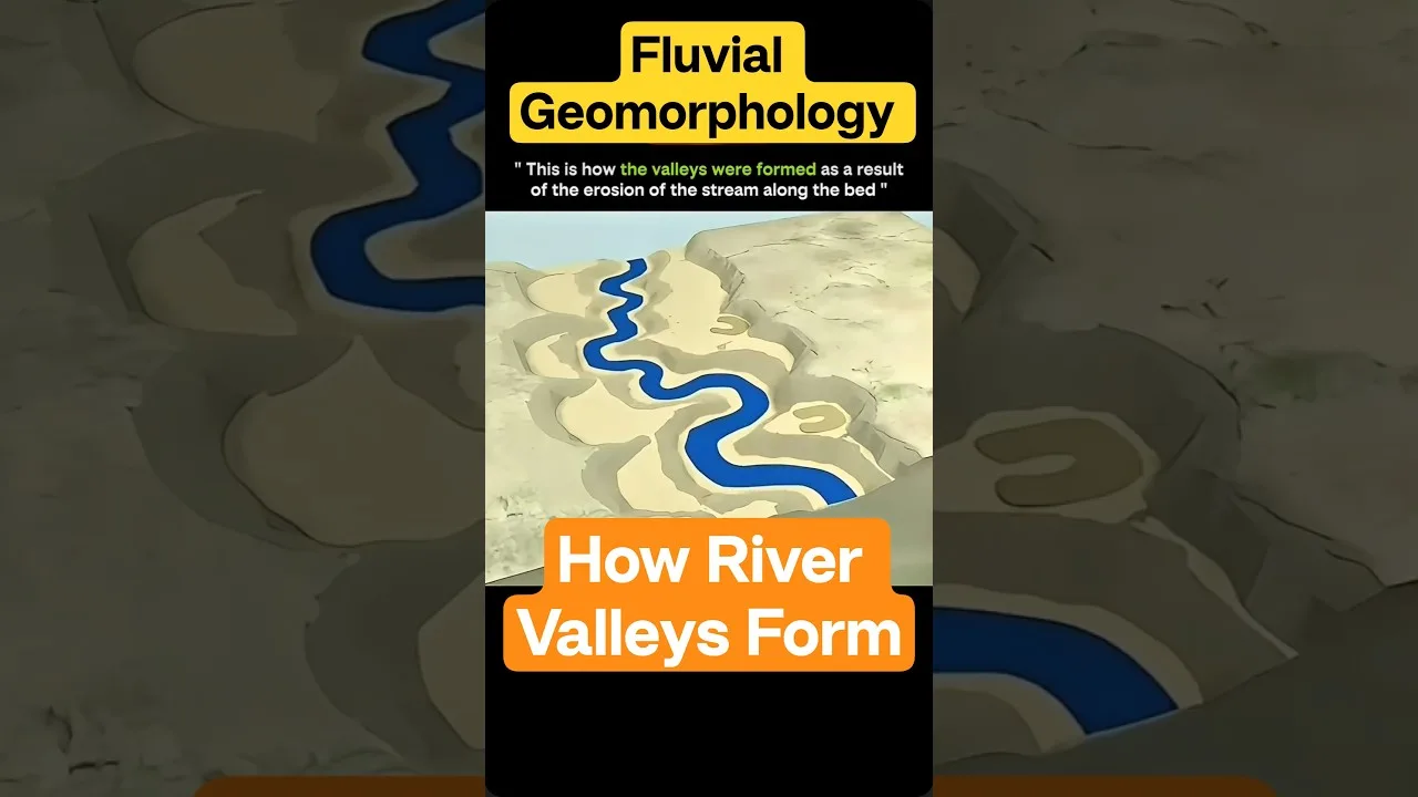
One of the most iconic fluvial landforms is the V-shaped valley. As a youthful river flows down a steep gradient, it engages in intense downcutting. While the river cuts vertically, weathering and mass wasting (like landslides) erode the valley sides, creating the characteristic ‘V’ shape. These valleys are a hallmark of high-energy river systems.
Gorges and Canyons
When a river cuts through particularly resistant rock with extreme efficiency, it can create deep, narrow gorges. Unlike the wider V-shaped valleys, gorges have nearly vertical walls. A famous example of such geological marvels can be found in the Grand Canyon, where millions of years of river action have exposed layers of Earth’s history.
Depositional Landforms: The Building Phase
As a river moves from its mountainous headwaters into flatter terrain, its velocity decreases, and it begins to lose the energy required to carry heavy sediments. This leads to the creation of depositional fluvial landforms.
Floodplains and Alluvial Soil
Floodplains are expansive, flat areas of land adjacent to a river. During periods of heavy rainfall or snowmelt, the river may overflow its banks. As the water spreads out across the land, it loses velocity and deposits fine-grained sediments like silt and clay. Over millennia, these repeated flooding events create incredibly fertile soil, making floodplains the backbone of global agriculture.
Meanders: The Sinuous Dance of Water
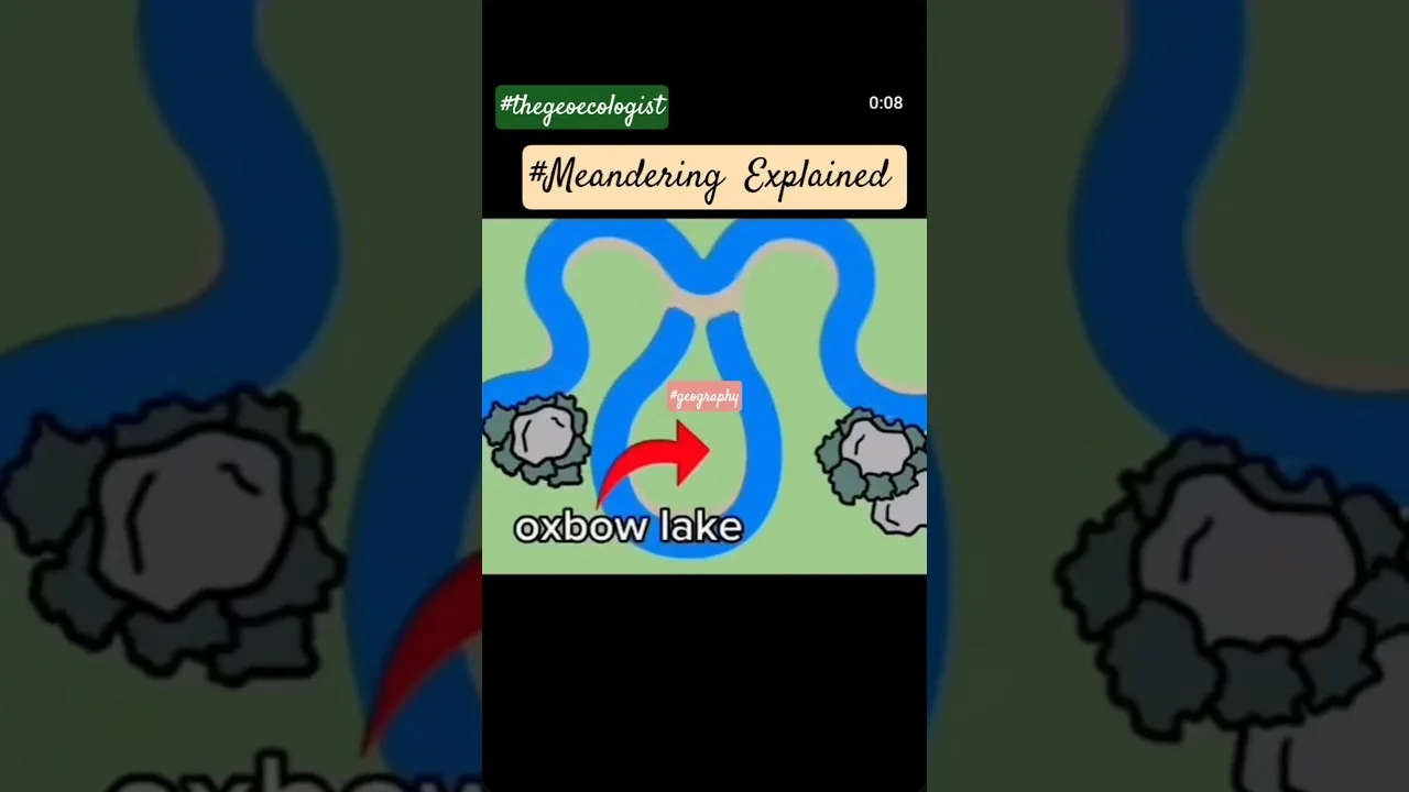
Rivers rarely flow in a straight line. Instead, they develop sinuous curves known as meanders. This occurs due to the uneven distribution of water velocity across a channel. The fastest-moving water (the thalweg) hits the outer bend, causing lateral erosion and creating a river cliff. Conversely, on the inner bend, the water moves more slowly, allowing sediment to settle and form point bars. This continuous process of erosion on one side and deposition on the other causes the meanders to migrate across the valley floor.
Oxbow Lakes: The Remnants of Meanders
When meanders become extremely pronounced, the neck between two bends becomes very narrow. During a flood event, the river may take the path of least resistance, cutting through the neck to create a straighter channel. This leaves behind a crescent-shaped body of water isolated from the main river, known as an oxbow lake. These serene features are vital components of the local ecosystem and are classic examples of fluvial landforms in transition.
Deltas: The Final Destination
Where a river meets a standing body of water, such as an ocean or a lake, its velocity drops to near zero. At this point, the river can no longer transport its sediment load, and it deposits it at the mouth. Over time, this accumulation builds out into the sea, forming a delta. Deltas are complex, fan-shaped fluvial landforms that are often highly fertile and support immense biodiversity. The Nile Delta is one of the most famous examples in human history, having supported civilizations for thousands of years.
Why Studying Fluvial Landforms Matters
The study of these landforms is not just an academic pursuit; it has profound real-world implications. Understanding the mechanics of fluvial landforms allows us to address several critical challenges:
- Flood Management: By understanding how floodplains work, engineers can design better levees and bypasses to protect urban populations.
- Agricultural Planning: Knowing where alluvial deposition occurs helps farmers identify the most fertile lands for crop production.
- Infrastructure Development: When building bridges or roads, engineers must account for the lateral migration of rivers to prevent structural failure.
- Environmental Conservation: Deltas and oxbow lakes are critical habitats. Protecting these fluvial landforms is essential for preserving wetland biodiversity.
Relevance for Competitive Exams
For students preparing for high-level competitive examinations like the UPSC (Union Public Service Commission) in India, fluvial landforms represent a cornerstone of Physical Geography. Aspirants must be able to distinguish between erosional and depositional features and understand the lifecycle of a river from its source to its mouth. Mastery of these concepts is essential for scoring well in Geography and Earth Science modules.
Conclusion
Fluvial landforms serve as a constant reminder of the power of water. From the sharp incision of a mountain gorge to the gentle expansion of a coastal delta, the movement of water is the primary architect of our terrestrial landscape. By studying these features, we gain a deeper appreciation for the dynamic, ever-changing nature of our planet. Next time you view a river, remember that you are not just looking at water—you are looking at a master sculptor at work.
Frequently Asked Questions
The two main processes are erosion (the wearing away of the land) and deposition (the settling of sediment as water slows down).
A V-shaped valley is typically formed by the vertical erosion of a youthful river in mountainous areas, whereas a U-shaped valley is often formed by glacial erosion widened by river action.
An oxbow lake is formed when a meander becomes very sharp and eventually gets cut off from the main river channel during a flood, leaving a crescent-shaped lake behind.