Blog
Accelerated Glacier Retreat: Why Ice Loss Is Speeding Up Globally

Table of Contents
- Understanding Glacier Mass Balance and Retreat Dynamics
- The Physics of Ice Flow and Thinning
- Equilibrium Line Altitude Shifts
- Primary Drivers of Accelerated Glacier Retreat
- Atmospheric Warming and Temperature Sensitivity
- Changing Precipitation Patterns
- Black Carbon and Albedo Reduction
- Regional Hotspots of Accelerated Glacier Retreat
- High Mountain Asia: The Third Pole Under Threat
- European Alps: A Century of Documented Decline
- Andes: Tropical Glaciers on the Brink
- Western North America: Rapid Changes in the Rockies and Cascades
- Downstream Impacts: Water Security and Hazard Risks
- Seasonal Water Availability Shifts
- Glacial Lake Outburst Floods (GLOFs)
- Ecosystem and Biodiversity Consequences
- Monitoring and Quantifying Accelerated Glacier Retreat
- Space-Based Observations: The GRACE Revolution
- Laser Altimetry: ICESat and ICESat-2
- Ground-Based Networks: WGMS and Direct Measurements
- Future Projections: Committed Loss and Policy Relevance
- Centennial-Scale Commitment
- Sea-Level Rise Contributions
- Water Security Adaptation Strategies
- Conclusion: The Urgency of Action
Accelerated glacier retreat is reshaping mountain landscapes worldwide as rising temperatures disrupt the delicate balance between snowfall accumulation and ice melt. High in the mountains, glaciers are losing ice at unprecedented rates, with recent studies confirming that the pace of ice loss has more than doubled since the early 2000s. This phenomenon isn’t just about disappearing ice—accelerated glacier retreat fundamentally alters downstream water systems, threatens biodiversity, and contributes significantly to global sea-level rise. Understanding the mechanisms driving this rapid change is critical for communities, policymakers, and scientists working to adapt to a warming world.
- Glaciers are losing mass at an accelerating rate, with global ice loss doubling since 2000.
- Accelerated glacier retreat threatens freshwater supplies for nearly 2 billion people downstream.
- High Mountain Asia, including the Himalayas, holds the largest ice reserves outside polar regions.
- Sea-level rise contributions from glaciers now exceed those from ice sheets in some decades.
- Monitoring technologies like GRACE satellites and ground-penetrating radar provide critical data.
Understanding Glacier Mass Balance and Retreat Dynamics
Glaciers function as massive freshwater reservoirs, accumulating snow during cold seasons and releasing meltwater during warm periods. The mass balance of a glacier—the difference between accumulation (snowfall) and ablation (melting, sublimation, calving)—determines whether accelerated glacier retreat advances, remains stable, or retreats. When annual melt exceeds snowfall over sustained periods, the glacier enters negative mass balance, triggering retreat. The current accelerated glacier retreat observed globally indicates that negative mass balance has become the norm rather than the exception.
The Physics of Ice Flow and Thinning
Ice flows downslope under its own weight through internal deformation and basal sliding. As a glacier thins due to surface melt, the driving stress decreases, which should theoretically slow flow. However, meltwater percolating to the bed lubricates the glacier base, enhancing basal sliding—a positive feedback that can temporarily accelerate ice discharge even as the glacier shrinks. This dynamic thinning propagates upstream, drawing down ice from higher elevations and expanding the ablation zone. Research published in Nature (2021) documented this process across Greenland’s outlet glaciers, where speed-ups of 30-50% coincided with surface melt increases.
Equilibrium Line Altitude Shifts
The equilibrium line altitude (ELA)—the elevation where accumulation equals ablation—has been rising steadily. In the European Alps, the ELA has climbed approximately 300 meters since 1980, according to the World Glacier Monitoring Service (WGMS). This upward shift exposes more glacier surface to melting conditions while shrinking the accumulation zone. For every 100-meter rise in ELA, many alpine glaciers lose 15-20% of their accumulation area, creating a geometric amplification of mass loss that drives accelerated glacier retreat.
Primary Drivers of Accelerated Glacier Retreat
Atmospheric Warming and Temperature Sensitivity
Global mean surface temperature has risen approximately 1.2°C above pre-industrial levels (IPCC AR6, 2021), but high-mountain regions experience amplified warming—often 1.5 to 2 times the global average. This elevation-dependent warming stems from snow-albedo feedback (less snow cover exposes darker surfaces that absorb more radiation), water vapor feedback, and changes in lapse rates. A 2019 study in Nature Climate Change found that mountain regions above 4,000 meters warmed 75% faster than lowlands since 1950. This disproportionate heating directly fuels accelerated glacier retreat across the Himalayas, Andes, Rockies, and Alps.
Changing Precipitation Patterns
While warming dominates the mass loss signal, precipitation changes modulate regional responses. In the Karakoram anomaly region, increased winter snowfall temporarily stabilized some glaciers, but recent analyses suggest this respite is ending. Conversely, the Southern Andes and Patagonia face declining precipitation alongside warming, creating a “double penalty” for glacier mass balance. The IPCC Sixth Assessment Report projects continued precipitation increases in high-latitude mountains but decreases in subtropical mountain ranges, implying divergent glacier futures.
Black Carbon and Albedo Reduction
Deposition of light-absorbing particles—black carbon from fossil fuel combustion, biomass burning, and mineral dust—darkens glacier surfaces, reducing albedo and enhancing melt. In the Himalayas, black carbon concentrations in ice cores have tripled since the 1970s, correlating with industrial emissions from the Indo-Gangetic Plain. A 2020 PNAS study estimated that black carbon accounts for 20-30% of observed Himalayan glacier mass loss since 1990, making it a significant accelerator of accelerated glacier retreat in this region.
Regional Hotspots of Accelerated Glacier Retreat

High Mountain Asia: The Third Pole Under Threat
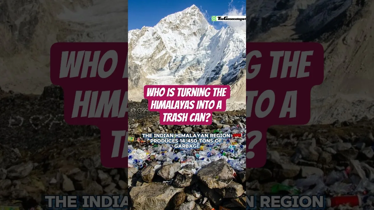
High Mountain Asia (HMA)—encompassing the Himalayas, Karakoram, Hindu Kush, Pamir, and Tibetan Plateau—contains approximately 95,000 glaciers covering 100,000 km², storing the largest ice volume outside the polar regions. This “Third Pole” feeds ten major river systems supporting 1.9 billion people. Satellite gravimetry (GRACE/GRACE-FO) reveals HMA lost 267 ± 16 Gt of ice annually during 2000-2019, with loss rates accelerating from -15 Gt/yr (2000-2009) to -43 Gt/yr (2010-2019). The eastern Himalayas show the most negative mass balances (-0.5 to -1.0 m w.e./yr), while the Karakoram exhibits near-neutral or slightly positive balances—though recent data suggest this anomaly is weakening.
European Alps: A Century of Documented Decline
The Alps serve as a global benchmark for glacier monitoring, with records dating to the 1850s Little Ice Age maximum. Since 1850, Alpine glaciers have lost approximately 60% of their volume. The extreme summers of 2003, 2015, 2019, and 2022 caused catastrophic mass loss years. In 2022 alone, Swiss glaciers lost 6% of their remaining volume—the worst year on record since monitoring began. The Glacier Monitoring in Switzerland (GLAMOS) network documents that many small glaciers (<0.5 km²) will vanish within two decades, while larger valley glaciers like Aletsch will persist but dramatically shrink.
Andes: Tropical Glaciers on the Brink
Tropical Andean glaciers—located in Colombia, Ecuador, Peru, and Bolivia—are among the most vulnerable globally due to their small size, high radiation receipt, and year-round ablation conditions. Peru’s Quelccaya Ice Cap, the world’s largest tropical ice body, has shrunk 46% since 1976. Bolivia’s Chacaltaya Glacier, once the world’s highest ski area, disappeared completely in 2009. These losses threaten water security for cities like La Paz and Lima during dry seasons, when glacier melt contributes 15-30% of streamflow.
Western North America: Rapid Changes in the Rockies and Cascades
Glaciers in the U.S. Rocky Mountains and Cascade Range have lost 30-50% of their area since the Little Ice Age. Glacier National Park (Montana) exemplifies this trend: of 150 glaciers present in 1850, only 26 active glaciers remained by 2015. The 2021 Pacific Northwest heat dome—where temperatures exceeded 49°C at low elevations—caused exceptional melt on Mount Rainier and Olympic Peninsula glaciers. Research indicates accelerated glacier retreat in this region will reduce late-summer streamflows critical for salmon habitat, irrigation, and hydropower.
Downstream Impacts: Water Security and Hazard Risks
Seasonal Water Availability Shifts
Glaciers act as seasonal buffers, releasing meltwater during hot, dry summers when precipitation is scarce. As glaciers shrink, this buffering capacity diminishes. Initially, meltwater increases (“peak water”), but after a tipping point—typically when glacier area declines 20-50%—runoff declines permanently. A 2019 Nature Climate Change study found that 45% of studied glacierized basins have already passed peak water, including most of the European Alps, Western Canada, and the Tropical Andes. For the Indus and Brahmaputra basins, peak water is projected around 2050-2060, after which accelerated glacier retreat will reduce dry-season flows for hundreds of millions.
Glacial Lake Outburst Floods (GLOFs)
Retreating glaciers leave behind overdeepened basins that fill with meltwater, forming potentially hazardous glacial lakes. The number and volume of glacial lakes globally increased 53% and 51% respectively between 1990 and 2018 (Shugar et al., 2020, Nature Climate Change). High Mountain Asia hosts the most lakes and highest GLOF risk. The 2021 Chamoli disaster in Uttarakhand, India—triggered by a rock-ice avalanche onto a glacial lake—killed over 200 people and destroyed two hydropower projects. Such events are expected to increase as accelerated glacier retreat creates new lakes and destabilizes valley walls.
Ecosystem and Biodiversity Consequences
Glacier-fed streams host unique cold-adapted biodiversity, including specialized invertebrates (e.g., Lednia tumana, the meltwater stonefly) and microbial communities. As glaciers vanish, these habitats shrink or disappear. A 2022 Global Change Biology meta-analysis found that glacier retreat reduces alpha diversity in proglacial streams by 11-38% and causes community homogenization. Alpine species face “escalator to extinction” dynamics as they migrate upslope until no suitable habitat remains.
Monitoring and Quantifying Accelerated Glacier Retreat
Space-Based Observations: The GRACE Revolution
The Gravity Recovery and Climate Experiment (GRACE, 2002-2017) and GRACE-FO (2018-present) satellites measure monthly changes in Earth’s gravity field, detecting mass changes at ~300 km resolution. These missions revolutionized glacier mass balance estimation, revealing that glaciers (excluding ice sheets) contributed 0.74 ± 0.08 mm/yr to sea-level rise during 2002-2019, accelerating to 0.94 mm/yr in the latter decade. GRACE data confirm that accelerated glacier retreat accounts for 21% of observed sea-level rise since 2000—surpassing the Greenland Ice Sheet’s contribution during some years.
Laser Altimetry: ICESat and ICESat-2
NASA’s ICESat (2003-2009) and ICESat-2 (2018-present) laser altimeters provide high-resolution (10-17 m footprint) elevation change measurements. ICESat-2’s ATLAS instrument uses photon-counting lidar to detect surface elevation changes at centimeter precision. Combined with DEM differencing from ASTER, TanDEM-X, and ArcticDEM, these datasets enable glacier-specific mass balance estimates for >200,000 glaciers globally. The consensus: mass loss rates increased from -227 Gt/yr (2000-2004) to -328 Gt/yr (2015-2019), a 44% acceleration.
Ground-Based Networks: WGMS and Direct Measurements
The World Glacier Monitoring Service (WGMS), coordinated from the University of Zurich, compiles standardized in situ mass balance measurements from ~500 glaciers worldwide, with ~40 “reference glaciers” having continuous records >30 years. These ground-truth data validate satellite products and capture processes remote sensing cannot—firn compaction, internal accumulation, and basal melt. WGMS’s 2021 Global Glacier Change Bulletin confirms 33 consecutive years of negative mass balance for reference glaciers, with mean annual loss exceeding -1 m w.e. since 2010—clear evidence of accelerated glacier retreat.
Future Projections: Committed Loss and Policy Relevance
Centennial-Scale Commitment
Even if global temperatures stabilize at 1.5°C above pre-industrial levels, glaciers will continue losing mass for decades to centuries due to their response times (years for small glaciers, centuries for large ice caps). A 2023 Science study (Rounce et al.) modeled all 215,000+ glaciers globally under multiple emission scenarios. Under 1.5°C warming, 49% of glaciers by number (26% by volume) are committed to disappear by 2100. Under 2.7°C (current policy trajectory), 68% by number (41% by volume) vanish. This committed loss means accelerated glacier retreat will continue regardless of near-term mitigation, though the magnitude differs dramatically.
Sea-Level Rise Contributions
Glaciers are projected to contribute 79-159 mm to global mean sea-level rise by 2100 (IPCC AR6), depending on emission scenario. While the Antarctic and Greenland ice sheets dominate long-term (centennial-millennial) sea-level commitment, glaciers dominate the 21st-century signal due to their faster response times. Critically, glacier contributions are virtually certain (unlike ice sheet dynamical instabilities), making them a reliable component of sea-level budgets for coastal planning.
Water Security Adaptation Strategies
Adapting to accelerated glacier retreat requires integrated water resource management: (1) improving seasonal forecasting using glacier mass balance and snowpack data; (2) investing in reservoir storage to replace lost natural glacier storage; (3) enhancing irrigation efficiency in agriculture (which consumes 70-90% of glacier-fed water); (4) developing transboundary water treaties for shared glacier-fed basins (Indus, Ganges, Brahmaputra, Amu Darya, Syr Darya); and (5) protecting high-mountain wetlands and peatlands that regulate runoff. The Andes’ “water funds” model—where downstream users finance upstream watershed conservation—offers a replicable governance innovation.
Conclusion: The Urgency of Action
The evidence is unequivocal: accelerated glacier retreat is a global phenomenon with profound implications for water security, sea-level rise, natural hazards, and mountain ecosystems. While the trajectory of glacier loss over the next few decades is largely committed due to past emissions, the magnitude of loss by 2100 remains deeply contingent on current and future policy choices. Limiting warming to 1.5°C could preserve roughly half of current glacier ice volume, whereas unchecked emissions would eliminate two-thirds or more. For the nearly 2 billion people dependent on glacier-fed rivers, and for coastal communities facing rising seas, the difference is existential. Continued investment in monitoring, modeling, and adaptive governance is not optional—it is a prerequisite for climate resilience in the 21st century.
Frequently Asked Questions
Accelerated glacier retreat is driven primarily by atmospheric warming amplified in mountain regions, changing precipitation patterns, and black carbon deposition reducing ice albedo. These factors create positive feedback loops that increase melt rates beyond linear temperature responses.
The European Alps, Tropical Andes, Western North America, and eastern Himalayas show the most rapid mass loss. High Mountain Asia loses the largest total ice volume (267 Gt/yr), while tropical glaciers face near-total disappearance within decades.
Initially, meltwater increases (peak water), but after glaciers shrink past a tipping point, dry-season runoff declines permanently. 45% of glacierized basins have already passed peak water, threatening water security for 1.9 billion people downstream.