Blog
Uttar Pradesh Agriculture: Mastering Exam Concepts with the Right eBook

Students preparing for Assistant Professor and State PSC exams often struggle to grasp the spatial dynamics of Uttar Pradesh Agriculture, especially when questions link cropping patterns, the Green Revolution, and the sugarcane belt to broader geographical concepts. The sheer volume of facts, maps, and case studies can feel overwhelming, leading to fragmented preparation and low confidence in map‑based questions.
- Understand why Uttar Pradesh Agriculture is a high‑yield topic for Assistant Professor, UP PCS, UPSC optional, and UGC NET Geography.
- Learn how to evaluate study resources for conceptual clarity, map integration, and exam relevance.
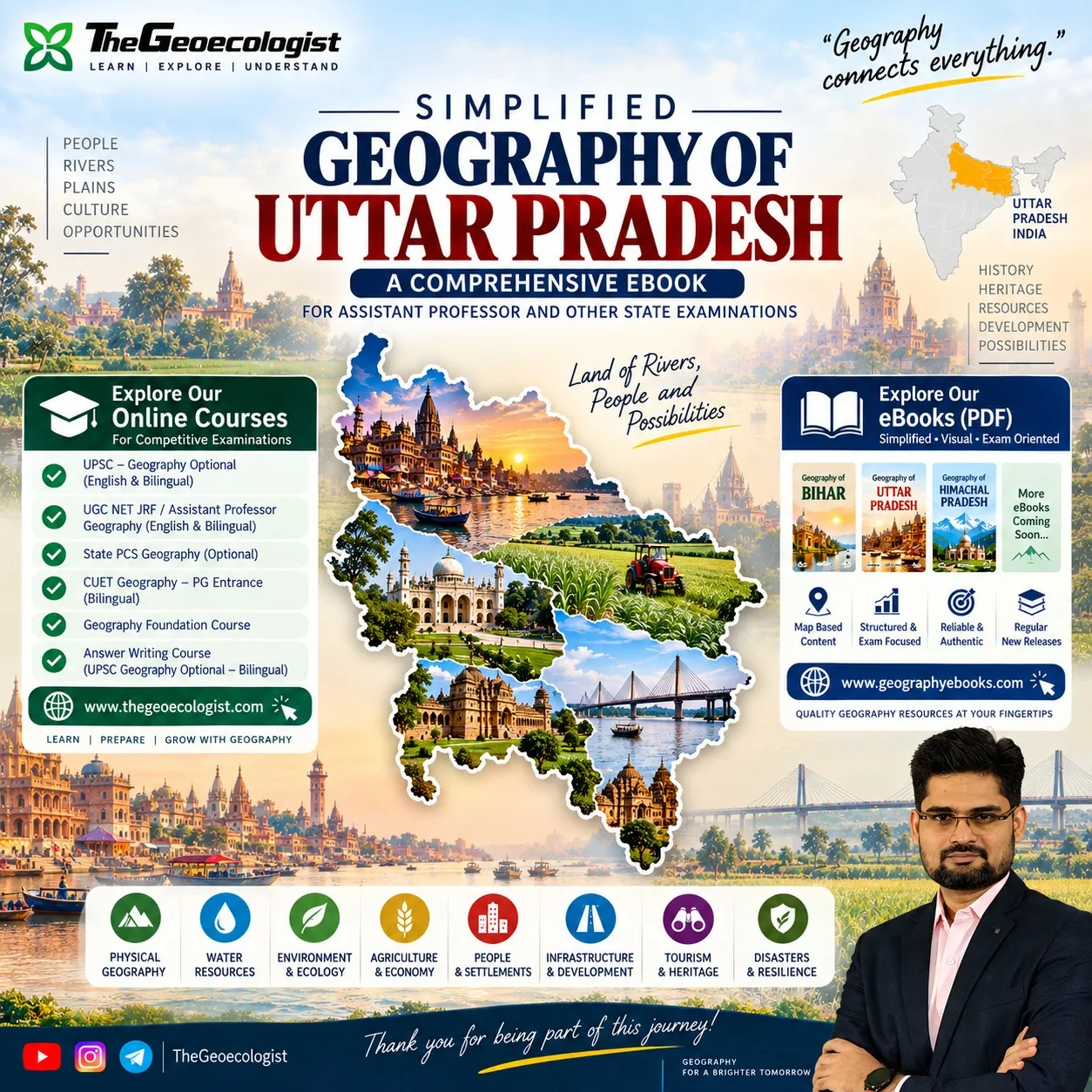
- Discover why Geography of Uttar Pradesh | eBook | Dr. Krishnanand provides the structured, visual approach needed to turn scattered facts into a coherent spatial narrative.
- Get practical tips for integrating the eBook into daily study routines and maximizing retention.
- Receive clear buying guidance to ensure you invest in a resource that matches your syllabus and exam goals.
The Challenge: Understanding Uttar Pradesh Agriculture in Competitive Exams
When aspirants encounter questions about Uttar Pradesh Agriculture, they are often asked to connect physical geography with socio‑economic outcomes. For example, a typical UP PCS question might ask: “Explain how the Green Revolution transformed the cropping patterns of the Upper Ganga Plain and its impact on sugarcane cultivation in the western districts.” Answering such a question requires more than memorizing statistics; it demands an understanding of soil types, irrigation infrastructure, market access, and policy interventions. Many candidates rely on generic notes that list crop percentages without showing the spatial relationships that examiners test. This gap leads to lost marks on map‑based questions, diagram interpretation, and case‑study analyses.
Research from the Wikipedia page on Agriculture in Uttar Pradesh shows that the state contributes over 19% of India’s total food grain production and houses the largest sugarcane belt in the country. Yet, exam materials rarely illustrate how the Terai’s alluvial soils, the Bundelkhand’s rocky plateau, and the central plains’ irrigation canals interact to produce these outcomes. Without a resource that ties these elements together, students struggle to synthesize information under time pressure.
How to Evaluate a Geography Resource for Exam Success
Before investing time or money, aspirants should assess a study material against five criteria:
- Conceptual Depth: Does the resource explain why</Uttar Pradesh Agriculture patterns exist, not just what they are?
- Map and Diagram Integration: Are there annotated maps, cross‑sections, and spatial models that reinforce each concept?
- Exam‑Oriented Structure: Is the content aligned with the syllabus of Assistant Professor, UP PCS, UPSC optional, and UGC NET Geography?
- Credibility of Author: Is the author experienced in teaching geography for competitive exams?
- Updates and Relevance: Does the material incorporate recent policy changes, such as the PM‑KISAN scheme or the National Horticulture Board initiatives?
Most free PDFs or scattered lecture notes fail on at least two of these fronts, especially map integration and exam‑specific framing. A high‑quality eBook should feel like a guided lecture series where each section builds on the previous one, culminating in a clear mental model of the state’s agricultural geography.
Why Geography of Uttar Pradesh | eBook | Dr. Krishnanand Stands Out
Geography of Uttar Pradesh | eBook | Dr. Krishnanand directly addresses the five evaluation criteria above. Authored by Dr. Krishnanand, who has taught UPSC, State PCS, and UGC NET aspirants for over a decade, the eBook transforms lecture notes into a visually driven narrative. It uses maps, diagrams, spatial models, and geographical synthesis to connect physical processes (such as riverine alluvium in the Terai) with human outcomes (like sugarcane dominance in the western belt).
The eBook’s tagline—”Know Where, Understand Why There, See the Bigger Picture”—captures its pedagogical approach. Rather than presenting isolated facts, it shows how the Uttar Pradesh Agriculture landscape evolved: from the Green Revolution’s introduction of high‑yield wheat and rice varieties in the 1960s to the subsequent shift toward cash crops like sugarcane and potatoes in response to market signals and irrigation expansion.
Because the content is based on Dr. Krishnanand’s actual lecture series, each chapter mirrors the flow of a classroom explanation, making it easier for auditory learners to follow. The eBook also includes practice‑style questions at the end of each section, enabling self‑assessment without needing external test series.
Core Modules Covered in the eBook
The eBook is organized into eight thematic modules, each designed to be a self‑contained unit that can be studied in 30‑45 minutes:
- Physical Geography & Relief: Overview of the Terai, Gangetic plains, Vindhyan plateau, and Bundelkhand hills; soil classification and erosion patterns.
- Water Resources & River Systems: Detailed maps of the Ganga, Yamuna, Ghaghara, Gandak, and their tributaries; irrigation canal networks and groundwater zones.
- Environment & Ecology: Wetlands, forest cover, biodiversity hotspots, and the impact of agro‑chemical runoff.
- Agriculture & Economy: Cropping patterns, Green Revolution effects, sugarcane belt dynamics, horticulture, and livestock integration.
- People & Settlements: Rural‑urban migration, agricultural labor demographics, and land‑holding patterns.
- Infrastructure & Development: Road and rail connectivity, mandi networks, cold storage, and agro‑processing units.
- Tourism & Heritage: Agro‑tourism circuits, cultural landscapes linked to farming festivals.
- Disasters & Resilience: Flood vulnerability in the Ghaghara basin, drought mitigation in Bundelkhand, and climate‑adaptive farming practices.
Each module contains at least three custom‑drawn maps, two comparative diagrams, and a “quick‑recap” box that summarizes key takeaways—ideal for last‑minute revision before the exam.
Practical Tips for Using the eBook in Your Study Routine
To maximize the benefit of Geography of Uttar Pradesh | eBook | Dr. Krishnanand, consider the following study plan:
- Preview (10 minutes): Scan the module headings and look at the maps. Form a mental question: “What physical factor explains the concentration of sugarcane in Meerut and Saharanpur?”
- Deep Dive (30 minutes): Read the explanatory text, annotate the diagrams, and try to redraw a simplified map from memory.
- Application (15 minutes): Answer the end‑of‑module practice questions without looking at the text. Compare your answers with the provided explanations.
- Revision (5 minutes): Review the quick‑recap box and create a one‑sentence summary that links physical geography to agricultural outcome.
- Weekly Review: At the end of each week, revisit the maps of all modules covered and attempt a cross‑topic question (e.g., “How does groundwater depletion in the western plains affect sugarcane yield?”)
By treating each module as a mini‑lecture and actively engaging with the visual elements, aspirants convert passive reading into active spatial reasoning—a skill that directly translates to higher scores in map‑based and diagram‑interpretation questions.
Buying Guidance: What to Look for Before Purchase
When deciding to purchase Geography of Uttar Pradesh | eBook | Dr. Krishnanand, verify these points:
- File Format: Ensure the eBook is provided as a searchable PDF with selectable text and high‑resolution images—essential for zooming into map details.
- License: Confirm that the purchase grants you lifetime access and the ability to download the file on multiple devices (laptop, tablet, smartphone).
- Support: Check whether the seller offers email support for clarifications or updates (e.g., if a new edition incorporates the latest agricultural census data).
- Price vs. Value: At INR 249, the eBook is priced competitively compared to coaching institute notes that often cost INR 800‑1500 for comparable content.
- Preview Availability: Look for a sample chapter or a few preview pages to assess the visual quality and writing style before committing.
If the product meets these criteria, it represents a low‑risk, high‑reward investment for anyone serious about mastering Uttar Pradesh Agriculture for competitive exams.
Final Thoughts and Next Steps
The intersection of physical geography, human activity, and policy makes Uttar Pradesh Agriculture a uniquely rich topic for geography examinations. Success hinges on having a resource that does more than list facts—it must show the “why” behind the spatial patterns and equip you to think like a geographer. Geography of Uttar Pradesh | eBook | Dr. Krishnanand delivers exactly that: a lecture‑driven, visually enriched, exam‑focused guide that turns confusion into clarity.
Take the next step: preview the eBook, evaluate it against the five criteria outlined above, and if it aligns with your preparation strategy, add it to your study toolkit. With the right resource in hand, the daunting landscape of Uttar Pradesh’s agricultural geography becomes a navigable map toward higher scores and deeper understanding.
Our Recommendation
📖 Part of our complete guide: Evolution of Geographical Thought: A Comprehensive Guide for UPSC Aspirants and Geography Enthusiasts
Frequently Asked Questions
Is the eBook suitable for UPSC Geography optional?
Yes, the eBook is designed for UPSC Geography optional, UP State PCS, Assistant Professor, and UGC NET Geography, focusing on conceptual clarity and map-based questions.
Does the eBook include practice questions?
Each module ends with practice‑style questions and explanatory answers to help you test your understanding and improve retention.
How can I access the eBook after purchase?
After purchase you receive a downloadable, searchable PDF that can be accessed on any device with lifetime access, as stated in the product listing.