Blog
Uttar Pradesh Population Literacy: Mastering Census Trends for UP Exams with Dr. Krishnanand’s eBook

Aspirants targeting Assistant Professor, UP State PCS, UGC NET Geography, or UPSC optional papers often encounter questions that require a deep understanding of Uttar Pradesh’s demographic landscape. The phrase Uttar Pradesh Population Literacy appears repeatedly in syllabi and previous year papers, reflecting the exam’s emphasis on interpreting Census data, sex ratio trends, and urbanization patterns. Without a structured resource, candidates risk memorising isolated numbers instead of grasping the spatial and socio‑economic forces that shape these statistics. This guide walks you through why these metrics matter, how to evaluate reliable sources, and how the Geography of Uttar Pradesh | eBook | Dr. Krishnanand transforms raw Census figures into exam‑ready insight.
- Understand the significance of Population Literacy, Sex Ratio, and Urbanization Trends in Uttar Pradesh Census for state‑level and national exams.
- Learn how physical geography, agriculture, and infrastructure influence demographic outcomes.
- Discover a step‑by‑step approach to interpret Census tables, maps, and spatial models.
- See how Dr. Krishnanand’s eBook integrates these themes with visual aids and conceptual synthesis.
- Get practical tips for using the eBook in revision, answer writing, and map‑based questions.
Uttar Pradesh Population Literacy: Why These Metrics Matter for UP Exams
When you examine the syllabus for Assistant Professor recruitment or UP State PCS, you will find explicit references to “Population Literacy Sex Ratio and Urbanization Trends in Uttar Pradesh Census.” Exam setters use these indicators to test a candidate’s ability to link demographic change with development challenges. For instance, a question may ask why districts in eastern Uttar Pradesh show lower literacy rates despite high population density, or how the sex ratio in western UP correlates with migration patterns. Answering such questions requires more than rote recall; it demands an understanding of the underlying geographic processes—terrain, river basins, agricultural productivity, and access to education facilities. By focusing on Uttar Pradesh Population Literacy as a lens, you can connect disparate facts into a coherent narrative that scores well in both objective and descriptive papers.
Physical Geography Context Influencing Demographics in Uttar Pradesh
The state’s diverse physiography—from the Terai plains in the north, through the Gangetic alluvial belt, to the Bundelkhand plateau and Vindhyan hills in the south—creates stark contrasts in resource availability and human settlement. These physical variations directly affect Uttar Pradesh Population Literacy outcomes. For example, the flood‑prone Terai region faces challenges in school accessibility, impacting literacy, while the fertile plains of western UP support higher urbanization and better sex ratios due to diversified economies. The eBook’s chapter on “Physical Geography & Relief” uses detailed maps and cross‑sections to illustrate how elevation, soil type, and river systems shape demographic patterns. Linking these physical factors to Census data helps you answer questions that ask you to “explain the spatial disparity in literacy rates across Uttar Pradesh.”
Data Sources and How to Interpret Census Figures
Reliable demographic analysis begins with credible sources. The primary source for Uttar Pradesh Population Literacy statistics is the Decennial Census of India, supplemented by the Sample Registration System (SRS) and National Family Health Survey (NFHS). When you open a Census table, look beyond the headline numbers: examine the rural‑urban split, gender disaggregation, and temporal trends. The eBook teaches a three‑step method: (1) identify the geographic unit (state, district, tehsil), (2) compare the indicator against national averages and neighbouring states, and (3) overlay spatial data such as literacy‑rate maps or sex‑ratio choropleths available in the eBook’s visual annex. This method transforms raw numbers into insightful observations that examiners reward.
Common Pitfalls When Studying UP Demographics
Many aspirants fall into traps that undermine their preparation. One frequent mistake is treating literacy as a static figure without considering age‑specific literacy or the impact of recent initiatives like the Sarva Shiksha Abhiyan. Another pitfall is ignoring the distinction between “crude” and “effective” sex ratio, which can lead to misinterpretation of gender bias. Additionally, candidates often overlook the role of migration—both intra‑state (from Bundelkhand to the NCR) and inter‑state (from Bihar and Jharkhand)—in shaping urbanization trends. The eBook’s section on “People & Settlements” includes case studies of migrant‑heavy districts, complete with diagrams showing push‑pull factors, helping you avoid these errors and answer analytically.
How Dr. Krishnanand’s eBook Integrates Population Literacy Trends
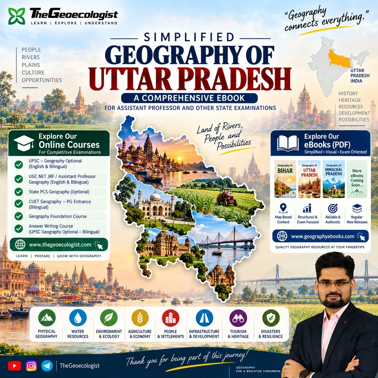
The Geography of Uttar Pradesh | eBook | Dr. Krishnanand is designed explicitly around the idea of “Know Where, Understand Why There, See the Bigger Picture.” Rather than presenting isolated facts, each chapter weaves physical, human, and developmental geography into a spatial narrative. For Uttar Pradesh Population Literacy, the eBook provides:
- District‑level literacy maps that highlight hotspots and lagging regions.
- Sex ratio trend lines from 1991 to 2021, annotated with policy milestones.
- Urbanization charts correlated with industrial corridors and highway networks.
- Spatial models that link literacy outcomes to access to schools, measured via GIS‑derived service area analysis.
These visual tools enable you to quickly grasp patterns that would take pages of text to explain, making revision efficient and answer writing more precise.
Practical Tips for Using the eBook in Exam Preparation
To maximise the benefit of the eBook for Uttar Pradesh Population Literacy topics, adopt the following routine:
- Begin with the chapter summary to identify the key concepts and data points covered.
- Use the embedded maps to practice sketching rough outlines—a skill valuable for map‑based questions in UPSC and State PCS.
- After reading a section, create a one‑sentence “geographic explanation” for a recent Census trend (e.g., “The rise in literacy in Gautam Buddh Nagar is linked to its proximity to the Delhi‑Mumbai Industrial Corridor and increased female workforce participation.”).
- Attempt previous year questions that mention literacy, sex ratio, or urbanization, then compare your answer with the eBook’s explanatory notes.
- For essay‑type answers, employ the eBook’s “spatial story” framework: start with the physical setting, layer human processes, and conclude with development implications.
By following this method, you transform the eBook from a reference text into an active study tool that builds the conceptual clarity examiners seek.
External Authoritative Resources for Further Reading
For those who wish to dive deeper into the data behind Uttar Pradesh Population Literacy, the following authoritative sources are recommended:
- Uttar Pradesh – Wikipedia offers a comprehensive overview of the state’s geography, history, and demographics, with citations to Census reports.
- Census of India – Official Portal provides access to the latest Census tables, meta‑data, and downloadable datasets for Uttar Pradesh.
These resources complement the eBook’s content and allow you to verify figures or explore additional variables such as workforce participation rates or migration streams.
Our Recommendation
📖 Part of our complete guide: Evolution of Geographical Thought: A Comprehensive Guide for UPSC Aspirants and Geography Enthusiasts
Frequently Asked Questions
How does the eBook help with map‑based questions on Uttar Pradesh demographics?
The eBook includes district‑level literacy, sex ratio, and urbanization maps, plus step‑by‑step guidance on interpreting spatial patterns, enabling you to sketch accurate maps and explain geographic reasons in answers.
Is the content of the eBook aligned with the UP State PCS syllabus?
Yes. The eBook’s chapters on Physical Geography, Water Resources, Agriculture, Settlements, Infrastructure, Tourism, and Disaster Resilience map directly to the UP State PCS Geography syllabus, with special focus on Census‑derived topics like Population Literacy and Sex Ratio.
Can I use the eBook for UGC NET Geography preparation?
Absolutely. The eBook’s conceptual synthesis, data interpretation methods, and visual aids are tailored for UGC NET Geography, where understanding the interplay of physical and human factors in Uttar Pradesh is essential for high scores.