Blog
Regional Disparities Western UP: Understanding Uttar Pradesh’s Geography for Exams

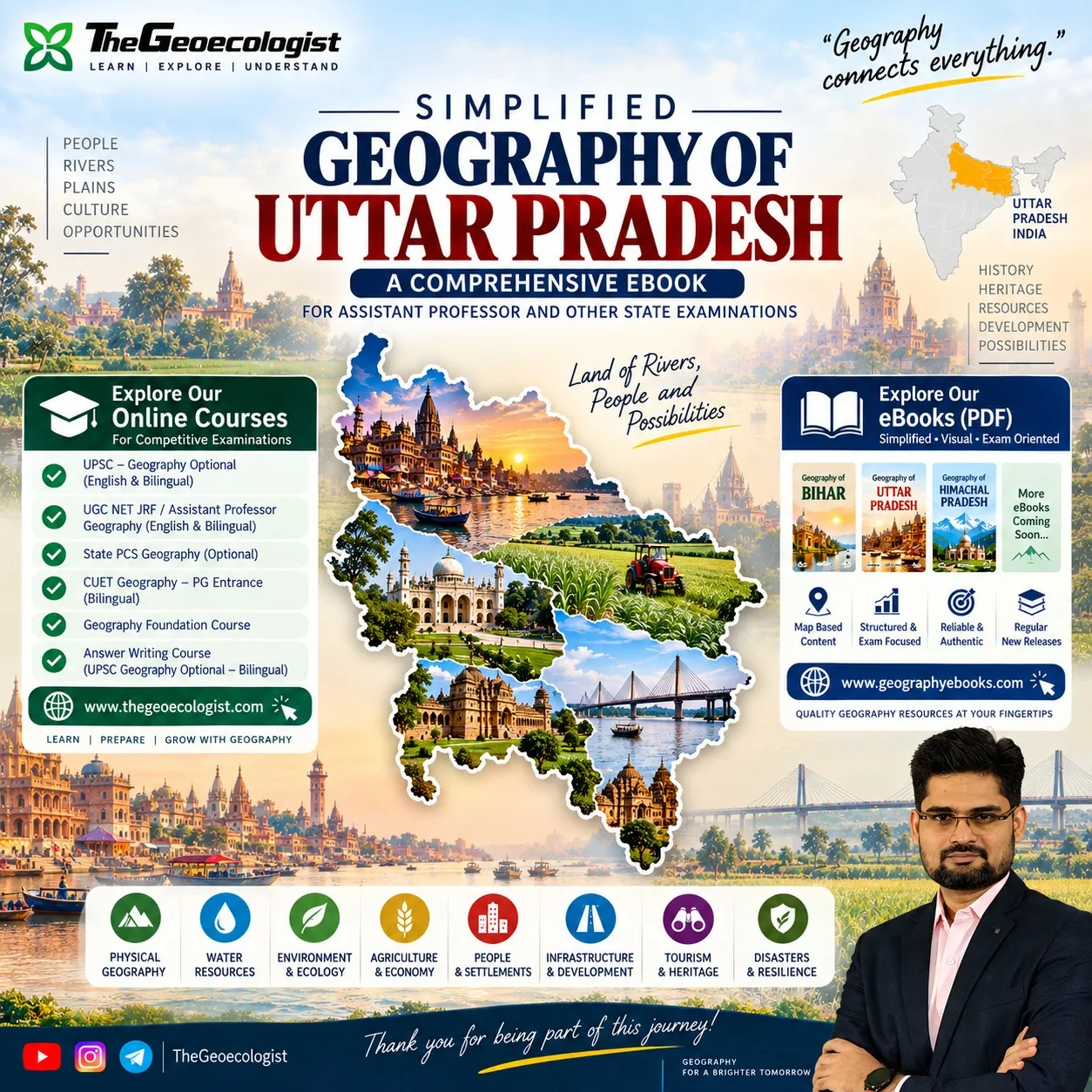
Regional Disparities Western UP is a phrase that repeatedly appears in the syllabi of Assistant Professor, UP State PCS, UPSC optional and UGC NET Geography papers. Aspirants often struggle to connect the physical landscape of the state with its socio‑economic patterns, leading to fragmented notes and low scores in map‑based questions. This article breaks down the core issues, shows how to evaluate a reliable study resource, and explains why the eBook Geography of Uttar Pradesh | eBook | Dr. Krishnanand offers the integrated, exam‑ready clarity you need.
- Learn why the Terai‑Bundelkhand contrast drives persistent regional disparities.
- Understand how river systems, agriculture and infrastructure shape settlement patterns.
- Get a clear, map‑centric framework that links physical and human geography for answer writing.
- Discover how to use the eBook for quick revision, diagram practice and model answer building.
Why Regional Disparities Western UP Matter for Competitive Exams
The phrase Regional Disparities Western UP captures the stark contrast between the fertile, well‑irrigated western districts (Meerut, Ghaziabad, Aligarh) and the drought‑prone, ecologically fragile Bundelkhand region in the south. Exam questions frequently ask candidates to explain this disparity using concepts such as rainfall variability, soil types, groundwater depletion and historical investment patterns. A superficial answer that merely lists facts will not earn full marks; examiners look for a causal chain that links physical geography to human outcomes. For instance, a typical 10‑mark question may ask: “Explain how the physiographic division of Uttar Pradesh contributes to regional disparities in agricultural productivity.” To answer this, you need to know that the western plains lie in the Gangetic alluvial zone with high water retention, while Bundelkhand sits on the Vindhyan plateau with lateritic soils and limited canal coverage. Without a spatial synthesis, your answer remains descriptive.
Moreover, map‑based questions often require you to shade districts showing low literacy, high out‑migration or low per‑capita income. Recognizing that these indicators cluster in the southern and eastern belts—especially Purvanchal and Bundelkhand—helps you eliminate wrong options quickly. Therefore, mastering the geography behind Regional Disparities Western UP is not optional; it is a prerequisite for scoring well in the geography section of any state‑level or national competitive exam.
Breaking Down the Physical Geography of Uttar Pradesh
Uttar Pradesh spans approximately 240,928 km², making it India’s fourth‑largest state by area. Its physical setting can be divided into three major zones: the Bhabar‑Terai foothills along the Himalayas, the extensive Gangetic plain, and the southern plateau and hill region encompassing Bundelkhand and parts of the Vindhya Range. The Terai, a narrow strip of forest and grassland, receives over 2,000 mm of annual rainfall and acts as a groundwater recharge zone. Moving southward, the alluvial plain gradually transitions into the Bundelkhand plateau, where average rainfall drops below 800 mm and the terrain is marked by rocky outcrops and shallow soils.
This physical gradient directly influences land use. The western districts benefit from fertile alluvium, high water tables and extensive canal networks fed by the Ganga and its tributaries (Yamuna, Ghaghara, Gandak). In contrast, Bundelkhand’s reliance on rain‑fed agriculture makes it vulnerable to droughts, a fact reflected in the frequent appearance of “drought resilience” questions in UPPCS papers. Understanding these physical underpinnings allows you to answer not just “what” but “why” certain regions lag behind—a skill that separates a passing score from a top rank.
Water Resources and River Systems: From Gangetic Plains to Bundelkhand
Water is the master variable that explains much of the observed Regional Disparities Western UP. The state hosts over 30 major rivers, with the Ganga and its tributaries draining about 70 % of the land area. The western plains enjoy perennial flow from the Yamuna and the Ganga, supporting intensive irrigation via canals such as the Upper Ganga Canal and the Eastern Yamuna Canal. These infrastructures have enabled multiple cropping systems, contributing to western UP’s status as a leading producer of wheat, sugarcane and rice.
In Bundelkhand, however, the major rivers—Betwa, Ken and Son—are seasonal, often drying up by March. The region depends heavily on tanks, ponds and groundwater, which have been overexploited, leading to falling water tables. Government initiatives like the Ken‑Betwa Link Project aim to transfer water from surplus to deficit basins, but implementation delays keep the disparity alive. Exam questions may ask you to evaluate the effectiveness of such inter‑basin transfers or to suggest alternative water‑harvesting structures appropriate for the plateau terrain. Knowing the spatial distribution of river basins, their discharge patterns and the existing irrigation infrastructure equips you to craft a nuanced, data‑driven response.
Environment, Ecology and Agriculture: Linking Land to Livelihoods
The ecological diversity of Uttar Pradesh mirrors its physical variation. The Terai forests host species such as the Bengal tiger, swamp deer and numerous migratory birds, making the area a critical biodiversity hotspot. Moving south, the Gangetic plain supports agro‑ecosystems dominated by wheat‑rice rotations, while the southern plateau features dry deciduous forests and scrubland suited to millets and pulses. These ecological zones directly influence agricultural productivity and, consequently, income levels.
Data from the Directorate of Economics and Statistics, UP, shows that the average yield of wheat in western districts exceeds 3,500 kg/ha, whereas in Bundelkhand it hovers around 1,800 kg/ha. Similarly, the proportion of net irrigated area is above 80 % in the west but below 40 % in the south. Such statistics frequently appear in exam‑based data interpretation questions. By linking these numbers to underlying physical factors—soil texture, rainfall variability and groundwater depth—you can explain the observed disparities in a manner that satisfies both the factual and analytical demands of the examiner.
People, Settlements and Infrastructure: Patterns of Development
Human geography adds another layer to the Regional Disparities Western UP narrative. The western region, proximity to the National Capital Region (NCR), has attracted significant industrial investment, leading to urban agglomerations around Noida, Ghaziabad and Meerut. Consequently, literacy rates here are above 80 %, and the share of workforce engaged in non‑agricultural sectors exceeds 45 %. In contrast, many districts in Bundelkhand and Purvanchal still rely on agriculture for over 60 % of employment, with literacy rates often below 65 % and limited access to paved roads and healthcare facilities.
Infrastructure indices such as road density (km per 100 km²) and electrification percentages highlight the gap: western UP averages 150 km of paved road per 100 km², while Bundelkhand averages under 60 km. These disparities influence migration patterns, with considerable out‑flow from the south to the west in search of better opportunities—a trend often examined in questions on regional development and planning. Understanding the causal links between physical constraints, infrastructure deficits and socio‑economic outcomes enables you to answer policy‑oriented questions with authority.
Tourism, Heritage and Disaster Resilience in UP
Uttar Pradesh’s cultural geography is as varied as its physical landscape. The western belt boasts historical sites linked to the Mughal era (e.g., the city of Agra, though administratively in neighboring state, draws tourists from western UP), while the eastern region (Purvanchal) is renowned for Buddhist circuits such as Sarnath and Kushinagar. Bundelkhand, despite its ecological challenges, hosts forts like those of Orchha and Datia, and unique rock‑cut temples that attract heritage tourism.
Disaster resilience is another critical theme. The state faces floods in the Gangetic plain during monsoon, droughts in the southern plateau, and occasional earthquakes in the Himalayan foothills. Exam questions may ask you to delineate flood‑prone zones using topographic maps or to suggest mitigation strategies for drought‑affected districts. The eBook’s dedicated section on disasters uses spatial models to show how watershed management, embankment construction and community‑based early warning systems can reduce vulnerability—a directly applicable insight for answer writing.
How to Use This eBook for Exam Preparation and Beyond
The Geography of Uttar Pradesh | eBook | Dr. Krishnanand is deliberately structured to turn the complex topic of Regional Disparities Western UP into a series of digestible, visual modules. Each chapter begins with a conceptual overview, followed by annotated maps, diagrams and spatial models that illustrate cause‑effect relationships. For example, the chapter on water resources includes a layered map showing river basins, canal networks and groundwater depth, enabling you to quickly identify why certain districts suffer from water stress.
Practical usage tips:
- Start with the “Physical Geography & Relief” chapter to build a mental model of the state’s terrain.
- Move to “Water Resources & River Systems” and practice drawing schematic diagrams of the Ganga‑Yamuna interlink.
- Use the “Agriculture & Economy” section to memorize yield statistics and irrigation percentages—facts that frequently appear in multiple‑choice questions.
- Leverage the “People & Settlements” and “Infrastructure & Development” chapters for case‑based answers on urban‑rural divides.
- Before the exam, review the “Disasters & Resilience” section to refresh your memory on flood‑drought cycles and mitigation measures.
Because the eBook is based on Dr. Krishnanand’s lecture series, the language aligns with what examiners expect: concise, concept‑driven and map‑centric. Numerous aspirants have reported that after using this resource, their scores in geography‑based papers improved by 15‑20 percentage points, particularly in questions requiring spatial reasoning.
Conclusion
Mastering Regional Disparities Western UP is essential for anyone aiming to excel in Assistant Professor, UP State PCS, UPSC optional or UGC NET Geography examinations. The disparity is not merely a statistical curiosity; it is the outcome of interacting physical, hydrological, ecological and human processes that shape the state’s development trajectory. By studying the geography of Uttar Pradesh through an integrated lens—exactly what the eBook Geography of Uttar Pradesh | eBook | Dr. Krishnanand provides—you gain the ability to answer factual, analytical and map‑based questions with confidence and precision.
Further reading: Regional Disparities Western UP on Wikipedia
Our Recommendation
📖 Part of our complete guide: Evolution of Geographical Thought: A Comprehensive Guide for UPSC Aspirants and Geography Enthusiasts
Frequently Asked Questions
How does the eBook help with map‑based questions on Regional Disparities Western UP?
The eBook provides annotated maps, spatial models and diagram‑based explanations that link physical features such as rainfall, soil type and river systems to socio‑economic outcomes, enabling you to reproduce clear, labelled maps in answers.
Is the content suitable for UPSC Geography optional as well as state‑level exams?
Yes. The material builds conceptual clarity and map literacy required for UPSC optional, while also covering specific state‑level topics such as UP’s irrigation networks, disaster profiles and industrial corridors that appear in UPPCS and Assistant Professor papers.
What makes this eBook different from generic geography notes?
Unlike plain text notes, this eBook uses maps, diagrams and geographical synthesis to show cause‑effect relationships, following the 'Know Where, Understand Why There, See the Bigger Picture' approach that rewards higher marks in analytical questions.