Blog
Planning Region Delineation: Formal vs Functional Regions Explained

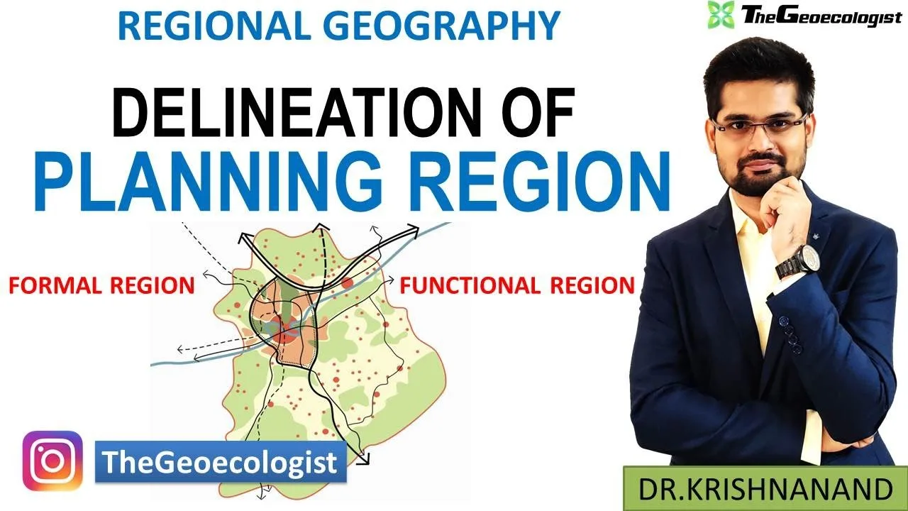
Table of Contents
- Understanding Planning Regions: Conceptual Framework
- Why Delineation Matters for Policy
- Formal Regions: Uniformity as the Defining Criterion
- Types of Formal Regions in Planning
- Methods for Formal Region Delineation
- Functional Regions: Interaction and Interdependence
- Structure of a Functional Region
- Types of Functional Regions
- Methods for Functional Region Delineation
- Comparative Analysis: Formal vs Functional Regions
- The Complementarity Principle
- Multi-Level Planning Region Hierarchy in India
- Macro Regions (National Level)
- Meso Regions (State/Inter-State Level)
- Micro Regions (District/Block Level)
- Criteria for Planning Region Delineation: A Synthesis
- 1. Homogeneity/Coherence
- 2. Nodality
- 3. Viability
- 4. Contiguity
- 5. Manageability
- 6. Flexibility
- Techniques and Tools: Traditional to Modern
- Traditional Approaches
- Modern Geospatial Techniques
- Case Studies: Planning Region Delineation in Practice
- Case 1: Damodar Valley Corporation (DVC) — River Basin Functional Region
- Case 2: National Capital Region (NCR) — Metropolitan Functional Region
- Case 3: Agro-Climatic Zones — Formal Regions for Agricultural Planning
- Challenges in Planning Region Delineation
- 1. Data Limitations
- 2. Administrative-Geographical Mismatch
- 3. Dynamic Boundaries
- 4. Multi-Scale Conflicts
- 5. Political Economy Considerations
- UPSC Geography Optional: Examination Relevance
- Previous Year Question Trends
- Future Directions: Smart Delineation for Smart Planning
- Real-Time Functional Regions
- Participatory Delineation
- Climate-Resilient Regions
- AI-Assisted Multi-Objective Optimization
- Conclusion
Planning Region Delineation is a fundamental concept in regional geography that involves identifying and demarcating areas for systematic development planning. Whether you are preparing for UPSC Geography Optional or studying regional planning academically, understanding the distinction between formal and functional regions is crucial for effective spatial analysis and policy formulation. This comprehensive guide explores the theoretical foundations, methodological approaches, and practical applications of delineating planning regions in the Indian context and beyond.
- Planning Region Delineation involves demarcating homogeneous or functional areas for development planning
- Formal regions are defined by uniform physical or cultural characteristics
- Functional regions are organized around a central node with interconnected flows
- Multiple criteria (physical, socio-economic, administrative) are used for delineation
- GIS and remote sensing have revolutionized regional delineation accuracy
- Essential for UPSC Geography Optional Paper II and regional planning practice
Understanding Planning Regions: Conceptual Framework
A planning region is a territorial unit designated for the purpose of formulating and implementing development plans. Unlike administrative boundaries which are often historical or political, planning regions are carved out based on geographical logic to ensure planning efficiency. The Planning Region Delineation process seeks to create units that are internally homogeneous or functionally coherent, enabling planners to address region-specific problems with tailored strategies.
The concept gained prominence in India after the establishment of the Planning Commission in 1950 (now NITI Aayog). The NITI Aayog continues to emphasize regional planning as a tool for balanced development. According to the Regional Planning framework, effective delineation requires understanding both the physical template and human geography of an area.
Why Delineation Matters for Policy
Proper Planning Region Delineation ensures that:
- Resource allocation matches regional potentials and needs
- Infrastructure investments generate maximum multiplier effects
- Environmental carrying capacity is not exceeded
- Administrative coordination becomes feasible
- Disparities between regions can be measured and addressed
Formal Regions: Uniformity as the Defining Criterion
A formal region (also called uniform or homogeneous region) is an area characterized by a high degree of uniformity in one or more selected phenomena. In the context of Planning Region Delineation, formal regions are identified based on measurable, observable characteristics that show minimal internal variation.
Types of Formal Regions in Planning
Physiographic Formal Regions
These are based on physical geography criteria such as relief, climate, soil, vegetation, and drainage. Examples include the Indo-Gangetic Plain, the Deccan Plateau, the Western Ghats, and the Thar Desert. Each exhibits distinct physical homogeneity that influences agricultural patterns, settlement types, and resource endowments.
Socio-Economic Formal Regions
These regions display uniformity in demographic, economic, or cultural attributes. Examples include the Punjab-Haryana wheat belt, the Chotanagpur mineral belt, or the Kerala littoral zone with high literacy and health indicators. Census data, NSSO surveys, and satellite imagery help identify such regions.
Administrative Formal Regions
While not purely geographical, districts, tehsils, and blocks often serve as default formal regions for data collection and plan implementation. The challenge lies in aligning these with geographical realities.
Methods for Formal Region Delineation
Geographers employ several quantitative techniques for Planning Region Delineation of formal regions:
- Weighted Index Method: Assigning weights to selected indicators (rainfall, soil type, crop yield) and computing composite scores
- Factor Analysis: Reducing multiple correlated variables into principal components that explain regional variance
- Cluster Analysis: Grouping spatial units (districts/blocks) based on similarity across multiple dimensions
- GIS Overlay Analysis: Superimposing thematic layers (soil, slope, rainfall) to identify homogeneous zones
Functional Regions: Interaction and Interdependence
Unlike formal regions, functional regions (also called nodal or polarized regions) are defined by the flow of goods, services, people, information, and capital between a central node and its surrounding hinterland. The Planning Region Delineation for functional regions focuses on spatial interaction patterns rather than attribute uniformity.
Structure of a Functional Region
A functional region comprises three key elements:
- Core/Node: The dominant center providing higher-order services (metropolitan city, industrial hub, market town)
- Hinterland/Periphery: The area dependent on the core for employment, services, markets, and administration
- Linkages: Transportation networks, communication channels, commodity flows, commuting patterns that bind core and periphery
Types of Functional Regions
Metropolitan Functional Regions
Large urban agglomerations like Delhi NCR, Mumbai Metropolitan Region, or Bengaluru Urban Region exemplify functional regions where daily commuting, service delivery, and economic integration create a unified labor and housing market.
Market Areas and Trade Regions
Based on Reilly’s Law of Retail Gravitation and Christaller’s Central Place Theory, these regions define the sphere of influence of a market center. The Planning Region Delineation here uses threshold population and range of goods concepts.
River Basin Regions
Hydrological units like the Damodar Valley Corporation (DVC) area or the Narmada Basin represent functional regions where water resource management requires integrated planning across administrative boundaries.
Methods for Functional Region Delineation
Identifying functional regions requires flow data and interaction metrics:
- Gravity Model: Predicts interaction between centers based on population size and distance
- Flow Analysis: Mapping actual movement data (commodity trucks, passenger traffic, telephone calls, bank clearings)
- Commuting Data: Census migration and journey-to-work data to define labor market areas
- Network Analysis: Using graph theory to identify nodal hierarchy and connectivity
Comparative Analysis: Formal vs Functional Regions
| Criterion | Formal Region | Functional Region |
|---|---|---|
| Defining Logic | Internal homogeneity | External interaction/interdependence |
| Boundary Nature | Transitional zones (fuzzy) | Sharp breakpoints in flow intensity |
| Data Requirements | Attribute data (census, surveys, remote sensing) | Flow/interaction data (origin-destination matrices) |
| Planning Utility | Resource-based planning, environmental management | Infrastructure, services, economic integration |
| Examples | Agro-climatic zones, soil regions | Metropolitan regions, river basins |
| Temporal Stability | Relatively stable | Dynamic, changes with infrastructure |
The Complementarity Principle
In practice, Planning Region Delineation rarely relies on a single approach. The most effective planning regions combine formal homogeneity with functional coherence. For instance, the National Capital Region (NCR) planning integrates the formal characteristics of the Delhi Ridge, Yamuna floodplains, and agro-climatic uniformity with the functional realities of commuting patterns, industrial corridors, and service linkages.
Multi-Level Planning Region Hierarchy in India
India’s planning framework recognizes multiple scales of Planning Region Delineation:
Macro Regions (National Level)
These are large physiographic or socio-economic divisions like the Himalayan Region, the Peninsula, the Coastal Plains, and the Islands. The Planning Commission’s 1980s exercise identified 15 agro-climatic zones, later refined into 127 agro-ecological sub-regions by ICAR.
Meso Regions (State/Inter-State Level)
Sub-divisions within states based on river basins (Mahanadi Basin), mineral belts (Singrauli), or metropolitan influence (Kolkata Metropolitan Area). State Planning Boards typically operate at this scale.
Micro Regions (District/Block Level)
These are the operational units for decentralized planning — blocks, watersheds, or taluks. The 73rd and 74th Constitutional Amendments mandated district planning committees, making micro-level Planning Region Delineation constitutionally significant.
Criteria for Planning Region Delineation: A Synthesis
Scholars like B.J.L. Berry, R.P. Mishra, and Moonis Raza have proposed multi-criteria frameworks. The essential criteria include:
1. Homogeneity/Coherence
The region should be internally consistent in terms of the chosen criteria (physical for formal, interaction for functional).
2. Nodality
Presence of a growth center or potential node that can polarize development.
3. Viability
Sufficient resource base, population threshold, and economic potential to sustain planned development.
4. Contiguity
The region must be a geographically contiguous unit (except for archipelagos).
5. Manageability
Size and complexity should allow effective administration and monitoring.
6. Flexibility
Boundaries should accommodate future changes in interaction patterns or administrative needs.
Techniques and Tools: Traditional to Modern
Traditional Approaches
Early Planning Region Delineation relied on:
- Overlay mapping with transparent sheets (McHarg’s method)
- Delphi technique for expert consensus
- Ranking and scoring of districts on development indicators
Modern Geospatial Techniques
Contemporary delineation leverages:
- GIS Multi-Criteria Evaluation (MCE): Analytic Hierarchy Process (AHP) for weight assignment
- Remote Sensing: Land use/land cover, night-time lights (proxy for economic activity), NDVI for agricultural homogeneity
- Big Data Analytics: Mobile phone CDR data, GPS traces, digital transaction flows for real-time functional region mapping
- Machine Learning: Unsupervised clustering (k-means, DBSCAN) on high-dimensional spatial data
Case Studies: Planning Region Delineation in Practice
Case 1: Damodar Valley Corporation (DVC) — River Basin Functional Region
Established in 1948, the DVC represents India’s first multipurpose river valley project as a functional planning region. Covering 24,235 sq km across Jharkhand and West Bengal, its delineation followed the hydrological boundary of the Damodar basin. The region integrated flood control, irrigation, power generation, and industrial development (steel, coal, thermal power). The functional logic — water as the integrating resource — overrode state boundaries, demonstrating how Planning Region Delineation can transcend administrative divisions.
Case 2: National Capital Region (NCR) — Metropolitan Functional Region
The NCR Planning Board Act (1985) created a functional region encompassing Delhi and adjoining districts of Haryana, Uttar Pradesh, and Rajasthan (total 55,083 sq km). Delineation criteria included:
- Commuting patterns (census journey-to-work data)
- Economic linkages (industrial corridors, wholesale markets)
- Transport connectivity (rail, road, metro network)
- Environmental continuity (Yamuna basin, Aravalli extension)
The NCR illustrates dynamic Planning Region Delineation — boundaries have expanded from 30,000 sq km (1985) to 55,083 sq km (2021) as metro connectivity and urban sprawl extended functional linkages.
Case 3: Agro-Climatic Zones — Formal Regions for Agricultural Planning
The Planning Commission’s 1988 delineation of 15 agro-climatic zones (later 127 sub-zones) used formal region criteria: rainfall, temperature, soil type, topography, and cropping pattern homogeneity. This Planning Region Delineation guides crop diversification, irrigation planning, and technology dissemination under schemes like RKVY and NMSA.
Challenges in Planning Region Delineation
1. Data Limitations
Flow data (commodity, commuting, capital) is scarce, outdated, or aggregated at coarse scales. The Economic Census and NSSO provide partial coverage.
2. Administrative-Geographical Mismatch
Planning regions rarely align with district/block boundaries, creating implementation friction. The “district as planning unit” compromise often sacrifices geographical logic.
3. Dynamic Boundaries
Functional regions evolve with infrastructure (new highways, metros), technology (digital connectivity), and policy (GST, labor codes). Static delineation becomes obsolete quickly.
4. Multi-Scale Conflicts
A region optimal for water management (river basin) may not suit industrial planning (corridor) or service delivery (metropolitan area). Nested hierarchies create coordination challenges.
5. Political Economy Considerations
Boundary decisions involve resource allocation, political representation, and identity claims. Technocratic delineation often confronts political resistance.
UPSC Geography Optional: Examination Relevance
For UPSC aspirants, Planning Region Delineation is a high-yield topic in Paper II (Human Geography and Regional Planning). Key focus areas include:
- Conceptual clarity: Definitions, differences, criteria for formal vs functional regions
- Thinkers: Christaller (Central Place), Losch, Isard, Berry, R.P. Mishra, Moonis Raza
- Models: Gravity model, Growth Pole (Perroux/Boudeville), Growth Center, Spread/Backwash effects
- Indian Case Studies: NCR, DVC, Chotanagpur, Agro-climatic zones, Command Areas
- Techniques: Weighted index, Factor analysis, GIS-MCE, Remote sensing applications
- Policy Linkages: NITI Aayog, Aspirational Districts, PM Gati Shakti, National Master Plan
Previous Year Question Trends
Recent questions have asked:
- “Distinguish between formal and functional regions with suitable examples from India” (2021)
- “Examine the criteria for delineation of planning regions in the context of multi-level planning” (2019)
- “Critically evaluate the relevance of Growth Pole theory in Indian regional planning” (2022)
Future Directions: Smart Delineation for Smart Planning
The future of Planning Region Delineation lies in dynamic, data-driven, and participatory approaches:
Real-Time Functional Regions
Using mobile network data, UPI transaction flows, and GST e-way bills to map economic regions that update monthly rather than decennially.
Participatory Delineation
Incorporating local knowledge through PGIS (Participatory GIS) to ensure regions reflect community perceptions of belonging and interaction.
Climate-Resilient Regions
Delineating planning units based on climate vulnerability assessments, water security zones, and carbon sequestration potential — aligning with India’s NDC commitments.
AI-Assisted Multi-Objective Optimization
Algorithms that simultaneously optimize for homogeneity, nodality, contiguity, and equity — generating Pareto-optimal regionalization alternatives for stakeholder deliberation.
Conclusion
Planning Region Delineation remains the spatial foundation of all regional development efforts. The dichotomy between formal and functional regions is not a choice but a complementarity — formal regions reveal what a place is (its endowments), while functional regions reveal what a place does (its connections). Effective planning synthesizes both perspectives, grounded in robust data, transparent methods, and adaptive governance. As India advances toward a $5 trillion economy with inclusive and sustainable regional development, the science and art of delineating planning regions will only grow in significance. For students, practitioners, and policymakers alike, mastering this craft is indispensable.
For comprehensive study material on Regional Planning and Development for UPSC Geography Optional, visit TheGeoecologist’s Regional Planning E-Book.
Frequently Asked Questions
Formal regions are defined by internal homogeneity in physical or socio-economic characteristics (like soil, climate, crop pattern), while functional regions are defined by spatial interactions and flows (commuting, trade, communication) organized around a central node.
India uses weighted index method, factor analysis, cluster analysis, GIS overlay for formal regions; and gravity models, flow analysis, commuting data, and network analysis for functional regions. Modern approaches integrate remote sensing, big data, and machine learning.
It is a core topic in Paper II (Regional Planning), frequently tested through conceptual questions, thinker-based theories (Christaller, Perroux, R.P. Mishra), Indian case studies (NCR, DVC, Agro-climatic zones), and contemporary policy linkages (NITI Aayog, Aspirational Districts, PM Gati Shakti).