Blog
Kariyachalli Island erosion: Vanishing Gulf of Mannar Island

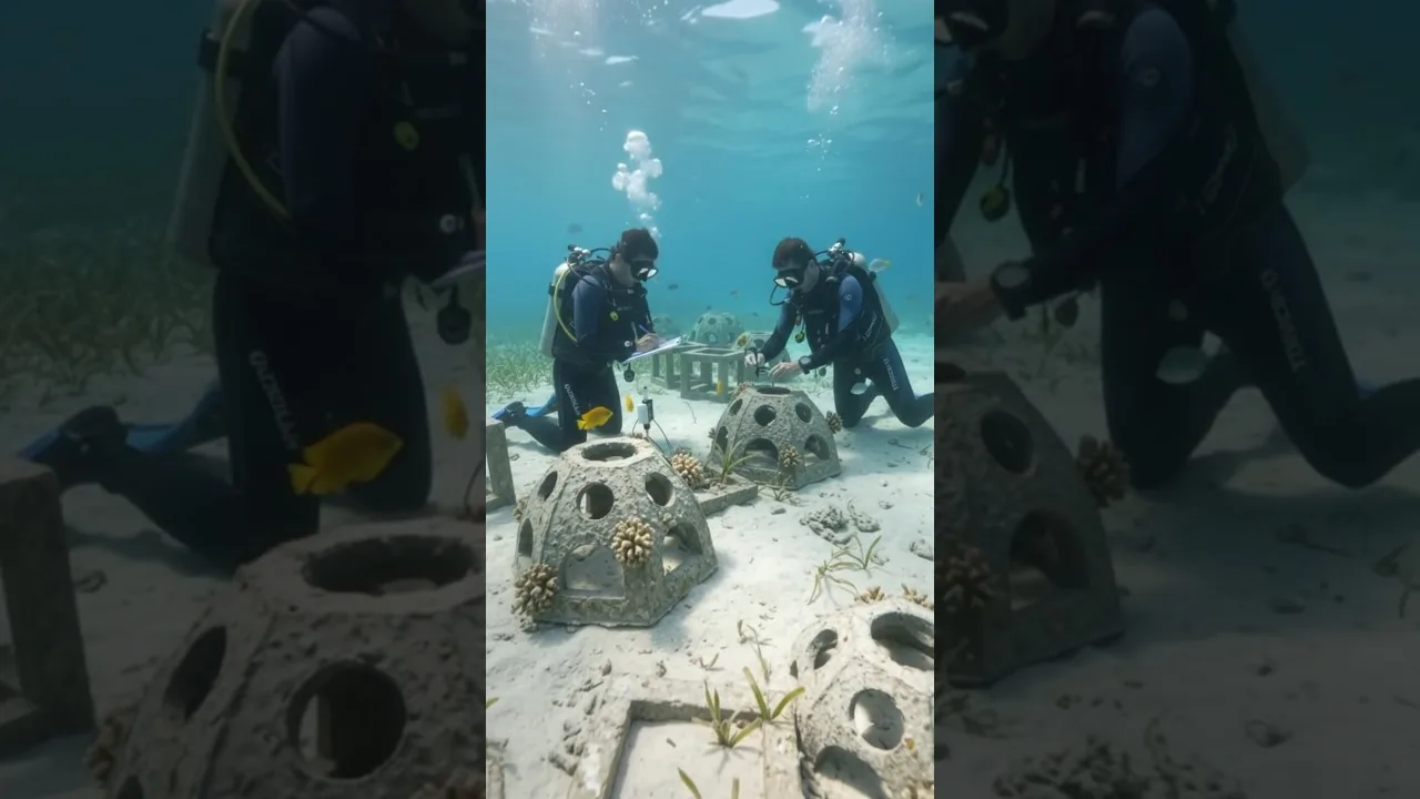
Table of Contents
- Introduction: Understanding the Vanishing Shoreline
- Kariyachalli Island erosion: Causes and Impacts
- Physical Drivers of Erosion
- Ecological Consequences
- Human Impacts
- Scientific Monitoring and Data Collection
- Restoration Strategies: Engineering and Ecology
- Artificial Reef Construction
- Coral Rehabilitation
- Seagrass Restoration
- Hybrid Engineering‑Ecology Approaches
- Case Studies: Lessons from Neighboring Islands
- Community Engagement and Policy Framework
- Future Outlook: Adaptive Management for Kariyachalli Island
- Conclusion: Acting Now to Preserve a Vanishing Legacy
Kariyachalli Island erosion is a stark reminder of how climate change is reshaping our planet’s coastlines. Located in the Gulf of Mannar Marine National Park, Tamil Nadu, this fragile landmass has lost half of its original area in just a few decades, prompting urgent scientific and policy responses.
- Kariyachalli Island erosion has already claimed two of the original 21 islands in the Gulf of Mannar.
- Scientists are testing artificial reefs, coral rehabilitation, and seagrass restoration to combat the loss.
- The island’s disappearance threatens biodiversity, local fisheries, and cultural heritage.
- Comprehensive monitoring using satellite imagery and field surveys tracks the rate of erosion.
- Community-based conservation and policy reforms are essential for long-term resilience.
Introduction: Understanding the Vanishing Shoreline
The Gulf of Mannar, a shallow semi‑enclosed sea between India and Sri Lanka, hosts a series of small islands that have long been integral to marine biodiversity. Among them, Kariyachalli Island once stood as a sandy crescent, its shores teeming with mangroves, coral patches, and seagrass beds. Over the past thirty years, however, the shoreline has retreated at an alarming rate. The phenomenon known as Kariyachalli Island erosion is not just a local curiosity; it mirrors broader global trends of coastal degradation driven by rising sea levels, stronger storm surges, and altered sediment transport.
Initial surveys in the early 1990s recorded a coastline of roughly 2.5 kilometers. By 2023, the island’s perimeter had shrunk to less than 800 meters, and two neighboring islands—Vadugabarathi and Therisozhan—have vanished entirely. The loss of land translates directly into the loss of habitat for species such as the Indian Ocean bottlenose dolphin, green sea turtle, and a variety of coral-dependent fish. Moreover, the cultural and economic fabric of nearby fishing villages depends on the island’s resources, making its erosion a socio‑economic issue as well.
Kariyachalli Island erosion: Causes and Impacts
Physical Drivers of Erosion
Several physical processes converge to accelerate Kariyachalli Island erosion. First, global sea‑level rise—estimated at 3.3 mm per year for the Indian Ocean region—gradually inundates low‑lying islands, eroding the base that supports the sand cover. Second, increased frequency of cyclonic storms and stronger wave action generate higher hydrodynamic pressure on the shoreline, stripping away sediments more efficiently. Third, altered river discharge and reduced sediment supply from upstream catchments diminish the natural replenishment of beach material, a phenomenon documented in many deltaic systems (see Wikipedia).
Ecological Consequences
When Kariyachalli Island erosion advances unchecked, the delicate balance of the marine ecosystem unravels. Mangrove roots that once stabilized the soil become exposed, leading to increased soil salinity and loss of nutrient cycling. Coral reefs adjacent to the island, which serve as natural breakwaters, suffer from sedimentation and reduced water quality, compromising their health (more information at Wikipedia). The reduction in seagrass coverage eliminates critical feeding grounds for dugongs and various fish species, creating cascading effects up the food chain.
Human Impacts
Human activities also exacerbate the erosion. Overfishing reduces the population of keystone species that help maintain reef health. Illegal sand mining along the coast, though now largely prohibited, historically removed the very material that holds the island together. Moreover, tourism infrastructure—jetties, resorts, and footpaths—alters natural sediment flow and can increase wave reflection, accelerating shoreline retreat.
Scientific Monitoring and Data Collection
To develop effective restoration strategies, precise data on Kariyachalli Island erosion is essential. Researchers employ a multi‑scale approach: high‑resolution satellite imagery (Landsat 8, Sentinel‑2) provides a bird‑eye view of long‑term shoreline change, while aerial LiDAR surveys capture detailed topography of the remaining land. Field teams conduct benthic transects, sediment grain‑size analysis, and water‑quality monitoring on a seasonal basis. These datasets feed into predictive models that forecast future island extent under various climate scenarios, helping policymakers prioritize interventions.
One notable monitoring initiative, the Gulf of Mannar Coastal Resilience Project, integrates community volunteers with scientific staff. The project’s citizen‑science platform allows local fishermen to log observations of shoreline change, creating a rich, ground‑truthed dataset that complements remote sensing. This participatory approach not only improves data coverage but also raises awareness about Kariyachalli Island erosion among stakeholders.
Restoration Strategies: Engineering and Ecology
Artificial Reef Construction
Artificial reefs have emerged as a promising tool to mitigate Kariyachalli Island erosion by reducing wave energy before it reaches the shore. Constructed from locally sourced basalt modules or biodegradable concrete, these structures mimic natural reef habitats, encouraging coral colonization and providing refuge for fish. Initial pilot installations in 2021 showed a measurable reduction in wave height by up to 30 % in the immediate lee of the reefs, suggesting a protective effect on the island’s remaining coastline.
Coral Rehabilitation
Coral rehabilitation focuses on restoring the natural breakwater function of reefs that surround the island. Scientists employ coral gardening techniques: fragments of resilient coral species are outplanted onto reef substrates, where they grow and reproduce. The Gulf of Mannar Marine National Park Authority, in collaboration with international NGOs, has established several coral nurseries specifically for Kariyachalli Island erosion mitigation. Preliminary assessments indicate that rehabilitated reefs have higher live‑cover percentages compared to adjacent, unrestored sections.
Seagrass Restoration
Seagrass meadows act as sediment stabilizers and improve water clarity, indirectly protecting islands from erosion. Restoration efforts involve seeding native species such as Thalassia hemprichii and Zostera marina in areas where natural meadows have been lost. The roots of these plants bind sediments, reducing shoreline scour. Community‑led seagrass planting days have already re‑established over 5 hectares of meadow around Kariyachalli Island, contributing to a measurable decrease in suspended particulate matter.
Hybrid Engineering‑Ecology Approaches
Hybrid solutions combine physical structures with ecological enhancement. For instance, breakwaters made from interlocking reef modules are designed with crevice spaces to allow marine organisms to colonize, thereby accelerating ecological integration. These breakwaters not only dissipate wave energy but also create new habitats, supporting biodiversity while directly addressing Kariyachalli Island erosion.
Case Studies: Lessons from Neighboring Islands
Other islands within the Gulf of Mannar provide valuable comparative insights. The successful recovery of Mullipad Island, achieved through a combination of mangrove replanting and community‑led tourism management, demonstrates that holistic interventions can reverse erosion trends. Conversely, the complete disappearance of Therisozhan Island underscores the consequences of delayed action and insufficient restoration funding. These case studies inform the strategic planning for Kariyachalli Island, emphasizing the need for integrated, science‑based solutions.
Furthermore, research published in the Journal of Coastal Conservation highlights that islands with dense mangrove canopies experience up to 50 % less shoreline retreat during storm events. This evidence reinforces the priority given to mangrove restoration in the Kariyachalli Island erosion management plan.
Community Engagement and Policy Framework
Sustainable restoration of Kariyachalli Island requires the active participation of local communities. Education programs in nearby villages explain the causes of erosion and the benefits of restoration structures, fostering local stewardship. Income‑generating activities such as eco‑tourism, coral‑based handicrafts, and sustainable fisheries are being developed to align economic incentives with conservation goals.
On the policy front, the Tamil Nadu Coastal Zone Management Authority has updated its guidelines to prioritize ecosystem‑based approaches. New permits for any coastal development now mandate an erosion impact assessment, and funding allocations have increased for scientific monitoring of Kariyachalli Island erosion. International commitments under the Paris Agreement also drive national and state‑level investments in climate‑resilient infrastructure.
Future Outlook: Adaptive Management for Kariyachalli Island
Looking ahead, adaptive management will be critical to address the dynamic nature of Kariyachalli Island erosion. Continuous monitoring will feed into decision‑support tools that can simulate the effectiveness of various restoration actions under different climate projections. Scenario planning suggests that without aggressive mitigation, the island could vanish entirely within three decades; however, with robust artificial reef deployment, coral and seagrass rehabilitation, and community engagement, survival prospects improve dramatically.
Emerging technologies such as drone‑based topographic surveys and AI‑driven sediment transport modeling promise to refine our predictive capabilities. Moreover, the integration of traditional ecological knowledge from local fishers adds a valuable, place‑based perspective to scientific models, enhancing the resilience of management strategies.
Conclusion: Acting Now to Preserve a Vanishing Legacy
Kariyachalli Island erosion stands as a vivid illustration of the pressures confronting coastal ecosystems worldwide. The combined forces of climate change, sea‑level rise, and anthropogenic impacts are eroding not only land but also the cultural and ecological heritage that depends upon it. However, the convergence of engineering solutions, ecological restoration, and community involvement offers a hopeful pathway forward. By scaling up artificial reef projects, expanding coral and seagrass rehabilitation, and embedding adaptive management into policy, we can safeguard Kariyachalli Island for future generations while reinforcing the resilience of the entire Gulf of Mannar marine landscape.
The story of this disappearing island is a call to action for scientists, policymakers, and citizens alike. Together, we can transform the narrative from loss to recovery, ensuring that the waves of the Gulf continue to nurture life rather than erase it.
Frequently Asked Questions
Kariyachalli Island erosion refers to the rapid loss of land on Kariyachalli Island in the Gulf of Mannar, driven by sea‑level rise, stronger wave action, reduced sediment supply, and human activities.
Two of the original 21 islands—Vadugabarathi and Therisozhan—have already vanished completely, leaving Kariyachalli Island as one of the few remaining islands facing severe erosion.
Scientists are implementing artificial reef structures, coral gardening, seagrass transplantation, and hybrid engineering‑ecology approaches to stabilize the shoreline and rebuild lost habitats.