Blog
Gandak River floods: Nepal Rainfall Triggers Bihar Crisis

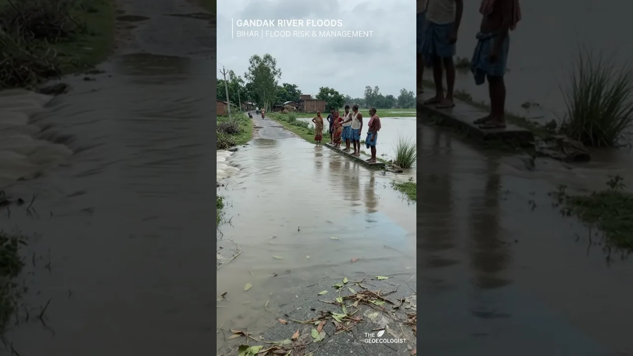
Table of Contents
- Understanding the Gandak River Basin: Geography and Hydrology
- Glacial Origins and Monsoon Magnification
- Sediment Load and Channel Instability
- Nepal Rainfall: The Primary Trigger for Downstream Inundation
- Early Warning Systems and Data Sharing Protocols
- Climate Change Attribution
- Embankment Breaches: Structural Failure and Institutional Gaps
- The Embankment Paradox
- Impact on Agriculture and Rural Livelihoods
- Crop Loss and Food Security
- Livestock and Fisheries
- Human Health and Displacement
- Flood Management Strategies: From Reactive to Resilient
- Structural Measures: Barrages, Detention Basins, and Channel Improvement
- Non-Structural Measures: Forecasting, Zoning, and Insurance
- Nature-Based Solutions and Wetland Restoration
- Transboundary Cooperation: The Nepal–India Dimension
- Future Outlook: Adaptation in a Warming Himalaya
- Key Takeaways
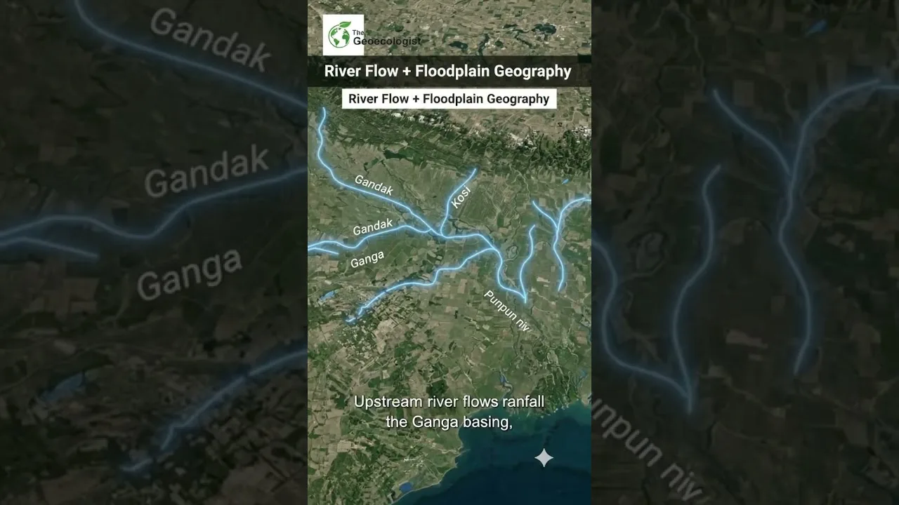
The Gandak River floods have once again brought the fragile hydrology of the Indo-Nepal border region into sharp focus. Heavy rainfall across Nepal’s catchment areas has led to a significant rise in the water level of the Gandak River, increasing flood risks in Bihar’s northern districts. This transboundary river, known as Narayani in Nepal and Gandak in India, originates in the high Himalayas and traverses a complex geological and political landscape before merging with the Ganga near Patna. The swelling river and embankment breaches have raised concerns for nearby agricultural fields, rural settlements, and low-lying areas, displacing thousands and submerging vast tracts of cropland.
- Transboundary dynamics: Rainfall in Nepal’s Himalayan catchment directly dictates flood intensity in Bihar within 24–48 hours.
- Embankment vulnerability: Aging flood protection infrastructure frequently fails under extreme discharge events.
- Agricultural devastation: Kharif crops — primarily paddy, maize, and sugarcane — face near-total loss in inundated zones.
- Recurring displacement: Over 2.5 million people in North Bihar remain annually exposed to flood risk.
- Climate amplification: Increasing frequency of extreme precipitation events exacerbates the flood cycle.
Understanding the Gandak River Basin: Geography and Hydrology
The Gandak River basin spans approximately 46,300 square kilometers, with nearly 70% lying in Nepal and the remainder in India. The river system comprises seven major tributaries — Kali Gandak, Trishuli, Budhi Gandak, Marsyangdi, Seti, Madi, and Daraundi — that converge in the Himalayan foothills before entering the plains at the Valmiki Nagar barrage in West Champaran district. This barrage, commissioned in 1965, serves as the primary control structure for irrigation and flood regulation. However, its design capacity of 8,500 cubic meters per second (cumecs) is frequently exceeded during monsoon peaks, as witnessed in 2017, 2019, 2020, and 2024. – a key consideration for Gandak River floods.
Glacial Origins and Monsoon Magnification
The river’s headwaters originate from glacial melt and permanent snowfields in the Annapurna and Dhaulagiri ranges. During the summer monsoon (June–September), the basin receives 80–85% of its annual rainfall, with intensities often exceeding 300 mm/day in the Middle Hills and Siwalik zones. This orographic rainfall, combined with glacial melt, creates a “double peak” hydrograph — an early summer snowmelt surge followed by the monsoon flood peak. The Gandak River floods are thus not merely pluvial events but compound hydro-meteorological disasters shaped by cryospheric and atmospheric processes.
Sediment Load and Channel Instability
The Gandak carries one of the highest sediment loads among Himalayan rivers — estimated at 80–100 million tonnes annually. This massive sediment flux, derived from the tectonically active Himalaya, causes rapid aggradation of the riverbed in the plains, reducing channel conveyance capacity and forcing the river to breach embankments or avulse into new courses. The river’s braided-to-meandering transition zone near the barrage is particularly unstable, with frequent channel shifting documented since the 1950s. This geomorphic dynamism makes static flood protection measures inherently short-lived. – a key consideration for Gandak River floods.
Nepal Rainfall: The Primary Trigger for Downstream Inundation
Real-time data from the Department of Hydrology and Meteorology (DHM), Nepal, and the Central Water Commission (CWC), India, confirm a direct teleconnection between extreme rainfall events in central Nepal and flood waves propagating downstream. In July 2024, stations at Pokhara, Bharatpur, and Rampur recorded 24-hour rainfall exceeding 250 mm — well above the 95th percentile. Within 36 hours, the discharge at Valmiki Nagar barrage surged from a baseline 2,000 cumecs to over 6,500 cumecs, triggering red alerts for Gopalganj, Saran, Siwan, and Muzaffarpur districts. – a key consideration for Gandak River floods.
Early Warning Systems and Data Sharing Protocols
Under the 1954 Gandak Agreement and subsequent protocols, Nepal shares real-time hydrological data from key stations — Devghat, Narayanghat, and Triveni — with Indian authorities during the monsoon. The Gandak River Wikipedia entry details the historical evolution of this cooperation. However, gaps persist in lead time: the travel time from Narayanghat to Valmiki Nagar is merely 18–24 hours, leaving limited windows for evacuation. The India Meteorological Department (IMD) and Central Water Commission have deployed Doppler weather radars and satellite-based rainfall estimation (GPM, INSAT-3D) to improve nowcasting, but ground-truthing in Nepal’s rugged terrain remains challenging. – a key consideration for Gandak River floods.
Climate Change Attribution
Recent studies by the Indian Institute of Tropical Meteorology (IITM) and ICIMOD indicate a statistically significant increase in extreme rainfall days (>150 mm/day) over the Gandak basin since 1980. The 2023 IPCC AR6 synthesis report highlights the Hindu Kush Himalaya as a “global hotspot” for climate-induced hydrological extremes. Warmer air holds more moisture (Clausius–Clapeyron relation: ~7% per °C), and shifting monsoon dynamics — including more frequent low-pressure systems tracking westward across the basin — amplify flood potential. The Gandak River floods of the past decade bear this fingerprint: higher peaks, shorter recurrence intervals, and expanded inundation footprints.
Embankment Breaches: Structural Failure and Institutional Gaps

Bihar’s flood protection strategy has historically relied on a network of 3,700+ kilometers of embankments along the Gandak and its tributaries. Constructed primarily between the 1950s and 1980s, these earthen structures were designed for a 25-year return period flood — a standard now rendered obsolete by climate non-stationarity. The 2024 breach at the Sonepur–Chhapra embankment (Saran district), which inundated 48 villages within six hours, exemplifies systemic vulnerabilities: – a key consideration for Gandak River floods.
- Design obsolescence: Embankments lack freeboard for current peak discharges.
- Maintenance deficit: Annual repair budgets cover <30% of identified vulnerable reaches.
- Encroachment: Settlements and agriculture on the riverward side weaken structural integrity.
- Piping and seepage: Sandy subsoil and rodent burrows create preferential flow paths during prolonged high stages.
The Embankment Paradox
Hydrologists argue that embankments, by confining floodwaters and sediment within a narrow corridor, elevate riverbeds and increase flood stages for a given discharge — a phenomenon documented in the Kosi (2008) and Gandak (2017) basins. This “levee effect” encourages floodplain occupation, magnifying damage when breaches inevitably occur. The Bihar State Disaster Management Authority (BSDMA) has initiated a “Room for the River” pilot in select reaches, promoting lateral connectivity with paleochannels and floodplain wetlands to attenuate peaks. However, land acquisition costs and political resistance limit scalability. – a key consideration for Gandak River floods.
Impact on Agriculture and Rural Livelihoods
The Gandak floodplain supports one of India’s most intensive agricultural systems, with cropping intensities exceeding 200% in protected zones. The Gandak River floods disrupt this economy through multiple pathways:
Crop Loss and Food Security
Kharif season (June–October) coincides with the flood window. In 2023, the Bihar Agriculture Department estimated 3.2 lakh hectares of paddy, 1.1 lakh hectares of maize, and 45,000 hectares of sugarcane damaged across 12 districts. Smallholder farmers — constituting 85% of landholdings — face total income loss, as crop insurance penetration (Pradhan Mantri Fasal Bima Yojana) remains below 40% in flood-prone blocks. The 2024 floods have already submerged nursery-stage paddy in West Champaran and East Champaran, forcing delayed transplantation and yield penalties of 30–50%.
Livestock and Fisheries
Floods displace over 2 million livestock annually, with mortality driven by waterborne diseases (hemorrhagic septicemia, foot-and-mouth), feed scarcity, and drowning. The Gandak’s floodplain wetlands (chaurs and mauns) support a vibrant capture fishery — an estimated 15,000 tonnes/year — but siltation and oxygen depletion during prolonged inundation cause fish kills. Post-flood, the recession agriculture (diara cultivation) on exposed riverbeds provides a critical secondary income, yet this window shrinks as flood duration increases.
Human Health and Displacement
Displaced populations in relief camps face elevated risks of diarrheal diseases, acute respiratory infections, and vector-borne illnesses (Japanese encephalitis, dengue). The 2017 floods saw a 3.2-fold spike in acute watery diarrhea cases in Saran district. Women and children bear disproportionate burdens: loss of sanitation access, interrupted maternal care, and school closures affecting 4–6 lakh students annually. The BSDMA’s “Satellite-Based Flood Inundation Mapping” now enables near-real-time identification of marooned villages, improving relief targeting.
Flood Management Strategies: From Reactive to Resilient
Structural Measures: Barrages, Detention Basins, and Channel Improvement
The Valmiki Nagar barrage remains the linchpin of Gandak regulation. Its 36 gates are operated per a rule curve balancing irrigation demand (1.44 million hectares command area) and flood cushioning. However, sediment accumulation upstream of the barrage — estimated at 400 million cubic meters since 1965 — has reduced live storage by 60%. Desilting is economically unviable at scale. Proposed detention basins in the Chitwan Valley (Nepal) and channel improvement works in the Indian reaches (dredging, spur construction) remain stalled due to transboundary coordination complexities and environmental clearances.
Non-Structural Measures: Forecasting, Zoning, and Insurance
The IMD’s “Impact-Based Forecasting” (IBF) framework, piloted in 2022, translates rainfall forecasts into probabilistic inundation maps at the village level. Coupled with the “Common Alerting Protocol” (CAP), this enables targeted SMS alerts to 1.2 crore registered users in Bihar. Floodplain zoning — mandated by the 1975 Central Water Commission guidelines but never enforced — could restrict high-value infrastructure in high-hazard zones. Parametric flood insurance, indexed to satellite-derived inundation extent, offers a promising risk-transfer mechanism; pilot projects with the World Bank and ICICI Lombard are underway in Muzaffarpur and Vaishali.
Nature-Based Solutions and Wetland Restoration
Restoring the Gandak’s lateral connectivity with its 200+ floodplain wetlands (chaurs) can attenuate flood peaks by 15–25%, per modeling by IIT Kanpur and Wetlands International. The “Namami Gange” programme includes chaur rejuvenation components, but implementation lags. Community-based flood management — reviving traditional “dhara” (drainage) networks and elevated homesteads (machans) — complements top-down interventions. The India Meteorological Department now integrates community rainfall observers (Varsha Mitra) into its observational network, enhancing ground validation.
Transboundary Cooperation: The Nepal–India Dimension
Effective Gandak River floods management is inseparable from Nepal–India hydro-diplomacy. The 1954 Gandak Treaty (revised 1964) governs water sharing and infrastructure, but lacks provisions for flood data sharing, joint reservoir operation, or climate adaptation. The Joint Committee on Inundation and Flood Management (JCIFM), established in 2004, meets annually but has limited executive authority. Recent developments offer hope:
- 2023 MoU on Hydrological Data Exchange: Commits to 15-minute interval data sharing from 12 Nepalese stations during monsoon.
- Joint Flood Forecasting Centre (proposed): To be co-located in Kathmandu and Patna, integrating WRF-Hydro and MIKE-11 models.
- Sediment Management Protocol: Under negotiation, addressing barrage desilting and upstream soil conservation.
Civil society networks — like the “Gandak River Basin Dialogue” — advocate for a basin-wide “Integrated Water Resources Management” (IWRM) framework, aligning with the UN Watercourses Convention principles. Nepal’s federal transition (2015 Constitution) adds provincial governments (Gandaki, Lumbini, Madhesh) as stakeholders, complicating but also localizing governance.
Future Outlook: Adaptation in a Warming Himalaya
Climate projections (CMIP6, SSP2-4.5 and SSP5-8.5) indicate a 10–20% increase in monsoon rainfall intensity over the Gandak basin by 2050, with glacial melt contribution peaking around 2040–2060 (“peak water”) before declining. This non-linear trajectory demands adaptive pathways:
- Short-term (0–5 years): Enhance forecast lead time to 72 hours via radar–satellite fusion; complete embankment vulnerability mapping; scale parametric insurance.
- Medium-term (5–15 years): Implement “Room for the River” at 50 priority sites; operationalize joint forecasting centre; restore 50,000 hectares of floodplain wetlands.
- Long-term (15+ years): Negotiate a basin-level treaty with climate adaptation clauses; invest in sediment-passing infrastructure; diversify floodplain livelihoods (aquaculture, eco-tourism, solar farming on diara lands).
The Gandak River floods are not an aberration but a recurring feature of a dynamic Himalayan river system. Managing them requires moving beyond “control” paradigms toward “living with water” — integrating cutting-edge science, transboundary cooperation, ecological wisdom, and social equity. As the 2024 monsoon unfolds, the resilience of North Bihar’s communities will again be tested. The measure of success will not be how high the embankments stand, but how swiftly and justly the system responds when they fail.
Key Takeaways
- The Gandak River basin’s transboundary nature makes Nepal’s rainfall the primary driver of Bihar’s flood risk.
- Embankment breaches result from design obsolescence, sediment aggradation, and maintenance deficits.
- Agriculture, livestock, and human health suffer cascading impacts, disproportionately affecting marginalized communities.
- Nature-based solutions, improved forecasting, and parametric insurance offer pathways to resilience.
- Sustainable flood management demands a climate-adaptive, basin-wide treaty between Nepal and India.
Frequently Asked Questions
The Gandak River originates in the Himalayas of Nepal, where 70% of its basin lies. Extreme monsoon rainfall in Nepal's catchment areas generates rapid runoff that reaches Bihar within 24–48 hours, overwhelming the river's channel capacity and embankments downstream.
Embankment breaches result from design obsolescence (built for 25-year return period floods), sediment aggradation raising riverbeds, inadequate maintenance funding, encroachment on riverward slopes, and piping failure in sandy subsoils during prolonged high-water stages.
Resilience requires a mix of improved transboundary forecasting (72-hour lead time), nature-based solutions like floodplain wetland restoration, parametric flood insurance for farmers, "Room for the River" approaches, and a basin-level treaty between Nepal and India incorporating climate adaptation.