Blog
NCERT Class 11 Geography: Latitude Longitude and Time Chapter 3 Complete Guide

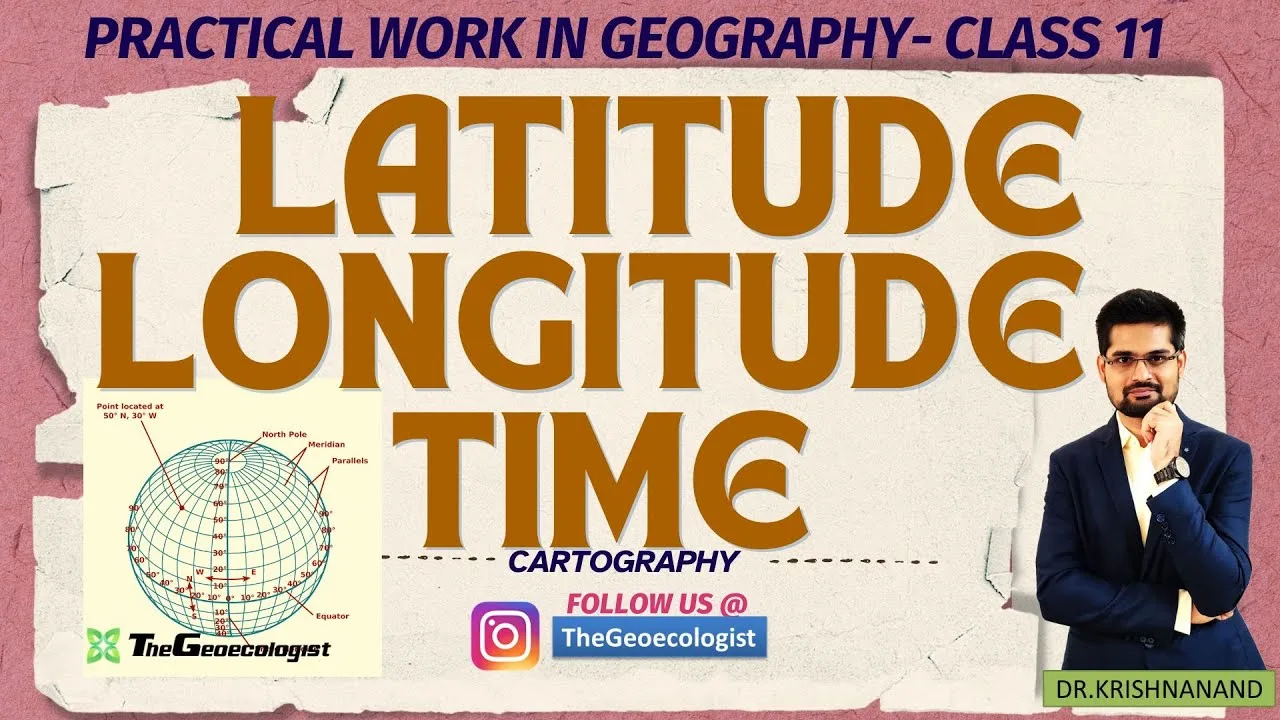
Table of Contents
- Understanding Latitude: The Horizontal Reference Lines
- Key Latitude Lines and Their Significance
- Practical Applications of Latitude
- Longitude: The Vertical Measurement System
- Prime Meridian Selection and Global Standardization
- Longitude and Time Calculation Fundamentals
- Time Zones and Standard Time Systems
- Global Time Zone Division
- Indian Standard Time (IST) Detailed Analysis
- Daylight Saving Time Considerations
- International Date Line: Managing Calendar Transitions
- Concept and Location
- Practical Implications and Calculations
- Examination-Oriented Problem Solving
- Standard Time Calculation Patterns
- Advanced Calculation: Local Mean Time vs Standard Time
- Competitive Examination Relevance
- UPSC Civil Services Examination
- CUET and University Entrance Tests
- UGC NET JRF Geography
- Effective Study Strategies and Resources
- Visual Learning Techniques
- Problem-Solving Practice Regimen
- Map-Based Learning Integration
- Common Misconceptions and Clarifications
- Misconception 1: Latitude Lines Are Equal Length
- Misconception 2: Time Zones Follow Longitude Strictly
- Misconception 3: 180° Meridian and IDL Are Identical
- Digital Tools and Modern Applications
- GIS and GPS Integration
- Online Calculation Resources
- Revision Checklist for Chapter 3
- Beyond Examinations: Real-World Applications
- Conclusion: Building a Robust Geographic Foundation
NCERT Class 11 Geography Chapter 3 forms the cornerstone of practical geography for CBSE students and competitive exam aspirants alike. This comprehensive guide covers latitude, longitude, and time concepts from the Practical Work in Geography textbook, providing detailed explanations, calculation methods, and exam-oriented insights that align perfectly with the latest CBSE curriculum and UPSC syllabus requirements.
- Latitude measures angular distance north/south of Equator (0° to 90°N/S)
- Longitude measures angular distance east/west of Prime Meridian (0° to 180°E/W)
- Each 15° longitude = 1 hour time difference; Earth rotates 360° in 24 hours
- Indian Standard Time (IST) follows 82.5°E meridian = UTC+5:30
- International Date Line at 180° manages calendar day transitions
- Critical for CBSE exams, UPSC, CUET, UGC NET JRF and other competitive tests
Understanding Latitude: The Horizontal Reference Lines
Latitude represents the angular distance of any point on Earth’s surface measured north or south from the Equator. The Equator serves as the primary reference line at 0° latitude, dividing the planet into Northern and Southern Hemispheres. These imaginary horizontal lines, called parallels, circle the Earth parallel to the Equator. – a key consideration for NCERT Class 11 Geography.
Key Latitude Lines and Their Significance
The most important parallels include the Tropic of Cancer (23.5°N), Tropic of Capricorn (23.5°S), Arctic Circle (66.5°N), and Antarctic Circle (66.5°S). These lines demarcate Earth’s major heat zones: the Torrid Zone between the tropics receives direct sunlight year-round, the Temperate Zones between tropics and polar circles experience distinct seasons, and the Frigid Zones near poles remain cold throughout the year. – a key consideration for NCERT Class 11 Geography.
According to the geographic coordinate system documented on Wikipedia, latitude values range from 0° at the Equator to 90° at the poles. Each degree of latitude spans approximately 111 kilometers (69 miles), making NCERT Class 11 Geography a consistent measurement unit unlike longitude which varies with latitude.
Practical Applications of Latitude
Navigators historically used latitude determination through celestial navigation — measuring the angle of the North Star (Polaris) or the Sun at noon. Modern GPS systems rely on latitude coordinates for precise positioning. In NCERT Class 11 Geography examinations, students frequently encounter questions requiring identification of heat zones, calculation of latitudinal extent, and understanding climatic implications of latitudinal position.
Longitude: The Vertical Measurement System
Longitude measures angular distance east or west from the Prime Meridian (0° longitude), which passes through the Royal Observatory in Greenwich, London. Unlike latitude lines, longitude lines (meridians) are semi-circles that converge at the poles and are of equal length. The Prime Meridian divides Earth into Eastern and Western Hemispheres. – a key consideration for NCERT Class 11 Geography.
Prime Meridian Selection and Global Standardization
The 1884 International Meridian Conference in Washington D.C. established the Greenwich Meridian as the universal Prime Meridian. This standardization was crucial for global navigation, cartography, and timekeeping. The conference also recommended the 24-hour day beginning at midnight at Greenwich, forming the basis for Coordinated Universal Time (UTC).
Longitude and Time Calculation Fundamentals
The relationship between longitude and time represents one of the most examination-critical concepts in NCERT Class 11 Geography. Earth completes a 360° rotation in 24 hours, yielding a rotation rate of 15° per hour (360°/24h = 15°/h). Consequently, each degree of longitude corresponds to 4 minutes of time difference (60 minutes/15° = 4 minutes/degree).
For example, when NCERT Class 11 Geography is 12:00 PM at the Prime Meridian (0°), the time at 30°E would be 2:00 PM (30° × 4 minutes = 120 minutes = 2 hours ahead), while at 30°W it would be 10:00 AM (2 hours behind). This principle underpins all time zone calculations and forms the basis for numerous CBSE and competitive examination problems.
Time Zones and Standard Time Systems
Global Time Zone Division
The world is theoretically divided into 24 standard time zones, each spanning 15° of longitude. However, political boundaries, national preferences, and practical considerations create numerous deviations. Countries like China (spanning five geographical time zones) use a single standard time (China Standard Time, UTC+8), while Russia spans 11 time zones. The time zone system reflects both geographical reality and political decisions.
Indian Standard Time (IST) Detailed Analysis
India adopts a single time zone based on the 82.5°E meridian passing through Mirzapur, Uttar Pradesh (near Allahabad/Prayagraj). This meridian was selected because NCERT Class 11 Geography lies roughly central to India’s longitudinal extent (68°7’E to 97°25’E). Indian Standard Time equals UTC+5:30, making NCERT Class 11 Geography 5 hours 30 minutes ahead of Greenwich Mean Time.
The choice of 82.5°E rather than the exact center (approximately 82.5°E) minimizes the maximum time difference within the country to about 1 hour 45 minutes between the easternmost (Arunachal Pradesh) and westernmost (Gujarat) points. This compromise balances administrative convenience with geographical reality — a frequent topic in NCERT Class 11 Geography case study questions.
Daylight Saving Time Considerations
India does not observe Daylight Saving Time (DST), unlike approximately 70 countries that adjust clocks seasonally. The consistent timekeeping simplifies scheduling but creates larger seasonal variations in daylight hours, particularly in northern regions. Understanding DST mechanisms and their absence in India appears in UPSC geography optional papers and general studies examinations.
International Date Line: Managing Calendar Transitions
Concept and Location
The International Date Line (IDL) roughly follows the 180° meridian but deviates significantly to accommodate political boundaries and island groups. NCERT Class 11 Geography serves as the global demarcation where calendar days change: crossing eastward subtracts a day, while crossing westward adds a day. The line zigzags through the Pacific Ocean, avoiding land masses to prevent communities from being split across different dates.
Practical Implications and Calculations
Consider a flight from Tokyo (139°E) to Los Angeles (118°W) crossing the IDL eastward. If departure is Monday 10:00 AM, the 10-hour flight arrives Sunday 6:00 AM local time — effectively arriving “before” departure in calendar terms. Such scenarios test conceptual understanding in competitive examinations. The official NCERT textbook PDF provides worked examples of IDL calculations essential for exam preparation.
Examination-Oriented Problem Solving
Standard Time Calculation Patterns
NCERT Class 11 Geography examinations consistently feature time calculation problems following predictable patterns:
Pattern 1: Given time at one longitude, find time at another longitude.
Example: If NCERT Class 11 Geography is 3:00 PM at 75°W, what is the time at 120°E?
Solution: Longitudinal difference = 75° + 120° = 195°. Time difference = 195° × 4 minutes = 780 minutes = 13 hours. Since 120°E is east of 75°W, add 13 hours: 4:00 AM next day.
Pattern 2: Finding longitude from time difference.
Example: When NCERT Class 11 Geography is 12:00 noon at Greenwich, a place shows 4:00 PM. Find its longitude.
Solution: Time difference = 4 hours = 240 minutes. Longitude = 240/4 = 60°. Since local time is ahead, longitude = 60°E.
Pattern 3: International Date Line crossing problems.
Example: A ship at 170°W crosses to 170°E. If NCERT Class 11 Geography is Monday 23:00 before crossing, what is day/time after?
Solution: Crossing IDL eastward subtracts a day. New time: Sunday 23:00 (same hour, previous day).
Advanced Calculation: Local Mean Time vs Standard Time
Students must distinguish between Local Mean Time (LMT) — based on a location’s exact longitude — and Standard Time — based on a country’s chosen central meridian. For instance, Mumbai (72.8°E) has LMT approximately 39 minutes behind IST (82.5°E × 4 min = 330 min = 5h30m; 72.8°E × 4 min = 291.2 min = 4h51m; difference = 39 min). This distinction appears in higher-order thinking questions.
Competitive Examination Relevance
UPSC Civil Services Examination
Geography constitutes a significant portion of UPSC General Studies Paper I and serves as a popular optional subject. Questions on latitude-longitude-time concepts appear in both preliminary and mains examinations. Recent trends show increased emphasis on applied problems: calculating time differences for international events, understanding implications of single vs multiple time zones for large countries, and analyzing IDL deviations for geopolitical reasons.
CUET and University Entrance Tests
The Common University Entrance Test (CUET) geography section draws heavily from NCERT Class 11 Geography textbooks. Chapter 3 concepts form the foundation for subsequent chapters on map projections, scale, and topographical map interpretation. Mastery of coordinate geometry and time calculations provides competitive advantage in these time-pressured examinations.
UGC NET JRF Geography
For UGC NET aspirants, practical geography including coordinate systems, time zones, and cartographic fundamentals represents core Paper II content. Questions often integrate Chapter 3 concepts with statistical methods, remote sensing, and GIS applications — requiring deep conceptual understanding rather than rote memorization.
Effective Study Strategies and Resources
Visual Learning Techniques
Geography is inherently visual. Students should practice drawing latitude-longitude grids, marking important parallels and meridians, and shading heat zones. Animation resources demonstrating Earth’s rotation, day-night cycle, and seasonal variations enhance conceptual clarity. TheGeoecologist’s bilingual video tutorials provide excellent animated explanations synchronized with NCERT content.
Problem-Solving Practice Regimen
Allocate dedicated practice sessions for time calculation problems. Start with basic longitudinal difference problems, progress to IDL crossing scenarios, then tackle multi-step problems involving both latitude (climate zones) and longitude (time zones). Maintain a formula sheet: Time difference (minutes) = Longitudinal difference × 4; Time zones = Longitude/15°.
Map-Based Learning Integration
Integrate coordinate system learning with atlas work. Locate places using latitude-longitude coordinates, trace the IDL path on a world map, identify countries with multiple time zones versus single time zones, and correlate latitudinal position with climatic data. This interdisciplinary approach strengthens retention and application skills.
Common Misconceptions and Clarifications
Misconception 1: Latitude Lines Are Equal Length
While longitude lines (meridians) are equal-length semi-circles, latitude lines (parallels) decrease in circumference from Equator to poles. The Equator spans ~40,075 km, while the Arctic Circle spans ~16,000 km. This affects map projections and scale calculations — a nuance tested in advanced cartography questions.
Misconception 2: Time Zones Follow Longitude Strictly
Political boundaries heavily influence time zone borders. India’s single time zone, China’s single time zone despite 5 geographical zones, and Nepal’s unique UTC+5:45 offset demonstrate political primacy over geographical logic. Examination questions often test awareness of these anomalies.
Misconception 3: 180° Meridian and IDL Are Identical
The 180° meridian is a mathematical line; the IDL is a legal/political construct that deviates significantly. The IDL detours east around Kiribati’s Line Islands (making them UTC+14, earliest time zone) and west around Siberia’s Chukchi Peninsula. Understanding this distinction is crucial for accurate date-line crossing calculations.
Digital Tools and Modern Applications
GIS and GPS Integration
Modern Geographic Information Systems (GIS) and Global Positioning Systems (GPS) rely fundamentally on the latitude-longitude framework. GPS receivers calculate position by triangulating signals from satellites, expressing results in decimal degrees (DD) or degrees-minutes-seconds (DMS). NCERT Class 11 Geography students should familiarize themselves with both formats: DD example: 28.6139° N, 77.2090° E (New Delhi); DMS example: 28°36’50″N, 77°12’32″E.
Online Calculation Resources
Several authoritative online tools assist with coordinate and time calculations: NOAA’s Solar Calculator for sunrise/sunset times by coordinates, TimeandDate.com for time zone conversions, and Google Earth for coordinate visualization. However, examination conditions prohibit digital aids, necessitating manual calculation proficiency.
Revision Checklist for Chapter 3
- Define latitude, longitude, parallels, meridians with examples
- List major parallels with degrees and climatic significance
- Explain Prime Meridian selection history and significance
- Derive and apply: 1° longitude = 4 minutes time; 15° = 1 hour
- Calculate time differences for given longitude pairs
- Determine longitude from given time difference
- Explain IST basis (82.5°E) and rationale for single time zone
- Describe IDL function, location deviations, and crossing rules
- Solve IDL crossing problems with day/date changes
- Differentiate Local Mean Time vs Standard Time
- Identify countries with notable time zone policies
- Convert between DD and DMS coordinate formats
Beyond Examinations: Real-World Applications
The latitude-longitude-time framework extends far beyond academic assessments. Aviation and maritime navigation depend on precise coordinate systems and time synchronization. International financial markets coordinate trading hours across time zones. Satellite communication, weather forecasting, and disaster management all utilize this geographic framework. Understanding these concepts equips students for careers in geospatial technology, urban planning, environmental science, and international relations.
As digital mapping becomes ubiquitous — from ride-sharing apps to precision agriculture — the coordinate system literacy developed through NCERT Class 11 Geography Chapter 3 translates directly into technological fluency. The ability to interpret coordinates, understand time zone implications for global collaboration, and appreciate the geopolitical dimensions of time standardization represents valuable 21st-century competency.
Conclusion: Building a Robust Geographic Foundation
Mastery of latitude, longitude, and time concepts from NCERT Class 11 Geography Chapter 3 provides the essential scaffold for all subsequent geography learning — from physical geography processes to human geography patterns, from cartographic techniques to geospatial technologies. The conceptual clarity gained here supports not only examination success but also informed global citizenship in an increasingly interconnected world.
Consistent practice with calculation problems, regular atlas correlation, and engagement with visual learning resources will cement these fundamentals. Remember that geography is not merely about memorizing facts but about developing a spatial perspective — the ability to see patterns, relationships, and processes across Earth’s surface. This chapter initiates that geographic way of thinking, making NCERT Class 11 Geography arguably the most important foundation in the entire Class 11 curriculum.
For comprehensive video explanations, solved examples, and exam-oriented practice materials, explore TheGeoecologist’s dedicated course offerings and free tutorial resources. Your journey toward geographic literacy and examination excellence begins with mastering these coordinates of space and time.
Frequently Asked Questions
The standard meridian for Indian Standard Time is 82.5°E, passing through Mirzapur, Uttar Pradesh. It was chosen because it lies roughly central to India's longitudinal extent (68°7'E to 97°25'E), minimizing the maximum time difference within the country to about 1 hour 45 minutes.
Calculate the longitudinal difference in degrees, then multiply by 4 minutes per degree. For example, difference between 30°E and 60°W = 90°. Time difference = 90 × 4 = 360 minutes = 6 hours. Add time if moving east, subtract if moving west.
Crossing the International Date Line eastward (toward America) subtracts one calendar day. Crossing westward (toward Asia) adds one calendar day. The time of day remains the same, only the date changes.