Blog
Map Projections NCERT: Complete Guide for Class 11 Geography & Competitive Exams

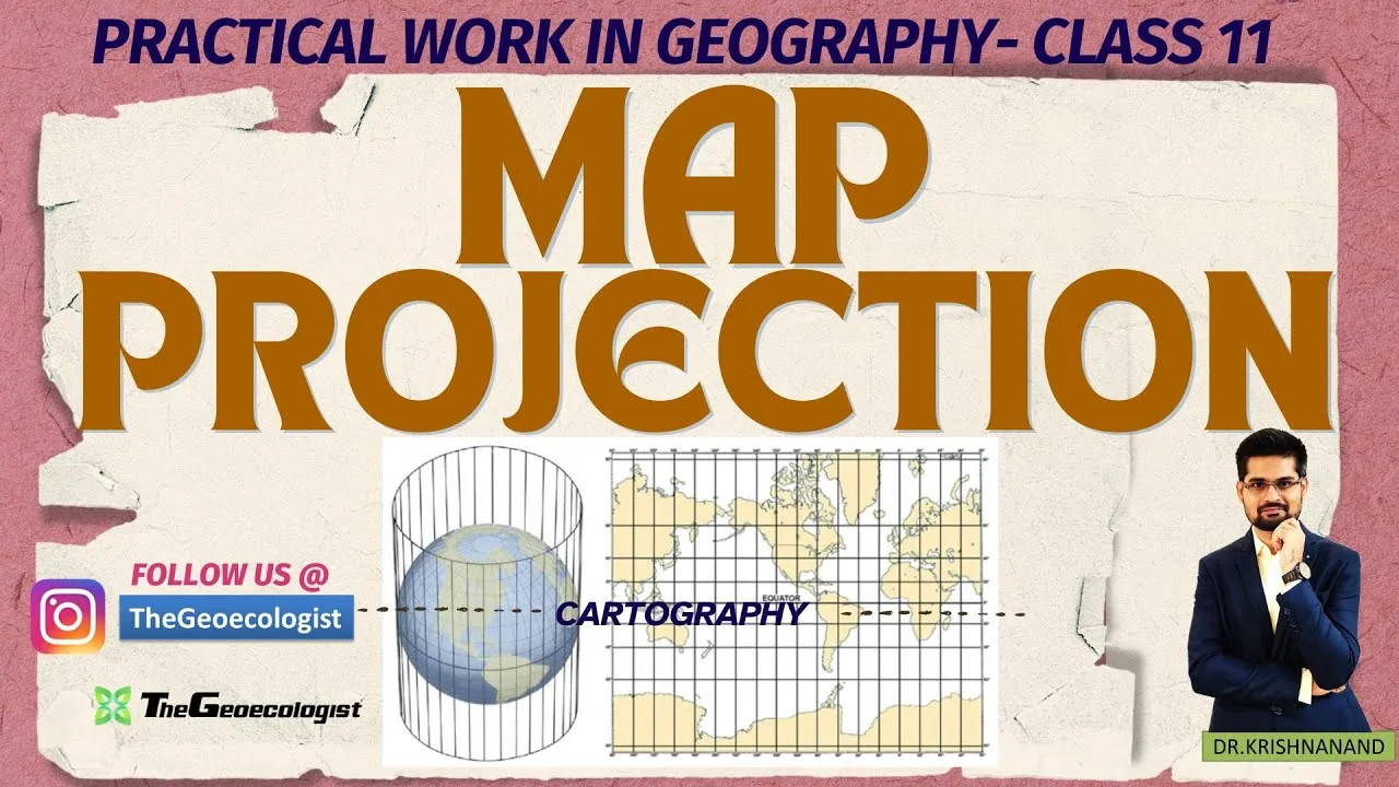
Table of Contents
- What Are Map Projections NCERT Class 11?
- Why Map Projections Matter in Geography
- Classification of Map Projections by Developable Surface
- 1. Cylindrical Projections
- 2. Conical Projections
- 3. Azimuthal (Planar) Projections
- Key Properties of Map Projections NCERT Students Must Know
- Conformality (Orthomorphic)
- Equivalence (Equal-Area / Homolographic)
- Equidistance
- Azimuthality
- Trade-offs: Choosing the Right Projection
- Map Projections NCERT: Exam-Oriented Insights
- CBSE Class 11 Practical Geography
- CUET and UPSC Geography
- UGC NET JRF Geography
- Common Pitfalls and Confusion Points
- Real-World Applications Beyond Exams
- GIS and Remote Sensing
- Web Mapping
- Climate and Environmental Modeling
- Study Strategy for Map Projections NCERT Chapter 4
- Frequently Asked Questions
- What is the main purpose of map projections in NCERT Class 11?
- Which map projection is best for navigation according to NCERT?
- How many types of map projections are covered in NCERT Class 11 Chapter 4?
- What is the difference between conformal and equal-area projections?
- Why does the Mercator projection exaggerate polar regions?
- Conclusion
Understanding map projections NCERT concepts is essential for every Class 11 Geography student and competitive exam aspirant. Chapter 4 of the NCERT Class 11 Practical Work in Geography textbook provides a comprehensive foundation for representing the three-dimensional Earth on a two-dimensional surface. map projections NCERT covers everything you need to master map projections for CBSE board exams, CUET, UPSC, and UGC NET JRF.
- Map projections systematically transform latitudes and longitudes from a sphere to a flat plane
- Every projection distorts shape, area, distance, or direction — no perfect projection exists
- Three main developable surfaces: cylindrical, conical, and azimuthal (planar)
- Four key properties: conformality, equivalence, equidistance, and azimuthality
- Projection choice depends entirely on the map’s intended purpose
What Are Map Projections NCERT Class 11?
A map projection NCERT definition describes map projections NCERT as a systematic mathematical transformation of the Earth’s graticule (network of latitudes and longitudes) from a spherical surface onto a developable flat surface. Since the Earth is an oblate spheroid — slightly flattened at the poles and bulging at the equator — representing it on paper inevitably introduces distortions. The NCERT Class 11 Geography Chapter 4 emphasizes that understanding these distortions is crucial for accurate map interpretation.
The concept dates back to ancient Greek cartographers. Claudius Ptolemy, in his Geographia (c. 150 CE), developed early conic projections. However, the Mercator projection (1569) revolutionized navigation by preserving rhumb lines as straight segments. For a detailed historical overview, see the Map projection Wikipedia article. – a key consideration for map projections NCERT.
Why Map Projections Matter in Geography
The map projections NCERT curriculum highlights that different projections serve different purposes. Navigators need true direction (conformal projections), while thematic maps comparing country sizes require equal-area projections. The choice involves trade-offs — preserving one property inevitably distorts others. This fundamental principle appears frequently in CBSE practical exams and competitive tests.
Classification of Map Projections by Developable Surface
The NCERT textbook classifies map projections NCERT students study into three categories based on the geometric surface used to “unwrap” the globe:
1. Cylindrical Projections
In cylindrical projections, a cylinder wraps around the globe, typically touching the equator. The graticule projects onto the cylinder, which then unfurls into a rectangle. Key characteristics:
- Parallels and meridians appear as straight lines intersecting at right angles
- Scale is true along the equator (standard parallel)
- Distortion increases dramatically toward the poles
Mercator Projection (1569): The most famous cylindrical projection. map projections NCERT preserves local angles and shapes (conformal), making it invaluable for marine navigation — a straight line represents a constant compass bearing (rhumb line). However, it grossly exaggerates high-latitude areas: Greenland appears larger than Africa, though Africa is actually 14 times bigger. The Mercator projection Wikipedia page provides mathematical details.
Transverse Mercator: The cylinder touches a meridian instead of the equator. Used for UTM (Universal Transverse Mercator) grid systems worldwide.
2. Conical Projections
A cone placed over the globe touches along one parallel (standard parallel) or intersects along two (secant cone). When flattened, parallels become concentric circular arcs, and meridians radiate as straight lines from the apex.
- Minimal distortion near the standard parallel(s)
- Ideal for mid-latitude regions (e.g., India, USA, Europe)
- Distortion increases away from standard parallels
Lambert Conformal Conic (1772): Preserves shape (conformal). Standard for aeronautical charts and many national mapping systems. India’s Survey of India uses a modified Lambert Conformal Conic for topographical maps.
Albers Equal-Area Conic: Preserves area proportions. Used for thematic maps of the United States and other large east-west countries.
3. Azimuthal (Planar) Projections
A flat plane touches the globe at a single point (usually a pole). Parallels appear as concentric circles; meridians radiate as straight lines.
- True direction (azimuth) from the center point to any other point
- Distortion increases radially outward
- Ideal for polar regions and air route planning
Stereographic Projection: Conformal, preserves angles. Used for polar navigation and planetary mapping.
Orthographic Projection: Resembles a photograph from infinite distance. Shows the Earth as a globe — used for illustrative purposes.
Gnomonic Projection: Great circles appear as straight lines. Essential for plotting shortest routes (great circle routes) in aviation and maritime navigation.
Key Properties of Map Projections NCERT Students Must Know
The map projections NCERT framework identifies four mutually exclusive properties. No single projection can preserve all four simultaneously:
Conformality (Orthomorphic)
Preserves local angles and shapes. Small areas retain their true shape, but area is distorted. Essential for navigation charts and topographic maps. Examples: Mercator, Lambert Conformal Conic, Stereographic.
Equivalence (Equal-Area / Homolographic)
Maintains accurate area proportions across the map. Shapes are distorted, especially near edges. Critical for thematic maps showing density, distribution, or comparison. Examples: Albers Equal-Area Conic, Lambert Azimuthal Equal-Area, Peters Projection.
Equidistance
Accurately represents distances from one or two specific points (usually the center) or along specific lines (meridians or standard parallels). Not true for all distances globally. Examples: Azimuthal Equidistant, Equirectangular (Plate Carrée).
Azimuthality
Retains true direction (azimuth) from a central point to all other points. Only azimuthal projections achieve this property perfectly. Examples: Stereographic, Orthographic, Gnomonic, Azimuthal Equidistant.
Trade-offs: Choosing the Right Projection
Understanding map projections NCERT trade-offs is a favorite exam topic. The classic example: Mercator vs. Peters.
| Projection | Property Preserved | Best For | Major Distortion |
|---|---|---|---|
| Mercator | Conformality (shape, direction) | Marine navigation | Area at high latitudes |
| Peters (Gall-Peters) | Equivalence (area) | Comparing country sizes | Shape severely distorted |
| Robinson | Compromise (none perfect) | World reference maps | All properties slightly distorted |
| Winkel Tripel | Compromise (minimizes mean distortion) | National Geographic world maps | Balanced but imperfect |
The Robinson projection (1963) and Winkel Tripel (1921) are compromise projections — they don’t perfectly preserve any single property but minimize overall distortion. National Geographic adopted Winkel Tripel in 1998, replacing Robinson.
Map Projections NCERT: Exam-Oriented Insights
CBSE Class 11 Practical Geography
Practical questions often present a map and ask students to:
- Identify the projection type based on graticule appearance
- Name the developable surface (cylinder, cone, plane)
- State which property is preserved (conformal, equal-area, etc.)
- Suggest a suitable projection for a given purpose (e.g., “Which projection for polar air routes?” → Azimuthal)
Memorize the “C-C-A” acronym: Cylindrical, Conical, Azimuthal — the three developable surfaces.
CUET and UPSC Geography
Conceptual clarity questions dominate:
- “Which projection would you use to compare the land area of countries?” → Equal-area (Peters, Albers)
- “Why is Mercator unsuitable for world political maps?” → Area exaggeration at poles misrepresents relative country sizes
- “Explain the difference between a tangent and secant cone in conical projections”
UGC NET JRF Geography
Technical depth increases:
- Mathematical equations for forward/inverse projections
- Scale factor variation across projections
- Historical development: Ptolemy → Mercator → Modern compromise projections
- GIS applications: Projected coordinate systems (UTM, State Plane)
Common Pitfalls and Confusion Points
TheGeoecologist’s video highlights frequent student errors:
- Confusing Mercator with Gall-Peters: Both are cylindrical, but Mercator is conformal; Peters is equal-area. Mercator preserves shape; Peters preserves area.
- Assuming “standard parallel” means zero distortion everywhere: Only along that specific parallel is scale true.
- Thinking equidistant means all distances are correct: Only from center or along specific lines.
- Overlooking secant vs. tangent cases: Secant (two standard parallels) reduces overall distortion for regional maps.
Real-World Applications Beyond Exams
Mastering map projections NCERT concepts has practical value:
GIS and Remote Sensing
Every GIS project begins with choosing a projected coordinate system. India uses UTM zones (Transverse Mercator) for large-scale mapping and Lambert Conformal Conic for small-scale national maps. Wrong projection choice leads to measurement errors in area, distance, and overlay analysis.
Web Mapping
Google Maps, OpenStreetMap, and most web maps use Web Mercator (EPSG:3857) — a spherical Mercator variant. map projections NCERT enables seamless tiling but distorts area severely at high latitudes. For thematic web maps, equal-area projections like Mollweide or Hammer are preferred.
Climate and Environmental Modeling
Equal-area projections (e.g., Lambert Azimuthal Equal-Area) are essential for calculating carbon flux, deforestation rates, or species distribution across latitudes without area bias.
Study Strategy for Map Projections NCERT Chapter 4
- Master NCERT diagrams: Reproduce graticule sketches for each projection type from memory
- Create comparison tables: Property preserved, developable surface, use case, distortion pattern
- Practice identification: Use blank world maps to recognize projection types by graticule shape
- Solve previous year questions: CBSE practical papers, CUET, UPSC prelims geography questions
- Watch TheGeoecologist’s bilingual tutorial: Visual demonstrations clarify distortion patterns better than static diagrams
Frequently Asked Questions
What is the main purpose of map projections in NCERT Class 11?
The main purpose is to represent the 3D spherical Earth on a 2D flat surface for map-making, acknowledging that all projections introduce some distortion in shape, area, distance, or direction.
Which map projection is best for navigation according to NCERT?
The Mercator projection is best for navigation because map projections NCERT preserves direction (rhumb lines appear as straight lines), making it ideal for marine charts.
How many types of map projections are covered in NCERT Class 11 Chapter 4?
NCERT Class 11 covers three main types based on developable surfaces: cylindrical, conical, and azimuthal (planar) projections, with examples of each.
What is the difference between conformal and equal-area projections?
Conformal projections preserve local shapes and angles (e.g., Mercator), while equal-area projections preserve accurate area proportions (e.g., Peters, Albers). No projection can be both conformal and equal-area simultaneously.
Why does the Mercator projection exaggerate polar regions?
Mercator stretches meridians increasingly apart toward the poles to maintain conformality, causing extreme area exaggeration — Greenland appears larger than Africa despite being 14 times smaller.
Conclusion
Map projections form the backbone of cartography and geographic analysis. The map projections NCERT Class 11 Chapter 4 equips students with the theoretical framework to understand how our 3D world transforms into 2D representations — and why that transformation always involves compromise. Whether you’re preparing for CBSE practicals, CUET, UPSC, or UGC NET JRF, mastering the three developable surfaces, four key properties, and their real-world applications will serve you well beyond examinations.
Revisit NCERT diagrams regularly, practice identifying projections from graticule patterns, and leverage resources like TheGeoecologist’s courses at thegeoecologist.com for structured, exam-focused learning. Connect with the community on Instagram @thegeoecologist for quick revision tips and doubt resolution.
Master map projections today — and conquer your geography exams with confidence! 🌍✨
Frequently Asked Questions
The three main types are cylindrical projections (cylinder touches equator), conical projections (cone touches a parallel), and azimuthal or planar projections (plane touches a point, usually a pole).
No map projection can preserve both shape (conformality) and area (equivalence) simultaneously. This is a fundamental theorem of cartography — preserving one property inevitably distorts the other.
Equal-area projections like the Peters (Gall-Peters), Mollweide, or Hammer projections are best for comparing country sizes because they preserve area proportions accurately.