Blog
Human Settlements Class 12: NCERT Geography Chapter 2 Guide

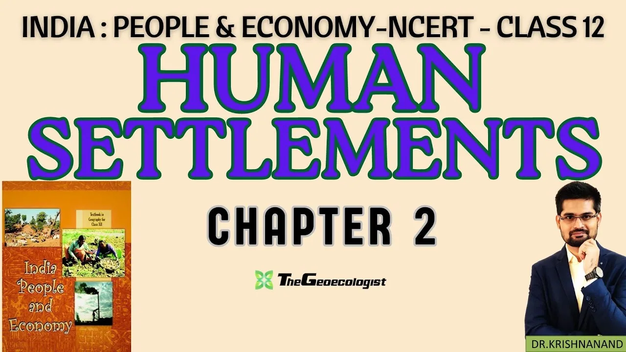
Table of Contents
- Understanding Human Settlements Class 12: Core Definitions
- Rural Settlements: Characteristics and Classification
- Urban Settlements: Hierarchy and Functional Classification
- Factors Influencing Settlement Location: The WATER Framework
- Urbanization in India: Trends, Data, and Projections
- Regional Disparities in Urbanization
- Challenges of Urban Settlements: A Multi-Dimensional Crisis
- 1. Infrastructure and Housing Deficits
- 2. Environmental Degradation
- 3. Socio-Economic Inequality
- Government Initiatives for Sustainable Human Settlements
- Smart Cities Mission (SCM)
- AMRUT (Atal Mission for Rejuvenation and Urban Transformation)
- PMAY-U (Pradhan Mantri Awas Yojana — Urban)
- Other Relevant Schemes
- Human Settlements Class 12: Exam Strategy and High-Yield Topics
- CBSE Board (Theory + Map Work)
- CUET / UPSC Prelims
- UPSC Mains / UGC NET
- Study Resources and Next Steps
- Conclusion
Human Settlements Class 12 is a pivotal chapter in the NCERT Geography textbook “India: People and Economy” that explores the intricate relationship between humans and their built environment. This comprehensive guide covers settlement types, patterns, influencing factors, urbanization trends, challenges, and government initiatives — essential for CBSE board exams, CUET, and UPSC preparation. Mastering Human Settlements Class 12 concepts provides a strong foundation for understanding India’s demographic and spatial dynamics.
- Human Settlements Class 12 distinguishes rural vs. urban settlements based on Census of India criteria (population ≥5,000, ≥75% non-agricultural workforce, density ≥400/km²).
- Four major settlement patterns: Clustered, Semi-clustered, Hamleted, and Dispersed — each shaped by physical and cultural factors.
- Key determinants include water availability, terrain, climate, economic resources, and cultural significance (WATER mnemonic).
- India’s urban population rose from 17.3% (1951) to 34.9% (2021), driving challenges like slums, pollution, and infrastructure deficits.
- Government missions — Smart Cities, AMRUT, PMAY — aim for sustainable, inclusive urban development.
Understanding Human Settlements Class 12: Core Definitions
The Human Settlements Class 12 chapter begins by defining a settlement as any form of human habitation, ranging from a single dwelling to a megacity. The Census of India 2011 provides the statutory framework for classifying settlements, which remains the gold standard for Human Settlements Class 12 exam questions. According to the Census, an area qualifies as urban if it meets all three criteria: a minimum population of 5,000; at least 75% of the male main working population engaged in non-agricultural pursuits; and a population density of at least 400 persons per square kilometre. This definition is critical because it directly impacts resource allocation, governance structures, and policy planning at every administrative level.
Rural Settlements: Characteristics and Classification
Rural settlements in Human Settlements Class 12 are primarily defined by their economic base — agriculture and allied activities dominate the workforce. These settlements exhibit low population density, simple infrastructure, and homogeneous social structures. The NCERT textbook classifies rural settlements into four morphological patterns based on spacing and arrangement of dwellings:
- Clustered (Compact) Settlements: Houses are closely packed around a central point — a temple, pond, or marketplace. Typical of the fertile Indo-Gangetic Plains (e.g., villages in Uttar Pradesh, Bihar) and parts of Rajasthan where defense and water access historically dictated compact living.
- Semi-Clustered (Fragmented) Settlements: A restricted cluster with outlying hamlets, often resulting from social stratification or topographic constraints. Common in Gujarat and Maharashtra.
- Hamleted Settlements: The main village splits into several physically distinct units (locally called panna, para, palli, nagla, dhani). Prevalent in the Ganga-Brahmaputra delta (West Bengal, Assam) and lower Himalayan valleys.
- Dispersed Settlements: Isolated dwellings scattered over a large area, characteristic of rugged terrain (Himalayas, Western Ghats), dense forests (Central India), and arid zones (Thar Desert).
Building materials further reflect regional geography: bamboo and thatch in flood-prone Assam, stone and mud in Himalayan regions, and baked bricks in the plains. These variations make Human Settlements Class 12 a rich topic for case-study questions.
Urban Settlements: Hierarchy and Functional Classification
Urban settlements in Human Settlements Class 12 are categorized by population size and function. The Census hierarchy ranges from Town (10 million). As of 2021, India hosts six megacities — Mumbai, Delhi, Kolkata, Chennai, Bengaluru, and Hyderabad — with Delhi NCR projected to become the world’s largest urban agglomeration by 2030 (UN World Urbanization Prospects).
Functional classification, a favorite in Human Settlements Class 12 exams, identifies cities by dominant economic activity:
- Administrative: New Delhi, Chandigarh, Bhubaneswar
- Industrial: Jamshedpur, Bhilai, Durgapur, Bokaro
- Commercial/Trade: Mumbai, Kolkata, Surat, Ahmedabad
- Transport: Mughalsarai, Katni, Jharsuguda
- Educational/Cultural: Varanasi, Prayagraj, Aligarh, Shantiniketan
- Tourist/Religious: Tirupati, Amritsar, Bodh Gaya, Ajmer
- Mining: Dhanbad, Kolar, Singrauli
Many cities are multi-functional (e.g., Bengaluru — IT, education, administration), reflecting economic diversification.
Factors Influencing Settlement Location: The WATER Framework
Human Settlements Class 12 emphasizes that no settlement arises in a vacuum. The WATER mnemonic encapsulates five universal determinants:
- W — Water: Perennial rivers (Ganga, Indus), lakes, and groundwater dictate site selection. Ancient cities like Varanasi, Prayagraj, and Patna owe their existence to river confluences.
- A — Altitude & Climate: Moderate temperatures and relief from extremes attract populations. Hill stations (Shimla, Darjeeling) originated as British summer capitals; the Deccan Plateau’s mild climate supports dense settlement.
- T — Terrain: Flat plains enable agriculture and transport; rugged terrain limits nucleation. The Indo-Gangetic Plain hosts India’s highest rural density, while the Himalayas remain sparsely settled.
- E — Economy: Resource proximity drives mining towns (Jharia coal, Kolar gold, Bailadila iron ore). Port cities (Mumbai, Chennai, Kandla) thrive on maritime trade.
- R — Resources (Cultural/Historical): Pilgrimage centers (Varanasi, Amritsar), historical capitals (Delhi, Hampi), and educational hubs (Kota, Pune) sustain populations beyond physical geography.
This framework is indispensable for answering “account for the location of X settlement” questions in Human Settlements Class 12 board papers.
Urbanization in India: Trends, Data, and Projections
The Human Settlements Class 12 chapter devotes significant space to India’s urban transition. Keyword urbanization — a process accelerating since economic liberalization (1991). Critical statistics every aspirant must memorize:
| Census Year | Urban Population (%) | Number of Towns/UA |
|---|---|---|
| 1951 | 17.3% | 2,843 |
| 1991 | 25.7% | 4,689 |
| 2011 | 31.1% | 7,935 |
| 2021 (est.) | 34.9% | ~8,500 |
Source: Census of India Official Portal and World Urbanization Prospects.
Drivers of this growth include rural-urban migration (push: agrarian distress, land fragmentation; pull: employment, education, healthcare), natural increase, and reclassification of rural areas as census towns. The 2011 Census identified 3,894 “census towns” — villages meeting urban criteria but governed by panchayats — a unique Indian phenomenon often tested in Human Settlements Class 12.
Regional Disparities in Urbanization
Urbanization is highly uneven. States like Goa (62.2%), Mizoram (52.1%), Tamil Nadu (48.4%), and Maharashtra (45.2%) far exceed the national average, while Bihar (11.3%), Assam (14.1%), and Odisha (16.7%) lag. The Human Settlements Class 12 textbook attributes this to historical industrialization, coastal trade, and service-sector growth in the west and south versus agrarian economies in the east.
Challenges of Urban Settlements: A Multi-Dimensional Crisis
Rapid, unplanned urbanization generates challenges that Human Settlements Class 12 categorizes into three interlinked domains:
1. Infrastructure and Housing Deficits
- Housing Shortage: Estimated at 18.78 million units (2012), 95% affecting EWS/LIG categories.
- Slums: 65.5 million people (17% of urban population) lived in slums in 2011 — lacking tenure security, water, sanitation, and drainage.
- Transport: Vehicle registration grows 10% annually; road space stagnates. Average peak-hour speed in Bengaluru: 18 km/h; Mumbai: 20 km/h.
- Water & Sanitation: Per capita supply averages 69 lpcd vs. 135 lpcd benchmark; 48% of urban wards lack sewerage networks.
2. Environmental Degradation
- Air Pollution: 39 of the world’s 50 most polluted cities (2023 IQAir) are in India. PM2.5 exceeds WHO limits by 5–10x in Delhi, Ghaziabad, Noida.
- Waste Crisis: Urban India generates 1.5 lakh tonnes/day of solid waste; only 75% collected, 30% treated.
- Water Bodies: Bengaluru lost 79% of lakes (1973–2016); Chennai’s Pallikaranai marsh shrank 90%.
3. Socio-Economic Inequality
- Gated communities with 24/7 power/back-up coexist with informal settlements lacking electricity.
- Gendered access: Women in slums spend 2–4 hours/day fetching water.
- Migrant vulnerability: 450 million internal migrants (2011) face exclusion from social protection.
Government Initiatives for Sustainable Human Settlements
The Human Settlements Class 12 syllabus requires familiarity with flagship urban missions launched post-2014. These are high-yield topics for CUET and UPSC prelims.
Smart Cities Mission (SCM)
Launched June 2015, SCM covers 100 cities with ₹2.05 lakh crore investment. Core elements: area-based development (retrofitting, redevelopment, greenfield) and pan-city ICT solutions (integrated command centers, smart meters, e-governance). As of March 2024, 7,800+ projects worth ₹1.6 lakh crore completed. Critiques note top-down selection and limited citizen participation.
AMRUT (Atal Mission for Rejuvenation and Urban Transformation)
Focus: universal water supply, sewerage/septage, stormwater drainage, green spaces, non-motorized transport. Covers 500 cities (population >1 lakh). AMRUT 2.0 (2021–26) targets 100% water supply coverage and 100% sewage treatment. Outcomes: 1.3 crore water tap connections, 85 lakh sewer connections added (2015–23).
PMAY-U (Pradhan Mantri Awas Yojana — Urban)
Goal: “Housing for All” by 2022 (extended to 2024). Four verticals: In-situ Slum Redevelopment (ISSR), Credit Linked Subsidy Scheme (CLSS), Affordable Housing in Partnership (AHP), Beneficiary-Led Construction (BLC). Sanctioned 1.18 crore houses; 75 lakh grounded; 45 lakh completed (Jan 2024).
Other Relevant Schemes
- Swachh Bharat Mission-Urban 2.0: Garbage-free cities, waste-to-energy, fecal sludge management.
- National Urban Livelihoods Mission (NULM): Skill training, self-employment, shelter for urban homeless.
- Metro Rail Policy 2017: Standardized funding, PPP models; 850+ km operational across 18 cities (2024).
Human Settlements Class 12: Exam Strategy and High-Yield Topics
To maximize scores in Human Settlements Class 12, prioritize these areas based on past paper analysis:
CBSE Board (Theory + Map Work)
- Definitions: Rural/Urban criteria, Census Town, Urban Agglomeration, Megacity.
- Diagram-based: Settlement patterns (sketch + labels), urban land-use models (Burgess, Hoyt, Harris-Ullman — though not in NCERT, often asked).
- Case Studies: Mumbai (primate city), Chandigarh (planned), Jamshedpur (company town), Varanasi (cultural).
- Map Items: Megacities, Smart Cities, industrial towns, census towns concentration (Kerala, West Bengal).
CUET / UPSC Prelims
- Scheme details: Funding patterns, targets, implementing agencies.
- Data points: Urbanization %, slum population, housing shortage, waste generation.
- Conceptual: Difference between statutory town and census town; push-pull factors; counter-urbanization.
- Current Affairs: Urban flooding (Chennai 2015, Bengaluru 2022), heat islands, 15-minute city concept.
UPSC Mains / UGC NET
- Analytical: “Smart Cities Mission promotes enclave development over inclusive urbanism.” Critically examine.
- Theoretical: Central Place Theory (Christaller), Rank-Size Rule, Primate City distribution in India.
- Policy: Land pooling vs. land acquisition; rental housing; transit-oriented development (TOD).
Study Resources and Next Steps
The NCERT textbook remains the primary source for Human Settlements Class 12. Download the official PDF from NCERT’s official repository. Supplement with:
- India: People and Economy — Class 12 NCERT (full book)
- Census of India 2011 — Primary Census Abstract, Town Directory
- Economic Survey (Annual) — Urbanization chapter
- Ministry of Housing and Urban Affairs (MoHUA) — Scheme dashboards, progress reports
- NITI Aayog Reports — “Reforms in Urban Planning Capacity in India” (2021)
For bilingual (Hindi-English) video lectures that simplify Human Settlements Class 12 concepts with diagrams and mnemonics, refer to TheGeoecologist’s YouTube channel. Their structured playlists align chapter-wise with NCERT, making revision efficient for visual learners.
Conclusion
Human Settlements Class 12 is more than a textbook chapter — it is a lens to interpret India’s spatial transformation. From the clustered villages of the Gangetic plains to the vertical sprawl of Mumbai, every settlement pattern tells a story of geography, history, and aspiration. Mastering this chapter equips students not only for examinations but for informed citizenship in an increasingly urban nation. Regular revision of definitions, data, diagrams, and scheme details — coupled with map practice — will secure high marks in CBSE, CUET, and UPSC. Start with the NCERT, deepen with Census data, and apply through previous-year questions. The settlement landscape is dynamic; so should be your preparation.
Frequently Asked Questions
An area qualifies as urban if it has: (1) minimum population of 5,000; (2) at least 75% of male main workers in non-agricultural activities; (3) population density of at least 400 persons per sq. km.
The four patterns are: Clustered/Compact, Semi-Clustered/Fragmented, Hamleted, and Dispersed — each shaped by terrain, water, and social factors.
Key schemes include Smart Cities Mission, AMRUT, PMAY-Urban, Swachh Bharat Mission-Urban 2.0, and NULM. Focus on objectives, coverage, funding, and latest progress data.