Blog
Urban Flooding Causes: Why Cities Flood Even When Rivers Don’t Overflow

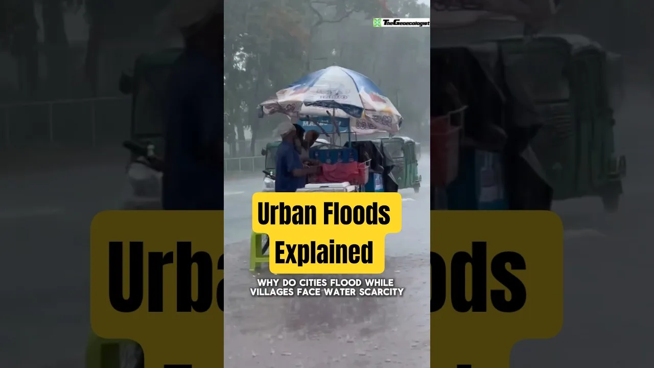
Table of Contents
- Understanding Urban Flooding Causes: The Core Mechanism
- Impervious Surfaces and Lost Absorption Capacity
- Drainage System Limitations
- Major Drivers Behind Urban Flooding Causes
- Encroachment on Natural Flood Defenses
- Unplanned Urbanization and Hydrological Ignorance
- Climate Change Amplification of Rainfall Intensity
- Waste Management Failures and Blocked Drains
- Case Studies: Indian Cities Grappling with Urban Flooding Causes
- Mumbai: Coastal Encroachment and Choked Drains
- Chennai: Vanishing Wetlands and Paved Floodplains
- Bengaluru: The Sinking City of Lakes
- Delhi and Gurugram: Infrastructure Deficits
- Sustainable Solutions to Address Urban Flooding Causes
- Sponge City Concept and Green Infrastructure
- Wetland Restoration and Floodplain Protection
- Drainage System Modernization
- Policy and Planning Reforms
- The Path Forward: From Gray to Green Infrastructure
Urban flooding causes are often misunderstood as simple acts of nature, but the reality is far more complex and largely anthropogenic. When heavy rainfall transforms city streets into raging rivers while nearby waterways remain within their banks, the phenomenon reveals a fundamental mismatch between urban design and hydrological reality. This comprehensive analysis explores the multifaceted urban flooding causes that plague metropolitan areas worldwide, with particular attention to the Indian subcontinent where rapid urbanization has outpaced infrastructure capacity.
- Impervious surfaces prevent natural groundwater recharge, forcing 90% of rainfall into immediate surface runoff compared to 10% in natural landscapes.
- Drainage systems designed for historical rainfall patterns cannot accommodate climate-change-intensified precipitation events.
- Wetland destruction removes critical flood buffers; cities like Chennai have lost over 85% of their wetlands since 1980.
- Unplanned development on floodplains and natural drainage paths redirects water into residential and commercial zones.
- Solid waste mismanagement clogs drainage networks, reducing conveyance capacity by 30-50% in many Indian cities.
- Sponge city principles — permeable pavements, rain gardens, urban forests — offer proven mitigation pathways.
Understanding Urban Flooding Causes: The Core Mechanism
Impervious Surfaces and Lost Absorption Capacity
The primary driver among urban flooding causes is the wholesale replacement of permeable landscapes with impervious materials. Natural terrain — soil, vegetation, wetlands — functions as a sponge, absorbing rainfall and releasing urban flooding causes slowly through infiltration and evapotranspiration. When cities pave over these surfaces with concrete, asphalt, and roofing materials, they fundamentally alter the hydrological cycle. Research from the United States Geological Survey indicates that urbanization increases surface runoff by 5-10 times compared to pre-development conditions. A single acre of parking lot generates 16 times more runoff than a meadow of equivalent size. This dramatic increase in runoff volume and velocity overwhelms drainage infrastructure designed for far lower peak flows.
Drainage System Limitations
Most urban drainage networks were engineered decades ago using historical rainfall intensity-duration-frequency (IDF) curves that no longer reflect current climatic realities. The IPCC Sixth Assessment Report confirms that extreme precipitation events have increased in frequency and intensity across most land regions since the 1950s, with human-induced climate change as the primary driver. Municipal stormwater systems typically accommodate 1-in-5 or 1-in-10 year rainfall events, yet cities now experience 1-in-50 or 1-in-100 year storms with alarming regularity. Mumbai’s drainage system, largely constructed during British colonial rule, was designed for 25 mm/hour rainfall intensity; the 2005 deluge saw 944 mm in 24 hours — nearly 40 times the design capacity.
Major Drivers Behind Urban Flooding Causes

Encroachment on Natural Flood Defenses
Wetlands, floodplains, mangroves, and urban lakes serve as nature’s flood mitigation infrastructure. Their systematic destruction ranks high among urban flooding causes. Chennai’s Pallikaranai marshland, once spanning 6,000 hectares, has shrunk to roughly 600 hectares — a 90% loss — due to IT corridor expansion, waste dumping, and real estate development. The 2015 Chennai floods, which caused economic losses exceeding ₹15,000 crore and claimed over 400 lives, were directly exacerbated by this encroachment. Similarly, Mumbai’s Mithi River floodplain has been constricted by the Bandra-Kurla Complex, slum settlements, and the international airport, reducing its carrying capacity by an estimated 60%. The World Bank’s Urban Flood Risk Management framework emphasizes that preserving natural drainage corridors is among the most cost-effective flood mitigation strategies, yielding benefit-cost ratios of 5:1 to 10:1.
Unplanned Urbanization and Hydrological Ignorance
Haphazard construction that disregards topography and natural drainage pathways constitutes a pervasive urban flooding cause. Bengaluru, once celebrated as the “City of Lakes” with over 1,000 interconnected water bodies, has lost 79% of its lake area to encroachment and sewage inflow since 1973. The city’s stormwater drain network — the Rajakaluve system — follows natural valleys but has been narrowed, built over, or converted to sewage channels in numerous stretches. A 2018 Indian Institute of Science study documented that 98% of Bengaluru’s lakes are encroached, and 90% receive untreated sewage. This systematic degradation of the urban hydrological network means even moderate rainfall (50-75 mm) now triggers widespread waterlogging in areas like Koramangala, Whitefield, and Sarjapur Road.
Climate Change Amplification of Rainfall Intensity
Anthropogenic climate change acts as a threat multiplier for all other urban flooding causes. Rising global temperatures increase atmospheric moisture-holding capacity by approximately 7% per degree Celsius (Clausius-Clapeyron relationship), fueling more intense, shorter-duration rainfall events. The Indian Meteorological Department reports a threefold increase in extreme rainfall events (>150 mm/day) over central India between 1950 and 2015. Urban heat islands — where dense built environments elevate temperatures 2-5°C above surrounding rural areas — further intensify convective rainfall over cities. This creates a vicious cycle: urbanization drives local warming, which amplifies rainfall extremes, which then overwhelm the very infrastructure that enabled the urbanization.
Waste Management Failures and Blocked Drains
Solid waste, particularly single-use plastics, construction debris, and municipal refuse, physically obstructs drainage networks, turning infrastructure liabilities into flood accelerators. The Central Pollution Control Board estimates that Indian cities generate 1.5 lakh tonnes of solid waste daily, with only 20% scientifically processed. In Delhi and Gurugram, stormwater drains frequently serve as de facto waste disposal channels. A 2021 audit by the Comptroller and Auditor General found that 68% of Delhi’s stormwater drains were partially or fully silted, reducing design capacity. During the 2023 monsoon, Gurugram’s Hero Honda Chowk underpass — a recurring flood hotspot — submerged within 30 minutes of moderate rainfall due to drain blockages from construction debris and plastic waste.
Case Studies: Indian Cities Grappling with Urban Flooding Causes
Mumbai: Coastal Encroachment and Choked Drains
Mumbai exemplifies the convergence of multiple urban flooding causes. The city’s 437 km stormwater drain network discharges into the Arabian Sea through 186 outfalls, many of which are tide-locked during high tides, preventing gravity drainage. Coastal regulation zone violations — including the Bandra-Worli Sea Link reclamation and coastal road project — have narrowed tidal estuaries and disrupted natural drainage. The Brihanmumbai Municipal Corporation’s ₹4,000 crore Brimstowad project (launched post-2005 floods) remains incomplete after 18 years. Meanwhile, plastic waste clogs 40% of the city’s drains according to a 2022 NGO audit. The result: annual monsoon paralysis, with low-lying areas like Hindmata, Sion, and Andheri subway flooding predictably each year.
Chennai: Vanishing Wetlands and Paved Floodplains
Chennai’s 2015 catastrophe — 1,200 mm rainfall in November alone — exposed the consequences of systematic wetland destruction. The city’s three major rivers (Cooum, Adyar, Kosasthalaiyar) and Buckingham Canal form a natural drainage framework, but encroachments have reduced their cross-sectional area by 30-50%. The Pallikaranai marsh, a critical flood buffer for South Chennai, was bisected by the IT Expressway and used as a dumping ground for 6,000 tonnes of daily waste. Post-2015, the Tamil Nadu government launched the Chennai Rivers Restoration Trust and initiated marshland restoration, but progress remains slow. The 2023 Cyclone Michaung (400+ mm in 48 hours) again inundated the same vulnerable zones — Velachery, Perumbakkam, and Tambaram — demonstrating persistent structural vulnerabilities.
Bengaluru: The Sinking City of Lakes
Bengaluru’s transformation from a lake-dotted plateau to a concrete metropolis illustrates how unplanned growth drives urban flooding causes. The city’s undulating terrain naturally directed runoff through a cascade of interconnected lakes (keres) into the Vrishabhavathi and Dakshina Pinakini river basins. Today, 837 lakes have vanished or been reduced to cesspools. Stormwater drains (rajakaluves) have been narrowed from designed widths of 15-30 meters to 2-5 meters in many stretches. The 2022 floods — triggered by 132 mm rainfall in 24 hours — submerged tech corridors like Outer Ring Road, Marathahalli, and Bellandur, causing ₹225 crore in damages per industry estimates. The Karnataka High Court’s 2021 directive to clear lake encroachments has seen limited enforcement.
Delhi and Gurugram: Infrastructure Deficits
The National Capital Region faces compounding urban flooding causes: the Yamuna floodplain has been constricted by the Ring Road, Akshardham complex, and Commonwealth Games Village; the Najafgarh drain (formerly the Sahibi River) carries 60% of Delhi’s sewage and stormwater but operates at 140% capacity; Gurugram’s rapid high-rise development on the Aravalli foothills has sealed recharge zones and increased runoff coefficients from 0.15 to 0.85. The 2023 monsoon saw Gurugram’s Golf Course Road and Cyber City — symbols of India’s economic ascent — submerged under waist-deep water. The National Green Tribunal’s 2022 order to restore the Najafgarh jheel (wetland) remains unimplemented.
Sustainable Solutions to Address Urban Flooding Causes
Sponge City Concept and Green Infrastructure
The “Sponge City” paradigm — pioneered in China and adopted globally — directly tackles urban flooding causes by restoring urban permeability. Core interventions include permeable pavements (allowing 70-90% infiltration), rain gardens and bioswales (capturing first-flush runoff), green roofs (retaining 50-80% of rainfall), and urban forests (enhancing evapotranspiration). Pilot projects in Chennai’s Taramani (IIT Madras campus) and Bengaluru’s Jakkur Lake catchment demonstrate 30-40% runoff reduction. The Ministry of Housing and Urban Affairs’ 2021 advisory on “Water-Sensitive Urban Design” mandates 30% permeable surface area for new developments, but enforcement varies across states.
Wetland Restoration and Floodplain Protection
Reclaiming wetlands and enforcing floodplain zoning addresses root urban flooding causes. The 2017 Wetlands (Conservation and Management) Rules require state governments to notify wetlands and prohibit conversion, yet only 75 wetlands are nationally notified as of 2024. Successful models exist: Kolkata’s East Kolkata Wetlands — a 12,500-hectare Ramsar site — treats 910 million litres of sewage daily while providing flood buffering worth ₹4,600 crore annually. Chennai’s Pallikaranai restoration (Phase I: 200 hectares) has improved local drainage. Legal tools like the “Blue Line” demarcation (mandated by NGT for Yamuna) must be implemented with revenue records integration to prevent encroachment.
Drainage System Modernization
Upgrading conveyance capacity to match climate-adjusted rainfall intensities is essential. This includes: (1) Real-time sensor networks for water level monitoring (implemented in Surat and Pune); (2) Automated floodgates at tidal outfalls (Mumbai’s planned 8 gates); (3) Decentralized detention ponds in parks and open spaces; (4) Regular desilting schedules with GPS-tracked accountability. The 15th Finance Commission allocated ₹8,000 crore for urban flood mitigation (2021-26), but fund utilization remains below 40% due to institutional fragmentation between municipal corporations, irrigation departments, and metro rail authorities.
Policy and Planning Reforms
Systemic urban flooding causes demand governance reforms: (1) Unified metropolitan water management authorities replacing fragmented jurisdictions; (2) Mandatory hydrological impact assessments for projects >5 hectares; (3) Stormwater utility fees based on impervious area (implemented in Pune, generating ₹120 crore/year for drainage); (4) Plastic ban enforcement with extended producer responsibility; (5) Climate-adaptive building codes requiring plinth elevation, rainwater harvesting, and permeable compounding. The National Mission on Sustainable Habitat (2023) integrates these principles but requires state-level legislative backing.
The Path Forward: From Gray to Green Infrastructure
Urban flooding causes are ultimately governance failures masked as hydraulic inevitabilities. Cities that have successfully reduced flood risk — Rotterdam (Water Squares), Singapore (ABC Waters), Tokyo (G-Cans underground reservoir) — share three attributes: long-term political commitment, cross-sectoral coordination, and community engagement. India’s urban population will reach 600 million by 2036; the infrastructure decisions made this decade will determine whether these cities float or flounder. The economic case is compelling: every ₹1 invested in flood resilience saves ₹7 in avoided damages (Global Commission on Adaptation). The technical solutions exist — permeable pavements cost 10-15% more than conventional asphalt but last 20-30 years with lower lifecycle costs; wetland restoration yields 10:1 benefit-cost ratios. What remains is the political will to prioritize blue-green infrastructure over gray concrete, to enforce zoning over expedient approvals, and to recognize that urban flooding causes are not acts of God but consequences of choice. As climate change accelerates, the window for transformative adaptation narrows. Cities must choose: become sponges that absorb and thrive, or remain sealed surfaces that flood and fail.
Frequently Asked Questions
The primary urban flooding causes in Indian cities include extensive impervious surfaces preventing groundwater recharge, outdated drainage systems designed for historical rainfall patterns, systematic encroachment of wetlands and floodplains, unplanned urbanization ignoring natural topography, climate change-driven extreme rainfall intensification, and solid waste blockages reducing drain capacity by 30-50%.
The sponge city concept mitigates urban flooding causes by mimicking natural hydrology through permeable pavements, rain gardens, green roofs, urban forests, and wetland restoration. These interventions increase infiltration, reduce peak runoff by 30-40%, enhance evapotranspiration, and provide decentralized flood storage, transforming cities from impervious surfaces into absorbent landscapes.
Mumbai, Chennai, Bengaluru, Delhi, Gurugram, Kolkata, Hyderabad, and Surat face recurrent urban flooding. Mumbai's tide-locked drains and coastal encroachment, Chennai's vanished wetlands, Bengaluru's lost lake network, and Delhi-NCR's constricted floodplains and overwhelmed drains exemplify how diverse urban flooding causes manifest across different hydro-geomorphic settings.