Blog
Central Nepal Floods: Rasuwagadi Disaster & Himalayan Cascading Hazards Explained

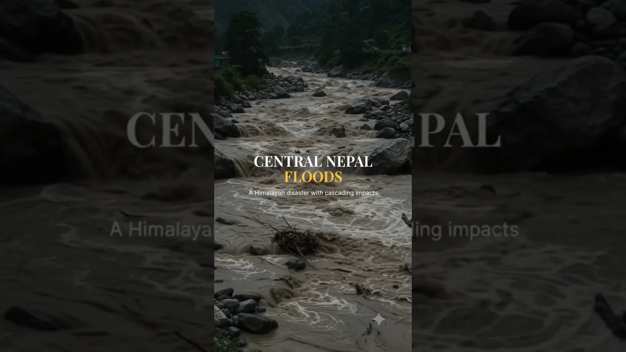
Table of Contents
- Meteorological Anatomy of the Central Nepal Floods
- Rasuwagadi: Geography of a Borderland Catastrophe
- Strategic Significance
- Physical Vulnerability
- Observed Impacts
- Cascading Hazards: From Cloudburst to Basin-Scale Disaster
- 1. Primary Trigger: Cloudburst & Flash Flood
- 2. Secondary: Landslide Dam Formation & Breach
- 3. Tertiary: Sediment Slug Propagation
- 4. Quaternary: Infrastructure & Socio-Economic Ripple Effects
- Climate Change Context: The Himalayan Amplifier
- Governance & Resilience Gaps
- Early Warning Deficits
- Land-Use & River Management Failures
- Transboundary Coordination
- Pathways to Resilience: Science-Informed Action
- 1. Multi-Hazard Early Warning Systems (MHEWS)
- 2. River Corridor Management
- 3. Climate-Adaptive Infrastructure
- 4. Transboundary Hydro-Diplomacy
- 5. Community-Centric Disaster Governance
- Conclusion: Learning from the Central Nepal Floods
- Frequently Asked Questions
- What caused the Central Nepal Floods in September 2024?
- Why was Rasuwagadi so severely affected?
- How does climate change influence Central Nepal Floods?
The Central Nepal Floods of late September 2024 have exposed the fragile intersection of extreme weather, steep Himalayan topography, and vulnerable infrastructure. Triggered by an unprecedented cloudburst over the Trishuli and Bhote Koshi river basins, the disaster devastated Rasuwagadi — a critical border settlement and trade corridor with China — while sending destructive pulse waves dozens of kilometers downstream. This event is not an isolated incident; Central Nepal Floods is a textbook case of how Central Nepal Floods evolve into cascading multi-hazard chains in high-mountain Asia.
- Extreme rainfall exceeding 300 mm in 24 hours triggered flash floods and debris flows across Rasuwa, Nuwakot, and Dhading districts.
- Rasuwagadi — a strategic customs point on the Nepal–China border — suffered catastrophic damage to the Friendship Bridge, customs facilities, and the Pasang Lhamu Highway.
- Cascading hazards transformed a localized cloudburst into a basin-scale disaster: landslide dams, outburst floods, and sediment slugs propagated downstream to the Trishuli and Narayani rivers.
- Climate change is amplifying the frequency and intensity of such events; the Hindu Kush Himalaya (HKH) region is warming at 0.3–0.7 °C per decade, faster than the global average.
- Disaster governance gaps — limited early warning, unregulated riverbed mining, and haphazard settlement expansion — compounded human and economic losses.
Meteorological Anatomy of the Central Nepal Floods
Between 26 and 28 September 2024, a low-pressure system originating in the Bay of Bengal interacted with the monsoon trough and orographic lifting along the south-facing slopes of the Langtang–Ganesh Himal range. The Department of Hydrology and Meteorology (DHM) recorded 327 mm of rainfall at the Dhunche station in 24 hours — a 1-in-50-year event. Satellite-derived GPM IMERG data confirmed rainfall rates exceeding 50 mm/hr over the Trishuli headwaters, saturating already primed slopes from an above-normal monsoon season (June–September 2024 rainfall was 118 % of the long-period average).
This meteorological setup is consistent with findings from the 2024 Nepal floods overview, which notes that extreme precipitation events in the central Himalaya have increased threefold since the 1980s. The Central Nepal Floods exemplify how synoptic-scale moisture transport, when funneled through deep valleys, creates hyper-localized deluges that overwhelm drainage networks designed for far lower return periods.
Rasuwagadi: Geography of a Borderland Catastrophe
Strategic Significance
Rasuwagadi (28.17° N, 85.37° E, ~2,300 m a.s.l.) sits at the confluence of the Bhote Koshi and Langtang Khola, immediately north of the Main Central Thrust (MCT) — a major tectonic suture zone. The settlement hosts the Rasuwagadi–Kerung border crossing, the only operational land port between Nepal and China since the 2015 Gorkha earthquake rendered the Tatopani–Zhangmu route unusable. In FY 2023/24, bilateral trade through Rasuwagadi exceeded NPR 45 billion (USD 340 million), making Central Nepal Floods Nepal’s third-largest customs point by revenue.
Physical Vulnerability
The valley floor at Rasuwagadi is narrow (<200 m wide), flanked by near-vertical gneiss and schist cliffs prone to rockfall and deep-seated landslides. The Pasang Lhamu Highway (NH-34) clings to the left bank of the Bhote Koshi, with minimal shoulder space. Decades of riverbed mining for construction aggregate have lowered the channel bed by an estimated 3–5 m, steepening bank slopes and undercutting the highway embankment. When the 28 September cloudburst dumped an estimated 12 million m³ of water and debris into the Bhote Koshi in under six hours, the channel capacity was exceeded by an order of magnitude.
Observed Impacts
- Friendship Bridge: The 110 m bailey bridge — reconstructed with Chinese assistance after 2015 — was washed away; its abutments scoured to bedrock.
- Customs & Immigration Complex: Inundated under 4 m of sediment-laden water; server rooms and document archives destroyed.
- Highway: 17 km of NH-34 damaged or destroyed at 42 locations; 14 major landslides reactivated.
- Settlements: 38 houses and 12 teahouses swept away; 3 confirmed fatalities, 7 missing (as of 5 Oct 2024, per District Police Office, Rasuwa).
Cascading Hazards: From Cloudburst to Basin-Scale Disaster

The defining characteristic of the Central Nepal Floods is their cascading nature. In the Himalayas, hazards rarely remain local. The sequence unfolded as follows:
1. Primary Trigger: Cloudburst & Flash Flood
Intense rainfall on saturated, over-steepened slopes generated immediate debris flows in tributary gullies (e.g., Thulo Khola, Sanu Khola). These flows bulked up by entraining channel sediment, increasing volume by 3–5×.
2. Secondary: Landslide Dam Formation & Breach
At least six valley-blocking landslides formed on the Bhote Koshi and Trishuli mainstems. The largest, at Bhairab Kunda (Trishuli mainstem), impounded an estimated 2.8 million m³ of water. Its overtopping breach 14 hours later released a flood wave with peak discharge ~4,500 m³/s — comparable to a 100-year flood — that reached Betrawati (35 km downstream) in under 90 minutes.
3. Tertiary: Sediment Slug Propagation
The breach mobilized a massive sediment slug (coarse gravel to boulders) that aggraded the Trishuli channel by 2–4 m over a 50 km reach. This raised flood levels at Trishuli Bazaar, Bidur, and Devghat, inundating riverside settlements and agricultural land. The Narayani River at Narayanghat recorded a 1.8 m stage rise 18 hours post-breach, disrupting water supply intakes for Bharatpur municipality.
4. Quaternary: Infrastructure & Socio-Economic Ripple Effects
- Hydropower: Three operational projects (Upper Trishuli-1 216 MW, Trishuli-3A 60 MW, Sanjen 42 MW) sustained penstock and intake damage; combined generation loss ~318 MW for 3–6 weeks.
- Transport: NH-34 closure severed Kathmandu’s northern supply route; fuel and food prices in Kathmandu Valley spiked 12–18 % within a week.
- Trade: Cross-border trade halted; 1,200+ cargo trucks stranded; perishable exports (cardamom, ginger, tea) worth ~NPR 200 million lost.
Climate Change Context: The Himalayan Amplifier
The Hindu Kush Himalaya (HKH) Assessment Report (ICIMOD, 2019) projects that even under 1.5 °C global warming, the HKH will warm by 1.8–2.2 °C. Observed trends already show:
- Monsoon extreme rainfall days (>100 mm/day) increased 15 % per decade since 1980 in central Nepal (DHM/NAST, 2023).
- Glacier mass loss in the Langtang basin accelerated to -0.62 m w.e. yr⁻¹ (2010–2020), expanding proglacial lakes and destabilizing lateral moraines.
- Permafrost thaw above 4,500 m is reducing rock-slope stability, increasing large rock-ice avalanche frequency.
These cryospheric changes mean that Central Nepal Floods will increasingly originate from compound events: extreme rain falling on melting snow/ice, triggering glacier lake outburst floods (GLOFs) that cascade into fluvial systems. The 2021 Melamchi disaster and 2023 Sikkim GLOF are grim precedents.
Governance & Resilience Gaps
Early Warning Deficits
Despite DHM’s SMS-based flood alerts, the Rasuwagadi catchment lacked community-level sirens, real-time water-level telemetry, and pre-identified evacuation routes. The 2017 Disaster Risk Reduction and Management Act mandates local disaster management committees (LDMCs), but Rasuwa’s LDMC had not conducted a mock drill since 2019. A 2023 UNDP assessment rated Rasuwa’s early warning readiness at 2.1/5.
Land-Use & River Management Failures
- Unregulated mining: 47 licensed and an estimated 120 unlicensed crusher plants operate in the Trishuli corridor, extracting ~1.2 million m³/yr — far exceeding the river’s natural replenishment rate (~0.3 million m³/yr).
- Encroachment: 62 % of structures within 50 m of the Bhote Koshi high-flood line are informal settlements built post-2015 without geotechnical clearance.
- Highway alignment: NH-34 follows the valley floor with no engineered debris-flow diversion structures; the 2021 DPR for realignment remains unimplemented due to land-acquisition disputes.
Transboundary Coordination
The Bhote Koshi originates in Tibet (China) as the Poiqu River. Real-time hydrological data sharing between DHM and China’s Ministry of Water Resources is limited to a 2018 MoU that covers only three stations and excludes sediment flux. During the September event, Chinese upstream rainfall data was not available to Nepali forecasters, reducing lead time by an estimated 3–4 hours.
Pathways to Resilience: Science-Informed Action
1. Multi-Hazard Early Warning Systems (MHEWS)
Deploy a dense network of radar-rain gauges (X-band), water-level radars, and seismic geophones in the Trishuli–Bhote Koshi headwaters. Integrate with the WMO Multi-Hazard Early Warning System framework. Target: 60-minute lead time for flash floods, 4-hour lead time for landslide-dam breach waves.
2. River Corridor Management
- Enforce a 100 m no-development buffer from high-flood lines (per 2022 River Protection Act).
- Implement sediment budgeting: cap extraction at 30 % of annual sediment yield; mandate replenishment mining only.
- Construct engineered debris-flow check dams at 12 priority tributaries identified by ICIMOD’s 2022 hazard atlas.
3. Climate-Adaptive Infrastructure
- Redesign NH-34 with elevated viaducts over active landslide zones; use rock-shed galleries where realignment is impossible.
- Relocate Rasuwagadi customs complex to a geotechnically stable terrace 1.5 km upstream; design for 500-year flood + debris flow impact loads.
- Hydropower intakes: adopt movable weir technology and sediment bypass tunnels (as piloted at Upper Tamakoshi).
4. Transboundary Hydro-Diplomacy
Upgrade the 2018 MoU to a binding data-sharing protocol covering precipitation, discharge, sediment, and GLOF early warning. Establish a joint Nepal–China technical working group under the Joint Committee on Water Resources (JCWR) with quarterly meetings and real-time API data exchange.
5. Community-Centric Disaster Governance
- Activate and fund Ward-level Disaster Management Committees (WDMCs) with trained volunteers, satellite phones, and evacuation kits.
- Conduct bi-annual basin-scale simulation exercises involving communities, security forces, and customs officials.
- Integrate indigenous knowledge (e.g., Tamang oral histories of past flood marks) into hazard zonation maps.
Conclusion: Learning from the Central Nepal Floods
The Central Nepal Floods of September 2024 are a stark reminder that in the Himalayas, geography dictates destiny — but governance writes the outcome. The Rasuwagadi catastrophe was not inevitable; it was Central Nepal Floods of decades of underinvestment in monitoring, unchecked river exploitation, and planning that treated the mountains as static backdrops rather than dynamic, hazardous systems. As the climate continues to warm, the frequency of such compound, cascading events will only rise. Nepal’s response must shift from reactive relief to anticipatory, science-driven resilience: robust early warning, river-wise land use, climate-proof infrastructure, and transboundary cooperation. The geography of the disaster is fixed; the geography of the response is ours to choose.
Frequently Asked Questions
What caused the Central Nepal Floods in September 2024?
An extreme cloudburst dropped over 300 mm of rain in 24 hours on the Trishuli and Bhote Koshi headwaters, triggering flash floods, debris flows, and landslide dam breaches that cascaded downstream.
Why was Rasuwagadi so severely affected?
Rasuwagadi sits in a narrow valley at the confluence of two rivers, with critical infrastructure (highway, bridge, customs) built on the active floodplain. Riverbed mining and lack of early warning amplified the damage.
How does climate change influence Central Nepal Floods?
Warming in the Hindu Kush Himalaya is nearly double the global average, intensifying monsoon extremes, accelerating glacier melt, and destabilizing slopes — all of which increase the frequency and magnitude of compound flood events.
Frequently Asked Questions
An extreme cloudburst dropped over 300 mm of rain in 24 hours on the Trishuli and Bhote Koshi headwaters, triggering flash floods, debris flows, and landslide dam breaches that cascaded downstream.
Rasuwagadi sits in a narrow valley at the confluence of two rivers, with critical infrastructure (highway, bridge, customs) built on the active floodplain. Riverbed mining and lack of early warning amplified the damage.
Warming in the Hindu Kush Himalaya is nearly double the global average, intensifying monsoon extremes, accelerating glacier melt, and destabilizing slopes — all of which increase the frequency and magnitude of compound flood events.