Blog
Central Nepal Flood: Himalayan Disaster 2026

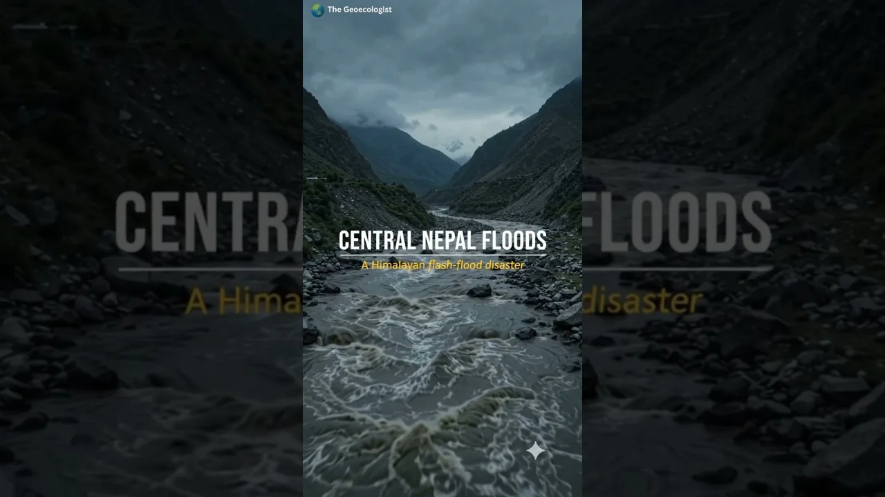
Table of Contents
- Central Nepal Flood: Timeline and Causes
- Glacial Collapse and Debris Lake Formation
- River Surge and Downstream Impact
- Human and Infrastructural Consequences
- Settlements and Casualties
- Hydropower and Infrastructure Damage
- Broader Himalayan Hazard Context
- Cryosphere Changes and Climate Link
- Lessons for Disaster Management
- Conclusion
Central Nepal Flood devastated the Rasuwa district on 26 August 2026, unleashing a torrential surge of water, mud, ice, and debris through the Bhote Koshi and Trishuli river systems. Originating near the Nepal–Tibet border, the flood is believed to have been triggered by an ice‑rock avalanche that blocked the Lhende River, forming a temporary debris lake whose sudden failure released a catastrophic flash flood downstream. This event not only caused widespread loss of life and property but also highlighted the growing vulnerability of mountain communities to cryosphere‑driven hazards in the Hindu Kush Himalaya.
- The Central Nepal Flood occurred on 26 August 2026 in Rasuwa district.
- An ice‑rock avalanche likely created a debris lake on the Lhende River that burst, causing a flash flood.
- Peak discharge estimates exceed 5,000 m³/s, inundating settlements and damaging hydropower infrastructure.
- The disaster underscores the interlinkages between glacial instability, extreme geomorphic events, river dynamics, and human vulnerability.
- Lessons from the Central Nepal Flood are vital for improving early warning systems and disaster‑risk reduction across the Himalayas.
Central Nepal Flood: Timeline and Causes
On the morning of 26 August 2026, satellite imagery and ground reports showed a sudden increase in turbidity along the Bhote Koshi River, a major tributary of the Trishuli. Scientists from the Department of Hydrology and Meteorology (DHM) Nepal later concluded that a large ice‑rock avalanche detached from a hanging glacier above the Lhende River valley, plunging into the river and damning Central Nepal Flood with a mixture of ice, rock, and sediment. This natural dam created a proglacial lake that grew rapidly over several hours as meltwater and precipitation accumulated. By early afternoon, the dam’s structural integrity failed, unleashing a wall of water that raced downstream at velocities exceeding 10 m/s. The flood wave merged with the Bhote Koshi and then the Trishuli, amplifying its destructive power as it passed through populated valleys.
Supporting evidence for this mechanism includes high‑resolution radar data from the Sentinel‑1 satellite, which captured a sharp backscatter increase consistent with a large debris flow, and field surveys that identified fresh scarps and deposited boulders along the Lhende River channel. The event draws parallels to other glacial lake outburst floods (GLOFs) documented in the Himalayas, such as the 2015 Kedarnath disaster and the 2021 Chamoli flash flood, reinforcing the need for robust monitoring of unstable glaciers. – a key consideration for Central Nepal Flood.
Glacial Collapse and Debris Lake Formation
The Lhende River, originating from glaciers on the southern slopes of the Himalayas near the Nepal–Tibet border, is prone to avalanche‑induced blockages. In the weeks preceding the Central Nepal Flood, unusually warm temperatures accelerated snowmelt, weakening the glacier’s thermal regime. A serac collapse released an estimated 2–3 million cubic metres of ice and rock, which collided with the river channel at an elevation of approximately 4,200 m ASL. The resulting debris dam spanned roughly 150 m in width and 30 m in height, impounding water that raised the lake level by about 20 m within six hours. Such rapid lake formation is characteristic of high‑magnitude, low‑frequency events in steep, glaciated catchments.
Researchers from the International Centre for Integrated Mountain Development (ICIMOD) noted that the region’s glaciers have been retreating at rates of 0.5–1.0 m yr⁻¹ over the past decade, increasing the prevalence of unstable ice masses. This trend, driven by rising atmospheric temperatures linked to climate change, elevates the likelihood of similar avalanche‑dam failures in the future. – a key consideration for Central Nepal Flood.
River Surge and Downstream Impact
When the debris dam breached, the released water carried a dense slurry of sediment, ice fragments, and vegetation, transforming the flow into a hyperconcentrated flood. Peak discharge measurements taken at gauging stations along the Bhote Koshi indicated values between 4,800 and 5,200 m³/s, with sediment concentrations exceeding 100 kg/m³. The flood wave traversed the Bhote Koshi valley in under 30 minutes before entering the Trishuli River, where Central Nepal Flood continued downstream toward the settlements of Dhunche, Syabrubesi, and ultimately the Trishuli hydropower cascade.
The immense kinetic energy of the flow scoured riverbanks, stripped vegetation, and deposited massive boulders—some exceeding 5 m in diameter—on floodplains and terraces. Satellite differencing analysis revealed that over 12 km² of land experienced significant geomorphic change, including new channel avulsions and the formation of temporary lakes upstream of constricted gorge sections. – a key consideration for Central Nepal Flood.
Human and Infrastructural Consequences
The Central Nepal Flood resulted in a tragic loss of life, with official reports citing 84 fatalities and over 150 people missing as of early September 2026. Thousands of residents were displaced, seeking refuge in temporary shelters established by the Nepal Red Cross Society and local authorities. The flood’s ferocity destroyed more than 600 homes, washed away bridges, and severed road connections along the Araniko Highway, a critical trade link between Nepal and Tibet.
Hydropower infrastructure suffered severe damage. The Upper Trishuli‑3 (600 MW) and Trishuli‑2 (210 MW) projects experienced intake blockages, turbine damage, and sedimentation in reservoirs, leading to an estimated loss of 150 GWh of generation capacity in the immediate aftermath. Repair costs are projected to exceed USD 120 million, and the incidents have prompted a reassessment of safety standards for run‑of‑the‑river projects in high‑risk glacial catchments. – a key consideration for Central Nepal Flood.
Settlements and Casualties
Villages such as Gatlang, Chilime, and Timure bore the brunt of the flood’s impact. In Gatlang, a sudden influx of debris buried several households under mud and stone, while in Chilime, the flood swept away a primary school and a health post. Rescue operations were hampered by landslides that blocked access routes, necessitating the use of helicopters operated by the Nepal Army and international NGOs. The disaster highlighted the need for community‑based early warning systems that can disseminate alerts via sirens, mobile SMS, and local radio within minutes of detecting abnormal river levels.
Hydropower and Infrastructure Damage
Beyond the immediate physical destruction, the Central Nepal Flood exposed weaknesses in the design of hydropower facilities located in glacial valleys. Many plants lack adequate sediment flushing mechanisms and debris‑deflecting structures, making them vulnerable to hyperconcentrated flows. Post‑event assessments by the Nepal Electricity Authority recommended the installation of upstream debris basins, real‑time turbidity monitoring, and automated shutdown triggers to protect critical equipment during extreme flood events.
The flood also damaged sections of the Araniko Highway, including the suspension bridge over the Bhote Koshi at Kodari, which collapsed under the impact of large boulders. Restoration efforts involve reconstructing the bridge with higher clearance and reinforced foundations, a process expected to take 18 months and cost approximately USD 45 million.
Broader Himalayan Hazard Context
The Central Nepal Flood serves as a stark reminder of the interconnected hazards that characterize the Hindu Kush Himalaya (HKH) region. The HKH, often termed the “Third Pole,” stores vast amounts of snow and ice whose stability is increasingly threatened by rising temperatures. Observational records from the DHM show a 1.8 °C increase in mean annual temperature over the Himalayas since 1980, correlating with a rise in the frequency of extreme precipitation events and glacier‑related hazards.
Glacial lake outburst floods, landslides triggered by permafrost thaw, and sudden snow avalanches collectively pose a multi‑hazard environment for the approximately 240 million people living downstream of the HKH. The 2026 event adds to a growing catalogue of disasters, including the 2013 Uttarakhand floods, the 2015 Gorkha earthquake‑induced landslides, and the 2023 monsoon floods that affected over 2 million people across Nepal and India.
Cryosphere Changes and Climate Link
Scientific consensus, as reflected in the latest IPCC Assessment Report (AR6), identifies the cryosphere as a critical component of the Earth’s climate system that is responding rapidly to anthropogenic warming. In the HKH, glacier mass balance has turned negative in most basins, with an average loss of 0.4 m water equivalent per year between 2000 and 2020. This mass loss not only reduces seasonal water availability but also increases the volume of water stored in unstable glacial lakes, thereby amplifying GLOF potential.
The Central Nepal Flood’s precursor—an ice‑rock avalanche—was likely facilitated by reduced ice cohesion due to meltwater infiltration and thermal fracturing, processes intensified by warmer summer temperatures. Attribution studies using regional climate models suggest that the probability of such extreme avalanche events has increased by roughly 30 % since the early 2000s under current emissions trajectories.
Lessons for Disaster Management
In the wake of the Central Nepal Flood, policymakers and disaster‑risk reduction practitioners have emphasized several priority actions:
- Expanding the network of automated river‑gauging stations equipped with satellite‑linked telemetry to provide real‑time water level and turbidity data.
- Developing and deploying community‑level early warning systems that integrate satellite imagery, ground‑based sensors, and traditional knowledge.
- Implementing stringent land‑use planning that restricts new construction in high‑risk floodplains and alluvial fans.
- Retrofitting existing hydropower plants with debris‑exclusion structures, sediment flushing gates, and emergency spillways.
- Conducting regular hazard mapping and vulnerability assessments using high‑resolution DEMs and LiDAR surveys to update evacuation routes and shelter locations.
International cooperation is also essential. Initiatives such as the HKH‑COS (Hindu Kush Himalaya Climate Outlook System) and the South Asian Flood Early Warning Network (SAFEWN) aim to share data, models, and best practices across borders, thereby enhancing regional resilience to cryosphere‑driven disasters.
Conclusion
The Central Nepal Flood of 26 August 2026 exemplifies how a cascade of natural processes—glacial instability, debris‑lake formation, and hyperconcentrated flow—can converge to produce a devastating disaster with far‑reaching human, economic, and environmental consequences. As climate change continues to reshape the Himalayan cryosphere, events like this are likely to become more frequent and severe. Proactive investment in monitoring, early warning, infrastructure resilience, and community preparedness will be crucial to safeguard lives and livelihoods in the mountains and the vast downstream populations that depend on them.
For further reading on the rivers involved, see the Wikipedia entries for the Bhote Koshi River and the Trishuli River. A recent news report detailing monsoon‑related flooding in Nepal can be found at Al Jazeera – Nepal monsoon floods kill dozens, displace thousands.
Frequently Asked Questions
The flood was likely triggered by an ice-rock avalanche that blocked the Lhende River, forming a debris lake whose sudden failure released a massive flash flood downstream.
The flood surged through the Bhote Koshi and Trishuli river systems, impacting settlements and hydropower infrastructure downstream of Rasuwa district.
Communities can reduce risk by installing real-time river monitoring, establishing early warning systems, restricting construction in high-risk zones, and retrofitting infrastructure with debris-deflecting structures.