Blog
Glacial Lake Outburst Floods: Complete Guide for UPSC Geography

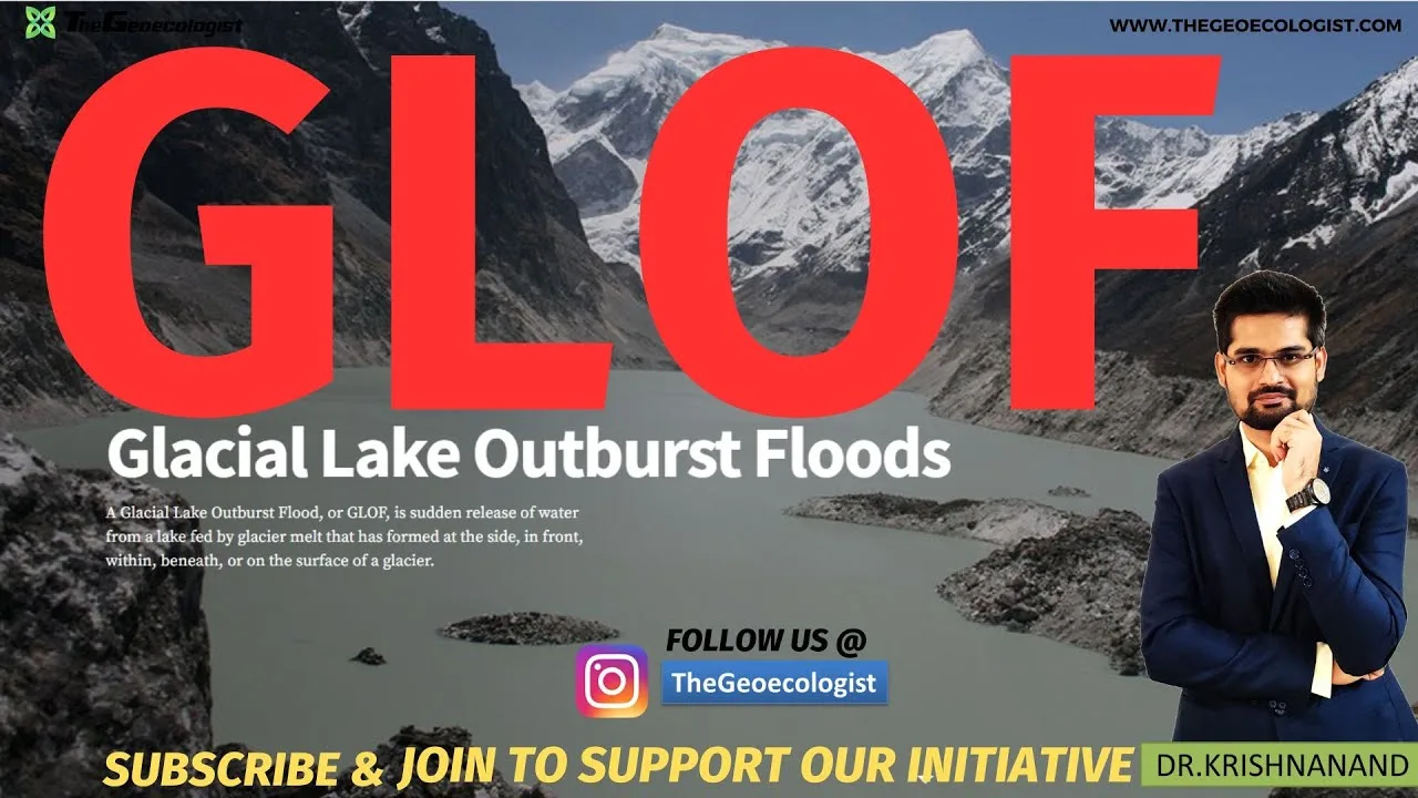
Table of Contents
- What Are Glacial Lake Outburst Floods?
- Formation and Classification of Glacial Lakes
- Moraine-Dammed Lakes (Highest GLOF Risk)
- Ice-Dammed Lakes
- Bedrock-Dammed Lakes
- Primary Causes and Triggering Mechanisms of Glacial Lake Outburst Floods
- 1. Glacial Retreat and Lake Expansion Driven by Climate Change
- 2. Moraine Dam Instability and Geotechnical Failure
- 3. Cryospheric and Seismic Triggers
- Impacts of Glacial Lake Outburst Floods on Mountain Communities
- Direct Human and Economic Losses
- Ecological and Geomorphological Consequences
- Transboundary and Cascading Hazard Dimensions
- Mitigation and Management Strategies for Glacial Lake Outburst Floods
- Early Warning Systems (EWS) and Monitoring
- Structural Interventions: Lake Level Lowering
- Policy Frameworks and Institutional Mechanisms
- Community-Based Disaster Risk Reduction
- Glacial Lake Outburst Floods in the Indian Himalayan Context
- Regional Distribution and Hotspots
- Recent Events and Lessons Learned
- Relevance to UPSC CSE: Syllabus Mapping and Answer Writing Strategy
- Geography Optional Paper I (Physical Geography)
- Geography Optional Paper II (Human & Environmental Geography)
- General Studies Paper III (Disaster Management)
- Answer Writing Tips for Maximum Marks
- Case Studies: Learning from Major Glacial Lake Outburst Floods
- 1. Dig Tsho, Nepal (1985) – The Wake-Up Call
- 2. Kedarnath, India (2013) – Compound Disaster
- 3. South Lhonak, Sikkim (2023) – Infrastructure Vulnerability
- Future Outlook: Climate Projections and Adaptation Pathways
- Conclusion
Glacial Lake Outburst Floods (GLOFs) represent one of the most devastating cryospheric hazards affecting mountain ecosystems globally. For UPSC Civil Services Examination aspirants, particularly those with Geography Optional, mastering Glacial Lake Outburst Floods is essential for addressing questions across Physical Geography, Environmental Geography, and Disaster Management (GS Paper III). This comprehensive guide covers the mechanisms, triggers, impacts, and management frameworks of Glacial Lake Outburst Floods with special emphasis on the Hindu Kush Himalaya region.
- Glacial Lake Outburst Floods are sudden releases of water from glacial lakes dammed by moraines or ice
- Climate change accelerates glacial retreat, expanding lakes and increasing GLOF frequency by 2-3x since 1990
- The Hindu Kush Himalaya hosts 9,000+ glacial lakes, with 200+ classified as potentially dangerous
- Key triggers: moraine dam failure, ice/rock avalanches, seismic activity, and extreme precipitation
- Mitigation combines early warning systems, structural interventions, and community-based disaster risk reduction
- Critical for UPSC: Paper I (Geomorphology), Paper II (Environmental Issues), GS III (Disaster Management)
What Are Glacial Lake Outburst Floods?
Glacial Lake Outburst Floods occur when water impounded by a glacial lake—formed through glacial meltwater accumulation behind natural dams of moraine debris or ice—is released catastrophically. Unlike regular seasonal flooding, GLOFs are characterized by extremely high peak discharges (often 10-100 times normal flow), massive sediment loads, and minimal warning time. The term was first formally defined in glaciological literature by Richardson and Reynolds (2000), who established the classification framework still used today.
These lakes typically form in three settings: (1) moraine-dammed lakes at glacier snouts, (2) ice-dammed lakes against glacier margins, and (3) bedrock-dammed lakes in glacial cirques. Moraine-dammed lakes pose the highest GLOF risk because their dams consist of unconsolidated sediment with ice cores that can melt, creating voids and structural weakness. The 2013 Kedarnath disaster in Uttarakhand—triggered by a Glacial Lake Outburst Flood from Chorabari Lake—exemplifies the destructive potential, claiming over 5,000 lives and causing economic losses exceeding $1 billion. – a key consideration for Glacial Lake Outburst Floods.
Formation and Classification of Glacial Lakes
Moraine-Dammed Lakes (Highest GLOF Risk)
These form when retreating glaciers leave behind terminal moraines that impound meltwater. The dams comprise heterogeneous mixtures of boulders, sand, silt, and often dead ice cores. As climate warming continues, ice-core degradation creates subsidence, piping, and eventual dam breach. The IPCC AR6 WGII report identifies moraine-dammed lakes as the primary GLOF source in High Mountain Asia. – a key consideration for Glacial Lake Outburst Floods.
Ice-Dammed Lakes
Formed when tributary glaciers block main valleys or when glacier surges create temporary dams. These lakes drain periodically through subglacial tunnels (jökulhlaups), common in Iceland, Alaska, and Karakoram. While predictable in some cases, sudden drainage can still cause catastrophic flooding.
Bedrock-Dammed Lakes
Confined by solid rock thresholds, these are generally stable but can fail due to seismic shaking or overtopping from extreme inflow events. Common in deeply eroded glacial cirques of the Greater Himalaya.
Primary Causes and Triggering Mechanisms of Glacial Lake Outburst Floods

1. Glacial Retreat and Lake Expansion Driven by Climate Change
Rising temperatures—1.5°C to 2°C above pre-industrial levels in the Himalaya—accelerate glacier mass loss. The Hindu Kush Himalaya Assessment Report (2019) projects 36-64% glacier volume loss by 2100 under RCP 4.5-8.5 scenarios. This retreat expands existing lakes and forms new ones; satellite inventories show a 9-12% increase in glacial lake area across High Mountain Asia between 1990-2018. Larger lakes exert greater hydrostatic pressure on moraine dams, exponentially increasing Glacial Lake Outburst Floods probability.
2. Moraine Dam Instability and Geotechnical Failure
Moraine dams lack engineering design; they are unconsolidated, heterogeneous, and often contain ice lenses. Failure modes include: (a) overtopping and erosion from surge waves, (b) piping and internal erosion through preferential flow paths, (c) slope instability and mass movements into the lake, and (d) seismic liquefaction of saturated dam material. The 1985 Dig Tsho GLOF in Nepal’s Khumbu region—triggered by an ice avalanche into the lake—demonstrated how external impacts can initiate dam breach within minutes.
3. Cryospheric and Seismic Triggers
Ice/rock avalanches into lakes generate displacement waves that overtop dams. The Himalaya’s high seismicity (M>7 earthquakes recurrence ~500 years) poses additional risk; the 2015 Gorkha earthquake (Mw 7.8) triggered numerous landslides and potentially destabilized several glacial lake dams. Extreme precipitation events—intensifying under climate change—can rapidly raise lake levels beyond dam freeboard.
Impacts of Glacial Lake Outburst Floods on Mountain Communities
Direct Human and Economic Losses
GLOFs produce hyperconcentrated flows with sediment concentrations 40-80% by volume, capable of transporting boulders >10m diameter. The 1994 Luggye Tso GLOF in Bhutan traveled 90km downstream, destroying 1,700 hectares of agricultural land and critical infrastructure. Economic impacts cascade through hydropower (vital for Bhutan/Nepal GDP), tourism, and transboundary water security. The National Disaster Management Authority (NDMA) estimates annual GLOF risk exposure for Indian Himalayan states at ₹2,500-3,000 crore.
Ecological and Geomorphological Consequences
Sudden sediment pulses alter river channel morphology, burying riparian habitats and disrupting aquatic ecosystems. Long-term aggradation raises floodplains, increasing future flood risk. Glacial flour input affects water chemistry and light penetration, impacting primary productivity. In the Tibetan Plateau, GLOFs have been linked to downstream wetland degradation and pastoral livelihood disruption.
Transboundary and Cascading Hazard Dimensions
Many Himalayan rivers are transboundary (Indus, Ganga, Brahmaputra). A GLOF in upstream Tibet/Nepal/Bhutan can propagate downstream across borders within hours, complicating early warning and response coordination. Cascading hazards—where GLOFs trigger landslides, which dam rivers creating secondary flood risk—compound disaster complexity. The 2021 Chamoli disaster (though primarily a rock-ice avalanche) demonstrated such cascading dynamics in the Dhauliganga valley.
Mitigation and Management Strategies for Glacial Lake Outburst Floods
Early Warning Systems (EWS) and Monitoring
Modern EWS integrate satellite remote sensing (Sentinel-1 SAR, Landsat, PlanetScope), in-situ water level sensors, seismic/acoustic monitoring, and automated alert dissemination. India’s Glacial Lake Outburst Floods monitoring program under the National Centre for Polar and Ocean Research (NCPOR) tracks 477 glacial lakes >0.01 km² in the Indian Himalaya. Bhutan’s early warning system on the Pho Chhu basin—installed after the 1994 GLOF—provides 60-90 minutes lead time for downstream communities.
Structural Interventions: Lake Level Lowering
Controlled drainage via siphoning, open-channel excavation, or tunneling reduces hydrostatic pressure. Successful implementations include: Tsho Rolpa (Nepal, 2000) – 3m lowering via open channel; Imja Tsho (Nepal, 2016) – 3.4m lowering via siphon/pump system; and Thorthormi Lake (Bhutan, 2008-2012) – 5m lowering through manual excavation. These projects cost $3-7 million but protect downstream assets valued orders of magnitude higher.
Policy Frameworks and Institutional Mechanisms
India’s National Disaster Management Plan (2019) includes GLOF-specific guidelines. The Himalayan States Regional Council (NITI Aayog) coordinates cross-state strategies. Internationally, the ICIMOD-led Hindu Kush Himalaya Monitoring and Assessment Programme (HIMAP) facilitates regional data sharing. The Sendai Framework for Disaster Risk Reduction (2015-2030) explicitly recognizes cryospheric hazards, urging integration into national DRR strategies.
Community-Based Disaster Risk Reduction
Structural measures alone are insufficient. Community-based approaches—hazard mapping, evacuation planning, regular drills, and integrating traditional knowledge—build resilience. The “GLOF Resilient Villages” pilot in Lachen, Sikkim, demonstrates how participatory vulnerability assessment combined with nature-based solutions (wetland restoration, afforestation) reduces exposure.
Glacial Lake Outburst Floods in the Indian Himalayan Context
Regional Distribution and Hotspots
India’s Himalayan states host 9,575 glacial lakes (NCPOR 2023 inventory), with Sikkim (380), Arunachal Pradesh (1,620), and Uttarakhand (1,250) having the highest counts. The Eastern Himalaya (Sikkim, Arunachal) shows faster lake expansion rates (15-20% per decade) than Western Himalaya due to higher precipitation and debris-covered glacier dynamics. Priority lakes for intervention include South Lhonak (Sikkim), Shako Cho (Arunachal), and Vasudhara Tal (Uttarakhand).
Recent Events and Lessons Learned
The October 2023 South Lhonak Lake GLOF in Sikkim—triggered by a glacial collapse into the lake—destroyed the 1,200 MW Teesta III hydropower project and claimed 40+ lives. This event exposed gaps in: (a) real-time monitoring of rapidly evolving lakes, (b) downstream warning dissemination to remote communities, and (c) hydropower project siting in GLOF pathways. The disaster prompted NDMA to accelerate the National GLOF Risk Mitigation Programme (NGRMP) with ₹150 crore allocation for 2024-2029.
Relevance to UPSC CSE: Syllabus Mapping and Answer Writing Strategy
Geography Optional Paper I (Physical Geography)
GLOFs feature in: Geomorphology (glacial processes, fluvioglacial landforms), Climatology (climate change impacts on cryosphere), and Environmental Geography (natural hazards). Questions often ask: “Explain the mechanism of Glacial Lake Outburst Floods with Himalayan examples” (15 marks, 2021) or “Discuss the role of climate change in increasing GLOF frequency” (10 marks, 2019).
Geography Optional Paper II (Human & Environmental Geography)
Relevant for: Regional Development (mountain region vulnerabilities), Disaster Management (hazard zonation, mitigation), and Contemporary Issues (climate justice, transboundary water conflicts). Case study integration—Sikkim 2023, Uttarakhand 2013, Bhutan 1994—strengthens answers significantly.
General Studies Paper III (Disaster Management)
Syllabus explicitly mentions “Disaster and disaster management.” GLOFs exemplify climate-induced disasters requiring: (a) hazard mapping and zonation, (b) early warning systems, (c) structural/non-structural mitigation, (d) community resilience, and (e) governance frameworks. Recent UPSC questions: “Analyze the effectiveness of early warning systems for glacial lake outburst floods in India” (2022).
Answer Writing Tips for Maximum Marks
- Define GLOF precisely in 2-3 lines with technical terminology (moraine dam, hydrostatic pressure, peak discharge)
- Use annotated diagrams: lake-dam cross-section, GLOF hydrograph vs normal flood hydrograph
- Integrate data: lake counts, expansion rates, economic losses, temperature anomalies
- Link to governance: NDMA guidelines, NGRMP, Sendai Framework, Paris Agreement
- Conclude with forward-looking measures: parametric insurance, transboundary treaties, AI-based forecasting
Case Studies: Learning from Major Glacial Lake Outburst Floods
1. Dig Tsho, Nepal (1985) – The Wake-Up Call
An ice avalanche from Langmoche Glacier displaced water in Dig Tsho, breaching the moraine dam. The flood traveled 60km, destroying the nearly completed Namche Hydropower Project, 14 bridges, and agricultural land. Losses: $1.5 million (1985). This event catalyzed the first systematic glacial lake inventory in Nepal and pioneered lake-lowering techniques at Tsho Rolpa.
2. Kedarnath, India (2013) – Compound Disaster
Chorabari Lake breach coincided with extreme rainfall (375mm in 48 hours), creating a compound hydro-meteorological disaster. The GLOF component amplified peak discharge in the Mandakini River by 5-10x. Over 5,000 fatalities; complete destruction of Kedarnath town infrastructure. Highlighted the need for multi-hazard early warning and regulation of pilgrimage/tourism in high-risk zones.
3. South Lhonak, Sikkim (2023) – Infrastructure Vulnerability
A 1.2 million m³ glacial collapse into South Lhonak Lake generated a 20m surge wave, breaching the moraine dam. The flood destroyed the 1,200 MW Teesta III dam (India’s largest hydropower project) and cascaded downstream through Teesta V, affecting West Bengal and Bangladesh. Demonstrated that even “engineered” infrastructure remains vulnerable to low-probability, high-magnitude GLOFs.
Future Outlook: Climate Projections and Adaptation Pathways
CMIP6 climate projections under SSP2-4.5 and SSP5-8.5 indicate continued Himalayan warming (0.3-0.7°C per decade), driving accelerated glacier mass loss. The number of glacial lakes in High Mountain Asia could increase 50-100% by 2050, with moraine-dammed lakes showing the highest growth. This implies rising Glacial Lake Outburst Floods frequency—potentially 2-3 events per decade per major basin compared to 0.5-1 historically.
Adaptation requires: (1) basin-scale integrated risk assessment combining glacial, hydrological, and seismic models; (2) climate-resilient infrastructure standards for hydropower/roads in GLOF pathways; (3) transboundary early warning treaties under SAARC/BIMSTEC frameworks; (4) innovative financing—catastrophe bonds, parametric insurance for mountain communities; and (5) capacity building for local governments in hazard zonation and land-use planning.
Conclusion
Glacial Lake Outburst Floods epitomize the intersection of cryospheric science, climate change adaptation, and disaster governance. For UPSC aspirants, Glacial Lake Outburst Floods offers rich interdisciplinary material spanning physical processes, human impacts, policy responses, and geopolitical dimensions. Mastery requires not just factual recall but the ability to synthesize across syllabus segments—linking glacial geomorphology to climate policy, hazard mitigation to federal governance, and regional case studies to global frameworks like Sendai and Paris. As the Himalaya warms faster than global averages, GLOFs will remain a defining challenge for India’s mountain states and a recurring theme in civil services examinations. Continuous engagement with evolving science (IPCC reports, NCPOR bulletins, ICIMOD assessments) and policy developments (NGRMP, state disaster management plans) will distinguish high-scoring answers.
Frequently Asked Questions
A GLOF is a sudden, catastrophic release of water from a glacial lake due to dam failure (moraine or ice), producing peak discharges 10-100 times higher than normal seasonal melt floods, with minimal warning time and massive sediment loads. Regular glacial melt floods follow predictable diurnal/seasonal patterns.
Sikkim, Uttarakhand, Arunachal Pradesh, and Himachal Pradesh are the most vulnerable. Sikkim has the highest density of potentially dangerous lakes per unit area, while Arunachal Pradesh has the largest absolute number of glacial lakes (1,620+). The 2023 South Lhonak (Sikkim) and 2013 Kedarnath (Uttarakhand) events underscore this vulnerability.
Focus on: (1) Mechanism and classification with labeled diagrams, (2) Himalayan case studies (Dig Tsho 1985, Kedarnath 2013, South Lhonak 2023) with data, (3) Mitigation hierarchy—monitoring, structural (lake lowering), non-structural (EWS, zoning), policy (NDMA, Sendai), (4) Climate change linkages with IPCC AR6 projections, (5) Transboundary governance challenges. Practice answer writing integrating physical and human geography dimensions.