Blog
Why Delhi Capital: The Strategic History Behind India’s Capital Choice

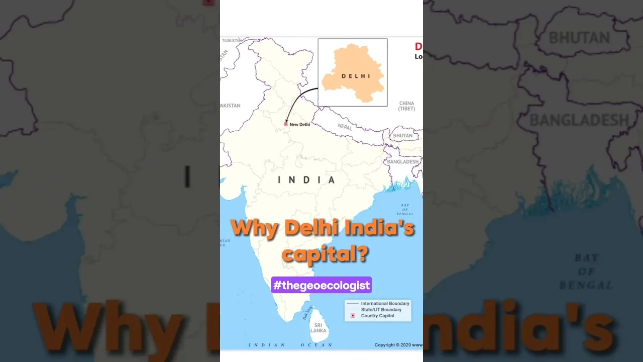
Table of Contents
- Historical Gravity: A Seat of Power Since Time Immemorial
- The Delhi Sultanate and Mughal Zenith
- Continuity Into the Colonial Era
- Geographic Imperatives: The "Heart of India"
- Central Hub of the Subcontinent
- Climate and Accessibility
- British Colonial Vision: Delhi's Rebirth (1911)
- Strategic Symbolism: Legitimacy Through History
- Geopolitical Balance: Neutralizing Regional Rivalries
- Lutyens' Delhi: An Imperial Blueprint
- Post-Independence Logic: Unity and Administration
- Neutral Ground: Avoiding Regional Hegemony
- Administrative Cohesion: The Bureaucratic Core
- Geopolitical Gravity: The Northern Frontier
- Why It Matters Today: Delhi as India's Strategic Nerve Center
- Demographic and Economic Scale
- Challenges and the Future
- Conclusion: A Capital by Design, Not Accident
When exploring Why Delhi Capital became the definitive answer for India’s seat of power, one must look beyond mere geography. The decision wasn’t arbitrary—Why Delhi Capital emerged from a millennium of historical gravity, strategic geography, colonial vision, and post-independence pragmatism. From the ancient ruins of Indraprastha to the grand boulevards of Lutyens’ Delhi, the city has consistently served as the subcontinent’s political heartbeat. Why Delhi Capital unpacks the layered reasoning behind Why Delhi Capital status was cemented in 1947 and why it endures today.
- Historical Continuity: Delhi served as the capital for multiple empires over 1,000+ years, creating deep-rooted symbolic authority.
- Geographic Centrality: Positioned at the crossroads of the Gangetic Plains, Himalayan foothills, and peninsular India, enabling administrative control.
- Colonial Legacy: The British shifted the capital from Kolkata to Delhi in 1911, building New Delhi as an imperial administrative hub.
- Post-Independence Neutrality: Delhi offered a neutral, non-coastal location free from regional rivalries associated with Kolkata or Mumbai.
- Strategic Security: Proximity to sensitive northern borders (Kashmir, Pakistan) reinforced its geopolitical importance after 1947.
Historical Gravity: A Seat of Power Since Time Immemorial
The question of Why Delhi Capital finds its deepest roots in history. Delhi isn’t merely a city; it’s a palimpsest of empires. Archaeological evidence and textual traditions trace its political significance to the legendary Indraprastha of the Mahabharata, believed to have stood near present-day Purana Qila. While the historicity of the Pandava capital remains debated, the Mahabharata itself cemented Delhi’s mythic status as a rajdhani (capital) in the Indian imagination.
The Delhi Sultanate and Mughal Zenith
From the 13th century onward, Delhi became the undisputed center of Islamic rule in India. The Delhi Sultanate (1206–1526)—spanning the Mamluk, Khalji, Tughlaq, Sayyid, and Lodi dynasties—established Delhi as the administrative nerve center of North India. The Delhi Sultanate constructed iconic fortifications like the Qutb Minar complex, Siri Fort, and Tughlaqabad, embedding institutional memory into the landscape.
The Mughal Empire (1526–1857) elevated this further. Emperors from Babur to Bahadur Shah Zafar ruled from Delhi (with a brief interregnum in Agra and Fatehpur Sikri). Shah Jahan’s Shahjahanabad (Old Delhi), founded in 1639, with its Red Fort and Jama Masjid, became the epitome of imperial grandeur. The 1857 Revolt, centered in Delhi, marked both the end of Mughal rule and the city’s enduring symbolism as the heart of Hindustan.
Continuity Into the Colonial Era
When the British Crown assumed direct control in 1858, Calcutta (Kolkata) remained the capital. Yet Delhi’s symbolic potency was never forgotten. The 1911 Delhi Durbar, where King George V announced the capital’s transfer, was a deliberate invocation of this historical continuity. The British understood that Why Delhi Capital resonated with Indian subjects precisely because of its thousand-year pedigree as a seat of sovereignty.
Geographic Imperatives: The “Heart of India”

Beyond history, geography provides a compelling answer to Why Delhi Capital. Delhi’s location at approximately 28.6° N, 77.2° E places it at a unique confluence of physiographic zones:
Central Hub of the Subcontinent
- Gangetic Plains: To the east and southeast lie the fertile alluvial plains of the Ganga-Yamuna doab, India’s demographic and agricultural core.
- Himalayan Foothills: To the north, the Shivalik hills and the Himalayas beyond provide strategic depth and water security via perennial rivers.
- Thar Desert & Rajputana: To the west, the arid zone and historic Rajput kingdoms.
- Peninsular India: To the south, the Deccan plateau connects via central Indian corridors.
This centrality allowed rulers—from the Tomaras and Chauhans (10th–12th century) to the Mughals and British—to project power in all directions. The Grand Trunk Road, renovated by Sher Shah Suri in the 16th century, linked Delhi to Kabul in the west and Chittagong in the east, making it a logistical linchpin.
Climate and Accessibility
While Delhi’s climate is extreme (45°C summers, 2°C winters), it avoids the oppressive humidity of Kolkata, the cyclone vulnerability of coastal cities, and the monsoon isolation of peninsular capitals. The Yamuna River provided water and a natural defensive barrier. Modern infrastructure—Indira Gandhi International Airport (busiest in India by passenger traffic, 73.7 million in FY2024), dense rail and highway networks—amplifies this accessibility.
British Colonial Vision: Delhi’s Rebirth (1911)
The formal answer to Why Delhi Capital in the modern sense begins with the British decision of 1911. Until then, Calcutta served as the capital of British India since 1772. The shift was driven by two intertwined motives:
Strategic Symbolism: Legitimacy Through History
Calcutta was a mercantile creation—a Company town built on trade. By 1911, it had become a hotbed of nationalist agitation (the 1905 Partition of Bengal sparked fierce resistance). The British sought a capital with pre-colonial legitimacy. Delhi’s aura as the Mughal capital and the site of the 1857 uprising made it a powerful symbolic counterweight. The 1911 Coronation Durbar, attended by King George V, staged this transfer as a restoration of imperial order.
Geopolitical Balance: Neutralizing Regional Rivalries
Calcutta represented Bengali dominance and eastern commerce. Bombay (Mumbai) was the western commercial gateway. Choosing either would exacerbate regional tensions. Delhi, historically the pivot of North Indian empires, sat at the political center—equidistant, symbolically, from competing regional identities. This logic mirrors the later post-independence reasoning for Why Delhi Capital.
Lutyens’ Delhi: An Imperial Blueprint
Architects Edwin Lutyens and Herbert Baker designed New Delhi (inaugurated 1931) as a garden city of wide avenues, roundabouts, and monumental architecture. The Viceroy’s House (now Rashtrapati Bhavan), Parliament House, and the Secretariat buildings created a ready-made administrative infrastructure. By 1947, New Delhi possessed the physical capacity to house a central government—a decisive practical factor in Why Delhi Capital was the default choice for independent India.
Post-Independence Logic: Unity and Administration
When the Constituent Assembly debated the capital in 1947–1949, several cities were proposed: Calcutta, Bombay, Lucknow, Hyderabad, even a new planned city. Yet Why Delhi Capital prevailed for reasons that blended pragmatism and symbolism.
Neutral Ground: Avoiding Regional Hegemony
India’s founding fathers—Nehru, Patel, Ambedkar—were acutely aware of linguistic and regional sensitivities. Calcutta carried the baggage of British colonialism and Bengali intellectual dominance. Bombay was the bastion of Marathi-Gujarati commerce and Westernized elite culture. Delhi, while Punjabi-Hindi speaking, was historically a cosmopolitan imperial capital, not a regional one. Its location in the Hindi belt was balanced by its Mughal-era syncretic culture (Urdu, Persian, Punjabi, Hindustani).
Administrative Cohesion: The Bureaucratic Core
North India—particularly the Punjab, United Provinces (UP), and Bihar—formed the demographic and bureaucratic backbone of the Raj. The Indian Civil Service (ICS), later the IAS, was disproportionately recruited from this zone. Delhi’s proximity to this talent pool ensured administrative continuity. The existing secretariat infrastructure in New Delhi meant the new government could function from Day One without disruptive relocation.
Geopolitical Gravity: The Northern Frontier
The 1947 Partition created a hostile border with Pakistan just 450 km from Delhi. The Kashmir conflict erupted within months. A capital in Calcutta (1,500 km away) or Bombay (1,400 km) would have been strategically detached from the most volatile frontier. Delhi’s proximity allowed rapid military-political coordination—a factor that remains relevant in 2025 with ongoing Line of Control tensions.
Why It Matters Today: Delhi as India’s Strategic Nerve Center
Seventy-seven years after independence, the rationale for Why Delhi Capital has only deepened. The city hosts:
- All three branches of government: Parliament (Legislative), Rashtrapati Bhavan & Prime Minister’s Office (Executive), Supreme Court (Judicial).
- Diplomatic corps: 160+ foreign missions, making it India’s primary interface with the world.
- Policy think tanks: NITI Aayog, IDSA, ICRIER, ORF—concentrated in the capital region.
- National institutions: National Museum, National Archives, IIT Delhi, AIIMS, JNU, DU.
Demographic and Economic Scale
The National Capital Territory (NCT) of Delhi spans 1,484 km² with a 2024 estimated population of 33.8 million (metro), making it the world’s second-largest urban agglomeration after Tokyo. Its GSDP (₹11.07 lakh crore in 2023–24) ranks second among Indian states/UTs. The NCR (National Capital Region) extends into Haryana, UP, and Rajasthan, creating a 58,000 km² economic zone.
Challenges and the Future
Delhi’s capital status brings challenges: severe air pollution (AQI frequently “severe”), water stress, traffic congestion, and seismic risk (Zone IV). Proposals for a secondary capital or shifting certain functions (like the 2020 Central Vista redevelopment) reflect ongoing adaptation. Yet the core logic of Why Delhi Capital—historical legitimacy, geographic centrality, administrative inertia, and strategic proximity—remains robust.
Conclusion: A Capital by Design, Not Accident
The answer to Why Delhi Capital is not monocausal. It is the sedimented outcome of a millennium of imperial history, the geographic logic of the subcontinent’s heartland, British imperial architecture, and the pragmatic choices of 1947. Delhi embodies India’s unity in diversity not as a slogan but as a spatial reality—a city where ancient ruins neighbor colonial monuments neighbor modern ministries. For students of geography, history, and polity—especially UPSC and UGC NET aspirants—Delhi’s capital story is a masterclass in how space, power, and time intertwine to shape nations.
Understanding Why Delhi Capital reveals a fundamental truth: capitals are not merely administrative nodes; they are condensed symbols of a civilization’s self-conception. Delhi, in all its chaotic, layered, resilient glory, remains that symbol for India. Government of India continues to operate from this historic center, reinforcing the choice made generations ago.
Frequently Asked Questions
Delhi was chosen for its historical legitimacy as a 1000+ year imperial capital, geographic centrality connecting all regions, existing British-built administrative infrastructure (New Delhi), and strategic proximity to the northern frontier after Partition. Kolkata and Mumbai were seen as colonial commercial hubs with strong regional identities, making Delhi a neutral, unifying choice.
The British announced the shift at the 1911 Delhi Durbar. New Delhi was formally inaugurated as the capital on 13 February 1931, after 20 years of construction led by architects Edwin Lutyens and Herbert Baker.
Delhi served as the capital for the Tomaras, Chauhans, Delhi Sultanate (1206–1526), Mughal Empire (1526–1857), and briefly the British (1911–1947). This millennium-long continuity embedded Delhi in the Indian psyche as the symbolic center of political authority, making it the natural choice for independent India.