Blog
Water in Atmosphere: NCERT Class 11 Geography Chapter 11 Complete Guide

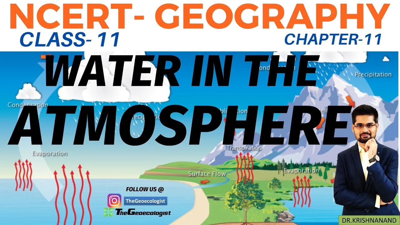
Table of Contents
- What Is Water in Atmosphere? — Forms, Distribution & Significance
- Three Physical Forms of Atmospheric Water
- Humidity: Measuring Water in Atmosphere
- Absolute Humidity
- Relative Humidity (RH)
- Measurement Instruments
- Evaporation & Condensation: The Engine of the Hydrological Cycle
- Evaporation
- Condensation
- Clouds: Visible Manifestations of Water in Atmosphere
- High Clouds (Base > 6 km) — Cirrus Family
- Middle Clouds (2–6 km) — Alto Family
- Low Clouds (Base < 2 km) — Stratus Family
- Vertical Development Clouds
- Precipitation: Return of Water in Atmosphere to Surface
- Growth Processes
- Forms of Precipitation
- Types of Rainfall — Mechanisms & Indian Examples
- 1. Convectional Rainfall
- 2. Orographic (Relief) Rainfall
- 3. Cyclonic / Frontal Rainfall
- Water in Atmosphere & the Indian Monsoon System
- Measurement & Monitoring of Water in Atmosphere
- Climate Change Impacts on Water in Atmosphere
- Study Strategy for CBSE & UPSC
- Real-World Applications Beyond Exams
- Frequently Asked Conceptual Doubts
- Why does relative humidity drop at noon even if absolute humidity is constant?
- Can clouds form without condensation nuclei?
- Difference between cloudburst and heavy rain?
- Authoritative References for Deeper Study
- Conclusion
The water in atmosphere is a fundamental component of Earth’s climate system, driving weather patterns, precipitation cycles, and the global hydrological balance. NCERT Geography Class 11 Chapter 11 provides an exhaustive framework for understanding how water exists, moves, and transforms within the gaseous envelope surrounding our planet. This guide is tailored for CBSE board aspirants, UPSC civil services candidates, and anyone seeking conceptual clarity on atmospheric moisture processes. Mastering the water in atmosphere concepts builds the bedrock for advanced climatology, Indian monsoon dynamics, and disaster management modules.
- Three States: Water in atmosphere exists as vapour (gas), droplets (liquid), and ice crystals (solid).
- Humidity Metrics: Absolute humidity (g/m³) vs. relative humidity (%) — the latter governs human comfort and condensation thresholds.
- Phase Changes: Evaporation (driven by temperature, wind, surface area) and condensation (at dew point) power cloud formation.
- Cloud Classification: Cirrus (high, wispy), Cumulus (vertical, cotton-like), Stratus (low, layered) — each indicates distinct weather.
- Rainfall Mechanisms: Convectional (tropics), Orographic (windward slopes), Cyclonic/Frontal (mid-latitude fronts & tropical cyclones).
- Exam Relevance: Direct CBSE questions; UPSC links to climatology, monsoons, agriculture, and disaster management.
What Is Water in Atmosphere? — Forms, Distribution & Significance
The term water in atmosphere refers to the total moisture content suspended in the air column, ranging from trace gases in the upper troposphere to dense fog at surface level. Although it constitutes only 0–4% of atmospheric volume by volume, its thermodynamic influence is disproportionately large. Water vapour absorbs outgoing long-wave radiation, making it the most potent greenhouse gas, while latent heat release during phase changes fuels storms, cyclones, and the global circulation.
Three Physical Forms of Atmospheric Water
- Water Vapour (Gas): Invisible, randomly distributed molecules; primary source is evaporation from oceans (≈86%), lakes, rivers, soil, and transpiration from vegetation.
- Liquid Droplets: Cloud droplets (10–50 µm), raindrops (0.5–5 mm), drizzle, dew, and fog. These form when vapour condenses on condensation nuclei (dust, salt, sulphate aerosols).
- Solid Particles: Ice crystals, snowflakes, graupel, hailstones. Dominant in cirrus clouds and convective cores where temperatures drop below −40 °C.
Vertical distribution is highly skewed: 50% of total atmospheric moisture resides below 1.5 km, and 90% below 5 km. This concentration explains why weather phenomena are largely tropospheric.
Humidity: Measuring Water in Atmosphere
Humidity quantifies the water in atmosphere at a given time and place. Two metrics dominate meteorology:
Absolute Humidity
Mass of water vapour per unit volume of air (grams per cubic metre, g/m³). It varies with temperature and pressure but does not indicate how close air is to saturation.
Relative Humidity (RH)
Ratio of actual vapour pressure to saturation vapour pressure at the same temperature, expressed as a percentage:
[ RH = frac{e}{e_s} times 100 % ]
where e = actual vapour pressure, e_s = saturation vapour pressure. RH governs human comfort (ideal 40–60%), evaporation rates, and the onset of condensation. A parcel cooled at constant pressure reaches 100% RH at its dew point — the temperature at which condensation begins.
Measurement Instruments
- Hygrometer: Hair hygrometer (organic fibre elongation), psychrometer (wet-bulb/dry-bulb thermometers), and modern capacitive sensors.
- Radiosonde: Balloon-borne package transmitting temperature, pressure, and humidity profiles up to 30 km.
- Satellite Retrievals: Microwave sounders (e.g., AMSU, ATMS) and infrared sounders (IASI, CrIS) provide global water in atmosphere columns for Numerical Weather Prediction (NWP) models.
Evaporation & Condensation: The Engine of the Hydrological Cycle
Phase transitions between liquid and gas drive the water in atmosphere cycle. Energy exchanges during these processes redistribute heat globally.
Evaporation
Conversion of liquid water to vapour requires 2,260 kJ/kg (latent heat of vaporization at 100 °C; higher at lower temperatures). Controlling factors:
- Temperature: Higher kinetic energy increases molecular escape.
- Wind Speed: Removes saturated boundary layer, maintaining vapour pressure gradient.
- Surface Area: Larger exposed area accelerates flux.
- Humidity Gradient: Lower ambient RH steepens gradient.
Potential evapotranspiration (PET) — the maximum loss from a well-watered surface — is estimated via Penman–Monteith equation, standard in agro-meteorology.
Condensation
Vapour transforms to liquid/solid when air cools to dew point. Cooling mechanisms:
- Radiative Cooling: Nocturnal long-wave loss → dew, frost, radiation fog.
- Advection Cooling: Warm moist air over cold surface → advection fog (e.g., San Francisco, Grand Banks).
- Adiabatic Cooling: Air expands as it rises, temperature drops at dry adiabatic lapse rate (9.8 °C/km) until saturation, then at saturated adiabatic lapse rate (4–7 °C/km). This is the primary cloud-forming mechanism.
Clouds: Visible Manifestations of Water in Atmosphere

Clouds are aerosols of condensed water in atmosphere. Classification follows Luke Howard’s 1803 system (genus, species, variety) adopted by WMO.
High Clouds (Base > 6 km) — Cirrus Family
- Cirrus (Ci): Detached, fibrous, silky — ice crystals; often precede warm fronts.
- Cirrocumulus (Cc): Small white flakes/ripples (“mackerel sky”).
- Cirrostratus (Cs): Transparent veil, halo phenomena.
Middle Clouds (2–6 km) — Alto Family
- Altocumulus (Ac): Grey/white sheets of rounded masses.
- Altostratus (As): Grey/blue sheet, sun visible as through ground glass.
Low Clouds (Base < 2 km) — Stratus Family
- Stratus (St): Uniform grey layer, drizzle.
- Stratocumulus (Sc): Low, lumpy layer with blue gaps.
- Nimbostratus (Ns): Dark, thick, continuous rain/snow cloud.
Vertical Development Clouds
- Cumulus (Cu): Detached, dense, sharp outlines — fair weather (Cu humilis) to towering (Cu congestus).
- Cumulonimbus (Cb): Thunderstorm cloud, anvil top, extends to tropopause; produces lightning, hail, tornadoes.
Cloud identification is a staple practical skill in CBSE Geography and a frequent UPSC map-based question.
Precipitation: Return of Water in Atmosphere to Surface
Precipitation is any product of condensation falling under gravity. The water in atmosphere must overcome updrafts; growth mechanisms determine drop size and type.
Growth Processes
- Collision–Coalescence (Warm Clouds): Larger drops fall faster, sweep smaller ones; dominant in tropics.
- Bergeron–Findeisen (Cold Clouds): Ice crystals grow at expense of supercooled droplets due to lower saturation vapour pressure over ice; primary in mid-latitudes.
Forms of Precipitation
- Rain: Drops > 0.5 mm; drizzle < 0.5 mm.
- Snow: Ice crystals aggregated; requires sub-freezing layer through depth.
- Sleet: Rain freezing into ice pellets before ground.
- Freezing Rain: Supercooled rain freezing on impact (glaze ice).
- Hail: Concentric ice layers from repeated updraft cycles in Cb.
Types of Rainfall — Mechanisms & Indian Examples
UPSC and CBSE examinations heavily test the three rainfall mechanisms. Each lifts air to condensation level differently.
1. Convectional Rainfall
Intense surface heating → buoyant thermals → adiabatic cooling → Cb clouds → short-duration, high-intensity afternoon showers.
- Global: Equatorial belt (ITCZ), interior continents in summer.
- India: Pre-monsoon “mango showers” in Kerala/Karnataka (March–May); afternoon thunderstorms in Chotanagpur plateau.
2. Orographic (Relief) Rainfall
Moist airflow forced up windward slopes → adiabatic cooling → heavy rain; leeward side descends, warms, dries (rain shadow).
- Global: Windward Himalayas, Andes, Western Ghats, New Zealand Alps.
- India: Cherrapunji/Mawsynram (Meghalaya) — world’s wettest places (≈11,000 mm/yr) due to funneling of Bay of Bengal branch into Khasi hills; Western Ghats windward side (Mahabaleshwar, Agumbe) receives 3,000–6,000 mm.
3. Cyclonic / Frontal Rainfall
Convergence of contrasting air masses along fronts (warm, cold, occluded) or low-pressure systems (temperate cyclones, tropical cyclones).
- Temperate Cyclones: Warm front (steady stratiform rain), cold front (narrow intense band). Affects North India in winter (Western Disturbances) — crucial for rabi crops.
- Tropical Cyclones: Intense spiral bands; Bay of Bengal & Arabian Sea systems (e.g., Cyclone Amphan 2020, Cyclone Biparjoy 2023) cause catastrophic rainfall in Odisha, West Bengal, Gujarat.
Water in Atmosphere & the Indian Monsoon System
The seasonal reversal of winds over the Indian subcontinent is fundamentally a water in atmosphere phenomenon. Key dynamics:
- Cross-Equatorial Flow: Southeast trades cross equator, deflect right (Coriolis) → Southwest Monsoon Current, laden with moisture from Indian Ocean.
- Low-Level Jet (LLJ): Core at 1.5 km over Arabian Sea (30–40 kt) transports massive moisture flux.
- Monsoon Trough: Elongated low-pressure zone; its north-south oscillations dictate active/break spells.
- Monsoon Depressions: Synoptic-scale vortices forming in Bay of Bengal, moving WNW, delivering 60–70% of seasonal rain to central India.
Understanding these links is non-negotiable for UPSC GS Paper I (Geography) and GS Paper III (Disaster Management, Agriculture).
Measurement & Monitoring of Water in Atmosphere
Modern observation systems feed data into global models like ECMWF IFS, GFS, and India’s NCUM (NCMRWF Unified Model).
- Surface Network: IMD operates 550+ observatories measuring RH, dew point, rainfall (ordinary & self-recording gauges).
- Upper-Air: 62 radiosonde stations (00 & 12 UTC) + pilot balloons.
- Radar: Doppler Weather Radar (DWR) network (S-band, C-band) — 33 operational, scanning reflectivity, velocity, polarimetric products for quantitative precipitation estimation (QPE).
- Satellites: INSAT-3D/3DR (imager & sounder), Oceansat-2/3 (scatterometer), Megha-Tropiques (SAPHIR microwave sounder), GPM Core Observatory (dual-frequency radar + GMI).
- GNSS-PWV: Ground-based GPS receivers derive Precipitable Water Vapour (PWV) with mm accuracy — now assimilated in real-time NWP.
Climate Change Impacts on Water in Atmosphere
IPCC AR6 (2021) confirms: global atmospheric moisture increases ~7% per °C warming (Clausius–Clapeyron relation). Observed trends:
- Global mean PWV risen 1–2% per decade since 1970s.
- Extreme precipitation events intensified over land (high confidence).
- Indian monsoon: increased inter-annual variability, more intense wet spells, longer dry spells — documented by IITM Pune & IMD.
These shifts demand adaptive water management, revised IDF (Intensity-Duration-Frequency) curves for infrastructure, and climate-resilient agriculture.
Study Strategy for CBSE & UPSC
- NCERT First: Read Chapter 11 line-by-line; highlight definitions (humidity, dew point, cloud types).
- Diagram Practice: Water cycle, orographic rainfall cross-section, cumulonimbus structure, monsoon onset isobars.
- Map Work: Mark Cherrapunji, Mahabaleshwar, Jaisalmer (rain shadow), monsoon onset/isochrones, cyclone tracks.
- Previous Year Questions: CBSE 2019–2024; UPSC 2011–2023 (e.g., “Mechanism of Indian monsoon”, “Cloudburst vs. flash flood”).
- Current Affairs: Link IMD forecasts, cyclone reports, Jal Shakti Ministry initiatives to static concepts.
- Bilingual Revision: Use TheGeoecologist’s Hindi-English videos for terminology like संघनन (condensation), ओसांक (dew point), पक्षिमी विक्षोभ (Western Disturbance).
Real-World Applications Beyond Exams
- Agriculture: RH forecasts guide irrigation scheduling, disease prediction (blight, rust).
- Aviation: Fog/visibility nowcasting (IGIA Delhi uses DVOR + LIDAR + microwave radiometer).
- Urban Planning: Urban heat island modifies local water in atmosphere; green corridors mitigate.
- Renewable Energy: Solar irradiance attenuation by water vapour/clouds; wind resource assessment.
- Health: Heat index (temperature + RH) warnings; vector-borne disease modelling.
Frequently Asked Conceptual Doubts
Why does relative humidity drop at noon even if absolute humidity is constant?
Temperature rises → saturation vapour pressure increases exponentially → RH = e/e_s falls. Same moisture, lower “relative” saturation.
Can clouds form without condensation nuclei?
Homogeneous nucleation requires supersaturation > 400% — virtually never achieved in atmosphere. Heterogeneous nuclei (CCN) are essential; marine air has fewer CCN → larger droplets → faster rain.
Difference between cloudburst and heavy rain?
IMD defines cloudburst as ≥ 100 mm in 1 hour over ~10 km². Heavy rain is ≥ 64.5 mm in 24 hrs. Cloudbursts are localized, orographically enhanced, often in Himalayas/Western Ghats.
Authoritative References for Deeper Study
- NCERT, India Physical Environment, Class 11, Chapter 11 — primary text.
- IMD, Monsoon 2023 End-of-Season Report — operational climatology.
- IPCC, AR6 WG1 Chapter 8 — water cycle changes.
- WMO, International Cloud Atlas (2017) — definitive cloud classification.
- P. K. Das, The Monsoons (NBP) — classic dynamical meteorology.
For official NCERT textbooks and supplementary material, visit the NCERT official textbook portal. For real-time weather data, forecasts, and climatological normals, the India Meteorological Department (IMD) website is the authoritative source. A comprehensive overview of the global hydrological cycle can be found at Wikipedia’s Water Cycle article.
Conclusion
Mastering the water in atmosphere chapter equips you with the conceptual toolkit to decode weather maps, interpret satellite imagery, answer board-exam questions precisely, and write analytical UPSC mains answers linking physical geography to policy. Combine NCERT rigor with TheGeoecologist’s bilingual pedagogy, practice diagrams daily, and anchor every concept to Indian examples — Cherrapunji’s orographic lift, Rajasthan’s rain shadow, Odisha’s cyclone vulnerability. The atmosphere’s moisture is not just a topic; it is the pulse of the planet’s climate engine.
Frequently Asked Questions
Water in atmosphere exists in three forms: gas (water vapour), liquid (cloud droplets, rain, dew), and solid (ice crystals, snow, hail). These phases continuously interchange through evaporation, condensation, and precipitation.
Absolute humidity is the actual mass of water vapour per unit volume of air (g/m³). Relative humidity is the percentage of moisture present relative to the maximum the air can hold at that temperature. RH changes with temperature even if absolute humidity stays constant.
Orographic rainfall causes extreme precipitation in Cherrapunji. Moisture-laden Bay of Bengal winds are forced up the Khasi Hills, cooling adiabatically and releasing enormous rainfall on the windward slopes, making it one of the wettest places on Earth.