Blog
South Asia Geography: Complete Guide to Physical & Human Landscapes

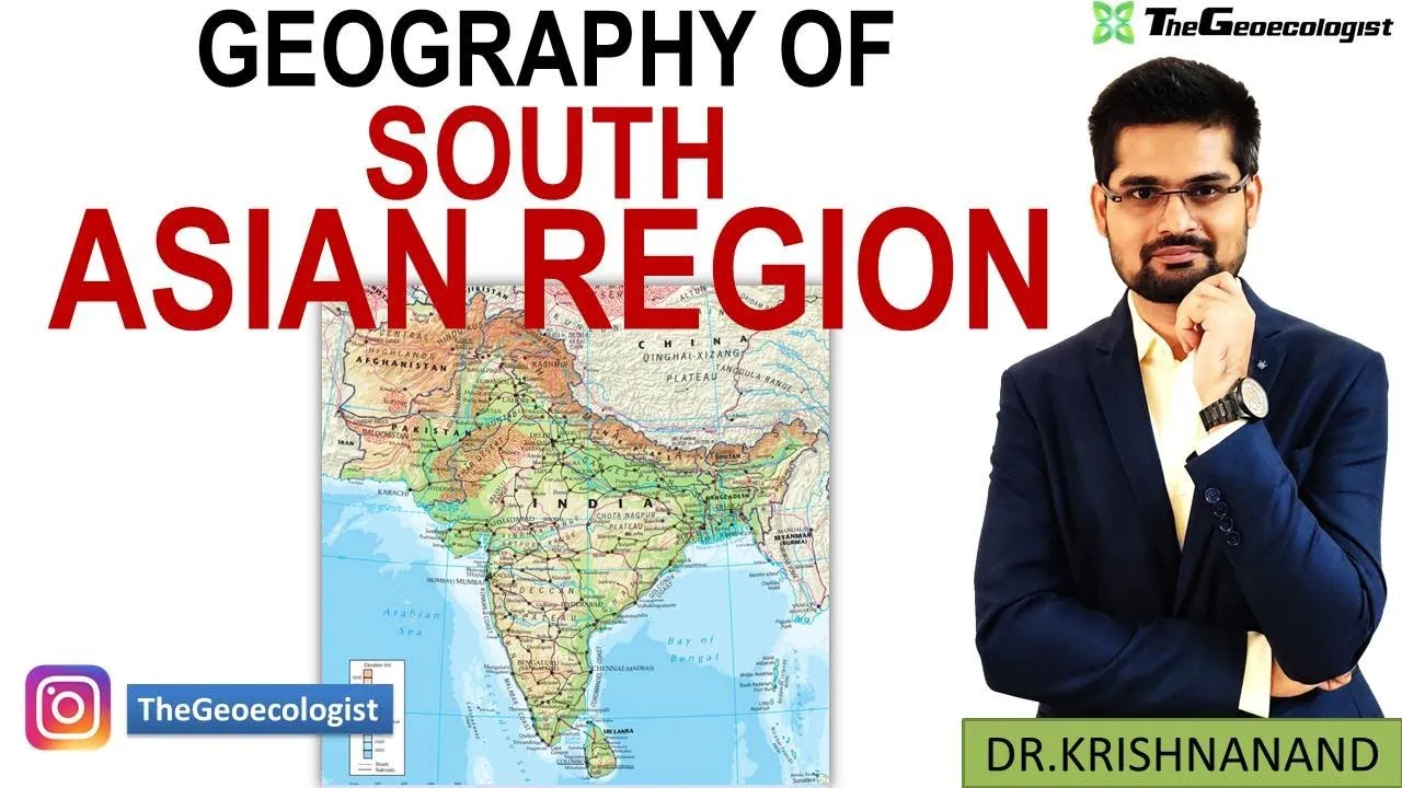
Table of Contents
- Physical Foundations of South Asia Geography
- Mountain Systems: The Himalayan Barrier
- River Systems: Lifelines of the Realm
- Coastal and Island Geography
- Climate Systems: Monsoon Dominance in South Asia Geography
- Human and Cultural Dimensions
- Demographics: Scale and Transition
- Cultural Mosaic
- Economic Activities and Development Trajectories
- Agriculture: Monsoon-Dependent Foundation
- Industry and Services: Structural Shift
- Environmental Challenges in South Asia Geography
- Deforestation and Biodiversity Loss
- Water Scarcity and Pollution
- Climate Change Vulnerability
- Geopolitical Context and Regional Cooperation
- SAARC and Sub-Regional Groupings
- Core Disputes and Flashpoints
- South Asia Geography in UPSC Examination: Strategic Focus Areas
- Conclusion: Integrating the South Asia Geography Framework
South Asia Geography represents one of the most dynamic and diverse regional studies in modern geography, encompassing a landmass of approximately 5.2 million square kilometers and hosting over 1.9 billion people as of 2024. This realm — comprising India, Pakistan, Bangladesh, Nepal, Bhutan, Sri Lanka, and the Maldives — serves as a critical intersection of tectonic forces, climatic systems, cultural diffusion, and geopolitical strategy. For UPSC aspirants and competitive exam candidates, mastering South Asia Geography is non-negotiable, as questions consistently draw from its physical foundations, human dimensions, and contemporary challenges. This guide synthesizes core concepts aligned with Dr. Krishnanand’s lecture on TheGeoecologist channel, offering a structured, exam-ready resource.
- South Asia Geography spans seven sovereign nations with shared tectonic, climatic, and cultural histories.
- The Himalayan orogeny defines the northern boundary and drives the monsoon system that sustains regional agriculture.
- Major river systems — Indus, Ganga, Brahmaputra — create the Indo-Gangetic Plain, one of Earth’s most densely populated zones.
- Demographic scale (1.9+ billion) and diversity (religions, languages, ethnicities) create unique governance and development challenges.
- Environmental stressors — glacial melt, groundwater depletion, air pollution — intersect with geopolitical tensions over water and territory.
- UPSC examination patterns prioritize monsoon mechanics, transboundary water disputes, urbanization trends, and climate vulnerability case studies.
Physical Foundations of South Asia Geography
Mountain Systems: The Himalayan Barrier
The Himalayas, stretching 2,400 km from the Indus gorge to the Brahmaputra bend, form the world’s highest mountain system and the defining feature of South Asia Geography. This young fold mountain range — still rising at 5 mm/year due to the Indian Plate’s northward convergence at 4-5 cm/year — acts as a formidable climatic barrier. It blocks cold Central Asian winds in winter and forces the southwest monsoon to shed moisture across the subcontinent. The range comprises four parallel belts: the Trans-Himalaya (Karakoram, Ladakh), Greater Himalaya (Himadri, peaks >8,000 m including Everest 8,848 m), Lesser Himalaya (Himachal), and Siwaliks (Outer Himalaya). To the northwest, the Hindu Kush and Pamir Knot extend the orogenic system, while the Vindhya-Satpura ranges partition the Deccan Peninsula from the northern plains. These structural features directly influence drainage patterns, soil formation, and biodiversity distribution across the region.
River Systems: Lifelines of the Realm
Three great trans-Himalayan rivers dominate South Asia Geography hydrology. The Indus River (3,180 km), sourced near Mount Kailash, traverses Ladakh and Pakistan before draining into the Arabian Sea, supporting the Indus Valley Civilization’s legacy and modern Pakistan’s agrarian economy. The Ganga River (2,525 km), originating at Gangotri Glacier, flows through the heartland of India, joined by major tributaries — Yamuna, Ghaghara, Gandak, Kosi — creating the fertile Ganga Plain. The Brahmaputra River (2,900 km), known as Yarlung Tsangpo in Tibet, executes a dramatic U-turn at the Namcha Barwa syntaxis before entering Arunachal Pradesh and Assam, where its braided channel and annual flooding shape a unique floodplain ecology. Peninsular rivers — Godavari (1,465 km), Krishna (1,400 km), Kaveri (800 km) — are rain-fed, seasonal, and flow eastward to the Bay of Bengal, sustaining the Deccan Plateau’s agriculture. These river systems are not merely physical features; they are geopolitical flashpoints, with the Indus Waters Treaty (1960), Ganga Water Sharing Treaty (1996), and ongoing Brahmaputra data-sharing discussions exemplifying hydro-diplomacy in South Asia Geography.
Coastal and Island Geography
The region’s 7,500+ km coastline (India alone) and island territories add maritime dimensions to South Asia Geography. The Arabian Sea coast features estuaries, backwaters (Kerala), and major ports (Mumbai, Kandla, Karachi). The Bay of Bengal coast hosts the world’s largest mangrove forest — the Sundarbans (10,000 km², shared India-Bangladesh) — a UNESCO World Heritage Site and critical tiger habitat. Sri Lanka’s 1,340 km coastline supports biodiversity hotspots and strategic ports (Colombo, Hambantota). The Maldives, an archipelago of 1,192 coral islands across 26 atolls, faces existential threat from sea-level rise (current rate 3.3 mm/year). These coastal zones concentrate population, economic activity, and climate vulnerability, making them focal points in regional geography.
Climate Systems: Monsoon Dominance in South Asia Geography
The southwest monsoon (June-September) delivers 70-80% of annual rainfall across most of the region, making it the single most important climatic phenomenon in South Asia Geography. The monsoon mechanism involves differential heating of the Tibetan Plateau (elevated heat pump theory), the Mascarene High pressure cell, and the Somali Jet cross-equatorial flow. Onset begins over the Andaman Sea (~May 15), advances to Kerala (~June 1), and covers the entire subcontinent by mid-July. Regional variations create distinct climatic zones: Tropical Wet (Western Ghats, Northeast India, >2,000 mm), Tropical Wet-Dry (Deccan Plateau, 1,000-1,500 mm), Subtropical Humid (Ganga Plain, 1,000-2,000 mm), Arid/Semi-Arid (Thar Desert, <400 mm), and Highland (Himalaya, elevation-dependent). The northeast monsoon (October-December) provides critical rainfall to Tamil Nadu and coastal Andhra Pradesh. Monsoon variability — delayed onset, prolonged breaks, extreme rainfall events — directly impacts GDP (agriculture contributes 16-18% of India's GDP, 42% employment), water security, and disaster management. Climate change projections indicate increased monsoon intensity but greater inter-annual variability, amplifying flood-drought cycles across South Asia Geography.
Human and Cultural Dimensions
Demographics: Scale and Transition
With 1.92 billion people (2024 UN estimates), South Asia Geography accounts for 24% of global population on 3.5% of land area. India (1.44 billion), Pakistan (240 million), Bangladesh (173 million) rank among the world’s top 10 most populous nations. Population density averages 370 persons/km² (vs. global 60), peaking in the Ganga-Brahmaputra delta (>1,100/km²). The region is mid-demographic transition: TFR ranges from 2.0 (India, Sri Lanka) to 3.4 (Pakistan), with a youth bulge (median age 27) offering a potential demographic dividend — contingent on education, skilling, and job creation. Urbanization stands at 36% (2023), with megacities Mumbai (21M), Delhi (33M), Dhaka (23M), Karachi (17M) facing infrastructure deficits, informal settlements, and air quality crises. These demographic realities shape labor markets, political representation, and resource demand across South Asia Geography.
Cultural Mosaic
Cultural diversity in South Asia Geography is unparalleled. The region is the birthplace of Hinduism, Buddhism, Jainism, Sikhism, while Islam arrived via trade (7th century) and conquest (12th century onward), now constituting ~31% of regional population. Over 780 languages (People’s Linguistic Survey of India) and thousands of dialects create a linguistic geography aligned with state boundaries (India’s linguistic reorganization, 1956). Caste, tribe, and ethnicity intersect with religion and language, producing complex social geographies. Festivals — Diwali, Eid, Vesak, Pongal, Bihu — reflect shared calendrical and agricultural rhythms. This pluralism underpins democratic resilience but also fuels identity politics and communal tensions, a recurring theme in regional human geography.
Economic Activities and Development Trajectories
Agriculture: Monsoon-Dependent Foundation
Agriculture employs 42% of India’s workforce, 37% in Pakistan, 38% in Bangladesh — the primary sector’s dominance in South Asia Geography reflects both historical continuity and structural transformation lags. The Green Revolution (1960s-70s) introduced HYV wheat/rice, irrigation, and fertilizers, achieving food self-sufficiency but creating regional disparities (Punjab-Haryana vs. Eastern India), groundwater depletion, and soil degradation. Major crops: Rice (178 MT, India 2nd globally), Wheat (112 MT, India 2nd), Sugarcane, Cotton, Tea (Assam, Darjeeling, Sri Lanka highlands). Climate-smart agriculture, millets revival (UN International Year of Millets 2023), and digital agritech (e-NAM, PM-KISAN) represent contemporary policy shifts. Food security remains precarious: 2023 Global Hunger Index ranks India 111/125, Pakistan 102, Bangladesh 81 — highlighting nutrition challenges amid production gains.
Industry and Services: Structural Shift
The services sector now contributes 54% of India’s GDP, 52% Pakistan, 51% Bangladesh — a hallmark of South Asia Geography‘s atypical structural transformation (bypassing manufacturing). India’s IT-BPM industry ($245B revenue, 5.4M employees, 2023) clusters in Bengaluru, Hyderabad, Pune, Gurgaon. Pakistan’s textile sector (60% exports) and Bangladesh’s RMG ($47B exports, 2023, 4M workers, mostly women) integrate the region into global value chains. Manufacturing share stagnates at 14-17% (India’s “Make in India” targets 25%), constrained by infrastructure, labor regulations, and land acquisition. Special Economic Zones (SEZs), industrial corridors (Delhi-Mumbai, Chennai-Bengaluru), and PLI schemes aim to revive manufacturing geography. Energy transition — India’s 500 GW non-fossil target by 2030, Pakistan’s 60% renewable goal — reshapes resource geographies.
Environmental Challenges in South Asia Geography
Deforestation and Biodiversity Loss
Forest cover in South Asia Geography stands at 24% (India 21.7%, Pakistan 5%, Bangladesh 14%, Sri Lanka 34%, Bhutan 71%). The Western Ghats and Eastern Himalaya are among 36 global biodiversity hotspots. Annual forest loss averages 0.4-0.7% driven by agricultural expansion, infrastructure (roads, dams), mining, and urbanization. The Sundarbans loses 5.5 km²/year to erosion and sea-level rise. Conservation frameworks — India’s Wildlife Protection Act (1972), Project Tiger (54 reserves, 3,682 tigers 2022), Nepal’s community forestry — show recovery potential but face human-wildlife conflict escalation.
Water Scarcity and Pollution
South Asia Geography faces acute water stress: per capita availability <1,700 m³/year (water stress threshold), declining to <1,000 m³ (scarcity) in parts of India/Pakistan. Groundwater extraction — India is the world's largest user (251 BCM/year) — depletes aquifers at 0.3-1.0 m/year in northwest India. Surface water pollution is severe: Ganga BOD exceeds 3 mg/L at 70% monitoring stations; Yamuna is functionally dead in Delhi stretch; Pakistan's Ravi, Sutlej carry industrial effluents. The Namami Gange programme ($3.5B, 2014-) and Pakistan's Clean Green Pakistan initiative address point/non-point sources, but governance gaps persist. Transboundary aquifer management remains absent from treaty frameworks.
Climate Change Vulnerability
The IPCC AR6 identifies South Asia Geography as a global climate hotspot. Himalayan glaciers lost 0.3-0.5 m w.e./year (2000-2019), threatening perennial river flows for 1.5 billion downstream users. Sea-level rise (3.3 mm/year) endangers 60M coastal residents by 2050 (World Bank). Extreme heat events — 2022 Pakistan floods (1,700 deaths, $30B losses), 2023 India heatwave (45°C+ across 15 states) — exceed adaptation limits. Cyclone frequency/intensity increases in Bay of Bengal (Amphan 2020, Mocha 2023). Nationally Determined Contributions (NDCs) target 45% emission intensity reduction (India, 2030), 50% renewable energy (Bangladesh), but climate finance gaps ($2.5T needed for India alone) constrain implementation.
Geopolitical Context and Regional Cooperation
SAARC and Sub-Regional Groupings
The South Asian Association for Regional Cooperation (SAARC, 1985) — comprising all seven nations plus Afghanistan (2007) — remains hamstrung by India-Pakistan tensions; the last summit was 2014 (Kathmandu). Intra-regional trade stands at 5% of total trade (vs. 25% in ASEAN), the lowest globally. Sub-groupings — BIMSTEC (Bay of Bengal Initiative, 7 members), BBIN (Bangladesh-Bhutan-India-Nepal Motor Vehicles Agreement), SASEC (South Asia Subregional Economic Cooperation) — bypass bilateral deadlocks. The South Asia Geography of connectivity is being reshaped by India’s “Neighbourhood First” and “Act East” policies, China’s Belt and Road Initiative (CPEC in Pakistan, Hambantota port in Sri Lanka), and US Indo-Pacific Strategy. Maritime domain awareness in the Indian Ocean — choke points at Malacca, Hormuz, Bab-el-Mandeb — adds strategic depth to regional geography.
Core Disputes and Flashpoints
Kashmir remains the primary India-Pakistan flashpoint (LoC 740 km, Siachen Glacier — world’s highest battlefield). Sir Creek (maritime boundary) and Indus water sharing persist. India-China border (LAC 3,488 km) saw Galwan clash (2020), with infrastructure competition in Ladakh and Arunachal. China’s Brahmaputra dam (Medog, 60 GW proposed) raises lower-riparian anxieties. Bangladesh-India share 54 transboundary rivers; Teesta water sharing awaits agreement. Rohingya displacement (1.2M in Bangladesh) adds humanitarian geography. These disputes structure defense spending (India $81B, Pakistan $11B, 2023), alliance formations, and internal security geographies across South Asia Geography.
South Asia Geography in UPSC Examination: Strategic Focus Areas
UPSC Civil Services Examination (Prelims, Mains, Optional) consistently tests South Asia Geography across multiple dimensions. Physical Geography questions target Himalayan orogeny, monsoon mechanisms (ITCZ shift, Tibetan heat pump, El Niño/La Niña teleconnections), river regime comparisons (Himalayan vs. Peninsular), and physiographic divisions. Human Geography emphasizes demographic transition, urbanization challenges (Smart Cities Mission, AMRUT), migration patterns (inter-state, rural-urban, cross-border), and cultural landscapes. Economic Geography covers agricultural revolutions, industrial corridors, mineral belts (Chotanagpur, Dharwar), and energy transitions. Environmental Geography prioritizes biodiversity hotspots, climate change impacts (glacial lake outburst floods, coastal vulnerability), disaster management (NDMA framework), and sustainable development goals localization. Geopolitics examines SAARC/BIMSTEC efficacy, China’s String of Pearls, India’s SAGAR doctrine, and Indian Ocean security architecture. Case Studies recur: Sundarbans (climate-biodiversity-development nexus), Himalayan glaciology (Chorabari, 2013 Kedarnath), Delhi-NCR air pollution (stubble burning, thermal inversion), Chennai water crisis (2019), and CPEC geography. Aspirants should integrate The Hindu / Indian Express geography-related editorials, Down To Earth reports, and Ministry of Earth Sciences / IMD publications for current affairs linkage. For authoritative data, refer to South Asia – Wikipedia and World Bank South Asia Region.
Conclusion: Integrating the South Asia Geography Framework
Mastering South Asia Geography demands a systems approach — linking tectonic origins to monsoon dynamics, river basins to agrarian civilizations, demographic transitions to urban futures, and resource geographies to geopolitical contestations. The region’s 1.9 billion people, shared waters, interconnected ecosystems, and nuclearized rivalries make it a planetary-scale geography laboratory. For UPSC aspirants, the path forward is clear: build conceptual clarity on physical processes, memorize key statistics (river lengths, peak elevations, demographic indicators, treaty dates), practice map-based questions (physiographic divisions, mineral belts, climate zones, strategic locations), and develop answer-writing frameworks that integrate physical, human, and environmental dimensions. Dr. Krishnanand’s TheGeoecologist lectures provide an excellent visual and conceptual foundation — supplement with NCERT Class 11-12 (India Physical Environment, India People and Economy), Majid Husain’s Geography of India, and Khullar’s India: A Comprehensive Geography. The South Asia Geography journey is rigorous but rewarding — it cultivates the spatial thinking and interdisciplinary synthesis that define geographic reasoning. Visit UPSC Official Website for syllabus updates and previous year papers. Your mastery of this realm begins with the first contour line.
Frequently Asked Questions
South Asia Geography encompasses seven sovereign nations: India, Pakistan, Bangladesh, Nepal, Bhutan, Sri Lanka, and the Maldives. Afghanistan is sometimes included in extended definitions (e.g., SAARC membership since 2007), but the core physiographic and cultural region comprises these seven countries sharing the Indian Plate, monsoon climate, and historical civilizational linkages.
The southwest monsoon delivers 70-80% of annual rainfall across South Asia Geography, directly sustaining rainfed agriculture (60% of net sown area), recharging aquifers, and driving the rural economy. Its onset, progression, and variability determine GDP growth (agriculture contributes ~16-18% of India's GDP), inflation, hydropower, and disaster cycles. Monsoon failure correlates with drought, food price spikes, and rural distress, making it the single most influential climatic system in the region.
Key transboundary water disputes in South Asia Geography include: (1) Indus Waters Treaty (1960) between India-Pakistan — tensions over Kishanganga, Ratle hydroprojects; (2) Ganga Water Sharing Treaty (1996) India-Bangladesh — Farakka barrage impacts; (3) Teesta River sharing India-Bangladesh — unresolved since 1983; (4) Brahmaputra/Yarlung Tsangpo — China's upstream dam construction (Zangmu, Medog) raises lower-riparian concerns for India and Bangladesh; (5) Mahakali Treaty (1996) India-Nepal — Pancheshwar multiproject stalled. These disputes intertwine hydrology, ecology, and geopolitics.