Blog
Pacific Region Geography: Comprehensive Guide to the Pacific Realm

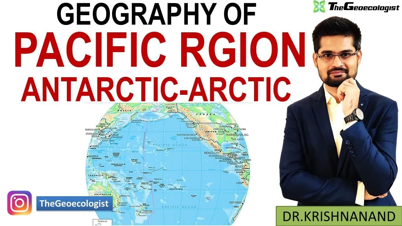
Table of Contents
- Introduction to the Pacific Realm
- Melanesia: The "Black Islands"
- Micronesia: The "Small Islands"
- Polynesia: The "Many Islands"
- Physical Geography: Tectonics, Topography, and Oceanography
- The Ring of Fire: Seismic and Volcanic Activity
- Island Formation: Volcanic Islands vs. Coral Atolls
- Oceanic Extremes: Trenches, Ridges, and Reefs
- Climate and Weather Systems
- Trade Winds, ITCZ, and Walker Circulation
- El Niño-Southern Oscillation (ENSO): Global Climate Driver
- Tropical Cyclones: Typhoons and Hurricanes
- Biodiversity and Ecosystems: A Global Hotspot
- Marine Biodiversity: The Coral Triangle and Beyond
- Terrestrial Endemism: Evolutionary Laboratories
- Threats: Bleaching, Acidification, and Invasives
- Cultural Diversity: Languages, Traditions, and Navigation
- Linguistic Diversity: 1,200+ Languages
- Indigenous Knowledge Systems
- Contemporary Cultural Dynamics
- Geopolitical and Economic Significance
- Strategic Sea Lanes and Trade Routes
- Resource Wealth: Fisheries, Minerals, and Energy
- Regional Organizations and Diplomacy
- Environmental Challenges: Climate Justice and Sustainability
- Sea-Level Rise: The Existential Threat
- Plastic Pollution and Waste Management
- Blue Economy and Sustainable Development
- Relevance to UPSC and Competitive Exams
- Key Examination Themes
- Answer Writing Strategy
- Conclusion
Pacific Region Geography encompasses one of the most dynamic and diverse geographical areas on Earth, spanning nearly one-third of the planet’s surface. For UPSC aspirants, competitive exam candidates, and geography enthusiasts, mastering the intricacies of this vast realm is essential for understanding global physical processes, cultural diversity, and contemporary geopolitical challenges. This comprehensive guide breaks down every critical aspect of the Pacific Realm, aligned with competitive exam syllabi including Geography Optional.
- The Pacific Realm covers approximately 165 million square kilometers, making Pacific Region Geography larger than all landmasses combined.
- Pacific Region Geography is divided into three distinct sub-regions: Melanesia, Micronesia, and Polynesia, each with unique geological and cultural characteristics.
- The Ring of Fire encircles the basin, driving intense tectonic activity including 75% of Earth’s volcanoes and 90% of earthquakes.
- Climate dynamics like ENSO (El Niño-Southern Oscillation) originate here, influencing global weather patterns including the Indian monsoon.
- Low-lying atoll nations face existential threats from sea-level rise, making climate justice a central geopolitical issue.
Introduction to the Pacific Realm
The Pacific Region Geography framework centers on the Pacific Ocean, the largest and deepest oceanic division on Earth. Stretching from the Arctic in the north to the Southern Ocean in the south, and bounded by Asia and Australia on the west and the Americas on the east, this realm contains over 25,000 islands—more than all other oceans combined. The region’s sheer scale defies simple categorization, yet geographers traditionally organize Pacific Region Geography into three cultural-geographic sub-regions based on ethnolinguistic and physical criteria.
Melanesia: The “Black Islands”
Melanesia, derived from Greek melas (black) and nesos (island), comprises the southwestern Pacific arc from New Guinea to Fiji. Major landmasses include Papua New Guinea (the world’s second-largest island), the Solomon Islands, Vanuatu, New Caledonia, and Fiji. These islands are predominantly continental or volcanic in origin, featuring rugged topography, rich mineral resources, and extraordinary biodiversity. Papua New Guinea alone hosts over 800 languages—the highest linguistic density globally—reflecting millennia of isolated community development. – a key consideration for Pacific Region Geography.
Micronesia: The “Small Islands”
Micronesia spans the western Pacific north of the equator, encompassing thousands of small islands and atolls across 2,000 kilometers. Key entities include the Federated States of Micronesia, Marshall Islands, Palau, Kiribati, Nauru, and the U.S. territories of Guam and the Northern Mariana Islands. Most islands are low-lying coral atolls barely rising above sea level, making them acutely vulnerable to climate change. Despite their small land area, these nations control vast Exclusive Economic Zones (EEZs) rich in tuna fisheries and seabed minerals. – a key consideration for Pacific Region Geography.
Polynesia: The “Many Islands”
Polynesia forms a vast triangle with vertices at Hawaii (north), New Zealand (southwest), and Easter Island (southeast). This sub-region includes Samoa, Tonga, Tuvalu, Cook Islands, French Polynesia, and the Māori homeland of Aotearoa (New Zealand). Polynesian navigators achieved remarkable feats of wayfinding, settling remote islands using celestial navigation, wave patterns, and bird behavior—knowledge systems now recognized by UNESCO as Intangible Cultural Heritage. Volcanic hotspot chains like Hawaii-Emperor Seamount Chain illustrate the region’s dynamic geological evolution. – a key consideration for Pacific Region Geography.
Physical Geography: Tectonics, Topography, and Oceanography
The physical foundation of Pacific Region Geography is defined by plate tectonics. The Pacific Plate, the largest tectonic plate at 103 million square kilometers, interacts with surrounding plates along convergent, divergent, and transform boundaries, creating the planet’s most geologically active zone.
The Ring of Fire: Seismic and Volcanic Activity
The Pacific Ring of Fire is a 40,000-kilometer horseshoe-shaped belt of subduction zones, volcanic arcs, and fault lines. Approximately 75% of Earth’s active and dormant volcanoes—over 450—lie along this arc. The 2011 Tōhoku earthquake (M9.1) and 2022 Hunga Tonga–Hunga Haʻapai eruption (VEI 5) exemplify the region’s capacity for catastrophic events. Subduction of the Pacific Plate beneath the Philippine Sea Plate creates the Mariana Trench, while the Tonga-Kermadec Trench marks convergence with the Indo-Australian Plate. These processes generate island arcs like Japan, the Philippines, and the Aleutians, and fuel geothermal energy potential across the realm. – a key consideration for Pacific Region Geography.
Island Formation: Volcanic Islands vs. Coral Atolls
Two primary island types dominate Pacific Region Geography:
- High Volcanic Islands: Formed by hotspot volcanism (e.g., Hawaiian Islands) or subduction-related arc volcanism (e.g., Fiji, Vanuatu). These islands feature dramatic relief, fertile soils, freshwater resources, and diverse ecosystems. The Hawaiian chain illustrates hotspot progression: Kauai (5.1 Ma) to the active Kīlauea and Mauna Loa on the Big Island, with Lōʻihi Seamount forming the next island submarine.
- Low Coral Atolls: Circular or horseshoe-shaped reefs encircling lagoons, formed atop subsiding volcanic foundations per Darwin’s subsidence theory. The Marshall Islands, Tuvalu, Kiribati, and Maldives exemplify this type. Atolls rarely exceed 3-4 meters elevation, rendering them ground zero for sea-level rise impacts. Pacific Ocean atoll nations face existential relocation questions within decades.
Oceanic Extremes: Trenches, Ridges, and Reefs
The Mariana Trench’s Challenger Deep (10,935 meters) represents Earth’s deepest point—deeper than Mount Everest is tall. The East Pacific Rise, a divergent boundary, spreads at 15 cm/year, among the fastest globally. The Great Barrier Reef, stretching 2,300 kilometers off Queensland, is the planet’s largest living structure, visible from space. Pacific Region Geography supports 1,500 fish species, 400 coral species, and generates $6.4 billion annually for Australia’s economy. However, mass bleaching events in 2016, 2017, 2020, and 2022 have devastated 50% of shallow-water corals, underscoring climate vulnerability.
Climate and Weather Systems
Climate dynamics in Pacific Region Geography are governed by ocean-atmosphere interactions operating at planetary scale. The Pacific acts as Earth’s thermal regulator, absorbing and redistributing solar energy.
Trade Winds, ITCZ, and Walker Circulation
Persistent easterly trade winds drive surface waters westward, piling warm water in the Western Pacific Warm Pool (WPWP)—the planet’s largest heat reservoir. The Inter-Tropical Convergence Zone (ITCZ) migrates seasonally, bringing intense rainfall to island nations. The Walker Circulation—an east-west atmospheric cell—links rising air over the WPWP with sinking air over the eastern Pacific cold tongue. Disruptions to this circulation drive ENSO cycles. – a key consideration for Pacific Region Geography.
El Niño-Southern Oscillation (ENSO): Global Climate Driver
ENSO is the dominant mode of interannual climate variability. During El Niño, weakened trade winds allow warm water to slosh eastward, shifting convection and altering global weather: droughts in Australia/Indonesia, floods in Peru/California, and weakened Indian monsoons. La Niña intensifies normal conditions. The 2015-16 “Godzilla El Niño” caused $100+ billion in global damages. NOAA monitors ENSO via the Oceanic Niño Index (ONI), critical for seasonal forecasting worldwide.
Tropical Cyclones: Typhoons and Hurricanes
The western Pacific generates more tropical cyclones than any basin—averaging 26 named storms annually. Super Typhoon Haiyan (2013) devastated the Philippines with 315 km/h winds and 7-meter storm surge, killing 6,300+. Climate models project fewer but more intense cyclones under warming, with poleward migration of peak intensity latitudes threatening unprepared regions.
Biodiversity and Ecosystems: A Global Hotspot
The Pacific Region Geography hosts unparalleled marine and terrestrial biodiversity, driven by isolation, geological age, and habitat heterogeneity.
Marine Biodiversity: The Coral Triangle and Beyond
The Coral Triangle (Indonesia, Philippines, Malaysia, Papua New Guinea, Solomon Islands, Timor-Leste) covers 1.6% of ocean area but contains 76% of known coral species (600+), 37% of reef fish species (2,000+), and 6 of 7 marine turtle species. Pacific Region Geography supports 120 million people directly dependent on marine resources. The Pacific hosts the world’s largest tuna fisheries—60% of global catch—worth $26 billion annually. Deep-sea ecosystems around hydrothermal vents and seamounts harbor endemic chemosynthetic communities, now threatened by nascent deep-sea mining.
Terrestrial Endemism: Evolutionary Laboratories
Island isolation drives speciation. Hawaii’s honeycreepers (Drepanidinae) radiated from a single finch ancestor into 50+ species (now mostly extinct). Fiji’s banded iguana (Brachylophus) and flightless kākāpō of New Zealand exemplify unique lineages. New Caledonia, a Gondwanan fragment, hosts 75% endemic flora including Amborella, the sister lineage to all flowering plants. Invasive species—rats, cats, mongoose, brown tree snake—have caused 80% of island bird extinctions globally.
Threats: Bleaching, Acidification, and Invasives
Ocean warming drives mass coral bleaching; acidification (pH down 0.1 since pre-industrial) impairs calcification. The 2016-2017 global bleaching event affected 70% of reefs. Plastic pollution concentrates in the Great Pacific Garbage Patch (1.6 million km², 80,000+ metric tons). Invasive species cost Pacific economies billions annually; the brown tree snake alone caused Guam’s forest bird extinctions and $2M/year in power outages.
Cultural Diversity: Languages, Traditions, and Navigation
Human settlement of the Pacific represents one of history’s greatest migration achievements. Pacific Region Geography cultural landscapes reflect 40,000+ years of adaptation.
Linguistic Diversity: 1,200+ Languages
The region hosts ~1,200 Austronesian languages (plus hundreds of Papuan languages in Melanesia)—20% of global languages on 0.5% of land area. Papua New Guinea alone has 840 languages. This diversity reflects geographic fragmentation: mountains, reefs, and ocean barriers isolating communities. Language endangerment is acute; UNESCO classifies 300+ Pacific languages as threatened.
Indigenous Knowledge Systems
Polynesian wayfinding—navigating by stars, swells, bird flight, and cloud patterns—enabled settlement across 25 million km² without instruments. The 1976 Hōkūleʻa voyage from Hawaii to Tahiti revitalized this knowledge. Māori mātauranga (knowledge) integrates environmental observations into resource management (rāhui closures). Pacific fire management, agroforestry (breadfruit, taro, coconut systems), and marine tenure (tabu areas) offer sustainable models.
Contemporary Cultural Dynamics
Urbanization, diaspora, and climate migration reshape identities. Auckland is the world’s largest Polynesian city. Remittances exceed 30% of GDP in Tonga and Samoa. Cultural festivals (Festival of Pacific Arts, Te Maeva Nui) reinforce regional solidarity. Digital platforms now transmit traditional knowledge across diasporas.
Geopolitical and Economic Significance
The strategic centrality of Pacific Region Geography has intensified in the 21st century, dubbed the “Indo-Pacific” in security discourse.
Strategic Sea Lanes and Trade Routes
Over 60% of global maritime trade transits the Pacific, including the Malacca, Sunda, and Lombok Straits chokepoints. The South China Sea carries $3.4 trillion in annual trade. U.S. Indo-Pacific Command, headquartered in Hawaii, maintains 375,000 personnel across the theater. China’s “String of Pearls” strategy and Belt and Road investments in Pacific ports (e.g., Darwin, Suva, Honiara) signal competing influence.
Resource Wealth: Fisheries, Minerals, and Energy
Tuna fisheries dominate: Pacific Island countries earn $500M+ annually from access fees. Deep-sea polymetallic nodules in the Clarion-Clipperton Zone contain nickel, cobalt, manganese critical for green tech—estimated at $16 trillion. The International Seabed Authority (ISA) regulates mining; Nauru Ocean Resources Inc. (NORI) sponsors exploration. Offshore oil/gas potential exists in the Timor Sea and East China Sea, though disputed.
Regional Organizations and Diplomacy
The Pacific Islands Forum (PIF), 18 members including Australia and New Zealand, is the premier political grouping. The 2050 Strategy for the Blue Pacific Continent prioritizes climate security, fisheries, and sovereignty. The Pacific Community (SPC) provides technical assistance. AUKUS, Quad, and Partners in the Blue Pacific represent external engagement frameworks. United Nations frameworks (SAMOA Pathway, BBNJ Treaty) address small island developing states (SIDS) priorities.
Environmental Challenges: Climate Justice and Sustainability
Environmental threats in Pacific Region Geography are existential, not incremental.
Sea-Level Rise: The Existential Threat
Global mean sea level rose 20 cm (1901-2018), accelerating to 3.7 mm/year (2006-2018). Kiribati (avg. elevation 2m), Tuvalu (2m), Marshall Islands (2m), and Maldives (1.5m) face inundation, salinization, and loss of habitable land by 2100 under high emissions. Kiribati purchased 2,200 hectares in Fiji (2014) for potential relocation. The “migration with dignity” framework seeks planned relocation over forced displacement.
Plastic Pollution and Waste Management
The Great Pacific Garbage Patch contains 1.8 trillion plastic pieces. Pacific islands, lacking waste infrastructure, receive disproportionate marine debris. The 2022 UN Plastic Pollution Treaty negotiations seek legally binding measures. Regional initiatives like the Pacific Regional Waste Management Strategy promote circular economies.
Blue Economy and Sustainable Development
The Blue Economy—sustainable ocean use for economic growth—is central to Pacific planning. Fiji’s Blue Economy Report values ocean assets at $2.5B/year. Integrated Coastal Zone Management (ICZM), Marine Spatial Planning (MSP), and Locally Managed Marine Areas (LMMAs) blend traditional tenure with science. The 2050 Strategy targets 30% marine protection by 2030 (30×30).
Relevance to UPSC and Competitive Exams
For aspirants, Pacific Region Geography is a high-yield topic across General Studies and Geography Optional papers.
Key Examination Themes
- Physical Geography: Ring of Fire mechanisms, island arc/trench systems, hotspot volcanism, coral reef formation (Darwin-Dana-Daly theory).
- Climatology: ENSO teleconnections with Indian monsoon, Walker Circulation, ITCZ dynamics, cyclone genesis.
- Biogeography: Wallace/Weber lines, island biogeography theory (MacArthur-Wilson), endemism, invasive species impacts.
- Human Geography: Austronesian expansion, linguistic diversity, traditional ecological knowledge, urbanization in SIDS.
- Geopolitics: Indo-Pacific construct, SIDS diplomacy, climate justice (loss and damage), blue economy, deep-sea mining governance.
- Regional Planning: ICZM, MSP, disaster risk reduction (Sendai Framework), sustainable tourism.
Answer Writing Strategy
Integrate maps (Pacific Plate boundaries, ENSO phases, Coral Triangle, Indo-Pacific choke points). Cite data: ONI values, sea-level rise rates, tuna catch statistics, EEZ sizes. Reference frameworks: SAMOA Pathway, BBNJ Treaty, 2050 Strategy. Link to India’s interests: Act East Policy, Forum for India-Pacific Islands Cooperation (FIPIC), HADR operations, ISA membership.
Conclusion
The Pacific Region Geography offers a microcosm of planetary processes—tectonic, climatic, biological, and cultural—operating at extremes. From the abyssal depths of the Mariana Trench to the cultural heights of Polynesian navigation, from the geopolitical chessboard of the Indo-Pacific to the climate frontlines of atoll nations, this realm demands integrated understanding. For UPSC aspirants, Pacific Region Geography provides rich material for interdisciplinary answers linking physical geography, environment, international relations, and ethics. Mastering the Pacific Realm is not merely academic; it is essential for comprehending 21st-century global challenges and India’s strategic horizon.
Enhance your preparation with Dr. Krishnanand’s detailed video lectures on TheGeoecologist YouTube Channel. Download specialized e-books on Regional Planning and Geography Optional. Follow TheGeoecologist on Instagram for daily updates, maps, and answer-writing practice. Subscribe to unlock expert guidance and exclusive perks!
Frequently Asked Questions
The three main sub-regions are Melanesia (Papua New Guinea, Fiji, Solomon Islands), Micronesia (Guam, Marshall Islands, Kiribati), and Polynesia (Hawaii, New Zealand, Samoa, Tonga, Easter Island).
El Niño typically weakens the Indian monsoon by shifting convection eastward, reducing rainfall over the subcontinent. La Niña generally strengthens monsoon rainfall. This teleconnection is a key UPSC climatology topic.
Low-lying atoll nations (Kiribati, Tuvalu, Marshall Islands) average 2-3 meters elevation, facing existential threats from sea-level rise, saltwater intrusion, and intensified cyclones. They contribute <0.03% of global emissions but face disproportionate impacts.