Blog
NCERT Class 11 Oceanography: Complete Guide to Water (Oceans) Chapter 13

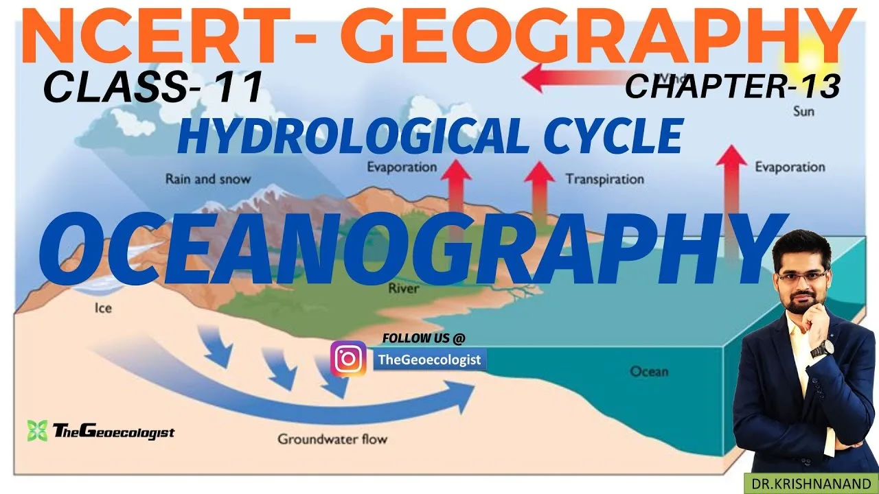
Table of Contents
- Understanding NCERT Class 11 Oceanography: Chapter Overview
- Why This Chapter Matters for CBSE and UPSC
- The Hydrological Cycle: Earth's Water in Perpetual Motion
- Key Processes of the Hydrological Cycle
- Residence Time and Budget
- Composition of Ocean Water: Salinity, Temperature, and Density
- Salinity: The Salt of the Sea
- Temperature: The Thermocline Barrier
- Density: Driver of Deep Circulation
- Ocean Movements: Waves, Tides, and Currents
- Waves: Energy in Motion
- Tides: The Gravitational Dance
- Ocean Currents: Rivers Within the Ocean
- Submarine Relief Features: Topography of the Ocean Floor
- Major Relief Divisions
- Minor Relief Features
- Exam-Centric Preparation Strategy for NCERT Class 11 Oceanography
- CBSE Board Exam Focus
- UPSC Civil Services Strategy
- Study Resources and Pro Tips
- Conclusion: Mastering the Blue Planet
NCERT Class 11 Oceanography forms the backbone of physical geography for CBSE students and UPSC aspirants alike. Chapter 13 of the NCERT Geography textbook, titled “Water (Oceans),” introduces learners to the dynamic processes governing Earth’s marine environments. This comprehensive guide distills every critical concept — from the hydrological cycle to submarine relief features — aligning strictly with the latest CBSE syllabus and competitive exam patterns.
- Hydrological Cycle: Continuous movement of water between oceans, atmosphere, and land through evaporation, condensation, precipitation, and runoff.
- Ocean Water Properties: Average salinity of 35 ppt; temperature decreases with depth forming a thermocline; density driven by temperature and salinity.
- Ocean Movements: Waves (wind-driven), tides (gravitational — spring and neap), and currents (wind, Coriolis effect, density differences).
- Submarine Relief: Continental shelf, slope, abyssal plains, trenches (Mariana Trench ~11,034 m), and mid-ocean ridges.
- Exam Relevance: CBSE focuses on definitions and diagrams; UPSC links currents to climatology (monsoon, El Niño) and resources.
Understanding NCERT Class 11 Oceanography: Chapter Overview
The NCERT Class 11 Oceanography chapter serves as a gateway to understanding Earth’s hydrosphere. Oceans cover approximately 71% of the planet’s surface and hold about 97% of Earth’s water, making them the primary regulator of global climate. The chapter, structured by the National Council of Educational Research and Training (NCERT), follows a logical progression: water cycle → water properties → water movements → ocean floor topography. This pedagogical design ensures students build conceptual clarity before tackling complex interactions like thermohaline circulation or the impact of currents on regional climates.
Why This Chapter Matters for CBSE and UPSC
For CBSE board exams, NCERT Class 11 Oceanography typically carries 8–12 marks in the Geography theory paper. Questions often test diagram-labeling skills (submarine relief, hydrological cycle), definition-based recall (salinity, thermocline, spring tides), and short notes on currents. For UPSC Civil Services Examination, the chapter’s relevance extends into General Studies Paper I (Geography) and Paper III (Environment). Aspirants must connect ocean currents to Indian Monsoon mechanisms, El Niño-Southern Oscillation (ENSO), cyclone formation, and marine resource distribution (polymetallic nodules, hydrocarbons on continental shelves). TheGeoecologist’s bilingual video lectures have become a go-to resource for visualizing these interlinkages.
The Hydrological Cycle: Earth’s Water in Perpetual Motion
The hydrological cycle, also called the water cycle, is the foundational concept in NCERT Class 11 Oceanography. NCERT Class 11 Oceanography describes the continuous exchange of water among the oceans, atmosphere, lithosphere, and biosphere. The cycle has no beginning or end, but for academic purposes, we trace it from the oceans — the largest reservoir.
Key Processes of the Hydrological Cycle
- Evaporation: Solar radiation converts liquid water into vapor. Oceans contribute ~86% of global evaporation (approx. 434,000 km³/year). Factors: temperature, wind speed, humidity, surface area.
- Transpiration: Water vapor released by plants. Combined with evaporation, NCERT Class 11 Oceanography’s termed evapotranspiration.
- Condensation: Water vapor cools and changes into tiny droplets, forming clouds. Requires condensation nuclei (dust, salt particles).
- Precipitation: Cloud droplets coalesce and fall as rain, snow, sleet, or hail. Global average precipitation: ~990 mm/year.
- Infiltration & Percolation: Water seeps into soil and recharges groundwater aquifers.
- Runoff: Surface flow returning water to oceans via streams and rivers. Completes the cycle.
Residence Time and Budget
A critical statistic in NCERT Class 11 Oceanography is residence time — the average duration a water molecule spends in a reservoir. For oceans: ~3,200 years; atmosphere: ~9 days; rivers: ~2 weeks. The global water budget is balanced: annual evaporation (~505,000 km³) equals annual precipitation. This equilibrium maintains sea level stability over geological timescales, though anthropogenic climate change is now altering this balance (thermal expansion, ice melt).
Composition of Ocean Water: Salinity, Temperature, and Density
The physical and chemical properties of seawater dictate marine ecosystems, circulation patterns, and climate regulation. NCERT Class 11 Oceanography emphasizes three interlinked parameters.
Salinity: The Salt of the Sea
Salinity is the total dissolved salts in seawater, expressed in parts per thousand (ppt or ‰). The global average is 35 ppt (3.5%). Major ions: Chloride (Cl⁻ ~55%), Sodium (Na⁺ ~31%), Sulfate (SO₄²⁻ ~8%), Magnesium (Mg²⁺ ~4%), Calcium (Ca²⁺ ~1%), Potassium (K⁺ ~1%). Seawater composition remains remarkably constant in open oceans (Principle of Constant Proportions), but varies regionally due to:
- High Salinity (>37 ppt): Subtropical gyres (e.g., Red Sea ~41 ppt, Persian Gulf ~38 ppt) — high evaporation, low precipitation, restricted circulation.
- Low Salinity (<34 ppt): Equatorial regions (high rainfall), polar regions (ice melt), coastal zones (river discharge — Amazon, Ganga-Brahmaputra).
- Latitudinal Variation: Salinity peaks at 20°–30° N/S (subtropical high-pressure belts); decreases toward equator and poles.
Temperature: The Thermocline Barrier
Ocean temperature distribution is three-dimensional:
- Surface Layer (0–200 m): Warm, mixed by wind. Average ~17°C globally; up to 30°C in tropics.
- Thermocline (200–1,000 m): Rapid temperature drop with depth. Acts as a barrier to vertical mixing. Critical for NCERT Class 11 Oceanography diagram-based questions.
- Deep Layer (>1,000 m): Near-uniform cold temperatures (~0–4°C). Contains ~90% of ocean volume.
Horizontal distribution: Isotherms shift poleward in summer, equatorward in winter. Enclosed seas (Mediterranean, Red Sea) show higher temperatures.
Density: Driver of Deep Circulation
Density (σₜ) depends on temperature (primary control) and salinity. Cold, saline water is denser. Pycnocline — zone of rapid density change — often coincides with thermocline. Density differences drive thermohaline circulation (global conveyor belt), a key concept linking NCERT Class 11 Oceanography to climate science.
Ocean Movements: Waves, Tides, and Currents
Water in oceans is never static. Three primary movements redistribute heat, nutrients, and energy.
Waves: Energy in Motion
Waves are oscillatory movements caused by wind friction on the surface. Key parameters: wavelength (crest-to-crest distance), wave height (trough-to-crest), wave period (time between crests). Orbital motion of water particles diminishes with depth (depth ≈ ½ wavelength). Breaking waves near shore transform kinetic energy into erosional power. Tsunamis — seismic sea waves — differ fundamentally: wavelength >100 km, period 10–60 min, speed up to 800 km/hr in deep water.
Tides: The Gravitational Dance
Tides are periodic rise and fall of sea level caused by gravitational pull of the Moon and Sun, and centrifugal force from Earth-Moon rotation.
- Spring Tides: Syzygy alignment (Sun-Moon-Earth) at New Moon and Full Moon. Higher high tides, lower low tides. Range ~20% greater than average.
- Neap Tides: Quadrature (Sun-Earth-Moon at 90°) at First and Third Quarter. Moderate tidal range.
- Tidal Types: Semi-diurnal (two high, two low daily — most coasts), Diurnal (one high, one low — Gulf of Mexico), Mixed (two unequal highs/lows — West Coast USA).
- Tidal Bore: Advancing tide front in narrow estuaries (e.g., Hooghly, Qiantang River).
Ocean Currents: Rivers Within the Ocean
Currents are persistent, directional flows of water. Classification in NCERT Class 11 Oceanography:
By Temperature
- Warm Currents: Flow poleward from tropics. Raise coastal temperatures, increase rainfall. Examples: Gulf Stream (North Atlantic), Kuroshio Current (North Pacific), East Australian Current, Brazil Current, Agulhas Current.
- Cold Currents: Flow equatorward from poles. Lower coastal temperatures, create aridity (fog, deserts). Examples: Canary Current (E. Atlantic), Benguela Current (SE Atlantic), California Current (E. Pacific), Peru (Humboldt) Current, West Australian Current, Oyashio Current (NW Pacific).
By Depth
- Surface Currents (~10% of volume): Wind-driven (prevailing winds: Trade Winds, Westerlies), deflected by Coriolis Effect (right in NH, left in SH). Form gyres (subtropical anticyclonic, subpolar cyclonic).
- Deep Water Currents (90%): Density-driven (thermohaline). North Atlantic Deep Water (NADW) formation near Greenland; Antarctic Bottom Water (AABW) near Antarctica. Global conveyor belt cycle: ~1,000 years.
Impact on Climate and Economy
Currents modulate coastal climates: Western Europe warmed by Gulf Stream/North Atlantic Drift (London ~5°C warmer than same-latitude Newfoundland). Upwelling zones (Peru, California, NW Africa) bring nutrients → high productivity → major fisheries. El Niño (warm phase) weakens Peru Current → disrupts monsoon, global weather. NCERT Class 11 Oceanography requires mapping major currents and associating them with climatic effects.
Submarine Relief Features: Topography of the Ocean Floor
The ocean floor exhibits relief as varied as continents. NCERT Class 11 Oceanography classifies NCERT Class 11 Oceanography into major and minor features.
Major Relief Divisions
- Continental Shelf: Gently sloping (1°–3°), submerged continental margin. Average width ~80 km; depth up to 200 m. Covers ~7.5% of ocean area. Rich in fisheries, sand, gravel, oil, natural gas (e.g., Bombay High, Gulf of Mexico). Exclusive Economic Zone (EEZ) extends 200 nautical miles from baseline.
- Continental Slope: Steep gradient (2°–5°), depth 200–3,000 m. Marks true edge of continent. Site of submarine canyons (e.g., Hudson Canyon) carved by turbidity currents.
- Continental Rise: Gentle slope (0.5°–1°) at base of slope, formed by sediment accumulation (turbidites). Merges into abyssal plains.
- Abyssal Plains: Flattest regions on Earth (slope <0.1°). Depth 3,000–6,000 m. Covered by fine sediments (clay, ooze). Cover ~40% of ocean floor.
Minor Relief Features
- Mid-Ocean Ridges: Divergent plate boundaries. Continuous mountain chain ~65,000 km long. Central rift valley, hydrothermal vents (black smokers), seafloor spreading. Example: Mid-Atlantic Ridge, East Pacific Rise.
- Seamounts & Guyots: Submerged volcanoes (>1,000 m height). Flat-topped guyots = eroded seamounts. Estimated >100,000 seamounts globally.
- Ocean Trenches: Convergent boundaries (subduction zones). Deepest points. Mariana Trench (Challenger Deep) = 11,034 m (deepest). Others: Tonga, Kuril, Peru-Chile, Java Trenches.
- Abyssal Hills: Low, rounded hills on abyssal plains, volcanic origin.
- Coral Reefs & Atolls: Biogenic structures in tropical waters (Darwin’s subsidence theory).
Exam-Centric Preparation Strategy for NCERT Class 11 Oceanography
Success in exams requires targeted preparation aligned with question patterns.
CBSE Board Exam Focus
- Definitions (1–2 marks): Salinity, thermocline, spring/neap tides, Coriolis effect, EEZ, guyot, turbidity current.
- Diagrams (3–5 marks): Hydrological cycle, submarine relief profile, major ocean currents map, thermohaline circulation.
- Short Notes (3 marks): Factors affecting salinity, types of tides, warm vs cold currents, continental shelf significance.
- Case-based Questions: Impact of El Niño on Indian monsoon; resource potential of continental shelves.
UPSC Civil Services Strategy
- Static-Dynamic Linkage: Connect currents to Indian Monsoon (Somali Current reversal, Mascarene High), ENSO (Walker Circulation, Southern Oscillation Index), cyclogenesis (warm SST >26.5°C).
- Resource Geography: Continental shelves → hydrocarbons (Mumbai High, KG Basin), polymetallic nodules (Clarion-Clipperton Zone), rare earth elements.
- International Law: UNCLOS (1982) — Territorial Sea (12 nm), Contiguous Zone (24 nm), EEZ (200 nm), Continental Shelf (legal vs geological definition), International Seabed Authority.
- Climate Change: Ocean acidification (pH drop ~0.1 since pre-industrial), coral bleaching, sea-level rise (3.3 mm/yr satellite era), AMOC slowdown risk.
Study Resources and Pro Tips
Leverage multimedia for better retention of NCERT Class 11 Oceanography concepts.
- TheGeoecologist YouTube Channel: Bilingual (Hindi-English) lectures with animations for thermohaline circulation, tidal patterns, and current maps. Highly recommended for visual learners.
- NCERT Textbook & Exemplar: Primary source. Solve all in-text and exercise questions.
- Atlas Practice: Oxford Student Atlas or Orient BlackSwan — map major currents, trenches, ridges, upwelling zones.
- Mnemonics: “Can God Bring Peace” → Canary, Guinea, Benguela, Peru (Cold Currents, E. Atlantic/ Pacific). “Guys Keep Buying Apples” → Gulf Stream, Kuroshio, Brazil, Agulhas (Warm Currents).
- Previous Year Papers: Analyze 10-year CBSE and UPSC trends. Focus on repeated themes: salinity factors, current-climate link, EEZ disputes.
Conclusion: Mastering the Blue Planet
NCERT Class 11 Oceanography is not merely a chapter to memorize — it is a lens to understand Earth’s climate engine, biodiversity cradle, and economic frontier. From the microscopic dance of water molecules in the hydrological cycle to the colossal conveyor belt connecting polar sinks to tropical sources, every concept interlinks. For CBSE students, mastery means high scores through precise definitions and labeled diagrams. For UPSC aspirants, it means weaving oceanography into climatology, geopolitics, and sustainable development narratives. Resources like TheGeoecologist’s bilingual videos bridge the gap between textbook abstraction and real-world visualization. Dive deep, map rigorously, and connect broadly — the oceans reward those who navigate their depths with curiosity and discipline.
Explore TheGeoecologist’s structured courses and downloadable study materials at thegeoecologist.com. Follow @thegeoecologist on Instagram for daily geography bites and exam tips.
Frequently Asked Questions
The average salinity of ocean water is 35 parts per thousand (ppt) or 3.5%, as stated in NCERT Class 11 Geography Chapter 13.
Warm currents raise coastal temperatures and increase rainfall (e.g., Gulf Stream warming Western Europe), while cold currents lower temperatures and create arid conditions (e.g., Peru Current causing Atacama Desert).
Major features include continental shelf, continental slope, continental rise, abyssal plains, mid-ocean ridges, seamounts, guyots, and ocean trenches (e.g., Mariana Trench at 11,034 m).