Blog
Distribution of Oceans and Continents: NCERT Class 11 Geography Chapter 4 Complete Guide

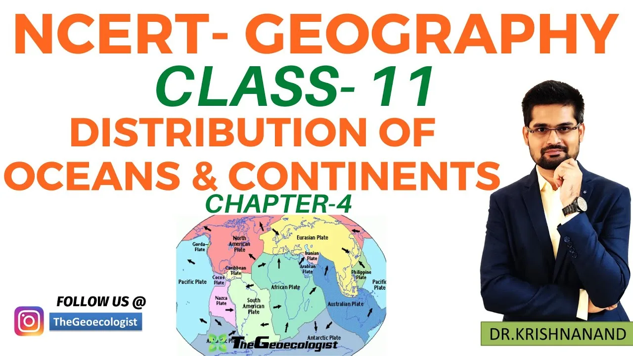
Table of Contents
- Understanding the Distribution of Oceans and Continents
- Continental Drift Theory: Wegener's Revolutionary Hypothesis
- The Core Proposition
- Four Pillars of Evidence
- Why Wegener Was Rejected Initially
- Convectional Current Theory: Arthur Holmes' Insight
- Seafloor Spreading: The Missing Mechanism Found
- Harry Hess and the Mid-Ocean Ridge System
- Three Lines of Confirmatory Evidence
- Plate Tectonics: The Unifying Theory
- Major Tectonic Plates
- Three Types of Plate Boundaries
- Evolution of Continents: From Pangaea to Present
- Breakup Timeline
- Supercontinent Cycle
- Why This Chapter Matters for Exams
- CBSE Class 11 Geography
- UPSC and State PSC Exams
- TheGeoecologist's Pedagogical Approach
- Key Concepts Quick Reference
- Frequently Misunderstood Points
- Conclusion
The Distribution of Oceans and Continents is a fundamental concept in physical geography that explains how Earth’s surface has evolved over millions of years. Chapter 4 of NCERT Class 11 Geography provides a comprehensive overview of the theories and evidence behind the current arrangement of landmasses and water bodies. Distribution of Oceans and Continents covers everything from Alfred Wegener’s Continental Drift Theory to modern Plate Tectonics, tailored for CBSE students and UPSC aspirants.
- Continental Drift Theory by Alfred Wegener (1912) proposed Pangaea and Panthalassa.
- Key evidences include jigsaw fit, fossil correlation, rock matching, and paleoclimatic data.
- Seafloor Spreading (Harry Hess, 1961) explained the mechanism via mid-ocean ridges.
- Plate Tectonics unifies all theories with three boundary types: divergent, convergent, transform.
- Exam focus: Diagrams of Pangaea breakup, plate boundaries, and Himalayan orogeny.
Understanding the Distribution of Oceans and Continents
The Distribution of Oceans and Continents across Earth’s surface is not static. Geological evidence confirms that continents have drifted, oceans have opened and closed, and mountain ranges have risen and eroded over geological time. The NCERT Class 11 Geography textbook Chapter 4 systematically presents the evolution of scientific thought—from early speculation to the robust framework of Plate Tectonics—that explains this dynamic planet.
Continental Drift Theory: Wegener’s Revolutionary Hypothesis
The Core Proposition
In 1912, German meteorologist Alfred Wegener published Die Entstehung der Kontinente und Ozeane (The Origin of Continents and Oceans). He hypothesized that approximately 300 million years ago (Late Carboniferous), all continents formed a single supercontinent called Pangaea (Greek for “all Earth”), surrounded by a global ocean named Panthalassa (“all sea”). – a key consideration for Distribution of Oceans and Continents.
According to Wegener, Pangaea began breaking up around 200 million years ago (Early Jurassic) into two large landmasses: Laurasia in the north (comprising present-day North America, Europe, and Asia) and Gondwanaland in the south (comprising South America, Africa, India, Australia, and Antarctica). Subsequent fragmentation and drift led to the modern Distribution of Oceans and Continents we observe today.
Four Pillars of Evidence
Wegener marshaled interdisciplinary evidence to support continental drift:
1. Jigsaw Fit of Coastlines
The most visually striking evidence is the complementary fit of continental margins. The eastern coastline of South America fits remarkably well into the western coastline of Africa. When reconstructed using the 1,000-fathom (approx. 1,800 m) isobath rather than present shorelines, the fit exceeds 99% accuracy—a point emphasized in modern Distribution of Oceans and Continents reconstructions.
2. Fossil Correlations Across Oceans
Identical fossil species occur on continents now separated by vast oceans. The freshwater reptile Mesosaurus (Permian, ~280 Ma) is found only in Brazil and South Africa. The seed fern Glossopteris (Permian) occurs in India, Australia, Antarctica, Africa, and South America. Since these organisms could not cross oceans, their distribution implies the continents were once joined. – a key consideration for Distribution of Oceans and Continents.
3. Rock Formation and Structural Continuity
Precambrian cratonic belts and Paleozoic orogenic belts align when continents are reassembled. The Cape Fold Belt in South Africa continues into the Ventania Fold Belt in Argentina. Similarly, the Appalachian Mountains in North America align with the Caledonian Mountains in Scandinavia and the British Isles. – a key consideration for Distribution of Oceans and Continents.
4. Paleoclimatic Indicators
Glacial deposits (tillites) of Permo-Carboniferous age (~300 Ma) are found in India, Australia, South America, and Africa—regions now in tropical or temperate latitudes. Conversely, coal deposits (indicating warm, humid climates) occur in Antarctica and Spitzbergen (high Arctic). These anomalies resolve if continents occupied different paleolatitudes. – a key consideration for Distribution of Oceans and Continents.
Why Wegener Was Rejected Initially
Despite compelling evidence, Wegener’s theory faced fierce opposition because he could not identify a credible mechanism for continental movement. He suggested tidal forces from the Moon and “polflucht” (flight from the poles) due to Earth’s rotation—both physically inadequate. Geophysicists like Harold Jeffreys calculated that tidal friction would stop Earth’s rotation in < 1 year if it moved continents. The geological community dismissed drift for decades. – a key consideration for Distribution of Oceans and Continents.
Convectional Current Theory: Arthur Holmes’ Insight
In the 1930s, British geologist Arthur Holmes proposed that thermal convection currents in Earth’s mantle could drive continental motion. He envisioned radioactive heat generating rising currents beneath continents (causing rifting) and sinking currents beneath oceans (pulling crust down). Though Holmes lacked direct evidence, his mechanism later became the engine of Plate Tectonics. Modern seismic tomography confirms large-scale mantle convection, validating Holmes’ foresight. – a key consideration for Distribution of Oceans and Continents.
Seafloor Spreading: The Missing Mechanism Found

Harry Hess and the Mid-Ocean Ridge System
In 1961, Princeton geologist Harry Hess published “History of Ocean Basins,” proposing that mid-ocean ridges (e.g., the Mid-Atlantic Ridge) are sites where new oceanic crust forms. Magma rises from the mantle, solidifies, and pushes older crust laterally—a conveyor belt of seafloor creation. Hess called this seafloor spreading. – a key consideration for Distribution of Oceans and Continents.
Three Lines of Confirmatory Evidence
1. Age Progression Away from Ridges
Deep-sea drilling (DSDP/ODP/IODP programs) revealed that oceanic crust is youngest at ridge axes (0 Ma) and ages symmetrically outward, reaching ~180 Ma near continental margins. No oceanic crust older than Jurassic exists—consistent with continuous creation and destruction. – a key consideration for Distribution of Oceans and Continents.
2. Magnetic Striping and Polarity Reversals
As basalt cools at ridges, iron-rich minerals lock in Earth’s magnetic field direction. Periodic geomagnetic reversals create alternating bands of normal and reversed polarity parallel to ridges. These magnetic anomalies serve as a “tape recorder” of spreading rates (typically 2–15 cm/yr half-rate). The Vine-Matthews-Morley hypothesis (1963) quantitatively linked striping to seafloor spreading.
3. Sediment Thickness and Heat Flow
Sediment thickness increases systematically with distance from ridges (thin/zero at axis, thick at margins). Heat flow measurements show high values at ridges (magma upwelling) and low values at old abyssal plains—exactly as predicted.
Plate Tectonics: The Unifying Theory
By 1967–68, the works of Morgan, McKenzie, Parker, and Le Pichon synthesized continental drift, seafloor spreading, and mantle convection into Plate Tectonics Theory. Earth’s rigid outer shell (lithosphere, ~100 km thick) is fractured into ~15 major and minor tectonic plates that move over the ductile asthenosphere.
Major Tectonic Plates
The seven largest plates cover ~94% of Earth’s surface:
- Pacific Plate (103 million km²) – mostly oceanic
- North American Plate (76 million km²)
- Eurasian Plate (68 million km²)
- African Plate (61 million km²)
- Antarctic Plate (61 million km²)
- Indo-Australian Plate (58 million km²) – often split into Indian and Australian plates
- South American Plate (44 million km²)
Smaller but significant plates include Nazca, Cocos, Caribbean, Philippine, Arabian, and Scotia plates.
Three Types of Plate Boundaries
Divergent Boundaries (Constructive)
Plates move apart. Magma rises, creating new crust. Examples: Mid-Atlantic Ridge (oceanic-oceanic), East African Rift (continental-continental, incipient ocean basin). Spreading rates: 1–15 cm/yr.
Convergent Boundaries (Destructive)
Plates collide. Three subtypes:
- Oceanic-Oceanic: One plate subducts, forming volcanic island arcs (e.g., Japan, Mariana Islands).
- Oceanic-Continental: Dense oceanic plate subducts beneath buoyant continent, forming continental volcanic arcs (e.g., Andes, Cascades).
- Continental-Continental: Neither subducts easily; crust thickens, forming collisional orogens (e.g., Himalayas from Indian-Eurasian collision starting ~50 Ma).
Transform Boundaries (Conservative)
Plates slide past each other horizontally. No crust created or destroyed. Example: San Andreas Fault (Pacific-North American plates). Earthquakes are shallow and frequent.
Evolution of Continents: From Pangaea to Present
The Distribution of Oceans and Continents has undergone dramatic reorganization:
Breakup Timeline
- ~200 Ma (Early Jurassic): Pangaea splits into Laurasia and Gondwanaland; Central Atlantic opens.
- ~180 Ma: Gondwanaland begins fragmenting; East Gondwana (India, Antarctica, Australia) separates from West Gondwana (Africa, South America).
- ~140 Ma: South Atlantic opens as Africa and South America drift apart.
- ~120 Ma: India breaks from Antarctica/Australia, begins rapid northward drift (~15–20 cm/yr).
- ~80 Ma: North Atlantic opens; Europe separates from North America.
- ~50 Ma: India collides with Eurasia; Himalayan orogeny begins.
- Present: Atlantic still widening (~2.5 cm/yr); Pacific shrinking; Africa moving north toward Europe (Mediterranean closure).
Supercontinent Cycle
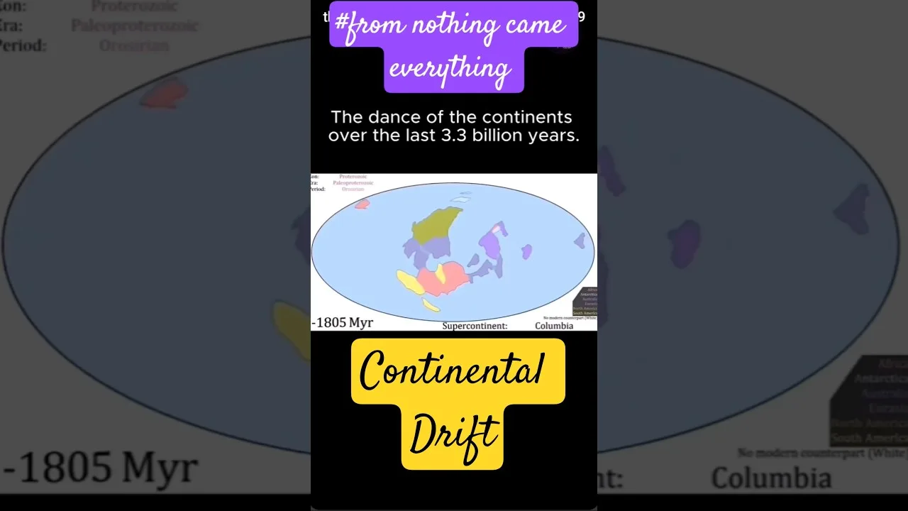
Geological history suggests a quasi-periodic supercontinent cycle (~300–500 Myr). Before Pangaea: Rodinia (~1.1–0.75 Ga), Nuna/Columbia (~1.8–1.5 Ga). Future projection: “Pangaea Proxima” or “Amasia” in ~250 Myr.
Why This Chapter Matters for Exams
CBSE Class 11 Geography
- Diagram-based questions: Pangaea reconstruction, seafloor spreading cross-section, three plate boundary types with labels.
- Short notes: Evidences of continental drift (4 points), convection current theory, magnetic striping.
- Distinguish between: Divergent vs. convergent boundaries; oceanic vs. continental crust; Laurasia vs. Gondwanaland.
- Case study: Himalayan formation as continent-continent collision.
UPSC and State PSC Exams
- Prelims: Factual MCQs on plate names, boundary types, ridge names, fossil evidence (Mesosaurus, Glossopteris).
- Mains (GS Paper I): “Explain the theory of Plate Tectonics and its role in the distribution of earthquakes and volcanoes.” (150 words).
- Geography Optional: Detailed answers on mantle convection models, supercontinent cycle, paleomagnetism, and hotspot tracks.
- Interdisciplinary links: Plate tectonics → mineral deposits (porphyry copper at convergent margins), hydrocarbon traps (rift basins), geothermal energy.
TheGeoecologist’s Pedagogical Approach
TheGeoecologist’s bilingual (Hindi-English) video tutorial on Distribution of Oceans and Continents enhances conceptual clarity through:
- Flowcharts linking historical theories (Wegener → Holmes → Hess → Plate Tectonics).
- Animated maps showing Pangaea breakup in stages with geological time stamps.
- Mnemonics for remembering four evidences of continental drift (e.g., “Jigsaw Fossils Rock Climate”).
- Real-world anchors: Himalayan seismicity, Deccan Traps (Réunion hotspot), Andaman-Sumatra subduction zone.
- Exam-oriented summary tables comparing boundary types, associated landforms, and earthquake/volcano patterns.
Key Concepts Quick Reference
| Concept | Proponent/Year | Key Idea |
|---|---|---|
| Continental Drift | Alfred Wegener, 1912 | Pangaea → Laurasia + Gondwanaland → modern continents |
| Convection Currents | Arthur Holmes, 1930s | Mantle convection drives plate motion |
| Seafloor Spreading | Harry Hess, 1961 | New crust forms at mid-ocean ridges |
| Plate Tectonics | Morgan, McKenzie, Parker, Le Pichon, 1967–68 | Lithosphere divided into moving plates; 3 boundary types |
| Paleomagnetism | Vine, Matthews, Morley, 1963 | Magnetic striping confirms seafloor spreading |
Frequently Misunderstood Points
- Continents don’t “drift” independently—they are passive passengers on moving plates.
- Plate boundaries ≠ continent edges (e.g., North American Plate includes half of Atlantic Ocean).
- Oceanic crust is young (max ~180 Ma); continental crust is old (up to 4 Ga).
- Subduction consumes oceanic crust, maintaining Earth’s constant surface area.
- Hotspots (Hawaii, Réunion) are intraplate, not boundary phenomena; they track absolute plate motion.
Conclusion
The journey from Wegener’s intuitive Distribution of Oceans and Continents hypothesis to the quantitative, predictive framework of Plate Tectonics exemplifies scientific progress. For students, mastering this chapter provides not just exam marks but a lens to interpret Earth’s dynamic surface—earthquakes, volcanoes, mountain belts, mineral resources, and even long-term climate change. TheGeoecologist’s resources bridge textbook theory and exam application, making complex geodynamics accessible. As you prepare, focus on diagrams, evidences, boundary classifications, and the Indian plate’s journey—these are perennial favorites in both CBSE and UPSC evaluations.
Pro Tip: Practice drawing the Pangaea breakup sequence (3–4 stages) and labeling all three plate boundary types with landform examples. This single skill covers ~40% of chapter weightage.
For authoritative background on the development of these theories, see the Continental Drift and Plate Tectonics articles on Wikipedia. The Seafloor Spreading page details magnetic anomaly evidence.
Frequently Asked Questions
The four main evidences are: (1) Jigsaw fit of coastlines (e.g., South America-Africa), (2) Fossil correlations (Mesosaurus, Glossopteris across separated continents), (3) Matching rock formations and mountain belts (Cape Fold Belt–Ventania, Appalachians–Caledonians), and (4) Paleoclimatic indicators (Permo-Carboniferous glacial tillites in now-tropical regions, coal in Antarctica).
Harry Hess (1961) proposed that mid-ocean ridges are sites of new oceanic crust formation via magma upwelling. This creates a conveyor belt: crust forms at ridges, moves laterally, and is consumed at subduction zones. Magnetic striping (Vine-Matthews-Morley, 1963) and age progression from ridges confirmed this mechanism, validating mantle convection as the driving force.
(1) Divergent: Plates move apart → mid-ocean ridges (oceanic), rift valleys (continental). (2) Convergent: Plates collide → subduction zones with trenches/volcanic arcs (oceanic-oceanic, oceanic-continental), collisional mountains like Himalayas (continental-continental). (3) Transform: Plates slide past → strike-slip faults (San Andreas), shallow earthquakes, no volcanism.