Blog
Coastal Landforms: Erosional and Depositional Features by Waves Explained

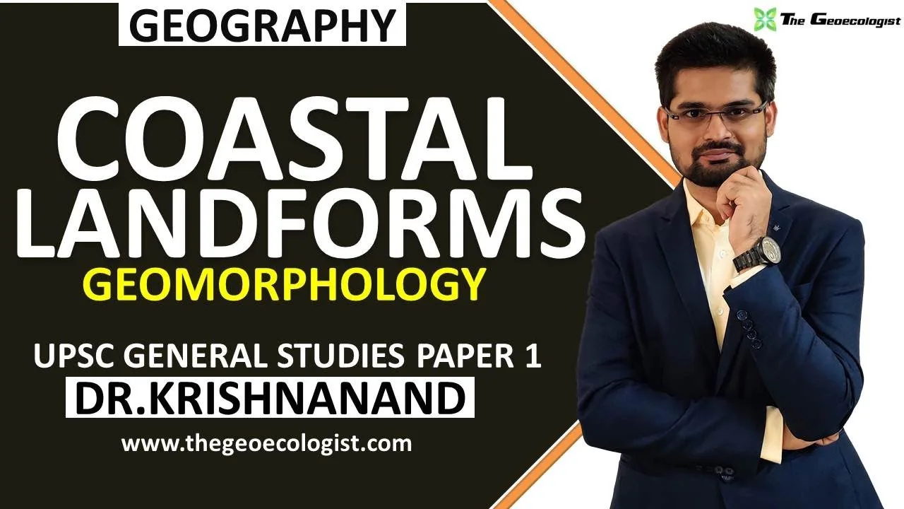
Table of Contents
- Introduction to Coastal Landforms and Wave Dynamics
- Wave Types and Their Geomorphic Roles
- Erosional Coastal Landforms: Sculpted by Wave Power
- Sea Cliffs and Wave-Cut Platforms
- Sea Caves, Arches, Stacks, and Stumps: The Erosional Sequence
- Geos, Blowholes, and Inlets
- Depositional Coastal Landforms: Built by Sediment Transport
- Beaches: The Most Ubiquitous Depositional Feature
- Spits, Bars, and Tombolos: Longshore Drift Masterpieces
- Barrier Islands and Coastal Dunes
- Factors Controlling Coastal Landform Development
- Sea-Level Change: The Ultimate Architect
- Rock Structure and Differential Erosion
- Coastal Landforms in the Indian Context
- Relevance for UPSC and Competitive Examinations
- Study Strategy and Resources
- Coastal Management and Anthropogenic Impacts
- Conclusion
Coastal landforms represent the dynamic interface where lithosphere, hydrosphere, and atmosphere interact through the relentless energy of waves. These features, shaped by both erosional and depositional processes, are fundamental to understanding coastal geomorphology and are a critical component of the UPSC General Studies Paper-1 syllabus. Dr. Krishnanand, founder of TheGeoecologist, provides a simplified yet comprehensive explanation of these concepts, making them accessible for UPSC aspirants and geography students alike.
- Coastal landforms are shaped by wave energy, tidal currents, and longshore drift acting on varied rock types.
- Erosional features include cliffs, wave-cut platforms, sea caves, arches, stacks, and stumps.
- Depositional features comprise beaches, spits, bars, tombolos, barrier islands, and dunes.
- Understanding these processes is essential for UPSC GS Paper-1 and Geography Optional preparation.
- Dr. Krishnanand’s lecture simplifies complex geomorphological concepts for effective exam preparation.
Introduction to Coastal Landforms and Wave Dynamics
The study of coastal landforms falls under the broader domain of geomorphology — the scientific analysis of landforms and the processes that shape them. Waves are the primary agents of change along coastlines, generated by wind friction over the ocean surface. Their energy, determined by wind speed, duration, and fetch (the uninterrupted distance over which wind blows), dictates the intensity of erosion and deposition. According to the United States Geological Survey (USGS), wave action is responsible for some of the most rapid geological changes observable on human timescales.
Wave Types and Their Geomorphic Roles
Waves are classified as constructive or destructive based on their frequency and energy. Constructive waves (low frequency, long wavelength, strong swash, weak backwash) favor deposition, building up beaches and coastal landforms like berms. Destructive waves (high frequency, short wavelength, weak swash, strong backwash) dominate erosion, carving cliffs and platforms. The balance between these wave types, modulated by seasonal storms and sea-level fluctuations, determines the net morphodynamic state of a coastline.
Erosional Coastal Landforms: Sculpted by Wave Power
Erosional coastal landforms develop where wave energy exceeds the resistance of coastal rocks. The process involves hydraulic action (air compression in joints), abrasion (corrasion by sediment load), attrition (particle-to-particle collision), and solution (chemical dissolution). These mechanisms operate synergistically, producing a suite of distinctive features.
Sea Cliffs and Wave-Cut Platforms
Sea cliffs are steep rock faces formed by undercutting at the base through wave erosion. As the notch deepens, the overhanging rock collapses, causing the cliff to retreat landward. This retreat leaves behind a gently sloping wave-cut platform (or shore platform) at the base, often exposed at low tide. The rate of cliff retreat varies from millimeters to meters per year depending on rock lithology, joint density, and wave energy. The iconic white cliffs of Dover, composed of Cretaceous chalk, retreat at approximately 1 cm/year, while softer sedimentary cliffs in Holderness, Yorkshire, recede up to 2 m/year — among the fastest in Europe.
Sea Caves, Arches, Stacks, and Stumps: The Erosional Sequence
This classic sequence illustrates progressive erosion along lines of weakness (faults, joints, bedding planes). Sea caves form when waves exploit a weak zone, enlarging it landward. When a cave penetrates a headland completely, a natural arch forms. Continued erosion widens the arch until its roof collapses, leaving an isolated stack (e.g., Old Harry Rocks, Dorset; The Twelve Apostles, Australia). Finally, the stack is reduced to a stump, submerged at high tide. This sequence, often cited in textbooks like Geomorphology by Savindra Singh, exemplifies the cyclic nature of coastal erosion.
Geos, Blowholes, and Inlets
A geo is a narrow, steep-sided inlet formed by wave erosion along a fault or dyke. Where a geo intersects a joint reaching the surface, a blowhole may develop — a vertical shaft through which water and air are forcibly ejected during wave compression. These features are spectacularly displayed on the basalt coastlines of the Giant’s Causeway (Northern Ireland) and the Deccan Traps (India).
Depositional Coastal Landforms: Built by Sediment Transport

Depositional coastal landforms arise where sediment supply exceeds the transport capacity of waves and currents. Longshore drift — the zigzag movement of sediment along the shore driven by oblique wave approach — is the primary conveyor. Sediment sources include cliff erosion, river discharge, and offshore reworking. The National Oceanic and Atmospheric Administration (NOAA) estimates that global rivers deliver approximately 15–20 billion tonnes of sediment to coasts annually, fueling depositional systems.
Beaches: The Most Ubiquitous Depositional Feature
Beaches are accumulations of sediment (sand, shingle, cobbles) between the low-tide line and the landward limit of wave action. Their profile — berm, beach face, step, and longshore bars — reflects the equilibrium between wave energy and sediment characteristics. Coastal landforms like beaches are classified by sediment size (sand vs. shingle), morphology (dissipative vs. reflective), and composition (quartz, carbonate, volcanic). The world’s longest natural beach, Praia do Cassino (Brazil), extends over 250 km.
Spits, Bars, and Tombolos: Longshore Drift Masterpieces
A spit is an elongated ridge of sediment attached to the coast at one end, projecting into open water (e.g., Spurn Head, UK; Dungeness, UK). When a spit grows across a bay, it forms a baymouth bar, enclosing a lagoon. A tombolo connects an offshore island to the mainland (e.g., Chesil Beach linking Isle of Portland to Dorset; Adam’s Bridge between India and Sri Lanka). These features demonstrate the directional power of longshore drift and are key case studies in UPSC geography.
Barrier Islands and Coastal Dunes
Barrier islands are long, narrow sand islands parallel to the mainland, separated by lagoons or marshes. They form on low-gradient, microtidal coasts with abundant sediment supply (e.g., Outer Banks, USA; East Frisian Islands, Germany). Coastal dunes develop behind beaches where onshore winds transport dry sand landward, stabilized by vegetation (e.g., marram grass). Dune fields like the Skeleton Coast (Namibia) and Thar Desert coastal margins (India) illustrate aeolian-marine interaction.
Factors Controlling Coastal Landform Development
The morphology of coastal landforms is governed by a hierarchy of controls: tectonic setting (passive vs. active margins), sea-level history (eustatic vs. isostatic), rock structure (lithology, dip, jointing), wave climate, sediment budget, and anthropogenic influence. Passive margins (e.g., Atlantic coasts) typically exhibit wide shelves, barrier islands, and extensive depositional systems. Active margins (e.g., Pacific Ring of Fire) feature narrow shelves, tectonic uplift, and dominant erosional landforms.
Sea-Level Change: The Ultimate Architect
Quaternary sea-level fluctuations (glacial-interglacial cycles) have repeatedly reorganized coastlines. During the Last Glacial Maximum (~20,000 BP), sea level was ~120 m lower, exposing continental shelves. The subsequent Holocene transgression drowned river valleys (forming rias and fjords) and reworked sediments into modern coastal landforms. Current anthropogenic sea-level rise (~3.4 mm/yr, per IPCC AR6) threatens to accelerate erosion and submerge low-lying depositional features.
Rock Structure and Differential Erosion
Concordant coasts (rock strata parallel to shore) produce straight, uniform cliffs (e.g., Dalmatian coast). Discordant coasts (strata perpendicular to shore) yield headlands and bays through differential erosion — resistant rocks (granite, limestone) form headlands; weaker rocks (clay, shale) form bays. The Isle of Purbeck (Dorset, UK) is a textbook example, with Portland limestone headlands (Durlston Head) and Wealden clay bays (Swanage Bay).
Coastal Landforms in the Indian Context
India’s 7,517 km coastline (including islands) showcases diverse coastal landforms shaped by the Arabian Sea (west) and Bay of Bengal (east). The western coast is largely emergent, with cliffs, estuaries, and narrow continental shelf (Konkan, Malabar). The eastern coast is submergent, featuring deltas (Ganga-Brahmaputra, Mahanadi, Godavari, Krishna, Kaveri), lagoons (Chilika, Pulicat), and extensive barrier spits. The Gulf of Kachchh and Gulf of Khambhat exhibit extreme tidal ranges (>10 m), generating unique tidal flats and mudflats. Andaman & Nicobar and Lakshadweep islands display coral reefs, atolls, and fringing reefs — biogenic coastal landforms of immense ecological value.
Relevance for UPSC and Competitive Examinations
For UPSC aspirants, coastal landforms are a high-yield topic in General Studies Paper-1 (World Physical Geography) and Geography Optional (Paper-1: Geomorphology). Questions frequently test: (1) classification and formation mechanisms of erosional/depositional features, (2) sequence of cave-arch-stack-stump, (3) distinction between spit, bar, and tombolo, (4) impact of sea-level change, and (5) Indian coastal features. Dr. Krishnanand’s lecture on TheGeoecologist YouTube channel systematically covers these with diagrams and map-based examples, aligning with the UPSC syllabus. His Simplified Geomorphology e-book provides consolidated notes, practice questions, and previous-year solutions.
Study Strategy and Resources
Effective preparation involves: (a) mastering process-form relationships (e.g., hydraulic action → notch → cliff), (b) memorizing 5–6 global and Indian examples for each landform, (c) practicing diagram drawing (cliff profile, spit formation, barrier island cross-section), (d) solving PYQs (Previous Year Questions) from 2011 onwards, and (e) integrating with climatology (cyclones, sea-level rise) and oceanography (currents, tides). TheGeoecologist’s website (thegeoecologist.com) offers free lecture PDFs, test series, and mentorship for Geography Optional.
Coastal Management and Anthropogenic Impacts
Human activities increasingly modify coastal landforms. Hard engineering (seawalls, groynes, breakwaters) disrupts sediment budgets, often causing downdrift erosion. Soft engineering (beach nourishment, dune restoration, managed retreat) works with natural processes. The Netherlands’ “Room for the River” and India’s Coastal Regulation Zone (CRZ) notifications (2011, 2019) exemplify policy responses. Climate change amplifies risks: intensified cyclones, accelerated sea-level rise, and ocean acidification (threatening coral reefs) demand adaptive coastal zone management.
Conclusion
Coastal landforms are the visible expression of the ceaseless dialogue between land and sea. From the towering cliffs of erosional coasts to the sinuous spits of depositional shores, each feature narrates a story of energy, material, and time. For students of geography and UPSC aspirants, mastering these concepts — processes, classifications, sequences, controlling factors, and applied dimensions — is non-negotiable. Dr. Krishnanand’s expert guidance through TheGeoecologist platform transforms this complex syllabus into structured, exam-ready knowledge. Subscribe to the channel, download the e-book, and build your command over coastal geomorphology today.
Frequently Asked Questions
Coastal landforms are broadly classified into erosional features (cliffs, wave-cut platforms, sea caves, arches, stacks, stumps, geos, blowholes) and depositional features (beaches, spits, bars, tombolos, barrier islands, coastal dunes). Each forms through distinct wave-driven processes acting on coastal sediments and rocks.
Waves exploit a line of weakness (joint/fault) to form a sea cave. If the cave cuts through a headland, a natural arch forms. Roof collapse of the arch leaves an isolated stack. Continued erosion reduces the stack to a stump, submerged at high tide. This sequence illustrates progressive coastal erosion.
Coastal landforms are a core topic in UPSC General Studies Paper-1 (World Physical Geography) and Geography Optional Paper-1 (Geomorphology). Questions test process-form relationships, landform sequences, Indian coastal examples, and sea-level change impacts. Mastery of this topic yields high marks in both prelims and mains.