Blog
Remote Sensing Basics: A Comprehensive Guide for Class 11 Students

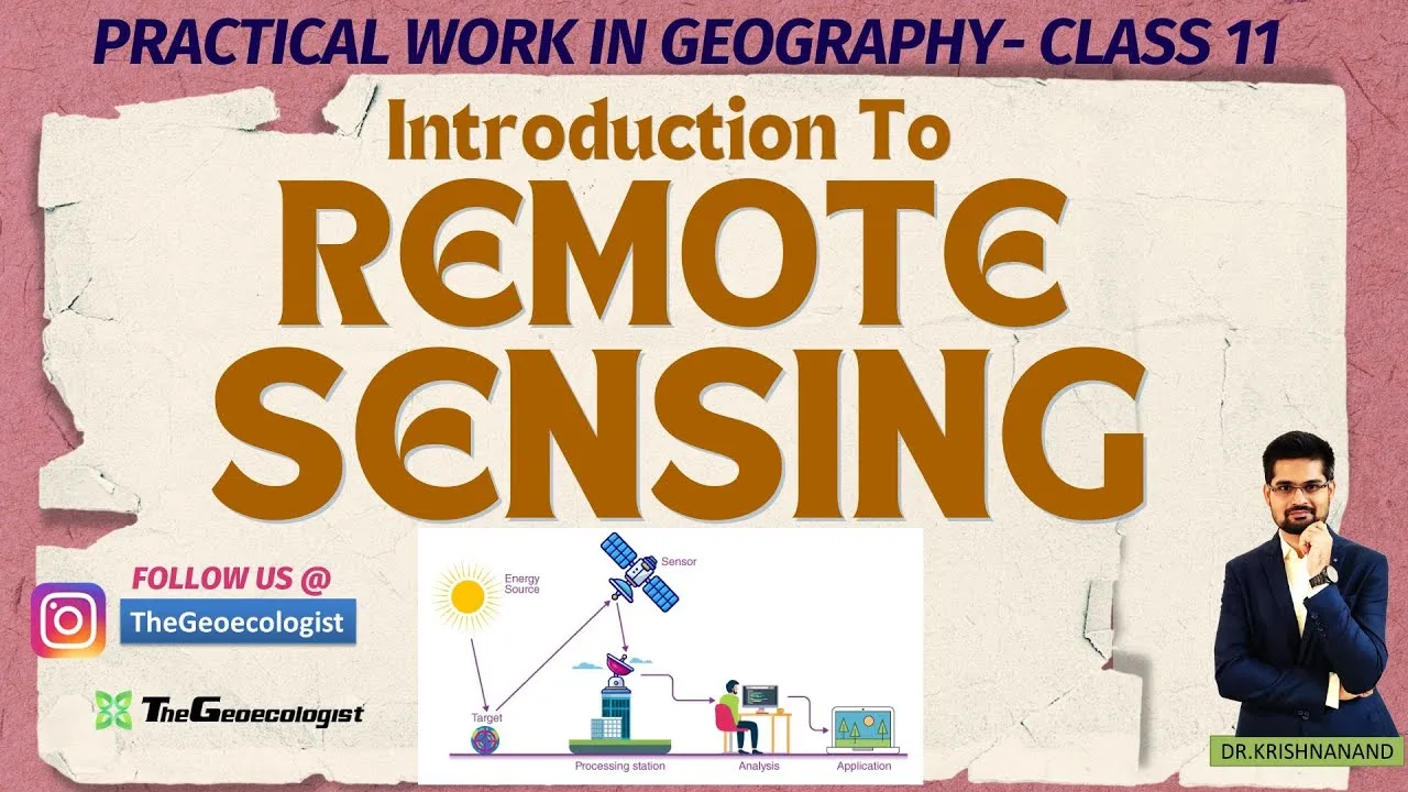
Table of Contents
Remote Sensing Basics are the foundation of modern geography, enabling us to observe the Earth’s surface from satellites, aircraft, and drones without physical contact. These techniques use electromagnetic energy to capture data that can be transformed into images and maps, providing insights into everything from deforestation to urban growth. For CBSE Class 11 students, mastering Remote Sensing Basics is essential when they tackle Chapter 7 of the NCERT Geography textbook, and it also serves as a cornerstone for competitive exams like CUET, UPSC, and UGC NET.
- Remote Sensing Basics empower geographers to monitor environmental changes.
- Understanding sensor types and resolutions is crucial for exam success.
- Practical image interpretation skills are tested in NCERT labs.
- Remote Sensing Basics open doors to careers in GIS, environmental science, and disaster management.
Understanding Remote Sensing Basics
The term Remote Sensing Basics refers to the entire suite of technologies that capture reflected or emitted radiation from the Earth’s surface. At its core, Remote Sensing Basics relies on two main energy sources: passive, which depends on natural sunlight, and active, which emits its own energy, such as radar or LiDAR. Both approaches are integral to Remote Sensing Basics, allowing scientists to study land cover, vegetation health, and even underground structures.
Core Components of Remote Sensing Basics
Remote Sensing Basics comprises four interlinked components: the energy source, the sensor and platform, data transmission, and interpretation. The energy source can be either the Sun (passive) or an onboard transmitter (active). Sensors—whether optical cameras, multispectral scanners, or synthetic aperture radar (SAR)—are mounted on platforms such as ISRO’s Resourcesat, NASA’s Landsat, or commercial drones. Raw data is then transmitted to ground stations where it is processed into images, indices, and maps. Finally, interpretation turns these images into actionable information, a skill that is heavily emphasized in the NCERT practical work for Remote Sensing Basics.
Passive vs. Active Remote Sensing Basics
In the realm of Remote Sensing Basics,ay the distinction between passive and active systems is fundamental. Passive Remote Sensing Basics captures reflected sunlight, making daylight and clear skies a prerequisite. In contrast,แจก active Remote Sensing Basics emits microwaves or laser pulses, enabling day‑night coverage and penetration through cloud cover. For example, the SAR payload on the Sentinel‑1 satellite is a classic illustration of active Remote Sensing Basics, providing data even during monsoon season.
While passive Remote Sensing Basics is ideal for studying vegetation, temperature, and water bodies, active Remote Sensing Basics excels in topographic mapping and flood monitoring. The combination of both approaches enrich Wil Remote Sensing Basics, offering a comprehensive view of the planet.
Real-World Applications of Remote Sensing Basics
Remote Sensing Basics are applied across diverse sectors. In agriculture, NDVI—a key index derived from Remote Sensing Basics imagery—helps farmers assess crop vigor and plan irrigation. Disaster management agencies use Remote Sensing Basics to map flood extents, track cyclone paths, and assess post‑hurricane damage. Conservationists rely on Remote Sensing Basics to detect illegal logging in the Western Ghats and to monitor glacier retreat in the Himalayas. Urban planners harness Remote Sensing Basics to map heat islands, plan green corridors, and assess land use changes.
The Indian Space Research Organisation (ISRO) launched the Resourcesat series in 2005, a flagship example of remote sensing basics satellites dedicated to monitoring agriculture, forestry, and water resources. Resourcesat’s multispectral data has been pivotal in recent studies on rice yield prediction, a topic frequently examined in NCERT’s practical exercises on Remote Sensing Basics.
Similarly, NASA’s Landsat program, which began in 1972, exemplifies the long‑term value of remote sensing basics for climate change studies. NASA Landsat provides free imagery that students can download for analysis.
Educational institutions use remote sensing basics imagery in classroom labs to teach students about land use change, spectral signatures, and spatial analysis. For a comprehensive overview, refer to the Remote Sensing Wikipedia article.
Preparing for Exams with Remote Sensing Basics
For CBSE Class 11 aspirants, a structured study plan is vital. Start by revisiting the NCERT Chapter 7, which outlines the fundamentals of remote sensing basics and includes a set of illustrative images. Next, practice interpreting satellite imagery using freely available datasets from NASA’s Earth Observing System and ISRO’s GloS portal. Finally, solve past CUET and UPSC questions that test your ability to calculate NDVI, identify land cover classes, and explain the advantages of passive versus active remote sensing basics.
Mastering remote sensing basics not only boosts your exam scores but also equips you with a skill set that is in high demand across environmental agencies, research institutions, and private firms. By integrating theory with hands‑on practice, students can transform remote sensing basics from a textbook concept into a powerful analytical tool.
Frequently Asked Questions
Remote Sensing Basics refers to the suite of technologies that capture electromagnetic energy from Earth's surface to generate images and data for analysis.
It helps students answer questions on technology, environmental monitoring, and disaster management in CBSE, CUET, UPSC, and UGC NET JRF.
Free datasets are available from NASA’s Landsat portal, ISRO’s GloBE, and the European Space Agency’s Sentinel Hub.