Blog
ISRO LULC Mapping: India’s New High-Resolution Milestone

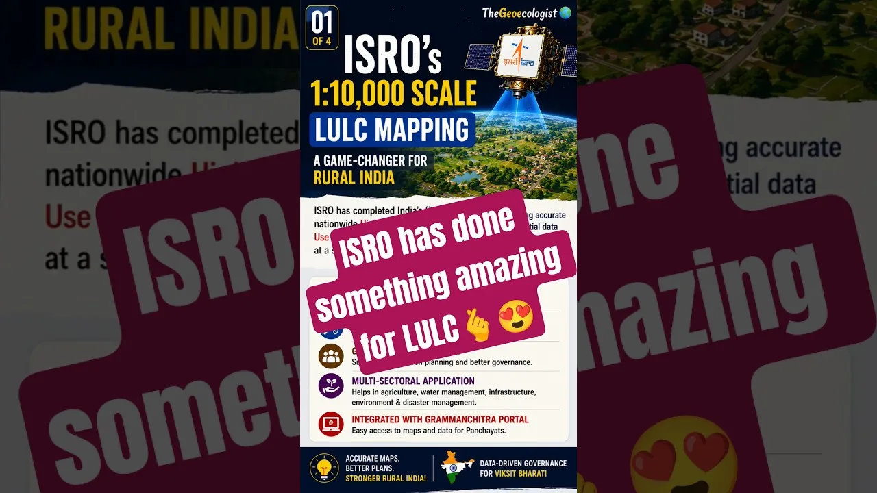
Table of Contents
- Introduction to ISRO LULC Mapping and India's Geospatial Revolution
- The Science Behind ISRO LULC Mapping
- Empowering Gram Panchayats through the Grammanchitra Portal
- Strategic Importance for Competitive Exams
- Technological Advancements in Geospatial Intelligence
- Applications in Urban and Rural Planning
- Future Prospects of Remote Sensing in India
- Conclusion
Introduction to ISRO LULC Mapping and India’s Geospatial Revolution
ISRO LULC mapping has reached a monumental milestone with the completion of India’s first nationwide High-Resolution Land Use & Land Cover mapping at a 1:10,000 scale. This groundbreaking achievement by the Indian Space Research Organisation (ISRO) represents a paradigm shift in how the nation understands its terrestrial landscape. By utilizing advanced satellite imagery and sophisticated geospatial algorithms, ISRO has provided a level of detail previously unavailable to administrative bodies. This precision ensures that every hectare of Indian land—from urban centers to remote rural villages—can be categorized with unprecedented accuracy.
- High-Resolution Data: Achieved at a 1:10,000 scale for granular accuracy.
- Grammanchitra Portal: A specialized platform to democratize geospatial data for local governance.
- Empowerment: Direct benefit to Gram Panchayats for localized planning.
- Scale Ratio: 1 cm on the map represents 100 meters on the ground.
- Key Applications: Agriculture, water management, and disaster mitigation.
The Science Behind ISRO LULC Mapping
Understanding ISRO LULC mapping requires a deep dive into Remote Sensing and Geographic Information Systems (GIS). Land Use (LU) refers to human activities on the land, such as agriculture, residential development, or industrial zones. Land Cover (LC) refers to the physical material on the Earth’s surface, such as forest, water, or bare soil. When ISRO performs this mapping, it integrates multi-spectral data from various satellite constellations to distinguish between these complex patterns.
This high-resolution approach is vital for modern governance. For instance, a 1:10,000 scale means that a single centimeter on a digital map corresponds to exactly 100 meters in the physical world. This level of detail allows planners to see individual field boundaries, small water bodies, and even narrow infrastructure corridors. This capability is essential for the Indian Space Research Organisation to support national development goals effectively.
Empowering Gram Panchayats through the Grammanchitra Portal
One of the most significant outcomes of the ISRO LULC mapping project is the launch of the Grammanchitra Portal. Traditionally, high-quality geospatial data was the domain of central agencies. However, the new mapping initiative brings this power directly to the grassroots level. Through this portal, Gram Panchayats can access precise data to drive local development.
With accurate ISRO LULC mapping, rural leaders can make data-driven decisions regarding:
- Agriculture: Optimizing crop patterns and identifying areas needing irrigation.
- Water Resource Management: Mapping seasonal ponds and groundwater recharge zones.
- Infrastructure Development: Planning roads, schools, and health centers based on population density and land availability.
- Disaster Management: Identifying flood-prone zones or landslide-susceptible areas to mitigate risks.
Strategic Importance for Competitive Exams
For aspirants preparing for competitive examinations like UGC NET Geography, UPSC, or State PCS, understanding the nuances of ISRO LULC mapping is critical. This topic intersects several core syllabus areas, including Remote Sensing, GIS, and Contemporary Indian Geography. Students must be able to explain the significance of the scale (1:10,000) and the socio-economic impact of the Grammanchitra Portal.
In the context of Geography, the ability to differentiate between land use and land cover is a fundamental concept. ISRO’s ability to automate this at a national scale using AI and machine learning is a recurring theme in current affairs sections of various civil services exams. Mastering the technical details of this mapping ensures a competitive edge in exams focusing on spatial technology.
Technological Advancements in Geospatial Intelligence
The success of ISRO LULC mapping is built upon decades of satellite technology evolution. From the early eras of IRS (Indian Remote Sensing) satellites to the modern high-resolution sensors, ISRO has consistently pushed the boundaries of what is possible from space. The integration of automated feature extraction ensures that the maps are updated frequently, reflecting the rapid pace of urbanization and land-use change in India.
The precision of this ISRO LULC mapping helps in combating illegal land encroachment and managing the increasing pressure on forest lands. As urban sprawl continues to expand, having a high-resolution baseline allows the government to monitor environmental degradation in real-time. This data-driven approach is a cornerstone of the ‘Digital India’ initiative, ensuring that technology serves the most vulnerable sections of society.
Applications in Urban and Rural Planning
While much of the focus is on rural development, ISRO LULC mapping is equally vital for urban planning. As Indian cities grow, the pressure on infrastructure, sanitation, and transport becomes immense. High-resolution maps allow urban planners to simulate different growth scenarios, ensuring that development is sustainable and does not come at the cost of ecological balance.
In rural settings, the mapping helps in identifying the exact extent of agricultural land available for specific crops. This prevents the mismanagement of resources and allows for better implementation of schemes like PM-KISAN. The granular detail provided by ISRO LULC mapping ensures that no village is left behind in the digital transformation of India’s administrative landscape.
Future Prospects of Remote Sensing in India
Looking forward, the integration of ISRO LULC mapping with real-time IoT (Internet of Things) sensors and drone technology could create a ‘Digital Twin’ of India. This would allow for predictive modeling of climate change impacts on local ecosystems. The ability to visualize land changes over time through temporal analysis is one of the most powerful tools provided by this new mapping initiative.
As we move toward more advanced satellite constellations, the resolution of ISRO LULC mapping is expected to improve even further. This will provide even more granular insights, perhaps down to the meter level, enabling even more precise management of urban and rural resources. The roadmap set by ISRO ensures that India remains a global leader in space-based geospatial applications.
Conclusion
In conclusion, the completion of the nationwide 1:10,000 scale ISRO LULC mapping is a landmark achievement for the nation. It bridges the gap between advanced space technology and grassroots governance through the Grammanchitra Portal. Whether you are a policymaker, a student preparing for exams, or a local administrator, the data provided by ISRO will be the bedrock of sustainable development in India for years to come. The era of precision governance has officially arrived, driven by the vision of ISRO.
Frequently Asked Questions
The new nationwide High-Resolution Land Use & Land Cover mapping is completed at a 1:10,000 scale.
It empowers Gram Panchayats by providing accurate geospatial data for rural planning, agriculture, and disaster management.
It means that 1 cm on the map represents 100 meters on the actual ground.