Blog
Himalayan Geological Formations: A Comprehensive Guide

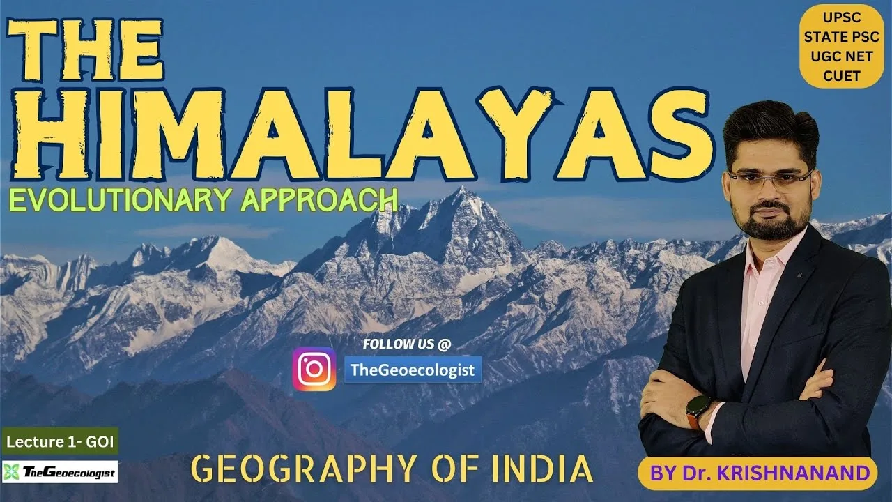
Table of Contents
- The Evolution of Himalayan Geological Formations
- 1. The Eocene Phase (50–30 Million Years Ago)
- 2. The Miocene Phase (25–5 Million Years Ago)
- 3. The Pleistocene Phase (2 Million Years Ago to Present)
- Major Zonation of the Himalayas
- The Trans-Himalayas (Tibetan Himalayas)
- The Greater Himalayas (Himadri)
- The Lesser Himalayas (Himachal)
- The Shiwaliks (Outer Himalayas)
- Spatial Distribution Across Nations and States
- Key Features and Global Significance
- Glaciers and River Systems
- Biodiversity Hotspot
- Climate Regulation and Economic Impact
- Why This Matters for UPSC Aspirants
- Conclusion
Understanding the Himalayan geological formations is essential for any student of geography, particularly for those preparing for the UPSC Civil Services Examination. Often referred to as the ‘Abode of Snow,’ this majestic mountain range is not merely a physical barrier but a dynamic tectonic marvel that shapes the subcontinent’s climate, ecology, and economy. Himalayan geological formations provides a deep dive into the tectonic evolution, structural zonation, and spatial distribution of these mountains, based on expert insights from Dr. Krishnanand of thegeoecologist.
- Tectonic Origins: The collision between the Indian and Eurasian plates.
- Phased Uplift: Evolution through the Eocene, Miocene, and Pleistocene eras.
- Structural Zonation: From the Trans-Himalayas to the Shiwalik foothills.
- Climatic Significance: Role in monsoon regulation and weather patterns.
- Strategic Importance: Geopolitical and ecological value to South Asian nations.
The Evolution of Himalayan Geological Formations
The existence of the Himalayan geological formations is a direct consequence of massive tectonic movements. Approximately 50 million years ago, the Indian Plate began a relentless northward journey, eventually colliding with the Eurasian Plate. This collision, a primary component of the Alpine-Himalayan orogenic belt, did not occur instantaneously but through several distinct geological phases.
1. The Eocene Phase (50–30 Million Years Ago)
During the Eocene epoch, the initial contact between the Indian and Eurasian plates occurred. This period was characterized by the closure of the ancient Tethys Sea. The sedimentary deposits from the Tethys Ocean were compressed, leading to the formation of the Tethys Himalayas, which now constitute the Trans-Himalayan Tibetan Plateau. This phase laid the foundational bedrock for the entire mountain system.
2. The Miocene Phase (25–5 Million Years Ago)
As the collision intensified, the Miocene phase saw significant folding and faulting. This era was responsible for the creation of the Greater Himalayas, also known as the Himadri. This is the core zone where the world’s highest peaks, including Mount Everest and Kanchenjunga, were thrust upward. The intense pressure during this phase transformed sedimentary rocks into metamorphic rocks, creating the rugged, high-altitude terrain we see today.
3. The Pleistocene Phase (2 Million Years Ago to Present)
The most recent phase of uplift is the Pleistocene epoch. This period witnessed the rapid rise of the Lesser Himalayas (Himachal) and the outermost foothills known as the Shiwaliks. Unlike the older, more stable core, these newer Himalayan geological formations are characterized by ongoing seismic activity. The tectonic stress remains high, making this region highly prone to earthquakes, landslides, and rapid erosion.
Major Zonation of the Himalayas

To simplify the study of such a complex system, geographers divide the mountains into four distinct longitudinal zones. Each zone possesses unique characteristics regarding altitude, vegetation, and rock composition.
The Trans-Himalayas (Tibetan Himalayas)
The northernmost segment, the Trans-Himalayas, acts as a buffer between the main range and the Tibetan Plateau. This region is composed of ancient granitic and metamorphic rocks. Himalayan geological formations includes the Karakoram and Ladakh ranges. Due to its rain-shadow position, it is significantly more arid than the southern slopes.
The Greater Himalayas (Himadri)
The Himadri is the heart of the entire mountain system. Himalayan geological formations consists of high, snow-capped peaks and massive glaciers, such as the Gangotri Glacier. This zone serves as a critical climatic barrier, preventing cold Central Asian winds from entering the Indian subcontinent and forcing the monsoon winds to rise, resulting in heavy rainfall.
The Lesser Himalayas (Himachal)
Located south of the Himadri, the Himachal range is known for its diverse topography. It features lush, green valleys like the Kashmir Valley and the Kullu Valley. This zone is a major hub for tourism and contains numerous hill stations, offering a temperate climate compared to the freezing heights of the Himadri.
The Shiwaliks (Outer Himalayas)
The Shiwaliks are the youngest and lowest-altitude ranges. Composed primarily of loose sediments, sand, and gravel brought down by rivers, these foothills are highly susceptible to landslides. They represent the outermost fringe of the mountain system.
Spatial Distribution Across Nations and States
The Himalayan geological formations extend across a massive distance of approximately 2,400 km. They are not confined to a single country but span across India, Nepal, Bhutan, China (Tibet), and Pakistan. This trans-border nature makes the region a subject of significant geopolitical interest.
In the Indian context, the distribution is as follows:
- Jammu & Kashmir and Ladakh: Home to the Karakoram and Pir Panjal ranges.
- Himachal Pradesh and Uttarakhand: Notable for high-altitude peaks and religious pilgrimage sites.
- Sikkim and Arunachal Pradesh: Features the massive Kanchenjunga and strategic passes like Nathu La.
- Purvanchal Hills: These extend eastward into Nagaland and Myanmar, characterized by dense, tropical forests.
Key Features and Global Significance
The importance of these Himalayan geological formations cannot be overstated. They serve multiple roles that are vital for the survival of millions of people.
Glaciers and River Systems
The Himalayas are the source of major perennial river systems including the Ganges, the Indus, and the Brahmaputra. These rivers are the lifeblood of South Asian agriculture. The presence of massive glaciers ensures a steady supply of water, even during the dry seasons.
Biodiversity Hotspot
The region is a global biodiversity hotspot. The varied altitudes create diverse microclimates, supporting species ranging from the elusive snow leopard to various endemic flora. This ecological richness is a key focus for conservationists worldwide.
Climate Regulation and Economic Impact
By acting as a physical barrier, the mountains regulate the Indian Monsoon, which is the backbone of India’s agrarian economy. Additionally, the steep gradients provide immense hydropower potential, which is essential for the nation’s energy security. Furthermore, the region is a cornerstone of the tourism industry, attracting millions of visitors annually.
Why This Matters for UPSC Aspirants
For candidates preparing for the UPSC Civil Services Exam, the Himalayan geological formations represent an interdisciplinary topic. It touches upon Physical Geography (geology and tectonics), Climate (monsoon patterns), Ecology (biodiversity), and International Relations (border disputes and strategic passes). Understanding the phased uplift and the zonation of the mountains is critical for answering both Prelims (factual/conceptual) and Mains (analytical/descriptive) questions.
To master these topics, students should refer to authoritative texts and expert-led lectures, such as those provided by thegeoecologist, which bridge the gap between textbook theory and competitive exam requirements.
Conclusion
In summary, the Himalayan geological formations are a testament to the Earth’s dynamic nature. From the ancient collision of tectonic plates to the modern-day seismic activity in the Shiwaliks, these mountains are constantly evolving. For any student of geography or competitive exam aspirant, a thorough grasp of their geological history, structural zonation, and vast distribution is indispensable. The Himalayas are more than just mountains; they are the heartbeat of the Indian subcontinent’s ecological and climatic identity.
Frequently Asked Questions
The Himalayas were formed by the tectonic collision between the Indian Plate and the Eurasian Plate approximately 50 million years ago, part of the Alpine-Himalayan orogenic belt.
The four zones are the Trans-Himalayas, the Greater Himalayas (Himadri), the Lesser Himalayas (Himachal), and the Shiwaliks (Outer Himalayas).
The Shiwaliks are the youngest part of the mountain range and are composed of loose sediments, sand, and gravel, making them unstable and prone to landslides.