Blog
Peninsular Plateau: Comprehensive Guide for UPSC Aspirants

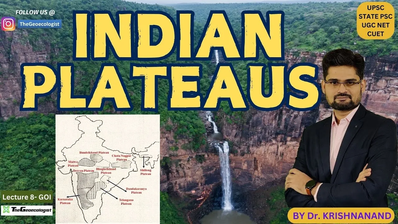
Table of Contents
- Peninsular Plateau: Geological Evolution and Boundaries
- Major Subdivisions of the Peninsular Plateau
- Deccan Plateau
- Chotanagpur Plateau
- Malwa Plateau
- Key Mountain Ranges and River Systems
- Vindhya Range
- Satpura Range
- Economic and Agricultural Significance
- Agricultural Productivity
- Mineral Wealth and Industries
- Ecological Diversity and Conservation
- Forests and Wildlife
- Environmental Challenges
- Why the Peninsular Plateau Matters for UPSC
- Geography Optional and General Studies
- Economic Geography
- Environment and Ecology
- Key Takeaways for Aspirants
Peninsular Plateau is one of the oldest and most significant geological formations in India, forming the backbone of the country’s physical landscape. This vast tableland, shaped over hundreds of millions of years, dominates the southern and central parts of the subcontinent and serves as a critical study area for UPSC geography aspirants. Understanding its origin, subdivisions, mineral wealth, river systems, and ecological importance is essential for both Prelims and Mains examinations.
- The Peninsular Plateau covers approximately 1.6 million square kilometres.
- It is subdivided into the Deccan Plateau, Chotanagpur Plateau, and Malwa Plateau.
- The region hosts about 90% of India’s mineral reserves, including coal, iron ore, manganese, and bauxite.
- Major rivers such as the Godavari, Krishna, Cauvery, Narmada, and Tapti originate here.
- The plateau’s black soil (regur) supports cotton, pulses, and oilseed cultivation.
Peninsular Plateau: Geological Evolution and Boundaries
The Peninsular Plateau was forged during the Precambrian era, making it one of the Earth’s oldest crustal blocks. Its formation involved multiple cycles of uplift, erosion, and volcanic activity, notably the Deccan Traps lava flows that occurred around 66 million years ago. The plateau is bounded by the Aravalli Range to the northwest, the Vindhya-Satpura ranges to the north, and the Eastern and Western Ghats to the east and west, creating a distinct geographical entity that separates North India from South India.
For a deeper dive into the volcanic origins, refer to the detailed explanation on Deccan Traps.
Major Subdivisions of the Peninsular Plateau
The Peninsular Plateau is broadly divided into three physiographic regions, each with unique geological, economic, and cultural characteristics.
Deccan Plateau
The Deccan Plateau constitutes the largest portion, covering Maharashtra, Karnataka, Telangana, Andhra Pradesh, and parts of Tamil Nadu and Kerala. Formed primarily by basaltic lava flows, it is renowned for its fertile black cotton soil (regur), which is ideal for cultivating cotton, sugarcane, and pulses. The plateau is drained by major east-flowing rivers such as the Godavari, Krishna, and Cauvery, which have created extensive deltas and supported ancient civilizations.
Chotanagpur Plateau
Located across Jharkhand, Odisha, West Bengal, and Chhattisgarh, the Chotanagpur Plateau is often termed India’s “mineral heartland.” It contains vast reserves of coal in the Damodar Valley, iron ore in Singhbhum, mica in Koderma, and copper in Ghatsila. This region fuels a significant portion of the nation’s steel, power, and heavy industries. The The Hindu highlights how the plateau’s mineral wealth continues to drive India’s economic development.
Malwa Plateau
The Malwa Plateau stretches across Madhya Pradesh and southeastern Rajasthan. Characterized by a semi-arid climate, it features extensive ravines and badlands formed by the Chambal, Betwa, and Son rivers. The region’s black soil patches support soybean and wheat cultivation, while its historical significance is evident in the numerous forts and temples dotting the landscape.
Key Mountain Ranges and River Systems

The Peninsular Plateau’s topography is further defined by two prominent hill ranges that act as climatic and drainage divides.
Vindhya Range
Extending from Gujarat in the west to Bihar in the east, the Vindhya Range forms a rough northern boundary of the plateau. Though not exceptionally high, it influences monsoon patterns and separates the Ganges basin from the Deccan watershed.
Satpura Range
Running parallel to the Vindhyas, the Satpura Range hosts the plateau’s highest peak, Dhupgarh (1,350 metres) in Pachmarhi, Madhya Pradesh. The range is crucial for watershed management, as it gives rise to the Narmada and Tapti rivers, which flow westward into the Arabian Sea, creating a rare west-flowing river system in peninsular India.
Economic and Agricultural Significance
The Peninsular Plateau contributes immensely to India’s agrarian and industrial economy.
Agricultural Productivity
The expansive tracts of black soil in the Deccan and Malwa regions are perfect for cotton cultivation, earning the area the nickname “Cotton Belt.” Besides cotton, the plateau supports pulses like tur and urd, oilseeds such as groundnut and soybean, and horticultural crops including citrus and grapes. In the well-irrigated river valleys of the Godavari, Krishna, and Cauvery, rice and sugarcane thrive, contributing significantly to national food security.
Mineral Wealth and Industries
As highlighted earlier, the Chotanagpur Plateau alone accounts for a major share of India’s coal and iron ore output, feeding steel plants in Bokaro, Rourkela, and Durgapur. The region also produces manganese, bauxite, limestone, and dolomite, supporting cement, aluminium, and chemical industries. The presence of these resources has led to the growth of major industrial corridors such as the Damodar Valley Corporation (DVC) belt.
Ecological Diversity and Conservation
The Peninsular Plateau is not merely an economic asset; it is a hotspot of biodiversity.
Forests and Wildlife
The Eastern Ghats, though discontinuous, harbour tropical deciduous and evergreen forests that shelter tigers, leopards, elephants, and numerous avian species. The Satpura-Maikal landscape is part of the Central Indian tiger landscape, hosting several tiger reserves like Kanha, Pench, and Satpura. Conservation efforts in these areas focus on mitigating human-wildlife conflict, preventing poaching, and preserving corridor connectivity.
Environmental Challenges
Despite its riches, the plateau faces environmental stresses. Deforestation for mining, unsustainable agricultural practices, and river pollution threaten its ecological balance. Soil erosion, particularly in the ravine-prone Malwa region, reduces agricultural productivity. UPSC frequently examines issues such as sustainable mining practices, watershed management, and the impact of industrial effluents on river systems like the Damodar and Subarnarekha.
Why the Peninsular Plateau Matters for UPSC
From a UPSC perspective, the Peninsular Plateau is a recurring theme across multiple subjects.
Geography Optional and General Studies
Topics such as the formation of the Deccan Traps, Gondwana rock systems, laterite soils, and the drainage patterns of peninsular rivers are staples in both Prelims and Mains. Questions often ask about the economic significance of specific mineral belts or the ecological importance of the Eastern and Western Ghats.
Economic Geography
The distribution of coal, iron ore, manganese, and bauxite; the location of major industrial centres; and the role of river valley projects are key areas for economic geography. Understanding the plateau’s contribution to India’s GDP helps aspirants tackle questions on regional development and resource-based industries.
Environment and Ecology
Contemporary issues like land degradation, desertification threats in the semi-arid zones, and the impact of climate change on monsoon-dependent agriculture are frequently tested. Aspirants must be familiar with government initiatives such as the National Mineral Policy, the Watershed Development Programme, and Project Tiger as they relate to the plateau’s conservation.
Key Takeaways for Aspirants
- The Peninsular Plateau is a Precambrian landmass, rich in volcanic and metamorphic rocks.
- Its three main subdivisions—Deccan, Chotanagpur, and Malwa—each have distinct geological and economic profiles.
- The region holds approximately 90% of India’s mineral reserves, making it vital for industrial growth.
- Black soil (regur) supports cotton and oilseed cultivation, while river valleys enable rice and sugarcane farming.
- The Vindhya and Satpura ranges, along with the Narmada and Tapti rivers, form a crucial watershed divide.
- Ecologically, the plateau hosts significant forest cover and wildlife, necessitating balanced conservation and development strategies.
For comprehensive video lectures, downloadable notes, and interactive quizzes on the Peninsular Plateau and other UPSC geography topics, visit TheGeoecologist. Our expert-curated content simplifies complex concepts, ensuring you are well-prepared for the UPSC examination.
Frequently Asked Questions
The Peninsular Plateau is a vast, ancient landmass covering central and southern India, rich in minerals, black soil, and river systems. It is important for UPSC because it forms a major part of the geography syllabus, covering geological formations, economic resources, and environmental issues frequently asked in Prelims and Mains.
The three main subdivisions are the Deccan Plateau, the Chotanagpur Plateau (also called Ranchi Plateau), and the Malwa Plateau. Each differs in geology, mineral wealth, climate, and agricultural patterns.
The Peninsular Plateau hosts about 90% of India's mineral reserves, including coal, iron ore, manganese, bauxite, and limestone. The Chotanagpur Plateau alone is a major source of coal and iron ore, supporting steel, power, and heavy industries across the country.