Blog
GIS Disaster Management: Complete Guide for UGC NET & CUET-PG Aspirants

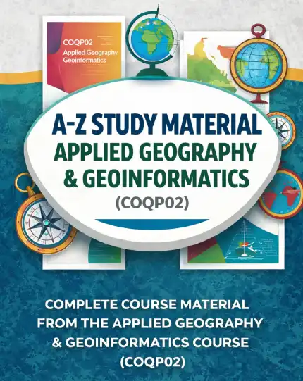
Geography students aiming for UGC NET, CUET‑PG, SET, or postgraduate admissions often encounter the challenge of mastering specialized topics that blend theory with real‑world application. One such high‑weightage area is GIS Disaster Management, which examines how geographic information systems support risk assessment, emergency response, and resilience planning. Because the subject draws from both core geography concepts and emerging geoinformatics tools, learners frequently struggle to find a single, coherent resource that covers the syllabus exhaustively while remaining exam‑focused. This article walks you through the problem of fragmented study material, shows how to evaluate potential solutions, explains why the A-Z Study Material- Applied Geography & Geoinformatics (COQPO2) aligns perfectly with the needs of GIS Disaster Management preparation, and offers practical usage and buying guidance.
- Understand why GIS Disaster Management is a pivotal topic for competitive geography exams.
- Learn the core syllabus components covered under COQP02 for this subject.
- Discover criteria for evaluating study resources effectively.
- See how the A-Z Study Material- Applied Geography & Geoinformatics (COQPO2) meets those criteria.
- Get actionable tips for integrating the material into your study routine.
- Receive clear buying guidance to make an informed purchase decision.
Understanding the Role of GIS in Disaster Management and Risk Reduction
Geographic Information Systems (GIS) have transformed disaster management by enabling authorities to visualize hazards, model exposure, and allocate resources efficiently. In the context of GIS Disaster Management, students learn to apply spatial analysis techniques such as overlay analysis, network modeling, and vulnerability mapping to scenarios like floods, earthquakes, landslides, and industrial accidents. The ability to generate timely, location‑specific insights directly supports preparedness, response, and recovery phases of the disaster management cycle. Authoritative sources such as the United Nations Office for Disaster Risk Reduction (UNDRR) emphasize that GIS‑based risk assessments reduce economic losses by up to 30 % when integrated into national planning frameworks (UNDRR). For exam aspirants, grasping these applications is essential because questions often require interpreting case studies, suggesting mitigation strategies, or evaluating the suitability of specific GIS tools for a given hazard.
Why GIS Disaster Management Matters for Geography Aspirants
Competitive exams like UGC NET and CUET‑PG allocate significant marks to applied geography papers, with COQP02 frequently featuring 20‑25 % of the total score. Within this paper, GIS Disaster Management appears as a recurring theme because it bridges theoretical geography (e.g., geomorphology, climatology) with practical technology (e.g., remote sensing, spatial databases). Mastery of this topic not only boosts scores but also equips students with skills valuable for research projects, internships, and careers in urban planning, environmental consultancy, and governmental disaster agencies. Moreover, the interdisciplinary nature of GIS Disaster Management means that a solid foundation aids performance in related sections such as environmental management, climate change studies, and resource geography, creating a synergistic effect across the entire syllabus.
Core Components of GIS Disaster Management Syllabus (COQP02)
The COQP02 syllabus for GIS Disaster Management is structured to progress from foundational concepts to advanced applications. Key components include:
- Fundamentals of GIS: data models, coordinate systems, and spatial data acquisition.
- Disaster risk assessment: hazard identification, vulnerability analysis, and capacity evaluation.
- Spatial modeling techniques: suitability analysis, evacuation route modeling, and shelter location optimization.
- Remote sensing integration: use of satellite imagery for pre‑disaster mapping and post‑disaster damage assessment.
- Geospatial web technologies: GIS portals, mobile data collection, and real‑time dashboards for emergency response.
- Policy and governance: role of GIS in national disaster management plans, SDG alignment, and international frameworks like the Sendai Framework.
- Case studies: analysis of recent events such as the 2015 Nepal earthquake, 2020 Kerala floods, and 2022 Pakistan floods.
Each of these units demands both conceptual clarity and the ability to interpret spatial outputs, making a well‑organized study guide indispensable.
How to Evaluate Study Resources for GIS Disaster Management
When selecting a preparation tool for GIS Disaster Management, consider the following criteria:
- Syllabus Alignment: The material must map explicitly to the COQP02 units listed above, avoiding extraneous content that dilutes focus.
- Exam‑Oriented Explanations: Definitions should be concise, with emphasis on frequently asked question patterns, diagram‑based queries, and application‑based caselets.
- Conceptual Progression: Topics should flow from basic GIS theory to advanced disaster modeling, mirroring the way examiners build difficulty.
- Visual Aids: Inclusion of maps, flowcharts, and annotated screenshots enhances understanding of spatial processes.
- Practice Integration: End‑of‑chapter questions, previous year paper extracts, and quick‑recap boxes support active recall.
- Currency: References to recent disasters and updated GIS software (e.g., QGIS, ArcGIS Pro) ensure relevance.
Resources that fail on any of these points often leave gaps that require supplementary searching, increasing study time and reducing confidence.
Why the A-Z Study Material- Applied Geography & Geoinformatics (COQPO2) Is the Right Fit
The A-Z Study Material- Applied Geography & Geoinformatics (COQPO2) is purpose‑built to satisfy the evaluation criteria outlined above. First, its table of contents mirrors the COQP02 syllabus verbatim, with dedicated sections for GIS Disaster Management that cover fundamentals, risk assessment, spatial modeling, remote sensing integration, and case studies. Second, explanations are crafted for exam success: each concept is presented in a bullet‑friendly format, followed by a “Exam Focus” highlight that points out typical question trends from UGC NET and CUET‑PG papers. Third, the material progresses logically—from GIS data types and coordinate systems to advanced modeling techniques such as multicriteria decision analysis for shelter placement—ensuring that learners never feel a sudden jump in difficulty. Fourth, the guide includes numerous annotated maps, schematic diagrams, and screenshots of GIS workflows, which help translate abstract ideas into concrete visual understanding. Fifth, after every major unit, there are practice questions drawn from previous year papers, along with answer keys that explain the reasoning behind each option. Finally, the content is updated to reflect recent disasters (e.g., 2023 Turkey‑Syria earthquake) and references open‑source GIS platforms, keeping the material aligned with contemporary practice. Because the product addresses all these dimensions, it eliminates the need to juggle multiple textbooks, lecture notes, and scattered online PDFs, offering a single, comprehensive solution for GIS Disaster Management preparation.
Practical Tips for Using the Study Material Effectively
To maximize the benefit of the A-Z Study Material- Applied Geography & Geoinformatics (COQPO2) for GIS Disaster Management, adopt the following study routine:
- Begin with a quick diagnostic: skim the syllabus outline in the guide and mark topics you feel less confident about.
- Allocate dedicated blocks (e.g., 90‑minute sessions) to each major unit, following the sequence presented in the material.
- While reading, create your own mini‑maps or flowcharts on paper or a digital canvas; this active reproduction reinforces spatial reasoning.
- After completing a unit, immediately attempt the associated practice questions without looking at the answers, then review explanations to identify misconceptions.
- Use the “Exam Focus” boxes to formulate flashcards for definitions, acronyms (e.g., DEM, LiDAR, GIS‑DSS), and key case‑study facts.
- Every two weeks, take a timed mock test covering all GIS Disaster Management sections to build stamina and improve speed.
- Supplement your learning with free online GIS tutorials (e.g., QGIS training modules) to practice the software steps described in the guide.
By integrating active recall, visual practice, and regular self‑testing, you transform the study material from a passive reading resource into a dynamic skill‑building tool.
Buying Guidance and Final Recommendations
When considering the purchase of the A-Z Study Material- Applied Geography & Geoinformatics (COQPO2), verify that you are accessing the latest edition through the official seller’s website to ensure content accuracy and access to any supplemental digital updates. The price point of ₹1,650 reflects the consolidation of what would otherwise require multiple textbooks, reference guides, and subscription‑based databases. Given the breadth of coverage, the exam‑oriented structure, and the inclusion of practice material specifically tailored to GIS Disaster Management under COQP02, the product offers strong value for serious aspirants. Avoid relying solely on generic geography guides or outdated GIS manuals, as they often lack the specific focus on disaster risk reduction that examiners prioritize. Instead, choose a resource that explicitly states its alignment with COQP02 and provides clear evidence of exam‑relevant content—qualities that this study material demonstrates consistently.
In summary, mastering GIS Disaster Management is not only essential for scoring well in UGC NET, CUET‑PG, and SET exams but also for building a foundation applicable to real‑world geographical practice. The A-Z Study Material- Applied Geography & Geoinformatics (COQPO2) delivers a syllabus‑aligned, visually rich, and practice‑driven solution that simplifies preparation and boosts confidence. By following the outlined study strategy and securing the guide from a reputable source, you position yourself to excel in this critical subject area and move closer to your academic and career goals.
Our Recommendation
📖 Part of our complete guide: Assistant Professor Geography Exam: Ultimate Preparation Guide
Frequently Asked Questions
What makes the A-Z Study Material- Applied Geography & Geoinformatics (COQPO2) suitable for GIS Disaster Management preparation?
It aligns directly with the COQP02 syllabus, offers exam‑focused explanations, includes visual aids and practice questions, and covers all core GIS Disaster Management units from fundamentals to recent case studies.
How many times should I review the GIS Disaster Management section to retain the information effectively?
Aim for at least three review cycles: initial reading with note‑making, a second round practicing end‑of‑chapter questions, and a third timed mock test before the exam to reinforce recall and application.
Are there any free external resources recommended to complement this study material for GIS Disaster Management?
Yes, the United Nations Office for Disaster Risk Reduction (UNDRR) website provides global reports and frameworks, while QGIS offers free tutorials that let you practice the spatial analysis techniques described in the guide.