Blog
Urban Regional Planning Spatial Analysis: A Complete Study Guide for Geography Professionals

What Is Urban Regional Planning Spatial Analysis?
Urban Regional Planning Spatial Analysis refers to the systematic examination of spatial data, land-use patterns, and geographic distributions within urban and regional contexts. It combines geographic theory with quantitative and qualitative methods to evaluate how cities and regions develop, expand, and function over time. According to the United Nations, over 68% of the world’s population is projected to live in urban areas by 2050, making spatial analysis an indispensable skill for planners, geographers, and policymakers.
If you are preparing for competitive exams like UGC NET, CUET-PG, or State SET, understanding Urban Regional Planning Spatial Analysis is not optional — it is a core competency tested across geography syllabi, particularly under papers like COQP02 (Applied Geography & Geoinformatics). This article walks you through the essentials, evaluation criteria, and the best resource available for mastering this subject.
- Key Takeaway: Urban Regional Planning Spatial Analysis integrates geographic theory, geoinformatics tools, and quantitative methods to solve real-world planning problems.
- Key Takeaway: Mastery requires structured study material that covers the complete COQP02 syllabus from basic to advanced levels.
- Key Takeaway: Exam-oriented resources with interlinked concepts and application-based learning outperform scattered notes for competitive exam preparation.
- Key Takeaway: The A-Z Study Material for Applied Geography & Geoinformatics (COQP02) provides consolidated, syllabus-aligned coverage designed specifically for UGC NET, CUET-PG, and SET aspirants.
Why Spatial Analysis Matters for Urban and Regional Planners
Spatial analysis is the backbone of modern urban and regional planning. It enables planners to identify land-use conflicts, optimize transportation networks, assess environmental vulnerabilities, and model demographic shifts. Tools such as Geographic Information Systems (GIS), remote sensing, and spatial statistics transform raw geographic data into actionable intelligence.
The importance of Urban Regional Planning Spatial Analysis extends across several critical domains:
- Urban and Regional Planning: Zoning, land-use allocation, and infrastructure development rely heavily on spatial data interpretation.
- Environmental Management: Monitoring deforestation, pollution spread, and watershed health requires spatial modeling.
- Disaster Risk Reduction: Flood mapping, earthquake vulnerability assessment, and evacuation routing are all spatial analysis tasks.
- Resource Management: Optimal allocation of water, energy, and agricultural land depends on spatial distribution analysis.
- Climate and Sustainability Studies: Tracking urban heat islands, carbon sequestration patterns, and climate adaptation strategies demands geospatial expertise.
For students preparing under the COQP02 syllabus, these applications are not abstract concepts — they are exam topics that require both theoretical understanding and practical application skills. According to the UGC NET Geography paper pattern, applied geography and geoinformatics together account for a significant portion of Paper II marks, making focused preparation essential.
How to Evaluate the Right Study Material for Spatial Analysis
Choosing the right study material can make or break your exam preparation. With countless books, notes, and online resources available, how do you identify what actually works? Here are the evaluation criteria that matter:
- Syllabus Alignment: The material must strictly follow the COQP02 syllabus without digressing into unrelated topics. Every chapter, subtopic, and learning objective should map directly to the prescribed curriculum.
- Conceptual Progression: Effective resources move from foundational concepts to advanced applications. A study material that jumps to complex spatial statistics without building basics will confuse learners.
- Exam Orientation: Past paper patterns, frequently asked questions, and marking trends should inform the content structure. The best study material anticipates what examiners will test.
- Interlinked Concepts: Urban Regional Planning Spatial Analysis is not an isolated topic — it connects with geoinformatics, cartography, remote sensing, and quantitative methods. The resource should highlight these interlinkages.
- Simplified Complex Topics: Geospatial topics like spatial interpolation, kernel density estimation, and network analysis can be intimidating. The material should break these down into digestible explanations.
Most students end up buying three or four different books and still feel unprepared. The reason is simple: scattered resources lack coherence. A consolidated, exam-oriented approach eliminates redundancy and fills gaps systematically.
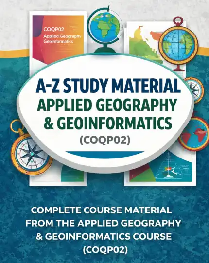
A-Z Study Material: Applied Geography & Geoinformatics (COQP02)
The A-Z Study Material for Applied Geography & Geoinformatics (COQP02) is a comprehensive, consolidated resource designed specifically for UGC NET, CUET-PG, State SET, PhD entrance exams, and postgraduate geography students. Unlike generic geography books, this study material is built strictly from the COQP02 syllabus, ensuring that every page you read directly contributes to your exam readiness.
What sets this resource apart is its structured A-to-Z arrangement. Content progresses logically from foundational concepts to advanced applications, ensuring smooth learning without abrupt jumps in complexity. The material covers:
- Complete Applied Geography concepts aligned with COQP02
- Comprehensive Geoinformatics theory including GIS, remote sensing, and spatial databases
- Exam-oriented explanations that mirror the UGC NET and CUET-PG question patterns
- Structured notes ranging from basic definitions to advanced analytical frameworks
- Interlinked concepts that connect urban planning, spatial analysis, and geoinformatics
- Simplified explanations for complex geospatial topics that typically confuse students
This eliminates the need for multiple books, scattered notes, and unreliable online resources. For students struggling with Urban Regional Planning Spatial Analysis, having a single, authoritative source reduces study time and improves retention.
What Does This Study Material Cover?
The A-Z Study Material for COQP02 covers the full spectrum of Applied Geography and Geoinformatics. Key areas include:
Applied Geography Core Topics
The material addresses urban and regional planning frameworks, settlement geography, transportation networks, and land-use classification systems. It explains how spatial analysis techniques are applied to real-world planning challenges such as urban sprawl modeling, smart city development, and regional inequality assessment.
Geoinformatics Components
Students receive thorough coverage of GIS fundamentals, spatial data structures (vector and raster), database management, remote sensing imagery interpretation, and GPS applications. The content explains how these tools integrate with applied geography to support decision-making in urban planning and resource management.
Exam-Oriented Content
Every section includes exam-focused explanations, model question answers, and application-based learning exercises. This ensures that students not only understand concepts but can also apply them in exam scenarios — a critical skill for UGC NET and CUET-PG papers.
For reference on the broader context of geoinformatics in planning, you can explore the Wikipedia article on Geographic Information Systems for foundational understanding.
Who Benefits Most from This Resource?
The A-Z Study Material for Applied Geography & Geoinformatics (COQP02) is designed for a specific audience, and it delivers maximum value to:
- UGC NET Geography Aspirants: Students preparing for UGC NET Paper II in Geography need syllabus-specific resources. This material aligns precisely with the COQP02 paper pattern.
- CUET-PG Geography Candidates: The centralized postgraduate entrance test demands deep conceptual clarity and application skills — both of which this resource builds systematically.
- State SET and PhD Entrance Aspirants: State-level SET exams and PhD entrance tests often include applied geography and geoinformatics as core subjects. The exam-oriented approach prepares candidates for these advanced-level questions.
- Postgraduate Geography Students: Students enrolled in MA/MSc Geography programs benefit from the consolidated coverage, which reduces dependence on multiple textbooks.
- Self-Learners and Educators: Anyone seeking a structured, A-to-Z reference on applied geography and geoinformatics can use this material for self-study or teaching purposes.
If your goal is to master Urban Regional Planning Spatial Analysis within the COQP02 framework, this resource provides the structured pathway you need.
Practical Tips for Maximizing Your Study Material
Owning the right resource is only half the battle. Here is how to use the A-Z Study Material effectively:
- Follow the A-to-Z Sequence: Do not skip chapters. The material is designed with a learning progression — each concept builds on the previous one. Skipping ahead can create knowledge gaps.
- Combine Reading with Practice: After each section, attempt the application-based questions. Spatial analysis skills are developed through practice, not passive reading.
- Map Concepts to Past Papers: Cross-reference topics with previous years’ UGC NET and CUET-PG papers to identify high-frequency areas within Urban Regional Planning Spatial Analysis.
- Use Interlinked Sections: When you encounter a concept that connects to another topic, revisit the related section. The interlinked structure of the material is designed to reinforce understanding across domains.
- Revise Using Structured Notes: The concise, structured notes at the end of each section serve as excellent revision material closer to exam day.
Frequently Asked Questions
What is Urban Regional Planning Spatial Analysis?
Urban Regional Planning Spatial Analysis is the application of spatial data techniques, geographic theory, and quantitative methods to understand and solve planning problems in urban and regional contexts. It encompasses land-use analysis, transportation modeling, environmental assessment, and infrastructure planning using tools like GIS and remote sensing.
Why is COQP02 important for UGC NET and CUET-PG preparation?
COQP02 (Applied Geography & Geoinformatics) is a core, high-weightage paper in the UGC NET and CUET-PG geography syllabi. It tests both theoretical knowledge and practical application of geoinformatics tools, making it a decisive factor in overall exam scores. According to the UGC syllabus framework, applied geography and geoinformatics together carry significant marks in Paper II.
How does the A-Z Study Material differ from other geography books?
The A-Z Study Material for Applied Geography & Geoinformatics (COQP02) is strictly aligned with the COQP02 syllabus, unlike general geography textbooks that cover broader or unrelated topics. It offers a consolidated, exam-oriented approach with structured notes, interlinked concepts, and simplified explanations — eliminating the need for multiple resources. Its A-to-Z progression ensures smooth learning from basic to advanced levels, specifically designed for competitive exam success.
Our Recommendation
📖 Part of our complete guide: Assistant Professor Geography Exam: Ultimate Preparation Guide
Frequently Asked Questions
What is Urban Regional Planning Spatial Analysis?
Urban Regional Planning Spatial Analysis is the systematic examination of spatial data, land-use patterns, and geographic distributions within urban and regional contexts, combining geographic theory with quantitative methods to evaluate how cities and regions develop and function.
Who is the A-Z Study Material for COQP02 designed for?
It is designed for UGC NET, CUET-PG, State SET, PhD entrance exam aspirants, and postgraduate geography students preparing for the Applied Geography & Geoinformatics course (COQP02).
Does the A-Z Study Material cover both Applied Geography and Geoinformatics?
Yes, the A-Z Study Material provides complete coverage of both Applied Geography concepts and comprehensive Geoinformatics theory, including GIS, remote sensing, and spatial databases, all aligned strictly with the COQP02 syllabus.