Blog
Eastern Ghats Formation: Complete Guide to Geology, Characteristics & Significance

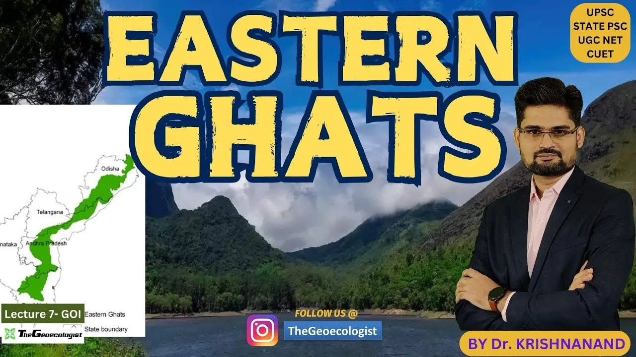
Table of Contents
- Geological History: Decoding the Eastern Ghats Formation
- Archean Foundations: The Deep-Time Beginning
- Gondwana Breakup and Tectonic Collision
- Multiple Orogenic Cycles
- Physiographic Characteristics: Topography, Drainage & Climate
- Discontinuous Ridge System and Major Peaks
- River Dissection: The Great Peninsular Rivers
- Climate Regime: Rain Shadow and Monsoon Dynamics
- Lithology and Mineral Wealth: Economic Geology of the Eastern Ghats
- Khondalite and Charnockite: Signature Rock Suites
- Strategic Mineral Deposits
- Biodiversity and Ecological Significance
- Forest Types and Endemism
- Protected Areas and Conservation Corridors
- Cultural Landscape: Indigenous Communities and Heritage
- Eastern Ghats vs. Western Ghats: Comparative Analysis for UPSC
- Current Challenges and Conservation Imperatives
- Deforestation and Fragmentation
- Mining Impacts and Regulatory Framework
- Climate Change Vulnerability
- UPSC Preparation Strategy: Mastering the Eastern Ghats
- Map-Based Questions
- Interdisciplinary Linkages
- Previous Year Question Trends
- Conclusion: The Enduring Legacy of the Eastern Ghats Formation
- Frequently Asked Questions (FAQs)
- What is the primary geological process behind the Eastern Ghats formation?
- How do the Eastern Ghats differ from the Western Ghats in terms of origin?
- Which are the major minerals found in the Eastern Ghats region?
- Why are the Eastern Ghats discontinuous unlike the Western Ghats?
- What is the highest peak of the Eastern Ghats?
- How does the Eastern Ghats formation influence the region's climate?
The Eastern Ghats formation represents one of India’s most ancient and geologically complex mountain systems, stretching over 1,750 kilometers along the country’s eastern coastline. Unlike their younger western counterparts, these mountains tell a story spanning billions of years, shaped by continental collisions, tectonic upheavals, and relentless erosional forces. For UPSC aspirants, geographers, and earth science enthusiasts, understanding the Eastern Ghats formation process unlocks critical insights into India’s peninsular geology, biodiversity patterns, and mineral wealth distribution.
- Ancient Origins: The Eastern Ghats date back to the Archean era (>2.5 billion years), making them among India’s oldest mountain systems.
- Discontinuous Topography: Unlike the continuous Western Ghats, the Eastern Ghats are fragmented by major river systems including Godavari, Mahanadi, Krishna, and Kaveri.
- Unique Geology: Dominated by metamorphic rocks — khondalite (garnet-sillimanite) and charnockite (granulite) — reflecting high-grade metamorphism.
- Mineral Riches: Hosts significant deposits of bauxite, iron ore, manganese, and limestone, driving regional economies.
- Ecological Importance: Supports diverse ecosystems from dry deciduous forests to tropical moist forests, with hotspots like Simlipal and Nallamala.
- Cultural Landscape: Home to indigenous communities (Kondh, Savara, Gadaba) whose livelihoods and traditions are inseparable from these hills.
Geological History: Decoding the Eastern Ghats Formation
Archean Foundations: The Deep-Time Beginning
The Eastern Ghats formation story begins in the Archean Eon, approximately 2.5 to 3.5 billion years ago, when the Earth’s crust was still stabilizing. The basement rocks of these mountains — primarily granulites, gneisses, and schists — crystallized under extreme pressure and temperature conditions deep within the continental crust. According to the Geological Survey of India, the Eastern Ghats Mobile Belt (EGMB) represents a Proterozoic orogenic belt that underwent multiple phases of deformation and metamorphism.
Gondwana Breakup and Tectonic Collision
A pivotal chapter in the Eastern Ghats formation narrative unfolded during the Mesoproterozoic to Neoproterozoic (roughly 1.6 to 0.9 billion years ago) when the Indian Plate collided with the East Antarctic Craton as part of the supercontinent Rodinia’s assembly. This collision generated the high-grade metamorphism characteristic of the region’s khondalite and charnockite suites. Later, during the breakup of Gondwana (~130-120 million years ago), the Indian Plate’s northward drift reactivated ancient fault lines, creating the discontinuous, block-faulted topography we observe today.
Multiple Orogenic Cycles
Research published in the Journal of the Geological Society of India identifies at least four major tectonothermal events in the Eastern Ghats Belt: the Archaean (~3.0-2.5 Ga), the Palaeoproterozoic (~2.0-1.8 Ga), the Mesoproterozoic (~1.6-1.0 Ga), and the Neoproterozoic (~1.0-0.5 Ga). Each event added structural complexity, creating the mosaic of shear zones, folds, and thrust faults that define the range’s architecture. This polyphase deformation history distinguishes the Eastern Ghats formation from the relatively simpler volcanic origin of the Western Ghats.
Physiographic Characteristics: Topography, Drainage & Climate
Discontinuous Ridge System and Major Peaks
The Eastern Ghats do not form a continuous watershed like the Western Ghats. Instead, they appear as a series of disconnected hill ranges separated by broad river valleys. The highest peak, Jindhagada (also called Arma Konda), rises to 1,690 meters in Andhra Pradesh’s Visakhapatnam district. Other notable summits include Mahendragiri (1,501 m) in Odisha, Maliya (1,358 m), and the Nallamala Hills (up to 1,100 m) stretching across Andhra Pradesh and Telangana. This fragmented topography directly results from the Eastern Ghats formation process — specifically, the differential erosion of fault-bounded blocks over geological time.
River Dissection: The Great Peninsular Rivers
Four major east-flowing rivers — Mahanadi, Godavari, Krishna, and Kaveri — cut spectacular gorges through the Eastern Ghats, creating critical ecological corridors and hydrological divides. The Godavari’s gorge at Papikondalu, the Krishna’s passage through the Nallamala Hills, and the Kaveri’s descent at Hogenakkal Falls exemplify how these antecedent rivers maintained their courses while the land uplifted around them. This riverine dissection is a hallmark of the Eastern Ghats formation and subsequent denudational history.
Climate Regime: Rain Shadow and Monsoon Dynamics
The Eastern Ghats lie primarily in the rain shadow of the Western Ghats, receiving significantly less rainfall (800-1,200 mm annually) compared to the western coast (2,000-3,000+ mm). However, they intercept the northeast monsoon (October-December), which brings crucial precipitation to the Coromandel Coast and interior districts of Tamil Nadu, Andhra Pradesh, and Odisha. This climatic pattern shapes the region’s vegetation mosaic — from tropical dry deciduous forests on leeward slopes to moist deciduous and semi-evergreen patches on windward elevations.
Lithology and Mineral Wealth: Economic Geology of the Eastern Ghats
Khondalite and Charnockite: Signature Rock Suites
The term “khondalite” was coined by British geologist T.L. Walker in 1902, derived from the Khond tribe inhabiting these hills. This rock suite — dominated by garnet-sillimanite-graphite gneisses with quartzite and calc-silicate layers — represents metapelites (metamorphosed clay-rich sediments) subjected to granulite-facies conditions (750-900°C, 7-9 kbar). Charnockite, named after Job Charnock’s tombstone in Kolkata, is an orthopyroxene-bearing granulite formed from the high-grade metamorphism of igneous protoliths. Together, these rocks constitute >80% of the Eastern Ghats Belt’s exposed crust, a direct fingerprint of the Eastern Ghats formation under extreme P-T conditions.
Strategic Mineral Deposits
The Eastern Ghats formation concentrated several economically vital minerals:
- Bauxite: The East Coast Bauxite Belt (Odisha-Andhra border) hosts world-class deposits at Panchpatmali, Niyamgiri, and Jerrela. India’s largest aluminum producer, NALCO, operates here.
- Iron Ore: High-grade hematite deposits in the Badampahar-Gorumahisani-Suleipat belt (Odisha) and the Daitari-Tomka range.
- Manganese: The Vizianagaram-Srikakulam belt (Andhra Pradesh) and the Bonai-Keonjhar belt (Odisha) are major producers.
- Graphite: The Eastern Ghats contain ~75% of India’s graphite reserves, concentrated in khondalite-hosted veins.
- Rare Earth Elements: Recent exploration by the Atomic Minerals Directorate has identified REE potential in the coastal placer deposits and carbonatite intrusions.
Biodiversity and Ecological Significance
Forest Types and Endemism
The Eastern Ghats harbor remarkable biodiversity across a gradient of forest types: tropical dry deciduous (dominant), moist deciduous, semi-evergreen, and subtropical broadleaf at higher elevations. The IUCN recognizes the region as part of the “Eastern Ghats moist deciduous forests” and “Deccan thorn scrub forests” ecoregions. Endemic flora include Cycas beddomei (Beddome’s cycad), Pterocarpus santalinus (red sanders), and numerous orchids. Faunal endemics include the Jerdon’s courser (Rhinoptilus bitorquatus), rediscovered in 1986 after 86 years, and the Golden Gecko (Calodactylodes aureus).
Protected Areas and Conservation Corridors
Key protected areas include Simlipal Tiger Reserve (Odisha), Papikonda National Park (Andhra Pradesh), Nagarjunsagar-Srisailam Tiger Reserve (spanning the Nallamala Hills), and the proposed Eastern Ghats Wildlife Corridor connecting these fragments. The Eastern Ghats Biodiversity Network, a multi-stakeholder initiative, works on landscape-level conservation addressing habitat fragmentation — a direct consequence of the Eastern Ghats formation topography and modern anthropogenic pressures.
Cultural Landscape: Indigenous Communities and Heritage
The Eastern Ghats are home to over 50 Scheduled Tribe communities, including the Kondh (Kandha), Savara (Saora), Gadaba, Paraja, and Koya. These groups practice shifting cultivation (podu), collect non-timber forest produce (mahua, tamarind, honey), and maintain sacred groves that serve as biodiversity refugia. The Dongria Kondh of Niyamgiri Hills gained international attention for their successful resistance against bauxite mining, highlighting the tension between mineral extraction and cultural survival. Understanding this human dimension is essential for any holistic analysis of the Eastern Ghats formation and its contemporary relevance.
Eastern Ghats vs. Western Ghats: Comparative Analysis for UPSC
| Parameter | Eastern Ghats | Western Ghats |
|---|---|---|
| Age | Archean to Proterozoic (>2.5 Ga) | Cretaceous to Paleogene (~65-60 Ma) |
| Origin | Tectonic collision, metamorphism, faulting | Volcanic (Deccan Traps), fault-block uplift |
| Continuity | Discontinuous, dissected by rivers | Near-continuous watershed |
| Max Elevation | Jindhagada (1,690 m) | Anai Mudi (2,695 m) |
| Rainfall | 800-1,200 mm (NE monsoon dominant) | 2,000-7,000 mm (SW monsoon dominant) |
| Rock Types | Khondalite, charnockite, granulite, gneiss | Basalt, laterite, granite gneiss |
| Minerals | Bauxite, Fe, Mn, graphite, REE | Laterite (Al, Fe), bauxite, clay |
| Biodiversity Status | High endemism, less studied | Global biodiversity hotspot, UNESCO WHS |
Current Challenges and Conservation Imperatives
Deforestation and Fragmentation
Satellite data from the Forest Survey of India (2021-2023) indicates a net loss of 1,240 sq km of moderately dense forest in Eastern Ghats districts, driven by agricultural expansion, infrastructure projects, and mining. The discontinuous nature of the ranges — a legacy of the Eastern Ghats formation — exacerbates fragmentation effects, isolating wildlife populations and disrupting gene flow.
Mining Impacts and Regulatory Framework
Open-cast bauxite and iron ore mining has altered hydrology, degraded air quality, and displaced tribal communities. The Forest Rights Act (2006), PESA (1996), and the 2013 Supreme Court judgment on Niyamgiri (requiring Gram Sabha consent) provide legal safeguards, but implementation remains uneven. Sustainable mining practices, ecological restoration of mined-out areas, and benefit-sharing with local communities are critical policy priorities.
Climate Change Vulnerability
Climate models project increased temperature extremes and erratic rainfall for the Eastern Ghats region by 2050. The region’s dry deciduous forests are particularly vulnerable to drought-induced mortality and fire regimes. Conservation strategies must incorporate climate resilience — protecting elevational gradients, riparian corridors, and microrefugia that have persisted since the Eastern Ghats formation created this heterogeneous landscape.
UPSC Preparation Strategy: Mastering the Eastern Ghats
Map-Based Questions
Practice plotting: (1) Major peaks — Jindhagada, Mahendragiri, Maliya, Nallamala high points; (2) River gorges — Godavari at Papikondalu, Krishna at Srisailam, Mahanadi at Satkosia, Kaveri at Hogenakkal; (3) Mineral belts — Panchpatmali (bauxite), Badampahar (iron), Vizianagaram (manganese); (4) Protected areas — Simlipal, Papikonda, Nagarjunsagar-Srisailam, Kawal, Gundla Brahmeswaram.
Interdisciplinary Linkages
Connect Eastern Ghats formation geology to: (a) Environment — soil types (red lateritic, black cotton), groundwater potential in fracture zones; (b) Economy — aluminum, steel, and battery mineral supply chains; (c) Polity — Fifth Schedule areas, PESA, Forest Rights Act implementation; (d) Culture — tribal art (Saora wall paintings), language diversity (Dravidian, Austroasiatic, Indo-Aryan interfaces).
Previous Year Question Trends
UPSC has asked about: (1) Differences between Eastern and Western Ghats (2017, 2021); (2) Mineral belts of Odisha-Andhra (2019); (3) Tribal communities and forest rights (2020, 2022); (4) River systems and interlinking projects (2018, 2023). Frame answers using the comparative table above and recent government reports (Ministry of Mines, MoEFCC, Tribal Affairs).
Conclusion: The Enduring Legacy of the Eastern Ghats Formation
The Eastern Ghats formation is not merely a geological event confined to deep time — it is an ongoing process whose fingerprints shape every aspect of peninsular India’s eastern flank. From the khondalite ridges that hold India’s aluminum future to the tribal sacred groves preserving genetic diversity older than the Himalayas, these ancient mountains demand both scientific understanding and compassionate stewardship. For the UPSC aspirant, they offer a perfect laboratory where geology, ecology, economy, and culture converge. For the nation, they represent a natural heritage that, if managed wisely, can power sustainable development while honoring the communities who have guarded these hills for millennia.
Frequently Asked Questions (FAQs)
What is the primary geological process behind the Eastern Ghats formation?
The Eastern Ghats formation resulted from multiple tectonothermal events spanning the Archean to Neoproterozoic, primarily driven by the collision of the Indian Plate with the East Antarctic Craton during Rodinia’s assembly, followed by reactivation during Gondwana breakup. This produced high-grade metamorphism (khondalite, charnockite) and block-faulted topography.
How do the Eastern Ghats differ from the Western Ghats in terms of origin?
The Eastern Ghats are ancient metamorphic mountains (>2.5 Ga) formed by tectonic collision and crustal deformation, while the Western Ghats are relatively young (~65 Ma) fault-block mountains associated with Deccan Traps volcanism and the Indian Plate’s separation from Madagascar.
Which are the major minerals found in the Eastern Ghats region?
The Eastern Ghats host world-class deposits of bauxite (Panchpatmali, Niyamgiri), high-grade iron ore (Badampahar, Daitari), manganese (Vizianagaram, Bonai-Keonjhar), graphite (khondalite-hosted), and emerging rare earth element potential in coastal placers and carbonatites.
Why are the Eastern Ghats discontinuous unlike the Western Ghats?
The discontinuity stems from the Eastern Ghats formation history: repeated faulting createdhorst-and-graben structures, and major antecedent rivers (Godavari, Mahanadi, Krishna, Kaveri) maintained their courses while dissecting the uplifted blocks, creating wide valleys that fragment the range.
What is the highest peak of the Eastern Ghats?
Jindhagada (also called Arma Konda) at 1,690 meters (5,545 ft) in the Visakhapatnam district of Andhra Pradesh is the highest peak. Mahendragiri (1,501 m) in Odisha is the second highest.
How does the Eastern Ghats formation influence the region’s climate?
The lower elevation and discontinuous nature allow moisture-laden winds to penetrate inland, but the range primarily lies in the Western Ghats’ rain shadow. It intercepts the northeast monsoon, creating a distinct rainfall regime (800-1,200 mm) that supports dry deciduous forests rather than the wet evergreen forests of the Western Ghats.
Frequently Asked Questions
The Eastern Ghats formation resulted from multiple tectonothermal events spanning the Archean to Neoproterozoic, primarily driven by the collision of the Indian Plate with the East Antarctic Craton during Rodinia's assembly, followed by reactivation during Gondwana breakup. This produced high-grade metamorphism (khondalite, charnockite) and block-faulted topography.
The Eastern Ghats are ancient metamorphic mountains (>2.5 Ga) formed by tectonic collision and crustal deformation, while the Western Ghats are relatively young (~65 Ma) fault-block mountains associated with Deccan Traps volcanism and the Indian Plate's separation from Madagascar.
The Eastern Ghats host world-class deposits of bauxite (Panchpatmali, Niyamgiri), high-grade iron ore (Badampahar, Daitari), manganese (Vizianagaram, Bonai-Keonjhar), graphite (khondalite-hosted), and emerging rare earth element potential in coastal placers and carbonatites.