Blog
Bihar Flood Drought: Problems and Mitigation Strategies for BPSC

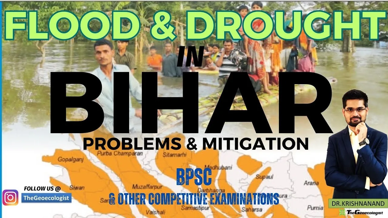
Table of Contents
- Understanding the Bihar Flood Drought Paradox
- Floods in Bihar: Causes and Geographical Vulnerability
- Himalayan River Systems and Sediment Load
- Glacial Melt and Monsoon Intensification
- Human-Induced Factors Amplifying Flood Risk
- Flood Impacts: Livelihoods, Infrastructure, and Health
- Flood Mitigation Strategies: Structural, Non-Structural, and Ecological
- Structural Measures: Engineering Interventions
- Non-Structural Measures: Governance and Technology
- Ecological Solutions: Nature-Based Flood Management
- Droughts in Bihar: The Silent Crisis in South Bihar
- Climatic Challenges and Erratic Monsoon Distribution
- Groundwater Over-Extraction and Irrigation Deficits
- Drought Impacts: Agrarian Distress and Migration
- Drought Mitigation Strategies: Conservation, Agriculture, and Policy
- Water Conservation and Traditional System Revival
- Agricultural Reforms for Climate Resilience
- Policy Initiatives: Jal Jeevan Hariyali and Beyond
- Climate Change and Holistic Planning: Integrating Flood and Drought Management
- Conclusion: Towards a Resilient Bihar
The Bihar flood drought paradox represents one of India’s most complex hydro-meteorological challenges, where a single state simultaneously battles devastating annual floods in its northern plains and crippling droughts in its southern regions. This dual disaster scenario disrupts livelihoods, devastates agriculture, and hampers socio-economic development across 38 districts, making Bihar flood drought a critical topic for BPSC aspirants and disaster management professionals alike. Understanding the intricate interplay of geography, climate change, and human activity driving the Bihar flood drought cycle is essential for formulating effective mitigation policies.
- Geographical duality: North Bihar faces recurrent floods from Himalayan rivers (Kosi, Gandak, Bagmati), while South Bihar suffers drought despite 1,000–1,200 mm annual rainfall.
- Human-induced aggravation: Embankment breaches, floodplain encroachment, deforestation, and groundwater over-extraction intensify both disasters.
- Structural measures: Strengthening embankments, proposed Kosi High Dam, river interlinking, and reservoir construction.
- Non-structural measures: Satellite-based flood forecasting, strict zoning laws, community awareness, and early warning systems.
- Ecological restoration: Wetland revival (Kanwar Lake), afforestation in catchment areas, and traditional water harvesting (ahars, pynes).
- Agricultural adaptation: Drought-resistant crops (millets), micro-irrigation, and watershed management.
- Policy integration: Jal Jeevan Hariyali, participatory disaster management, and climate-resilient planning.
Understanding the Bihar Flood Drought Paradox
The Bihar flood drought phenomenon stems from the state’s unique physiographic setting. Bihar lies in the Gangetic plains, bifurcated by the Ganga River into North Bihar (flood-prone) and South Bihar (drought-prone). This geographical division creates a stark contrast: while districts like Supaul, Khagaria, and Madhubani face annual inundation, regions like Rohtas, Aurangabad, and Kaimur grapple with water scarcity. The paradox is further complicated by climate change, which amplifies extreme rainfall events causing flash floods while simultaneously delaying monsoon onset, prolonging dry spells.
Floods in Bihar: Causes and Geographical Vulnerability
Himalayan River Systems and Sediment Load
North Bihar’s flood vulnerability originates in the Himalayan catchments of the Kosi, Gandak, Bagmati, and Ghaghara rivers. These rivers carry enormous sediment loads — the Kosi alone transports approximately 100 million cubic meters of silt annually — causing frequent channel avulsion and embankment breaches. The Kosi River, historically known as “Bihar’s Sorrow,” has shifted its course over 120 km westward in the last 250 years, rendering vast tracts of land unstable. The flat terrain of the northern plains (gradient ~6 cm/km) combined with inadequate natural drainage exacerbates waterlogging and prolongs flood duration. – a key consideration for Bihar flood drought.
Glacial Melt and Monsoon Intensification
Accelerated glacial melt in the Hindu Kush Himalaya region, documented by the International Centre for Integrated Mountain Development (ICIMOD), increases lean-season flows and contributes to extreme monsoon discharges. The 2008 Kosi breach at Kusaha, Nepal, displaced over 3 million people and inundated 1,000+ villages, illustrating the transboundary nature of the Bihar flood drought crisis. Climate models project a 10–20% increase in monsoon intensity by 2050, further elevating flood risk.
Human-Induced Factors Amplifying Flood Risk
Anthropogenic interventions have significantly worsened flood impacts. Embankment construction, while providing localized protection, has confined rivers to narrow channels, raising bed levels and increasing breach probability. Floodplain encroachment for agriculture and settlements reduces natural water retention capacity. Deforestation in the Chure/Siwalik hills of Nepal diminishes infiltration, accelerating surface runoff. A 2021 study by the National Institute of Disaster Management (NIDM) estimated that 73% of North Bihar’s population lives in recurrent flood zones, with annual average economic losses exceeding ₹1,500 crore. – a key consideration for Bihar flood drought.
Flood Impacts: Livelihoods, Infrastructure, and Health
The Bihar flood drought cycle’s flood component inflicts multi-dimensional damage. Crop losses affect predominantly small and marginal farmers (85% of landholdings), destroying kharif crops like paddy, maize, and vegetables. Infrastructure destruction includes roads, bridges, schools, and health centers, disrupting essential services. Post-flood waterborne diseases — cholera, typhoid, hepatitis A — surge due to contaminated water sources. Displacement forces seasonal migration to urban centers, creating socio-economic pressures. The 2017 floods affected 17.1 million people across 19 districts, with 514 fatalities, underscoring the recurring humanitarian crisis.
Flood Mitigation Strategies: Structural, Non-Structural, and Ecological
Structural Measures: Engineering Interventions
Structural mitigation focuses on physical infrastructure. Embankment strengthening using geo-synthetic materials and proper maintenance protocols can reduce breach frequency. The proposed Kosi High Dam at Barahakshetra (Nepal), with a live storage capacity of 9.5 billion cubic meters, could regulate flows and generate 3,300 MW hydropower, but requires Indo-Nepal treaty ratification. River interlinking — particularly the Kosi-Mechi link — aims to divert surplus floodwater to water-deficit basins. Reservoir construction on tributaries like Bagmati and Kamla Balan can attenuate peak floods. The Bihar Government’s Flood Management Information System (FMIS) integrates real-time gauge data for operational decision-making. – a key consideration for Bihar flood drought.
Non-Structural Measures: Governance and Technology
Non-structural approaches emphasize preparedness and governance. Satellite-based flood forecasting using INSAT-3D/3DR and Sentinel-1 SAR imagery enables 72-hour lead-time predictions. The Central Water Commission (CWC) operates 34 flood forecasting stations in Bihar. Strict enforcement of floodplain zoning regulations — prohibiting construction in high-risk zones — is critical. The Bihar Disaster Management Act, 2004, mandates district-level disaster management plans. Community-based early warning systems, leveraging mobile networks (SMS, IVRS) and local volunteers (Aapda Mitras), enhance last-mile connectivity. Capacity building through mock drills and school safety programs fosters resilience culture. – a key consideration for Bihar flood drought.
Ecological Solutions: Nature-Based Flood Management
Ecological restoration offers sustainable, cost-effective flood mitigation. Wetland revival — particularly Kanwar Lake (Kabar Taal), Asia’s largest freshwater oxbow lake and a Ramsar site — can absorb 100+ million cubic meters of floodwater. Afforestation in the Kosi and Gandak catchments (Chure hills) enhances infiltration and reduces sediment yield. The “Room for the River” concept, successfully implemented in the Netherlands, advocates setting back embankments to restore natural floodplains. Reviving traditional drainage channels (chaurs, mauns) improves natural drainage. The National Mission for Clean Ganga (NMCG) supports wetland conservation under the Namami Gange programme. – a key consideration for Bihar flood drought.
Droughts in Bihar: The Silent Crisis in South Bihar
Climatic Challenges and Erratic Monsoon Distribution
Despite receiving 1,000–1,200 mm annual rainfall, South Bihar faces meteorological and hydrological drought due to highly skewed temporal distribution. Over 85% rainfall occurs in four monsoon months (June–September), with frequent dry spells during critical crop growth stages. The region’s hard rock terrain (Vindhyan and Archaean formations) limits groundwater recharge to 8–12% of rainfall. Districts like Aurangabad, Rohtas, Kaimur, and Gaya experience drought once every 3–4 years. The Bihar flood drought asymmetry is stark: while North Bihar drowns, South Bihar’s aquifers deplete.
Groundwater Over-Extraction and Irrigation Deficits
South Bihar’s agriculture depends 70% on groundwater, with tube well density exceeding 15 per km² in some blocks. The Central Ground Water Board (CGWB) classifies 11 blocks as “over-exploited” and 14 as “critical.” Canal irrigation covers only 30% of cultivable area, with major projects (Sone, Badua, Chandan) operating below design capacity due to siltation and maintenance gaps. Traditional water bodies — ahars (embanked reservoirs) and pynes (diversion channels) — numbering over 20,000 historically, have declined by 60% due to encroachment and neglect, eroding community-based water security. – a key consideration for Bihar flood drought.
Drought Impacts: Agrarian Distress and Migration
Drought triggers cascading socio-economic impacts. Rainfed crops (pulses, oilseeds, millets) fail, reducing farm incomes by 40–60%. The 2015–16 drought affected 23 districts, with kharif production declining 22%. Groundwater depletion forces deeper borewells, escalating energy costs. Drinking water scarcity affects 15,000+ habitations during summer. Distress migration to Punjab, Haryana, and Delhi surges, with women and elderly left behind facing increased workload. Malnutrition rates in drought-prone districts exceed state averages (stunting 48% vs. 42% state average per NFHS-5).
Drought Mitigation Strategies: Conservation, Agriculture, and Policy
Water Conservation and Traditional System Revival
Reviving ahars and pynes through community participation (Jal Jeevan Hariyali Abhiyan) can restore 2–3 billion cubic meters of storage. Watershed management — contour trenching, check dams, percolation tanks — enhances recharge. The Mahatma Gandhi National Rural Employment Guarantee Act (MGNREGA) converges with water conservation, creating 500,000+ water structures annually. Rooftop rainwater harvesting mandates for urban buildings (patna Municipal Corporation bylaws) augment domestic supply. The National Disaster Management Authority promotes drought monitoring using Standardized Precipitation Index (SPI) and satellite-derived Vegetation Condition Index (VCI).
Agricultural Reforms for Climate Resilience
Crop diversification towards drought-tolerant varieties — finger millet (marua), pearl millet (bajra), sorghum (jowar), and pigeon pea (arhar) — reduces water demand by 30–50%. The Bihar Agricultural University (BAU), Sabour, has developed short-duration paddy varieties (Sugandha, Rajendra Bhagwati) escaping terminal drought. Micro-irrigation (drip, sprinkler) under Pradhan Mantri Krishi Sinchayee Yojana (PMKSY) improves water use efficiency to 90% vs. 40% in flood irrigation. Soil health cards guide balanced fertilization, enhancing moisture retention. Farmer Producer Organizations (FPOs) enable collective input procurement and market access.
Policy Initiatives: Jal Jeevan Hariyali and Beyond
The flagship Jal Jeevan Hariyali Mission (2019) integrates afforestation (24 crore plantations target), water body rejuvenation (1 lakh+ structures), and groundwater recharge. The Bihar Ground Water (Regulation and Control) Act, 2019, regulates extraction in notified areas. Atal Bhujal Yojana (World Bank-assisted) promotes participatory groundwater management in 11 water-stressed districts. Crop insurance (Pradhan Mantri Fasal Bima Yojana) covers 50%+ farmers, though claim settlement delays persist. The State Action Plan on Climate Change (SAPCC) mainstreams adaptation across departments.
Climate Change and Holistic Planning: Integrating Flood and Drought Management
Climate change acts as a threat multiplier for the Bihar flood drought cycle. The IPCC Sixth Assessment Report projects increased frequency of extreme precipitation events (+20% by 2100 under SSP5-8.5) and longer dry spells in the Gangetic plains. Rising temperatures (1.5°C above pre-industrial by 2040) elevate evapotranspiration, intensifying agricultural drought. A holistic approach must integrate floodplain zoning with drought-proofing: floodwater harvesting in North Bihar via managed aquifer recharge (MAR) can transfer surplus to deficit aquifers in South Bihar. The Ganga Basin Plan (National Mission for Clean Ganga) advocates basin-scale integrated water resources management (IWRM). Empowering Panchayati Raj Institutions (PRIs) through Gram Panchayat Development Plans (GPDPs) ensures local ownership. Participatory vulnerability assessments, gender-responsive planning, and indigenous knowledge integration (e.g., traditional flood coping mechanisms of Mallaah communities) enhance equity.
Conclusion: Towards a Resilient Bihar
Addressing the Bihar flood drought paradox demands scientific planning, policy enforcement, and community engagement in equal measure. Structural interventions must be complemented by ecological restoration and governance reforms. The convergence of Jal Jeevan Hariyali, PMKSY, MGNREGA, and disaster management frameworks offers a pathway to water security. For BPSC aspirants, mastering Bihar flood drought requires understanding not just facts but the systemic linkages between geography, climate, institutions, and society. As Bihar navigates the dual challenges of the 21st century, the lessons from its flood-drought interface hold relevance for the entire Gangetic basin and other hydro-climatically vulnerable regions globally. Continuous monitoring, adaptive management, and investment in human capital will determine whether Bihar transforms its water curse into a catalyst for sustainable development.
Frequently Asked Questions
Floods in North Bihar are caused by Himalayan rivers (Kosi, Gandak, Bagmati, Ghaghara) carrying heavy silt loads, flat terrain with poor drainage, glacial melt, embankment breaches, and floodplain encroachment. The Kosi River's frequent course shifts exacerbate the problem.
South Bihar faces drought due to erratic monsoon distribution (85% rain in 4 months), hard rock terrain limiting groundwater recharge (8-12%), over-reliance on groundwater (70% irrigation), low canal coverage (30%), and decay of traditional water bodies (ahars, pynes).
Jal Jeevan Hariyali Mission (2019) is Bihar's flagship water conservation program targeting 24 crore plantations, rejuvenation of 1 lakh+ water bodies, groundwater recharge, and restoration of traditional systems (ahars, pynes). It converges with MGNREGA and addresses both flood and drought through integrated water management.