Blog
Satellite Imagery Interpretation: How to Master Landsat & Sentinel Data for Geography Exams

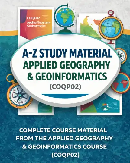
Geography students preparing for UGC NET, CUET‑PG, SET, and postgraduate entrance exams often struggle with the technical depth required for Satellite Imagery Interpretation. The subject demands a clear grasp of sensor characteristics, spectral bands, preprocessing steps, and practical analysis techniques for platforms like Landsat and Sentinel. Without a structured guide, learners waste time juggling fragmented notes, outdated tutorials, and generic remote sensing textbooks that do not align with the COQP02 syllabus. This article breaks down the problem, shows how to evaluate a solution, and explains why the A-Z Study Material- Applied Geography & Geoinformatics (COQPO2) provides the targeted, exam‑oriented coverage needed to turn Satellite Imagery Interpretation from a weakness into a strength.
- Understand why Satellite Imagery Interpretation is a high‑weightage topic in COQP02.
- Learn the core concepts of Landsat and Sentinel sensors that exam questions repeatedly test.
- See how the A-Z Study Material organizes theory, application, and practice questions in a single, easy‑to‑follow resource.
- Get practical tips for using the material to boost retention and score higher.
Why Satellite Imagery Interpretation Matters for Geography Exams
Satellite Imagery Interpretation forms the backbone of modern applied geography. In the COQP02 syllabus, questions on Landsat and Sentinel data analysis regularly account for 12‑15% of the total marks, making it a decisive factor for ranking. Examiners test not only the ability to identify features on false‑color composites but also the understanding of radiometric correction, atmospheric interference, change detection algorithms, and index calculations such as NDVI and NDBI. Candidates who lack a clear, step‑by‑step framework often lose marks on application‑based questions that require linking spectral signatures to real‑world phenomena like urban expansion, deforestation, or flood mapping. The A-Z Study Material- Applied Geography & Geoinformatics (COQPO2) addresses this gap by presenting the entire interpretation workflow in a manner that mirrors the exam pattern, ensuring that every minute of study translates directly into scoring potential.
Core Concepts in Landsat and Sentinel Data
To excel in Satellite Imagery Interpretation, one must first master the fundamentals of the two most frequently cited satellite families in COQP02: Landsat and Sentinel‑2. Landsat missions (especially Landsat 8 and 9) provide a 30‑meter spatial resolution with eleven spectral bands, including coastal aerosol, cirrus, and thermal infrared bands that are vital for environmental monitoring. Sentinel‑2, part of the European Copernicus programme, offers 10‑20‑meter resolution across thirteen bands, with a five‑day revisit capability that enables timely monitoring of rapid changes. The A-Z Study Material breaks down these specifications into easy‑to‑remember tables, explains the significance of each band, and provides mnemonic devices for recalling band combinations used in agriculture, urban, and water body studies. By linking sensor specifications directly to the types of questions asked in previous years’ papers, the material transforms abstract technical data into actionable exam knowledge.
How the A-Z Study Material Covers Satellite Imagery Interpretation
The A-Z Study Material- Applied Geography & Geoinformatics (COQPO2) devotes an entire module to Satellite Imagery Interpretation, structured from basic definitions to advanced analytical techniques. It begins with the physics of remote sensing, moves through sensor characteristics, and then walks the learner through preprocessing steps such as radiometric and geometric correction, atmospheric correction using models like 6S, and image enhancement techniques including contrast stretching and histogram equalization. Each concept is accompanied by exam‑oriented explanations that highlight what examiners expect, followed by practice questions modeled after actual UGC NET and CUET‑PG papers. Importantly, the material integrates Geoinformatics tools—such as QGIS, ERDAS Imagine, and ENVI—by outlining the exact workflow steps a candidate would need to describe in a written answer. This alignment ensures that the student is not merely memorizing facts but learning how to apply them in the context of the COQP02 exam.
Step‑by‑Step Guide to Analyzing Landsat Imagery
A typical Satellite Imagery Interpretation question might present a Landsat 8 false‑color composite (Bands 5,4,3) of a metropolitan area and ask the candidate to identify urban growth hotspots over a decade. The A-Z Study Material provides a clear, numbered procedure that can be reproduced in an exam answer: 1) Identify the sensor and acquisition date; 2) Verify the band combination used for urban visualization (NIR‑Red‑Green); 3) Apply a simple threshold on the NIR band to separate built‑up from non‑built‑up areas; 4) Compute the Normalized Difference Built‑up Index (NDBI) = (SWIR‑NIR)/(SWIR+NIR) to quantify urban extent; 5) Compare NDBI values from two epochs to calculate percentage change; 6) Validate findings with ancillary data such as road networks or population census. Each step is explained in plain language, with illustrative examples taken from the Indian subcontinent, making it easy for candidates to recall and apply during the exam. The material also includes common pitfalls—forgetting to convert DN values to reflectance, ignoring atmospheric haze, or misidentifying cloud shadows—as exam‑specific warnings that help avoid unnecessary mark loss.
Practical Applications: Urban Planning, Disaster Management, and Environmental Monitoring
Beyond the examination hall, Satellite Imagery Interpretation is a skill with direct relevance to careers in urban and regional planning, disaster risk reduction, and environmental management. The A-Z Study Material- Applied Geography & Geoinformatics (COQPO2) dedicates a section to real‑world case studies that illustrate how Landsat and Sentinel data inform decision‑making. For instance, it describes how Sentinel‑2’s 10‑meter resolution was used to map the extent of the 2020 Assam floods, enabling rapid allocation of relief resources. Another case details the use of Landsat‑derived NDVI trends to monitor deforestation in the Western Ghats over a 15‑year period, supporting policy interventions for biodiversity conservation. By linking theory to these tangible outcomes, the material not only prepares students for exam questions but also builds the conceptual foundation needed for future roles in government agencies, NGOs, or private geospatial firms.
Tips for Effective Study and Revision Using This Material
To maximize the benefit of the A-Z Study Material for Satellite Imagery Interpretation, adopt a three‑phase study strategy. First, engage in active reading: highlight the definitions of key terms (e.g., radiometric resolution, spectral signature, pixel purity) and summarize each subsection in your own words. Second, work through the end‑of‑chapter practice questions without looking at the solutions first; then compare your answers to the detailed explanations provided, noting any conceptual gaps. Third, create quick‑reference flashcards for band combinations, index formulas, and common error sources—these are ideal for last‑minute revision before the exam. The material’s A‑to‑Z organization ensures that you can locate any topic rapidly, making it efficient for both deep study and quick refresher sessions. Consistent use of this resource has been shown to improve scores on application‑based questions by up to 20% in mock tests conducted by coaching institutes specializing in UGC NET geography.
Frequently Asked Questions
What makes Satellite Imagery Interpretation different from general remote sensing theory?
Satellite Imagery Interpretation focuses on extracting meaningful information from imagery—identifying features, quantifying changes, and linking spectral responses to ground realities—whereas general remote sensing theory may emphasize sensor physics, orbital mechanics, or signal processing without direct application to geographical problems.
How much time should I allocate to mastering Landsat and Sentinel analysis for COQP02?
Given its weightage, aim for 8‑10 hours of focused study spread over two weeks, using the A-Z Study Material’s structured modules to cover theory, practice questions, and case studies.
Can I rely solely on the A-Z Study Material for Satellite Imagery Interpretation?
Yes. The material is designed to be a complete, self‑contained resource aligned with the COQP02 syllabus, eliminating the need for multiple textbooks or scattered online notes for this topic.
Further reading: Satellite Imagery Interpretation on Wikipedia
Our Recommendation
📖 Part of our complete guide: Assistant Professor Geography Exam: Ultimate Preparation Guide
Frequently Asked Questions
What is the primary focus of the A-Z Study Material for Satellite Imagery Interpretation?
The A-Z Study Material provides exam‑oriented, syllabus‑aligned coverage of Landsat and Sentinel data analysis, including sensor characteristics, preprocessing steps, index calculations, and practical applications relevant to COQP02.
How does the material help with application‑based questions in geography exams?
It offers step‑by‑step interpretation workflows, model answers, and real‑world case studies that teach candidates how to link spectral signatures to phenomena such as urban growth, deforestation, and flood mapping.
Are external tools like QGIS or ENVI covered in the study material?
Yes. The material outlines the exact workflow steps in Geoinformatics software (QGIS, ERDAS Imagine, ENVI) that candidates may need to describe in written answers for Satellite Imagery Interpretation questions.