Blog
Political Space Concept: Where Geography Meets Power & Politics

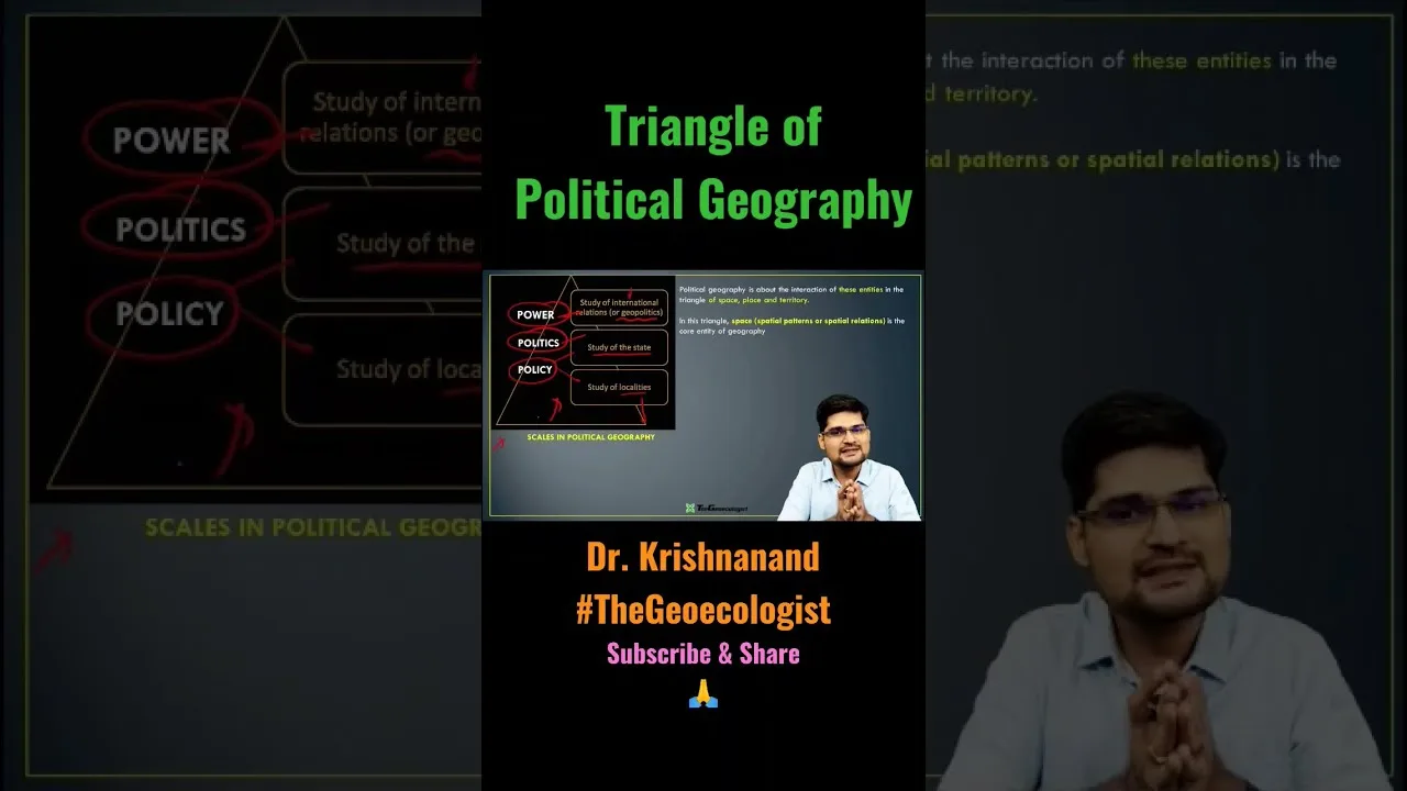
Table of Contents
- Defining the Political Space Concept in Political Geography
- Core Components of Political Space
- Power Dynamics: How States Shape Political Space
- Territoriality and Border Formalization
- Resource Control as Political Leverage
- Soft Power and Invisible Political Space
- Geoecological Dimensions: When Political Space Meets Ecology
- Transboundary River Disputes
- Border Infrastructure and Habitat Fragmentation
- Why the Political Space Concept Matters for Strategic Studies
- Maritime Political Space and UNCLOS
- Internal Conflicts and Sub-State Political Space
- Historical Evolution of Political Space Thinking
- From Westphalia to Globalization
- Globalization's Challenge to Political Space
- Contemporary Frontiers: Digital and Outer Space Political Space
- Cyberspace as Political Space
- Outer Space: The Ultimate Political Space
- Methodological Approaches to Studying Political Space
- Policy Implications and Future Trajectories
- Conclusion: Political Space as Analytical Master Key
The political space concept represents the dynamic intersection where geography, power, and politics converge to shape human civilization. Far beyond mere physical territory, this framework explains how nations claim, control, contest, and reshape spatial domains to assert dominance, negotiate sovereignty, and secure vital resources. From the icy Arctic to the disputed Himalayan borders, understanding the political space concept is essential for grasping why maps shift, conflicts erupt, and nations rise or fall in the 21st century.
- Political space transcends physical borders—it encompasses territoriality, resource control, and soft power projection.
- Geopolitical decisions directly impact ecosystems, as seen in river disputes and border wall construction.
- The political space concept underpins critical UPSC topics including India’s neighborhood policy, maritime boundaries under UNCLOS, and internal conflicts.
- Power dynamics in political space operate through hard power (military, borders) and soft power (culture, trade, diplomacy).
- This framework reveals why geography remains destiny in international relations despite technological globalization.
Defining the Political Space Concept in Political Geography
The political space concept emerged from the sub-discipline of political geography, which examines the spatial dimensions of political processes. Unlike traditional geography that focuses on physical features, political geography analyzes how human societies organize themselves spatially to exercise authority. The concept was pioneered by scholars like Friedrich Ratzel, who introduced the organic state theory, and Halford Mackinder, whose Heartland Theory argued that control of Eastern Europe’s pivot area meant global dominance.
Modern interpretations, advanced by geographers like John Agnew and Stuart Elden, emphasize that political space is not a passive container but an active product of social relations. Agnew’s “territorial trap” critique warns against assuming that sovereign state territories are natural or fixed. Instead, the political space concept reveals how boundaries are continuously produced through practices of bordering, governance, and resistance. This perspective is crucial for understanding contemporary challenges where digital spaces, maritime zones, and atmospheric corridors all constitute new frontiers of political contestation.
Core Components of Political Space
Three interdependent pillars structure the political space concept:
- Territoriality: The primary expression of political space, where states establish exclusive control over defined geographic areas. This includes land borders, maritime zones, and airspace.
- Sovereignty: The recognized authority to govern within a territory without external interference, codified in the 1648 Peace of Westphalia and reinforced by the UN Charter.
- Power Projection: The capacity to influence outcomes beyond immediate borders through military, economic, cultural, or diplomatic means.
Power Dynamics: How States Shape Political Space
Territoriality and Border Formalization
Territoriality manifests most visibly in border delineation. The political space concept explains why states invest enormous resources in demarcating boundaries. The India-China Line of Actual Control (LAC), stretching 3,488 kilometers across the Himalayas, exemplifies how ambiguous borders become flashpoints. Since the 1962 Sino-Indian War, the LAC has witnessed repeated standoffs, including the 2020 Galwan Valley clash that killed 20 Indian soldiers and an undisclosed number of Chinese troops. These confrontations demonstrate how the political space concept operates in practice: competing territorial claims transform geography into a political battleground.
Similarly, the Kashmir dispute involves three nuclear-armed claimants—India, Pakistan, and China—each asserting sovereignty over overlapping portions. The region’s strategic location, controlling headwaters of the Indus River system, makes it a textbook case of the political space concept where geography, water security, and national identity converge. The 2019 revocation of Article 370 by India fundamentally altered the political space of Jammu & Kashmir, demonstrating how internal administrative decisions reshape geopolitical realities.
Resource Control as Political Leverage
Control over natural resources transforms geographic space into strategic assets. The Arctic illustrates this dimension of the political space concept dramatically. As climate change reduces sea ice—Arctic summer ice extent has declined 13% per decade since 1979—previously inaccessible hydrocarbon reserves and shipping routes become viable. The U.S. Geological Survey estimates the Arctic holds 13% of world’s undiscovered oil and 30% of undiscovered natural gas. Five coastal states (Russia, Canada, USA, Norway, Denmark via Greenland) and three non-coastal claimants (China, Japan, South Korea) actively contest this emerging political space.
Russia has planted a titanium flag on the Lomonosov Ridge seabed at 4,261 meters depth (2007), while China declares itself a “near-Arctic state” and builds icebreakers. The United Nations Convention on the Law of the Sea (UNCLOS) provides the legal framework for these claims, allowing states to extend continental shelves beyond 200 nautical miles if geological continuity is proven. This legal-political interplay epitomizes the political space concept where science, law, and power intersect.
Soft Power and Invisible Political Space
Beyond physical territory, the political space concept encompasses what Joseph Nye termed “soft power”—the ability to attract and co-opt rather than coerce. Cultural exports, educational exchanges, development aid, and digital platforms create “invisible political space” extending far beyond national borders. South Korea’s “Hallyu” (Korean Wave) illustrates this: K-pop, K-dramas, and cinema generated $12.3 billion in cultural exports (2021), enhancing Seoul’s diplomatic leverage. Similarly, India’s yoga diplomacy, Bollywood reach, and IT workforce create soft power political space across the Global South.
China’s Confucius Institutes (over 500 worldwide pre-2020), Belt and Road Initiative cultural corridors, and TikTok’s algorithmic reach represent state-backed soft power projection. The political space concept thus explains how nations compete not just for land but for minds, markets, and narrative dominance in a globally connected information environment.
Geoecological Dimensions: When Political Space Meets Ecology
Transboundary River Disputes
The political space concept reveals how political decisions cascade into ecological consequences. The Indus Waters Treaty (1960), brokered by the World Bank, allocates the Indus River system between India and Pakistan. Despite three wars, the treaty survived—until climate change and population pressure strained its framework. India’s Kishanganga and Ratle hydroelectric projects on western rivers (allocated to Pakistan) triggered arbitration proceedings at the Permanent Court of Arbitration (2023), demonstrating how the political space concept governs life-sustaining resources.
Similarly, the Grand Ethiopian Renaissance Dam (GERD) on the Blue Nile creates political space tensions among Ethiopia, Sudan, and Egypt. Ethiopia views the $4.6 billion dam as sovereign development right; Egypt sees existential threat to 97% of its freshwater supply. The African Union-mediated negotiations illustrate how the political space concept operates in hydro-hegemony contexts, where upstream states gain leverage over downstream neighbors.
Border Infrastructure and Habitat Fragmentation
Physical border barriers—central to the political space concept of territoriality—impose severe ecological costs. The US-Mexico border wall (700+ miles of barriers as of 2023) bisects migration corridors for jaguars, ocelots, and Mexican gray wolves. A 2021 BioScience study found barriers affect 1,506 native species, with 62 critically endangered. India’s 4,096 km Bangladesh border fence similarly disrupts elephant corridors in Assam and West Bengal, escalating human-wildlife conflict.
These examples demonstrate that the political space concept cannot be analyzed in isolation from planetary boundaries. Political geography decisions—border walls, dams, resource extraction—rewrite ecological maps, creating feedback loops where environmental degradation fuels further political instability.
Why the Political Space Concept Matters for Strategic Studies
Maritime Political Space and UNCLOS
The United Nations Convention on the Law of the Sea (UNCLOS), often called the “constitution for the oceans,” codifies the political space concept in maritime domains. It establishes territorial seas (12 nm), contiguous zones (24 nm), exclusive economic zones (200 nm), and continental shelf rights. The South China Sea disputes—where China’s “nine-dash line” claims overlap with Philippines, Vietnam, Malaysia, Brunei, and Indonesia—represent the most consequential application of the political space concept in maritime space. The 2016 Permanent Court of Arbitration ruling (Philippines v. China) rejected China’s historic rights claim, yet enforcement remains elusive, illustrating the gap between legal political space and effective control.
India’s “Act East” policy and SAGAR (Security and Growth for All in the Region) doctrine operationalize the political space concept in the Indo-Pacific. By deepening naval cooperation with Quad partners (USA, Japan, Australia), securing strategic ports (Chabahar in Iran, Duqm in Oman, Sabang in Indonesia), and conducting freedom of navigation operations, India expands its maritime political space to counterbalance China’s String of Pearls strategy.
Internal Conflicts and Sub-State Political Space
The political space concept also explains sub-national contestation. India’s Northeast, with its complex ethnic geography and porous borders with Myanmar, Bangladesh, and China, illustrates how state political space can be contested by non-state actors. The Naga peace process (ongoing since 1997 ceasefire), Assam’s citizenship register (NRC), and Manipur’s ethnic violence (2023) all reflect struggles over political space definition at sub-state levels. Similarly, Pakistan’s Balochistan and Khyber Pakhtunkhwa regions, Afghanistan’s tribal territories, and Myanmar’s borderlands demonstrate how the political space concept operates where state authority is fragmented.
Historical Evolution of Political Space Thinking
From Westphalia to Globalization
The modern political space concept traces to the 1648 Peace of Westphalia, which established territorial sovereignty as the organizing principle of international order. The Westphalian system assumed congruence between nation, state, and territory—a “territorial trap” that Agnew critiques. Colonialism exported this model globally, imposing arbitrary borders across Africa (Berlin Conference 1884-85) and the Middle East (Sykes-Picot 1916) that ignored ethnic, linguistic, and ecological realities. Post-colonial states inherited these borders, creating persistent political space tensions.
Globalization’s Challenge to Political Space
Late 20th-century globalization theorists predicted the “end of geography” and “borderless world.” Capital flows, digital networks, and transnational corporations seemed to transcend the political space concept. Yet the 2008 financial crisis, COVID-19 pandemic, and 2022 Ukraine war triggered “re-territorialization”—states reasserting border control, supply chain sovereignty, and strategic autonomy. The political space concept proves resilient: political geography adapts but never disappears.
Contemporary Frontiers: Digital and Outer Space Political Space
Cyberspace as Political Space
The political space concept now extends into digital domains. States assert “cyber sovereignty”—China’s Great Firewall, Russia’s sovereign internet law (2019), EU’s GDPR data localization requirements. The 2020 SolarWinds hack (attributed to Russian SVR) and 2021 Colonial Pipeline ransomware attack demonstrate how political space conflict migrates to digital infrastructure. The UN Group of Governmental Experts debates norms for state behavior in cyberspace, effectively negotiating the political space concept for the digital age.
Outer Space: The Ultimate Political Space
The 1967 Outer Space Treaty declares space “province of all mankind” and prohibits national appropriation. Yet the political space concept operates through orbital slots, frequency allocations, and resource claims. The 2020 Artemis Accords (USA-led, 30+ signatories) and 2021 China-Russia International Lunar Research Station agreement create competing governance frameworks for lunar political space. Anti-satellite tests (China 2007, USA 2008, India 2019 Mission Shakti, Russia 2021) demonstrate kinetic contestation of this ultimate political space.
Methodological Approaches to Studying Political Space
Scholars employ diverse methods to analyze the political space concept. Critical geopolitics (Ó Tuathail, Dalby) examines how geographic representations—maps, media, policy discourse—construct political space. Feminist political geography (Mountz, Hyndman) reveals how borders gender migration experiences. Assemblage theory (Anderson, McFarlane) treats political space as emergent from heterogeneous human-nonhuman interactions. Digital trace data (satellite imagery, mobile phone records, social media) now enables real-time political space mapping at unprecedented resolution.
Policy Implications and Future Trajectories
Understanding the political space concept yields actionable insights for policymakers. Climate adaptation requires reimagining political space: sinking island states (Kiribati, Tuvalu) negotiate “migration with dignity” frameworks, challenging Westphalian assumptions. Resource governance demands transboundary cooperation beyond zero-sum territoriality—the UN Watercourses Convention (2014) and regional basin commissions offer models. Digital sovereignty debates require balancing security, innovation, and human rights within evolving political space norms.
For India specifically, the political space concept informs neighborhood policy (Neighbourhood First, Act East, SAGAR), border infrastructure (vibrant villages program), maritime domain awareness (Information Fusion Centre-Indian Ocean Region), and technology sovereignty (Digital Public Infrastructure stack). Mastering this concept enables strategic foresight in an era where political space is simultaneously fragmenting (micro-nationalisms) and consolidating (great power blocs).
Conclusion: Political Space as Analytical Master Key
The political space concept is not merely academic—it is the master key for decoding 21st-century conflict and cooperation. From Himalayan standoffs to Arctic resource races, from Nile dam diplomacy to lunar governance treaties, the same logic applies: humans organize power through spatial claims. The concept’s fluidity—shaped by history, force, diplomacy, technology, and ecology—means political space is never settled. Maps will shift. Wars may erupt. Nations will rise and fall. But the political space concept endures as the fundamental framework for understanding why. For UPSC aspirants, strategic analysts, and engaged citizens alike, mastering this concept transforms geography from static backdrop into dynamic protagonist of human destiny.
For authoritative background on political geography foundations, see Political Geography on Wikipedia. The UNCLOS framework governing maritime political space is detailed at the UN Division for Ocean Affairs and the Law of the Sea. For transboundary water governance case studies, the World Bank’s Indus Waters Treaty page provides primary documentation.
Frequently Asked Questions
The political space concept refers to the arena where geography, power, and politics intersect. It encompasses how states and non-state actors claim, control, contest, and reshape spatial domains—including territory, maritime zones, cyberspace, and outer space—to assert sovereignty, secure resources, and project influence. Unlike static maps, political space is fluid and continuously produced through social, legal, and coercive practices.
India's border disputes with China (LAC) and Pakistan (Kashmir) exemplify the political space concept where competing territorial claims transform geography into political battlegrounds. These disputes involve not just land but water security (Indus system), strategic infrastructure, and national identity. The concept explains why administrative decisions like Article 370 revocation or border infrastructure development (vibrant villages program) fundamentally reshape geopolitical realities.
The political space concept underpins core UPSC syllabus topics: India's neighborhood policy (Act East, SAGAR, Neighbourhood First), maritime boundaries under UNCLOS, internal security challenges (Northeast, Left-wing extremism), transboundary river disputes (Indus, Brahmaputra), and global governance frameworks. Mastery of this concept enables aspirants to analyze current affairs through a structural geographic lens rather than episodic event-based memorization.