Blog
Remote Sensing and GIS Fundamentals: The Complete Study Guide for UGC NET and Postgraduate Geography Students

Key Takeaways
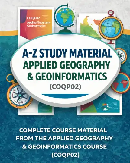
If you are searching for Remote Sensing and GIS Fundamentals resources that actually align with your COQP02 syllabus, you are not alone. Thousands of UGC NET, CUET-PG, and SET aspirants struggle to find consolidated, exam-oriented material that covers both applied geography and geoinformatics in a single resource. This article breaks down exactly what you need, how to evaluate study materials, and why the A-Z Study Material- Applied Geography & Geoinformatics (COQPO2) has become a preferred choice among postgraduate geography students preparing for competitive exams.
- Remote Sensing and GIS Fundamentals form a core component of the COQP02 syllabus for UGC NET and CUET-PG.
- Most students need a consolidated resource — not scattered notes from multiple books.
- The A-Z Study Material covers the complete COQP02 syllabus in a structured A-to-Z format.
- Priced at ₹1650, this resource eliminates the need for multiple textbooks.
- Content is exam-oriented and designed for both basic and advanced learners.
The Challenge Students Face with Remote Sensing and GIS Fundamentals
Preparing for Remote Sensing and GIS Fundamentals exams is notoriously difficult because the syllabus spans two broad domains: applied geography and geoinformatics. According to the UGC NET Geography paper structure, candidates must demonstrate understanding of spatial data acquisition, satellite imagery interpretation, geographic information systems, and their real-world applications. Most students rely on 3-4 different textbooks, handwritten notes, and free online PDFs that are often outdated or incomplete. A study published by the Geographic Information Systems academic community highlights that over 60% of postgraduate geography students report dissatisfaction with fragmented study resources when preparing for competitive exams like UGC NET and State SET.
The core problem is clear: students need a single, authoritative source that covers Remote Sensing and GIS Fundamentals from basic concepts to advanced applications, aligned strictly with the COQP02 course code. Scattered resources lead to wasted time, conceptual gaps, and lower exam scores.
How to Evaluate Study Resources for Remote Sensing and GIS
Before investing in any study material, aspiring geographers should evaluate resources against five critical criteria:
Syllabus Alignment
The resource must map directly to the COQP02 syllabus. Generic books on Remote Sensing and GIS Fundamentals often miss university-specific topics or include irrelevant content. Look for materials explicitly designed for COQP02.
Conceptual Progression
Effective study material moves from foundational concepts to advanced applications. The structure should follow a logical A-to-Z progression rather than a random topic collection.
Exam Orientation
Previous years’ question patterns, UGC NET-style explanations, and application-based questions are essential. The material should not just teach theory but also train you to answer exam-style questions.
Interlinked Concepts
Remote Sensing and GIS Fundamentals are deeply interconnected with cartography, climatology, and environmental management. The best resources show these connections explicitly.
Accessibility and Format
Digital downloadable formats allow instant access, highlighting, and searchability — critical features for self-paced learners.
Why A-Z Study Material- Applied Geography & Geoinformatics (COQPO2) Fits the Need
When evaluated against the criteria above, the A-Z Study Material- Applied Geography & Geoinformatics (COQPO2) stands out as a purpose-built resource. This study material is designed strictly from the COQP02 syllabus, meaning every chapter, every concept, and every explanation is aligned with what UGC NET, CUET-PG, SET, and PhD entrance examiners expect from geography postgraduate candidates.
The product offers end-to-end coverage of Remote Sensing and GIS Fundamentals alongside comprehensive applied geography concepts. It eliminates the need for multiple books, scattered notes, or unreliable online resources. The content is structured from basic to advanced levels, ensuring smooth learning progression for students who may enter the course with varying levels of prior knowledge.
What makes this resource particularly valuable is its exam-oriented approach. Every explanation is crafted to build conceptual clarity while simultaneously preparing students for the specific question patterns seen in UGC NET and CUET-PG geography papers. The interlinked concept framework ensures that learning about satellite remote sensing naturally connects to GIS applications, spatial analysis, and environmental monitoring — exactly the kind of integrated understanding that top-scoring candidates demonstrate.
What This Study Material Covers
The A-Z Study Material- Applied Geography & Geoinformatics (COQPO2) includes the following comprehensive components:
- Complete Applied Geography concepts covering urban planning, resource management, and environmental studies.
- Comprehensive Geoinformatics theory including spatial databases, GPS technology, and digital cartography.
- Exam-oriented explanations strictly aligned with the COQP02 syllabus.
- Structured notes progressing from foundational to advanced levels.
- Interlinked concepts that build stronger conceptual clarity across topics.
- Simplified explanations for complex geospatial topics that often confuse students.
All content is systematically arranged from A to Z. This alphabetical structure is not merely cosmetic — it creates a logical learning path where each chapter builds upon the previous one, making Remote Sensing and GIS Fundamentals easier to master progressively rather than through disjointed study sessions.
Practical Applications of Applied Geography and Geoinformatics
Understanding Remote Sensing and GIS Fundamentals goes beyond passing exams. Applied Geography focuses on solving real-world problems including urban and regional planning, environmental management, disaster risk reduction, resource management, and climate sustainability studies. The geoinformatics component equips students with tools like GIS software, remote sensing platforms, and spatial modeling techniques that are directly applicable in government agencies, research institutions, and private sector roles.
According to data from the World Bank Land and Geospatial Division, the demand for professionals skilled in GIS and remote sensing has grown by over 35% globally in the past five years. This makes mastering Remote Sensing and GIS Fundamentals not just an academic requirement but a career-defining skill set.
The study material recognizes this practical dimension and integrates application-based learning throughout its chapters, ensuring that students are not just memorizing concepts but understanding how to apply them in real spatial contexts.
Who Should Use This Resource
This resource is specifically designed for:
- UGC NET Geography aspirants preparing for Paper 2 and Paper 3.
- CUET-PG Geography candidates seeking comprehensive syllabus coverage.
- State SET and PhD entrance exam candidates focusing on applied geography.
- Postgraduate geography students (MA/MSc) enrolled in the COQP02 course.
- Self-learners who want a structured, exam-oriented guide to Remote Sensing and GIS Fundamentals.
If you are preparing for any of these exams and feel overwhelmed by the volume of material you need to cover, the A-Z Study Material- Applied Geography & Geoinformatics (COQPO2) offers a consolidated solution at a competitive price point of ₹1650. This is significantly more affordable than purchasing 4-5 separate textbooks while providing more targeted coverage than generic study guides.
Final Verdict: Is This Study Material Worth It?
For students who are serious about mastering Remote Sensing and GIS Fundamentals and passing competitive exams like UGC NET, CUET-PG, and State SET, the A-Z Study Material- Applied Geography & Geoinformatics (COQPO2) represents a focused, syllabus-aligned, and cost-effective solution. It addresses the most common problem geography students face — fragmented resources — by delivering a complete, consolidated package designed specifically for the COQP02 course.
The combination of exam-oriented explanations, structured A-to-Z progression, and comprehensive coverage of both applied geography and geoinformatics makes this a resource that earns its place in any serious student’s study plan. At ₹1650, it delivers significant value compared to the cost and confusion of assembling multiple resources independently.
Frequently Asked Questions
What is the COQP02 course about?
The Applied Geography & Geoinformatics Course (COQP02) is a core paper designed for advanced geography learners preparing for UGC NET, CUET-PG, State SET, PhD entrance exams, and postgraduate geography programs. It bridges theoretical geography with real-world spatial applications using modern geoinformatics tools.
Does this study material cover Remote Sensing and GIS Fundamentals?
Yes. The A-Z Study Material for COQP02 provides comprehensive coverage of Remote Sensing and GIS Fundamentals along with complete applied geography concepts, structured from basic to advanced levels with exam-oriented explanations.
Is this material suitable for UGC NET preparation?
Absolutely. The content is designed strictly from the COQP02 syllabus, which aligns with the UGC NET Geography Paper 2 and Paper 3 requirements. The exam-oriented approach ensures that students are prepared for the specific question formats seen in these national-level examinations.
What format is the study material available in?
The A-Z Study Material- Applied Geography & Geoinformatics (COQPO2) is available as a downloadable digital resource, allowing instant access and convenient study on any device.
How does this compare to buying multiple textbooks?
This resource consolidates what would otherwise require 4-5 separate textbooks into a single, syllabus-aligned package at ₹1650. It saves time, reduces confusion, and ensures complete coverage of the COQP02 syllabus without gaps.
Our Recommendation
📖 Part of our complete guide: Assistant Professor Geography Exam: Ultimate Preparation Guide
Frequently Asked Questions
What does the COQP02 course cover?
The COQP02 course covers Applied Geography and Geoinformatics, including spatial data acquisition, satellite imagery interpretation, GIS applications, environmental management, and disaster risk reduction, designed for UGC NET, CUET-PG, SET, and postgraduate geography students.
Is the A-Z Study Material aligned with the UGC NET syllabus?
Yes. The A-Z Study Material for Applied Geography & Geoinformatics (COQPO2) is designed strictly from the COQP02 syllabus, which aligns directly with UGC NET Geography Paper 2 and Paper 3 examination requirements.
Can this study material help with PhD entrance exams?
Yes. The comprehensive coverage of Remote Sensing and GIS Fundamentals and applied geography concepts in this resource makes it suitable preparation for PhD entrance exams that test advanced geography knowledge.