Blog
Moila Top Chakrata: Treeline Ecology and Glacial Landforms Explored

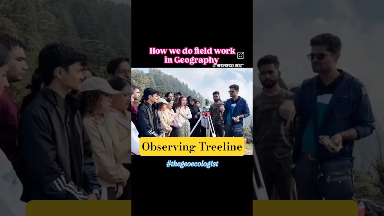
Table of Contents
- Treeline Ecology at Moila Top Chakrata: Nature's Elevational Frontier
- Climate Change Bioindicators: Shifting Treelines as Thermometers
- Dendrochronological Evidence of Climate Change
- Krummholz Adaptation: Survival Strategies in Extreme Winds
- Glacial Landforms: Echoes of the Pleistocene Ice Age at Moila Top Chakrata
- Erosional Features: Whaleback Shapes and Polished Bedrock
- Depositional Legacy: Moraine Fragments as Geological Breadcrumbs
- Fieldwork as Pedagogy: Bridging Theory and Terrain at Moila Top Chakrata
- Techniques Practiced: GPS Terrain Modeling, Sediment Sampling, and Ecological Transects
- Interdisciplinary Synergy: Merging Biogeography with Geomorphology
- Why Moila Top Chakrata Matters for the Western Himalaya
- Geomorphic-Bioclimatic Transition Zone Dynamics
- Hydrology and Soil Fertility: Downstream Implications
- Conservation Implications and Future Research Directions
- Conclusion: Decoding Earth's Memory at Moila Top Chakrata
Treeline Ecology at Moila Top Chakrata: Nature’s Elevational Frontier
Moila Top Chakrata, a remote yet scientifically profound site in the Western Himalaya, serves as a natural archive where treeline ecology and glacial landforms converge to reveal millennia of Earth’s history. Nestled in the rugged terrains of Chakrata district, Uttarakhand, this high-altitude locale has become a focal point for interdisciplinary research led by Dr. Krishnanand and the team from Sharda University’s School of Social Sciences and Humanities.
- Treeline dynamics at Moila Top Chakrata act as sensitive bioindicators of climate change in the Himalayas
- Pleistocene glacial landforms including phyllitic mounds and moraines document ice-sheet dynamics over 12,000 years ago
- Field-based pedagogy transforms students into practitioners of GPS terrain modeling, sediment sampling, and ecological transects
- Interdisciplinary synergy merges biogeography with geomorphology to forecast ecological futures amid accelerating glacial retreat
- Conservation urgency arises as phyllitic bedrock influences soil fertility, hydrology, and vegetation resilience across the Lesser Himalayas
The treeline at Moila Top Chakrata represents more than just a botanical boundary—it embodies the complex interplay between climate, geology, and ecology in one of Earth’s most sensitive mountain ecosystems. This elevational frontier marks the uppermost limit where trees can survive, creating a dynamic interface between subalpine forests and alpine meadows that serves as a living laboratory for scientific inquiry.
Climate Change Bioindicators: Shifting Treelines as Thermometers
Long-term monitoring at Moila Top Chakrata reveals upward shifts in treeline elevation, serving as bioindicators of warming trends across the Himalayas. Studies indicate that treelines in the region have ascended by approximately 0.5–1.0 meters per decade since the 1970s, correlating with a 0.6°C rise in mean annual temperature. These shifts alter habitat connectivity for alpine specialists and modify carbon sequestration capacities of subalpine forests. Researchers from Sharda University employ dendrochronology and repeat photography to quantify these changes, contributing data to global networks such as the Global Treeline Initiative.
The implications extend beyond mere elevation gain. As temperatures continue rising, the treeline at Moila Top Chakrata is experiencing fundamental changes in species composition, with climate-sensitive varieties like Abies pindrow showing increased stress markers. The area’s position within the Western Himalaya makes it particularly vulnerable to monsoon pattern disruptions, which further complicate tree-line responses to warming.
Dendrochronological Evidence of Climate Change
Tree-ring analysis conducted at Moila Top Chakrata has revealed unprecedented growth acceleration in recent decades. Core samples from ancient conifers demonstrate that the site’s vegetation has responded to warming trends with increased radial growth rates, particularly notable in the post-1990 period. These findings align with broader Himalayan treeline research documenting similar patterns across elevation gradients.
Krummholz Adaptation: Survival Strategies in Extreme Winds
Stunted “krummholz” trees at Moila Top Chakrata exhibit remarkable morphological plasticity. Flagged crowns, prostrate growth forms, and dense needle mats reduce wind desiccation and frost damage. Physiological assays show elevated concentrations of antifreeze proteins and soluble sugars in these individuals, enabling metabolic activity at sub-zero temperatures. Understanding these adaptations informs assisted migration and conservation breeding programs for Himalayan conifers under future climate scenarios.
The krummholz formations at Moila Top Chakrata represent evolutionary marvels, showcasing how plant species develop specialized survival mechanisms when pushed to their physiological limits. These wind-sculpted specimens create unique microhabitats that support diverse alpine flora, including several endemic species found nowhere else in the region.
Glacial Landforms: Echoes of the Pleistocene Ice Age at Moila Top Chakrata

Beneath the verdant landscape lies an ancient glacial saga. The phyllitic mounds of Moila Top Chakrata—weathered metamorphic rocks—bear unmistakable scars of Pleistocene-era ice dynamics. These rounded, streamlined landforms, sculpted by glaciers over 12,000 years ago, tell tales of erosional patterns and depositional legacies that shape present-day landscape vulnerabilities.
The geological record preserved at Moila Top Chakrata provides invaluable insights into the extent and behavior of glaciers during the Last Glacial Maximum. These features serve as benchmarks for understanding current glacial retreat rates and predicting future landscape evolution in response to ongoing climate change.
Erosional Features: Whaleback Shapes and Polished Bedrock
Ice sheets grinding and polishing bedrock have produced characteristic whaleback forms (roches moutonnées) at Moila Top Chakrata. Striations and chatter marks on phyllite surfaces indicate ice flow directions predominantly from north-northeast to south-southwest. High-resolution drone photogrammetry and LiDAR-assisted mapping by the geomorphology team have documented over 200 such features across a 3 km² area, enabling 3D reconstruction of paleo-ice thickness exceeding 150 meters during the Last Glacial Maximum.
These erosional features at Moila Top Chakrata demonstrate the immense power of glacial movement, with rock surfaces polished to remarkable smoothness. The striation patterns provide crucial directional data for reconstructing ice flow dynamics, helping scientists understand how glaciers once advanced across this region during colder climatic periods.
Depositional Legacy: Moraine Fragments as Geological Breadcrumbs
Terminal and lateral moraines surrounding Moila Top Chakrata mark former glacier extents, preserving evidence of dramatic climate fluctuations. Cosmogenic nuclide dating suggests maximum glacial advance occurred around 22,000 years ago, during the Last Glacial Maximum. Subsequent retreat phases left behind unsorted till deposits, erratics, and kames that chronicle deglaciation history. These landforms influence modern hydrology by controlling meltwater pathways and groundwater recharge zones.
The moraine systems at Moila Top Chakrata function as natural reservoirs, storing significant volumes of water in their porous deposits. This hydrological role becomes increasingly important as contemporary glaciers retreat, potentially affecting downstream water availability for millions of people dependent on Himalayan meltwater resources.
Fieldwork as Pedagogy: Bridging Theory and Terrain at Moila Top Chakrata
The educational approach at Moila Top Chakrata emphasizes experiential learning through direct field engagement. Students participate in hands-on research activities that combine traditional geological mapping techniques with cutting-edge geospatial technology. This methodology ensures that emerging scholars develop both theoretical knowledge and practical skills essential for addressing contemporary environmental challenges.
Techniques Practiced: GPS Terrain Modeling, Sediment Sampling, and Ecological Transects
Field teams utilize differential GPS units and drone-mounted multispectral sensors to create detailed topographic models of Moila Top Chakrata’s glacial features. Sediment coring operations extract cores up to 3 meters in length, revealing stratigraphic sequences that record multiple glacial-interglacial cycles. Ecological transects establish quantitative relationships between vegetation zones and microclimatic variables, generating predictive models for ecosystem response to continued warming.
Interdisciplinary Synergy: Merging Biogeography with Geomorphology
Research at Moila Top Chakrata exemplifies successful integration between biological and geological sciences. By combining vegetation surveys with geomorphic analysis, researchers can reconstruct paleoenvironmental conditions while simultaneously assessing contemporary ecosystem health. This holistic approach enables more accurate forecasting of landscape evolution under various climate scenarios.
The collaboration between Sharda University’s biogeographers and geomorphologists has produced groundbreaking insights into how glacial history influences current biodiversity patterns. Understanding these connections proves crucial for developing effective conservation strategies that account for both historical legacy and future projections.
Why Moila Top Chakrata Matters for the Western Himalaya
This site occupies a critical position within the broader Himalayan system, representing a geomorphic-bioclimatic transition zone where multiple environmental gradients intersect. Changes observed here reflect processes occurring across vast elevational ranges, making Moila Top Chakrata an ideal sentinel location for monitoring regional environmental change.
Geomorphic-Bioclimatic Transition Zone Dynamics
The unique setting at Moila Top Chakrata allows researchers to study interactions between lithology, topography, and climate that drive landscape evolution. Phyllitic bedrock creates distinctive soil properties affecting vegetation distribution, while steep slopes generate complex microclimates that influence both plant communities and glacial behavior.
Hydrology and Soil Fertility: Downstream Implications
Water originating from Moila Top Chakrata feeds into major river systems serving northern India’s agricultural plains. The site’s glacial legacy influences seasonal flow patterns, while its vegetation affects sediment loads and nutrient cycling. Understanding these connections proves vital for regional water resource management and food security planning.
Conservation Implications and Future Research Directions
The accelerating changes documented at Moila Top Chakrata underscore urgent conservation needs. Protecting this site requires balancing scientific access with ecosystem preservation, ensuring that research activities don’t compromise the very features they seek to study. Future work will focus on establishing long-term monitoring protocols and developing predictive models linking glacial retreat to ecosystem transitions.
International collaboration becomes essential for addressing the scale of changes occurring at Moila Top Chakrata. Partnerships with institutions like the National Centre for Biological Sciences and global climate research networks will enhance data collection capabilities and improve predictive modeling accuracy.
Conclusion: Decoding Earth’s Memory at Moila Top Chakrata
Moila Top Chakrata stands as a testament to the interconnected nature of Earth’s systems, where geological history directly informs present-day ecological conditions. Continued research at this remarkable site promises to yield insights crucial for understanding mountain ecosystem responses to climate change. The integration of field-based education with rigorous scientific methodology ensures that future generations will possess both the knowledge and skills necessary to address mounting environmental challenges in the Himalayan region.
As one of the Western Himalaya’s most significant natural archives, Moila Top Chakrata will undoubtedly continue providing valuable information about Earth’s climatic past while helping predict its ecological future. The site’s dual role as research location and educational platform makes it indispensable for advancing our understanding of mountain environments in an era of rapid environmental transformation.
Frequently Asked Questions
Moila Top Chakrata serves as a critical sentinel site where treeline shifts and glacial landforms provide measurable indicators of climate change impacts in the Western Himalaya, with treelines ascending 0.5-1.0 meters per decade since the 1970s.
The phyllitic mounds, moraines, and whaleback erosional features at Moila Top Chakrata date back approximately 12,000-22,000 years, documenting ice sheet dynamics during the Pleistocene era and providing insights into paleo-ice thickness exceeding 150 meters.
Students engage in field-based pedagogy including GPS terrain modeling, drone photogrammetry, sediment sampling, and ecological transects, bridging theoretical knowledge with hands-on research experience in this high-altitude environment.