

Blog
Mount Anak Krakatau: Volcano in Sunda Strait

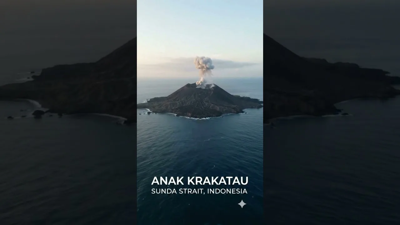
Table of Contents
Mount Anak Krakatau, located in Indonesia’s Sunda Strait, is one of the region’s most closely watched volcanic systems. Emerging from the caldera formed by the catastrophic 1883 eruption of Krakatau, this active cone has grown steadily since the 1920s, serving as a natural laboratory for studying volcanic island formation and arc tectonics. Its ongoing eruptions, lava flows, and occasional explosive events provide vital data for understanding how magma interacts with seawater and how volcanic hazards evolve in densely populated maritime regions.
- Mount Anak Krakatau sits in the Sunda Strait between Java and Sumatra, Indonesia.
- The volcano has been in near‑continuous eruptive activity since 1927, with major growth phases in the 1950s‑1960s and 2000s‑2020s.
- Its 2018 collapse triggered a deadly tsunami that claimed over 400 lives along the surrounding coastlines.
- Continuous monitoring by Indonesia’s PVMBG and international partners helps forecast eruptions and mitigate risks.
Geographical and Geological Setting
The Mount Anak Krakatau volcanic island rises to approximately 338 meters above sea level as of 2023, though its height fluctuates with each eruptive episode. Mount Anak Krakatau lies at coordinates 6°10′S 105°25′E, nestled in the Sunda Strait, a narrow sea passage that separates the islands of Java and Sumatra. This strait sits above the convergent boundary where the Indo‑Australian Plate subducts beneath the Eurasian Plate at a rate of about 6–7 cm per year. The subduction zone generates immense pressure and melting, feeding the magma chambers that power Krakatau’s eruptive behavior.
Geologically, Anak Krakatau is a stratovolcano composed of alternating layers of basaltic‑andesitic lava, tephra, and pyroclastic deposits. The volcano’s edifice is built on a submerged caldera rim that formed after the 1883 Krakatau eruption, which ejected an estimated 20 km³ of material and produced one of the loudest sounds in recorded history. Since its emergence, Anak Krakatau has undergone numerous cycles of cone building and partial collapse, the most notable being the December 2018 flank failure that reduced its height from roughly 338 m to 110 m and generated a tsunami with wave heights up to 13 m. – a key consideration for Mount Anak Krakatau.
Volcanic Activity History

Mount Anak Krakatau’s eruptive record is marked by frequent Strombolian to Vulcanian explosions, lava dome growth, and occasional Plinian columns. Key milestones include:
- 1927‑1930: First emergence above sea level; initial cone building.
- 1950s‑1960s: Rapid growth phase, reaching ~200 m elevation.
- 1992‑1993: Significant explosive eruption producing ash clouds that disrupted aviation.
- 2007‑2009: Renewed activity with lava flows extending into the sea.
- 2018: Catastrophic flank collapse on December 22, triggering a tsunami that affected the coasts of Java and Sumatra, resulting in 437 fatalities, over 14,000 injuries, and widespread property damage.
- 2020‑2023: Intermittent eruptions, including a notable event on April 10, 2023, which sent an ash plume to 3 km altitude and was captured by satellite imagery (Reuters).
Volcanic explosivity index (VEI) values for recent eruptions typically range from 1 to 2, though the 2018 collapse was driven more by gravitational failure than magma explosivity. The volcano’s magma supply is believed to be relatively steady, with a magma recharge rate estimated at 0.01–0.02 km³ per year, supporting its persistent activity. – a key consideration for Mount Anak Krakatau.
Tectonic Connections
The Sunda Strait occupies a pivotal position in the broader Sunda Arc system, where the Indo‑Australian Plate dives beneath the Eurasian Plate. This subduction generates a volcanic front that includes well‑known peaks such as Mount Merapi, Mount Semeru, and the Krakatau complex. The oblique convergence in this segment introduces transtensional stresses, facilitating magma ascent along fracture zones that weaken the crust.
Geodetic measurements using GPS and InSAR have detected crustal deformation rates of approximately 5–8 mm/yr across the strait, indicating strain accumulation that can both trigger volcanic eruptions and influence seismic activity. The 2018 tsunami, for example, was linked to a sudden slip on a submarine normal fault exacerbated by the oversteepened volcanic flank—a direct illustration of how tectonic and volcanic processes interact.
Seismic tomography studies reveal a low‑velocity zone beneath Anak Krakatau at depths of 20–35 km, interpreted as a magma reservoir fed by slab‑derived fluids. This reservoir’s pressure fluctuations correlate with observed changes in ground deformation and gas emissions, offering a predictive window for eruption forecasting.
Monitoring, Hazards, and Mitigation
Indonesia’s Center for Volcanology and Geological Hazard Mitigation (PVMBG) maintains a permanent observation post on Rakata Island, supplemented by seismic stations, tiltmeters, gas analyzers, and webcams. Satellite‑based monitoring from platforms such as Sentinel‑2 and Landsat provides thermal alerts and ash‑cloud tracking. The volcano is assigned an alert level system ranging from Normal (Level I) to Warning (Level IV), with Level III typically indicating heightened unrest.
Hazard assessments focus on:
- Tephra fall: Ash dispersal can affect aviation routes over the Strait and contaminate water supplies.
- Pyroclastic flows: Though less frequent due to the volcano’s relatively modest column heights, they remain a threat to proximal coastal zones.
- Lava‑sea interactions: When lava enters the water, Mount Anak Krakatau can generate steam explosions (littoral explosions) that hurl debris.
- Tsunami generation: Flank collapse or large submarine landslides are the primary tsunami sources, as demonstrated in 2018.
Mitigation strategies include community evacuation drills, early‑warning sirens linked to seismic and deformation thresholds, and public education campaigns about recognizing precursory signs such as increased seismicity, ground swelling, or changes in sea color.
Environmental and Societal Impacts
The eruptive output of Mount Anak Krakatau contributes nutrients to the surrounding marine ecosystem, fostering phytoplankton blooms that support fisheries. However, frequent ash deposition can damage coral reefs and reduce water clarity, affecting tourism and local livelihoods. The 2018 tsunami devastated mangrove forests and disrupted fishing villages, prompting large‑scale rehabilitation efforts funded by the Indonesian government and international NGOs.
From a societal perspective, the volcano serves as a powerful reminder of the need for integrated disaster risk reduction in tectonically active archipelagos. Educational programs in schools near the Sunda Strait incorporate volcano science into curricula, fostering a culture of preparedness among younger generations.
Conclusion
Mount Anak Krakatau stands as a dynamic emblem of Earth’s restless nature—born from one of history’s most violent eruptions, Mount Anak Krakatau continues to grow, reshape, and challenge the communities that fringe the Sunda Strait. Its persistent activity offers invaluable insights into magma‑tectonic interactions, eruption forecasting, and tsunami genesis. Continued investment in monitoring infrastructure, interdisciplinary research, and community resilience will be essential to coexist safely with this awe‑inspiring volcanic neighbor.
Frequently Asked Questions
Mount Anak Krakatau lies in the Sunda Strait between the islands of Java and Sumatra, Indonesia, at approximately 6°10′S latitude and 105°25′E longitude.
It has exhibited near‑continuous eruptive activity since its emergence above sea level in 1927, with frequent explosions, lava flows, and periodic flank collapses, most notably the 2018 event that triggered a tsunami.
Monitoring combines ground‑based seismic, tilt, and gas sensors with satellite remote sensing (e.g., Sentinel‑2, Landsat) and is conducted by Indonesia’s PVMBG and international partners to detect precursors and issue warnings.
