India: Location-Chapter -1- NCERT Geography-Class 11
Understanding India’s Location: NCERT Geography Class 11 Chapter 1 (India’s Physical Environment)
India’s geographical location plays a pivotal role in shaping its diverse physical, cultural, and economic landscapes. This article breaks down Chapter 1 of the NCERT Class 11 Geography textbook—India: Location—into key themes, helping students grasp fundamental concepts crucial for CBSE exams, CUET, UPSC, UGC NET, and other competitive exams. For a deeper dive, explore TheGeoecologist’s video lesson (available in Hindi-English mix) on this chapter, tailored for seamless learning.
1. Geographical Coordinates and Extent
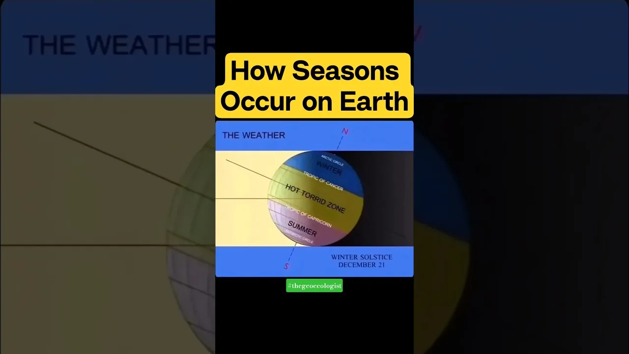
India spans 8°4’N to 37°6’N latitude and 68°7’E to 97°25’E longitude, placing it entirely in the Northern and Eastern Hemispheres. This vast latitudinal extent leads to:
- Diverse climatic zones: Tropical (south of Tropic of Cancer) and subtropical (north).
- North-South distance: ~3,214 km.
- East-West width: ~2,933 km.
- Total area: 3.28 million sq km (7th largest globally).
Key Fact: The Tropic of Cancer (23°30’N) passes through 8 states: Gujarat, Rajasthan, Madhya Pradesh, Chhattisgarh, Jharkhand, West Bengal, Tripura, and Mizoram.
2. India’s Neighbors
India shares land borders with 7 countries and maritime boundaries with 2:
- Northwest: Pakistan and Afghanistan.
- North: China, Nepal, and Bhutan.
- East: Myanmar and Bangladesh.
- Maritime: Sri Lanka (Palk Strait) and Maldives (Indian Ocean).
India’s 15,200 km land boundary and 7,516.6 km coastline (including islands) enhance its strategic and economic connectivity.
3. Strategic Location in Asia
India’s central position in Asia offers immense geopolitical advantages:
- Indian Ocean dominance: Controls key maritime routes (e.g., Strait of Malacca) critical for global trade and energy transport.
- Regional connectivity: Acts as a bridge between East Asia, West Asia, and Europe.
4. Time Zone in India
Despite a 30° longitudinal spread (leading to a 2-hour sun-time difference), India follows a single time zone based on 82.5°E longitude (near Mirzapur, UP). Indian Standard Time (IST) is UTC +5:30.
5. Physical Features Influenced by Location
- Himalayas: Shield against cold winds and source of perennial rivers.
- Monsoon climate: Southerly position between the Indian Ocean and Eurasia drives seasonal rains.
- Peninsular Plateau: Rich in minerals, shaped by ancient geological processes.
6. Significance for Competitive Exams
This chapter is a high-yield topic for:
- UPSC/CUET: Questions on coordinates, neighboring countries, and strategic location.
- Class 11 CBSE: MCQ-based queries on Tropic of Cancer states or India’s coastline.
- UGC NET: Discussing geographical theories like monsoons or India’s physiography.
Conclusion
Mastering India’s geographical location unlocks insights into its climate, culture, and international relations. For animated explanations, quizzes, and structured notes, enroll in TheGeoecologist’s paid courses at https://thegeoecologist.com/.
Follow Us:
- Instagram: @thegeoecologist
- Email: krishna.geography@gmail.com
india #physicalgeography #geographyofindia #indiaphysicalenvironment #class11 #ncertgeography #ncertclass11
(The article aligns with the NCERT Class 11 syllabus and integrates insights from TheGeoecologist’s video content, ideal for exam preparation!)
To Download E-Books & Study Material Visit The Shop Page