Horizontal Temperature Distribution | Factors and Processes | Climatology | Dr. Krishnanand
Horizontal Temperature Distribution: Factors and Processes
By Dr. Krishnanand
Founder of TheGeoecologist
Introduction
Temperature distribution across the Earth’s surface is a fundamental aspect of climatology. Understanding horizontal temperature distribution helps in analyzing global and regional climate patterns. This article explores the key factors influencing temperature distribution and the processes involved, particularly focusing on the latitudinal heat balance.
This discussion is part of a lecture series designed for undergraduate geography students and UPSC Geography (optional) aspirants. For a more detailed study, check out the Simplified Climatology E-book.
Factors Affecting Horizontal Temperature Distribution
1. Latitude
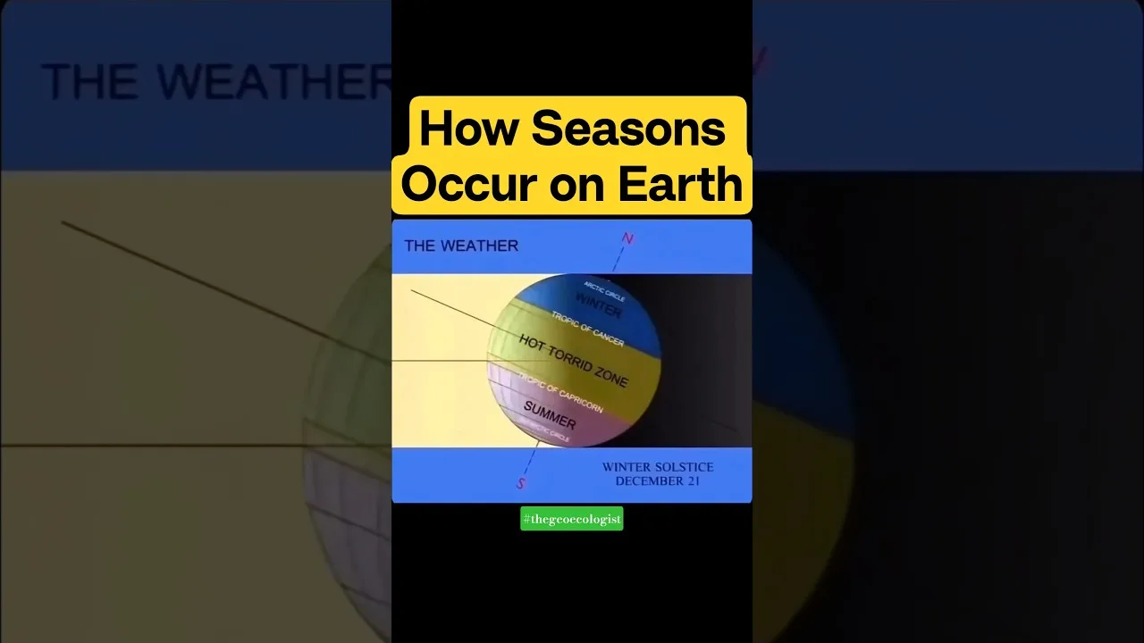
- The angle of the Sun’s rays varies with latitude, influencing solar insolation.
- Equatorial regions receive direct sunlight and remain hot, while polar regions, receiving oblique rays, are colder.
2. Land and Water Distribution
Land vs. Water Heating
- Land heats and cools faster than water, leading to greater temperature variations over continents.
- Oceans moderate temperatures due to their high specific heat capacity.
Maritime vs. Continental Climate
- Coastal areas have more stable temperatures (maritime climate).
- Interior regions experience extreme temperatures (continental climate).
3. Altitude and Relief
- Temperature decreases with altitude at a rate of 6.5°C per 1000 m (normal lapse rate).
- Mountain barriers can block cold or warm winds, affecting regional temperatures.
4. Ocean Currents
- Warm currents (Gulf Stream, Kuroshio) raise coastal temperatures.
- Cold currents (Labrador, Humboldt) lower temperatures along coastlines.
5. Prevailing Winds
- Winds can transfer heat from one region to another.
- Trade winds carry warm air towards the equator, while westerlies influence mid-latitude temperatures.
6. Cloud Cover and Albedo
- Cloud cover traps heat, reducing diurnal temperature variations.
- High albedo surfaces (snow, ice) reflect sunlight, keeping regions cooler.
Processes Influencing Temperature Distribution
1. Latitudinal Heat Balance
- The Earth maintains an equilibrium between incoming solar radiation and outgoing terrestrial radiation.
- Surplus heat at the equator is redistributed towards the poles via atmospheric and oceanic circulations.
2. Atmospheric Circulation (Hadley, Ferrel, Polar Cells)
- Global wind patterns help in heat redistribution.
- The Hadley Cell transports warm air from the equator to the subtropics.
3. Seasonal Variations
- Summer: Increased solar radiation in higher latitudes temporarily reduces temperature differences.
- Winter: Polar regions receive little to no sunlight, enhancing temperature contrasts.
4. Human Activities and Urban Heat Islands
- Deforestation and urbanization modify local temperatures, leading to urban heat islands.
Conclusion
The horizontal distribution of temperature is shaped by a combination of natural factors (latitude, altitude, ocean currents) and atmospheric processes (heat balance, wind systems). Understanding these elements is crucial for climatology studies and competitive examinations like UPSC Geography optional.
For an in-depth analysis, refer to the Simplified Climatology E-book.
Follow for more updates:
- Instagram: @thegeoecologist
- Website: https://thegeoecologist.com/
- Email: krishna.geography@gmail.com
📢 Subscribe to THEGEOECOLOGIST YouTube Channel for more Geography lectures!
Climatology #TemperatureDistribution #HeatBalance #UPSCGeography #GeographyOptional
To Download E-Books & Study Material Visit The Shop Page